Top Ten Gold Rushes of BC – Part 1

Top Ten Gold Rushes of BC – Part 1

Prior to the gold rushes in BC this part of the country remained almost entirely unexplored.  The Clovis people and their descendants the North American Indians were the first settlers of North America.  The Clovis crossed the Beringia Land Bridge from Siberia to present day Alaska approximately 13,500 years ago.  When Europeans began exploring the area, first by sea in the late 1700s and later by canoe, they encountered aboriginal groups covering much of the province.  Many Indians had seen gold in creeks but had little use for it.  They did not have the knowledge or motivation to mine gold until they came into contact with Europeans.  After learning the value of gold to the British they began to mine it and trade for goods.

Map of British Columbia Goldfields circa 1858
Map of British Columbia Goldfields circa 1858, click for larger image

The Spanish explorers on the other hand were completely obsessed with the yellow metal.  Spanish explorers were motivated primarily by legends of “El Dorado” in their search of the Americas.  Each Spanish explorer had the ultimate goal of returning to Spain with a ship full of gold.  Most of their attention was focussed in South America where their superior weaponry, armour and small pox allowed them to quickly decimate tribal empires and steal their gold.  There is evidence of Spanish gold exploration in BC as well.  Most of the Spanish exploration took place on Vancouver Island and other coastal areas such as Haida Gwaii.  One Spanish expedition travelled inland as far as the Okanagan and Similkameen regions.

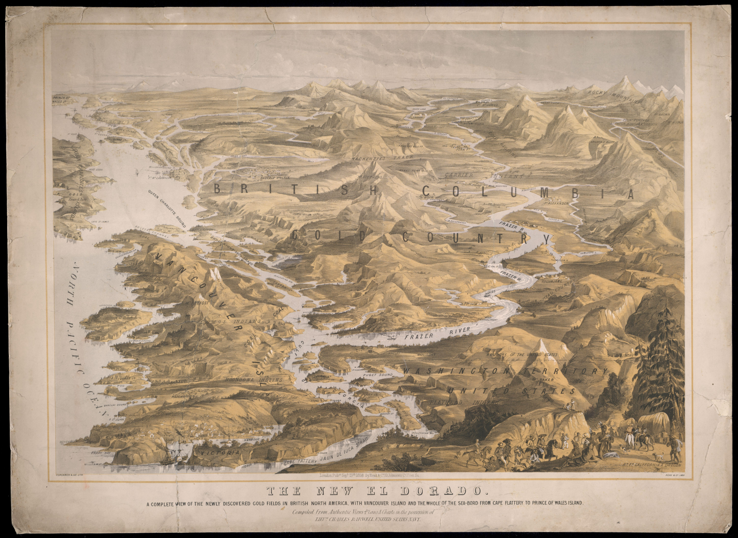
Fur trading is what led to the first European settlement of British Colombia but the impact remained relatively small.  The first settlements were established by early explorers such as Simon Fraser, Alexander Mackenzie, and David Thompson.  Early forts were established along the river routes that these explorers used as well as along the coast.  The area became a recognized fur trading district called New Caledonia and it held that name until it became a British Colony in 1858.

Fort St. James was founded in 1806 and was the first major inland fur trading post in BC and still bears that name.  Other notable early forts are Ft. George (now Prince George), Ft. Kamloops, Ft. Langley and Ft. Victoria (1844).  During the fur trade the European population slowly grew to a few hundred people but little effort was put into exploring new ground outside of the established trade routes.

EarlyBC

1851 Haida Gwaii Gold Rush

The Haida Gwaii gold rush was the first recorded gold rush in BC but was very short lived due to hostilities with the local natives.  The rush began in 1851 when a Haida man traded a 27 ounce nugget for 1500 blankets in Fort Victoria.  A Hudson’s Bay Company ship was sent up there soon after and discovered a very high grade lode deposit.

The HBC crew began mining the lode deposit but the Haida Indians soon turned against them and prevented further mining.  In 1852 a ship with 35 adventurers from San Francisco set out for the islands.  They arrived at “Gold Harbour” in the Tasu Sound but did not have much luck finding gold.  They did however manage to trade with the Haida Indians for gold.

1857 Gold Found At the Nicoamen River

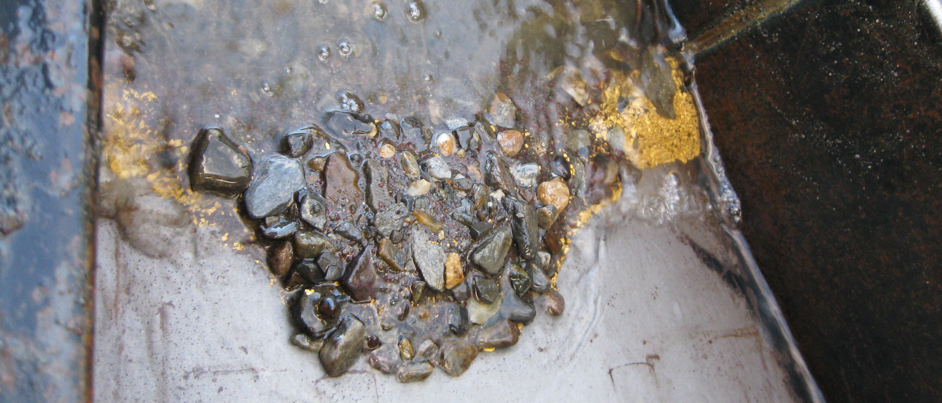
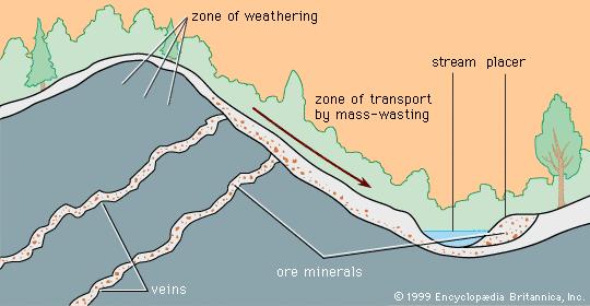
Placer gold was discovered in Nicoamen River which is a tributary to the Thompson River.  The Nicoamen enters the Thompson about 12 kilometers up stream from the confluence with the Fraser River at Lytton.  A local Indian discovered gold there by chance and soon the majority of the tribe was mining the area.  This discovery is credited with igniting the Fraser River gold rush.

1858 Fraser River Gold Rush

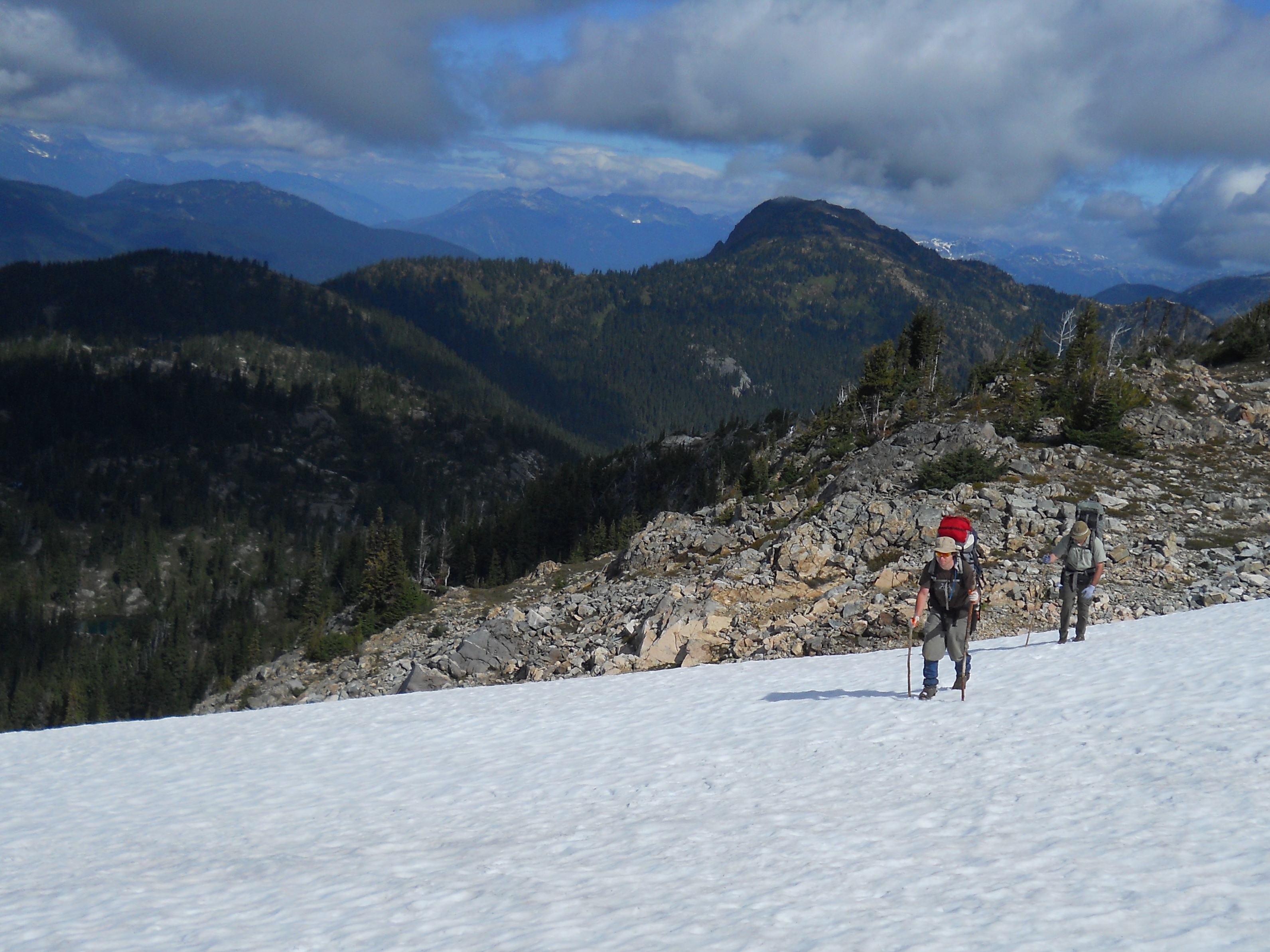
The Fraser River gold rush involved one of the largest populations of migrant prospectors in history.  It is estimated that around 30,000 people rushed to the lower Fraser River in 1858.  The rush began after an 800 ounce gold sample was sent from Fort Victoria to San Francisco for assay.

Yale in 1868
Yale in 1868

Soon after a shipload of 800 American prospectors from California arrived in Victoria to hunt for gold on the Fraser River.  The influx of American prospectors overwhelmed the small government that managed the territory.  HBC Governor James Douglas requested immediate help from Britain to control this massive foreign population .  The British Government responded by formally claiming BC as sovereign British Colony in 1858.  The new government quickly enacted mining laws to prevent the mayhem that took place in the California goldfields.  Along with the declaration came British military support and the Royal Engineers who went on to build several major road systems including the Cariboo Wagon road and Dewdney Trail.

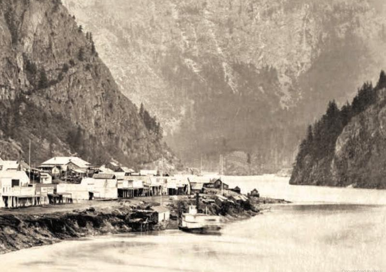
The early work centred around the community of Hope where steamboats allowed for easy access.  The majority of the gold rushers were participants in the California gold rush that fizzled out a few years earlier.  As a result the population of Yale was largely american and the town was modelled after San Francisco.

Lower Fraser River Circa 1862

A story in the San Francisco Bulletin is credited with igniting the rush.  According to the newspaper:

“In one month the Hudson’s Bay Company fort in Victoria had received 110 pounds of gold dust from the Indians … (prospected) without aid of anything more than … pans and willow baskets.”

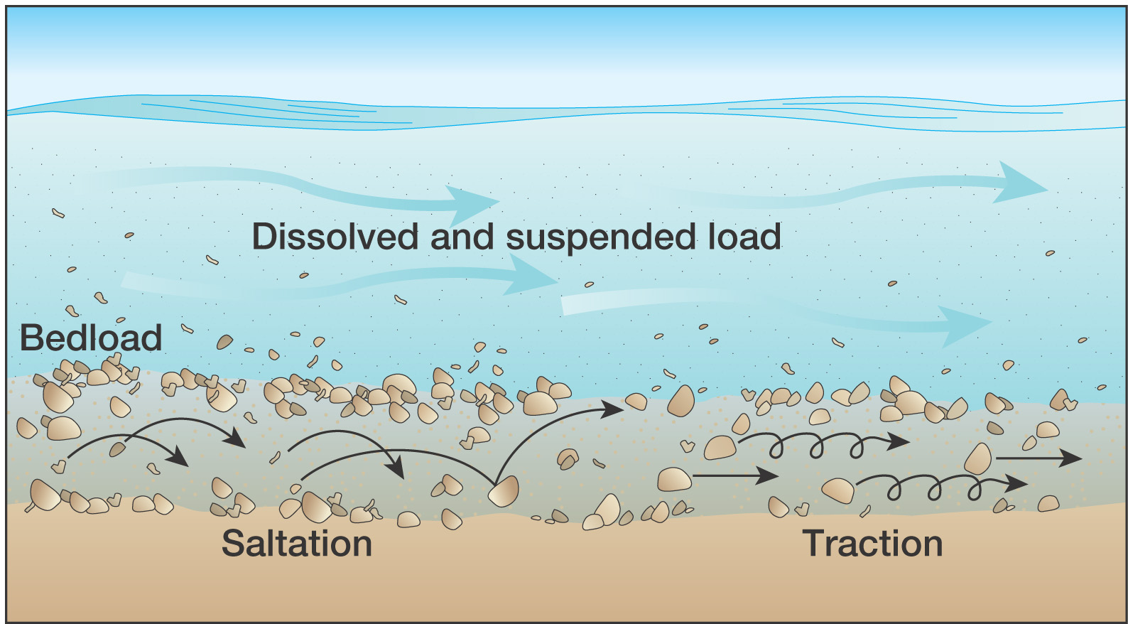
Numerous bars were prospected and mined between Hope and Lytton.  Some communities along the Fraser are still named after the bars that were mined such as “Boston Bar”.  Like most gold rushes the men who arrived first snapped up the good claims and the the majority of the adventurers ended up working for them.

Cariboo Wagon Road in Fraser Canyon 1867

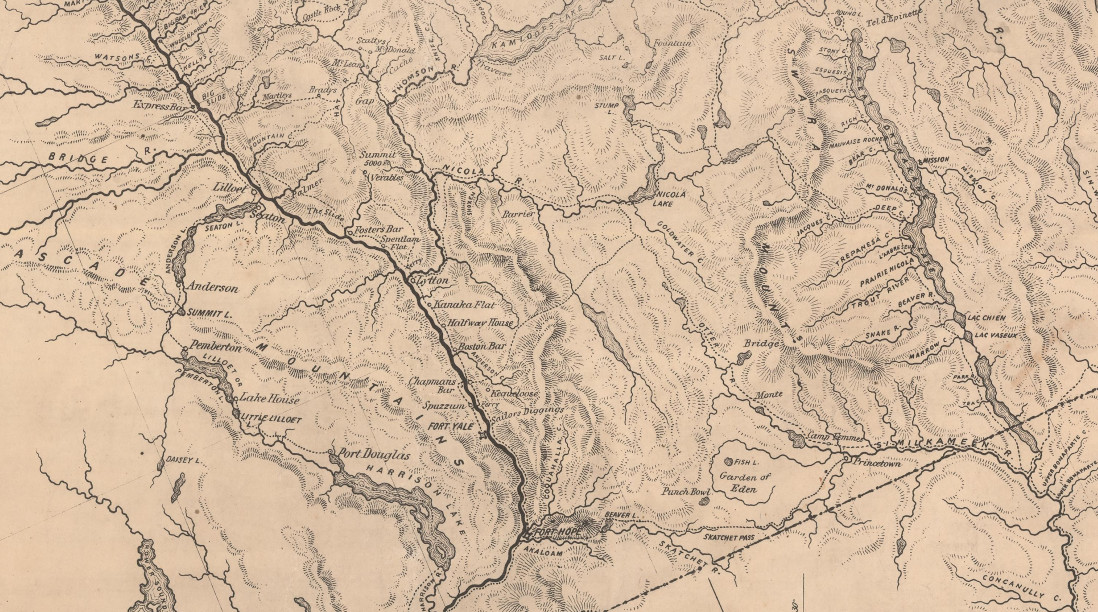
The British Royal engineers developed a route from Port Douglas at the head of Harrison Lake to Lillooet to accommodate the influx of miners.  Many new communities popped up and some are still settled today.

The Fraser rush brought people from all over the world but the bulk of the miners came from California.  At the peak of the rush there were over 10,000 miners operating on the section of river form Hope to Lillooet.  The bars depleted rapidly and by 1860 most of the miners continued on the other gold rushes in BC.

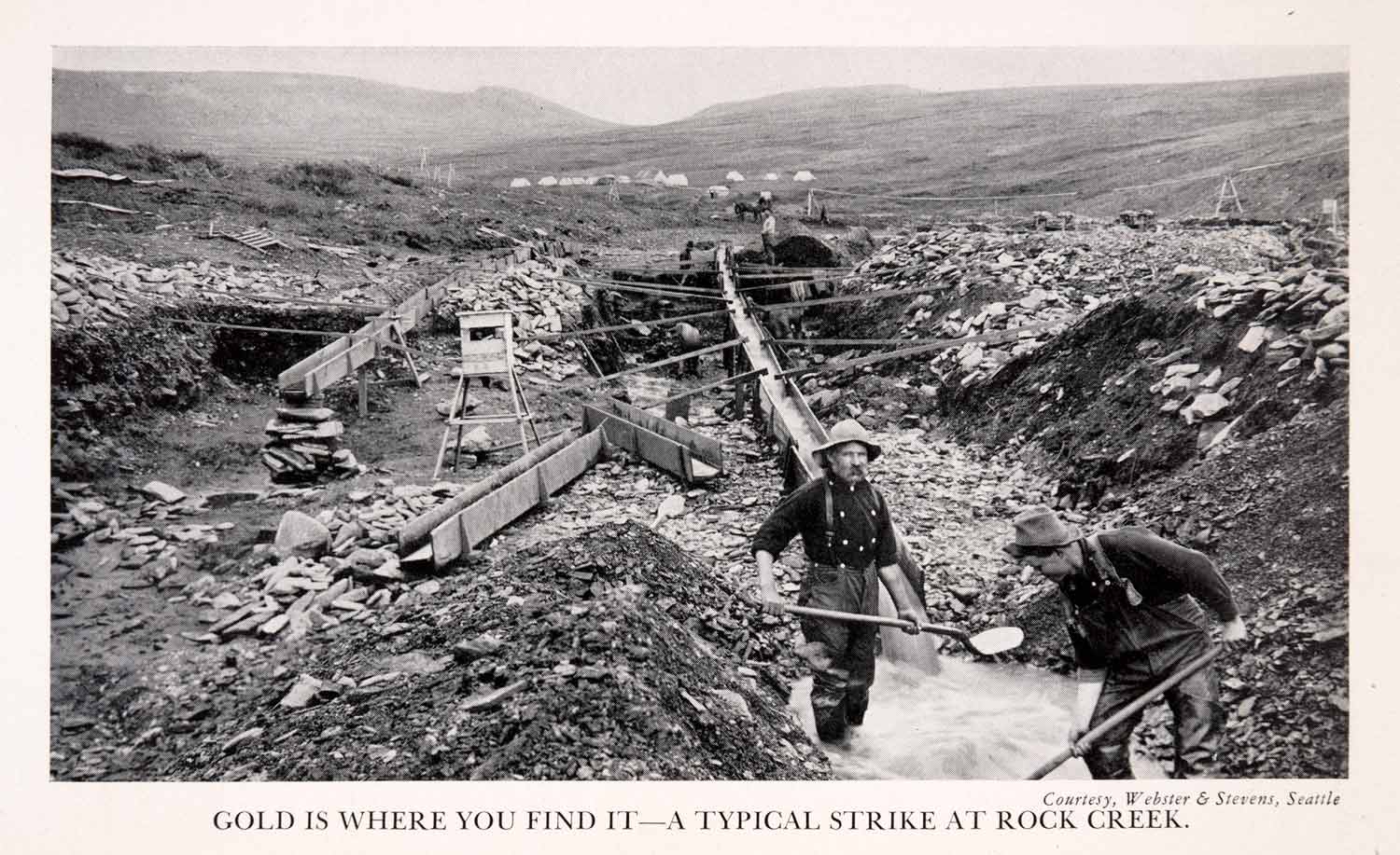
1858 Rock Creek Gold Rush

Gold was discovered in Rock Creek in 1858 soon after miners rushed in from the United States and the rest of the world.  The Rock Creek rush was also instrumental in the development of British Columbia.  The discovery was made by two American soldiers who were chased North of the boarder by a band of Indians.  Just 5km from the border where an unnammed creek entered the Kettle River they found gold.

XGEA8_008
This photo is actually from Rock Creek in Alaska, not BC. Still a good photo though.

At the time of the discovery the colony of British Columbia was only a year old.  American miners tried to claim the area as part of the United States due to the high grades and the fact that it was discovered by Americans.  The Rock Creek claim issues prompted the construction of the Dewdney Trail as a means to separate the new colony from the United States.  The Dewdney Trail snaked its way from New Westminster all the way to Wild Horse in the Kootenay region staying just North of the Canada-US border.

Soon after the discovery an estimated 5,000 prospectors migrated to the newly established town of Rock Creek.  In the beginning there were two saloons, a butcher’s shop, a hotel and five stores.  Within the first year a revolt broke out due to tensions between Chinese and American miners and refusal to pay for mining licences.  The incident became known as the Rock Creek War.  The governor of British Columbia Sir James Douglas travelled there from Victoria to straighten out the miners.  He threatened to send in 500 British soldiers if they couldn’t behave themselves.  Sir Douglas was successful and soon the miners paid their claim fees and mined the creeks in peace.

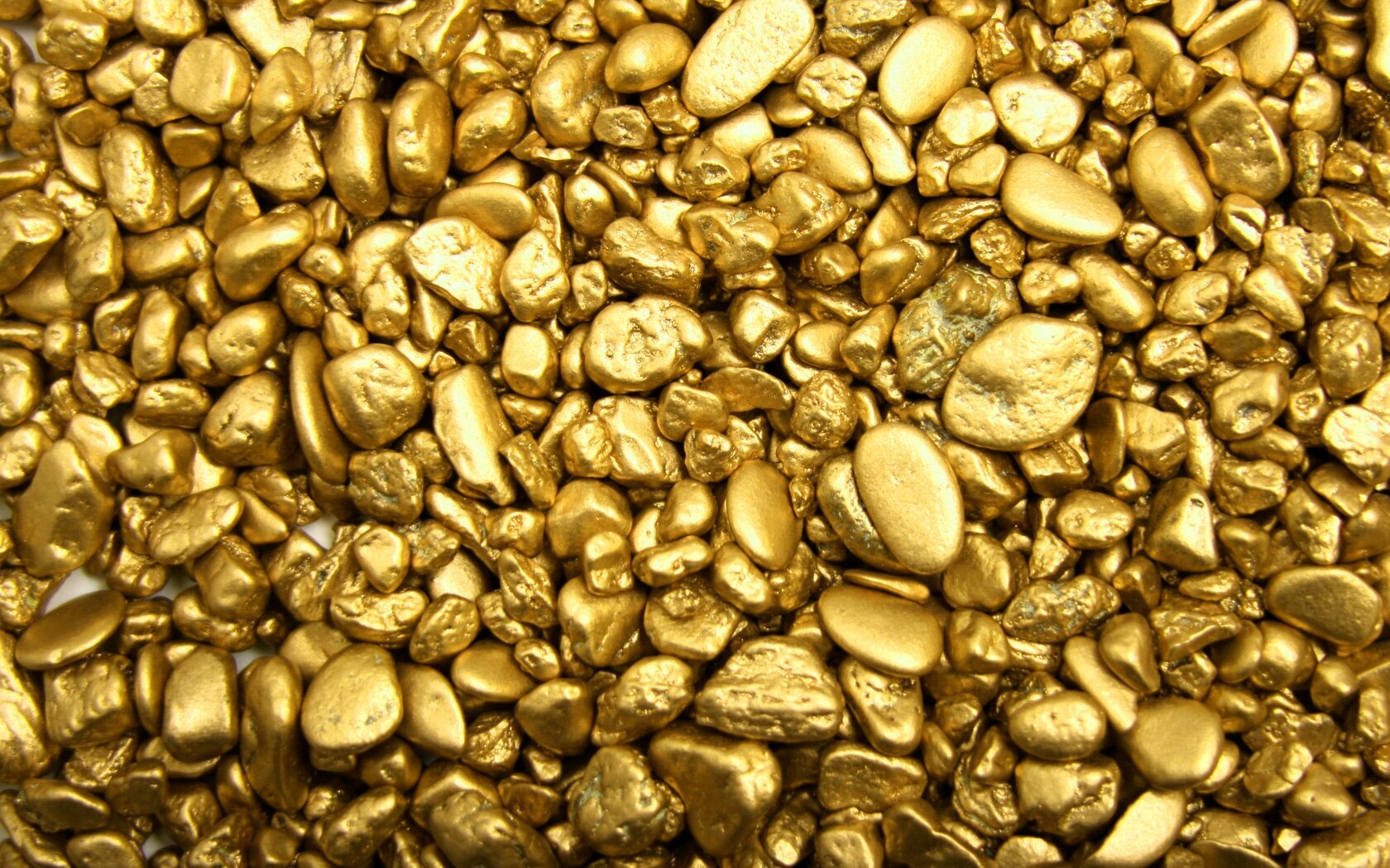
There were some amazing claims on Rock Creek.  Adam Beame’s claim on Soldier’s Bar  in 1859 allegedly netted $1,000 in six weeks.  That gold would be worth $70,500 today!  Other bars such as Denver Bar and White’s Bar produced similar results.

1859 Cariboo Gold Rush

Gold was discovered on the Horsefly River in 1859 by prospectors who participated in the Fraser River rush.  They were guided by a local Indian and shown a spot on the Horsefly River with abundant gold and nuggets the size of wheat kernels.  The rush was on as more miners from the Fraser River rush migrated North to the Cariboo.  Soon a town was erected near the strike that exists today.

Cariboo Map Circa 1862

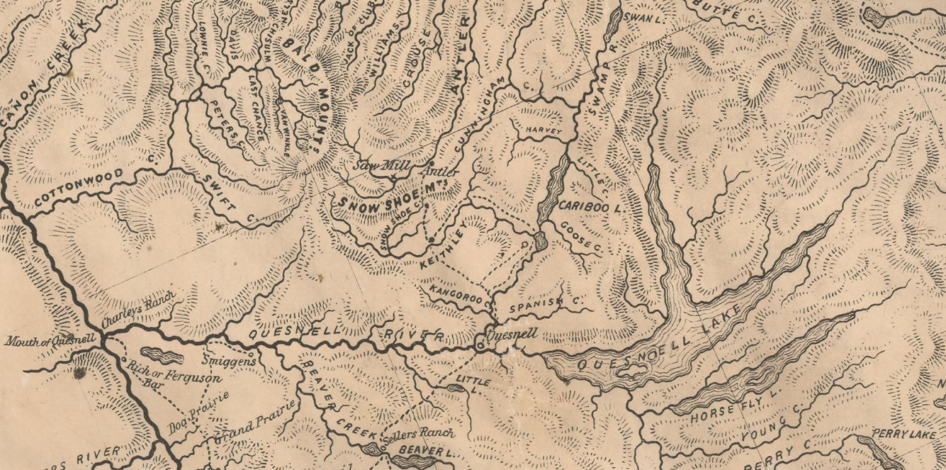
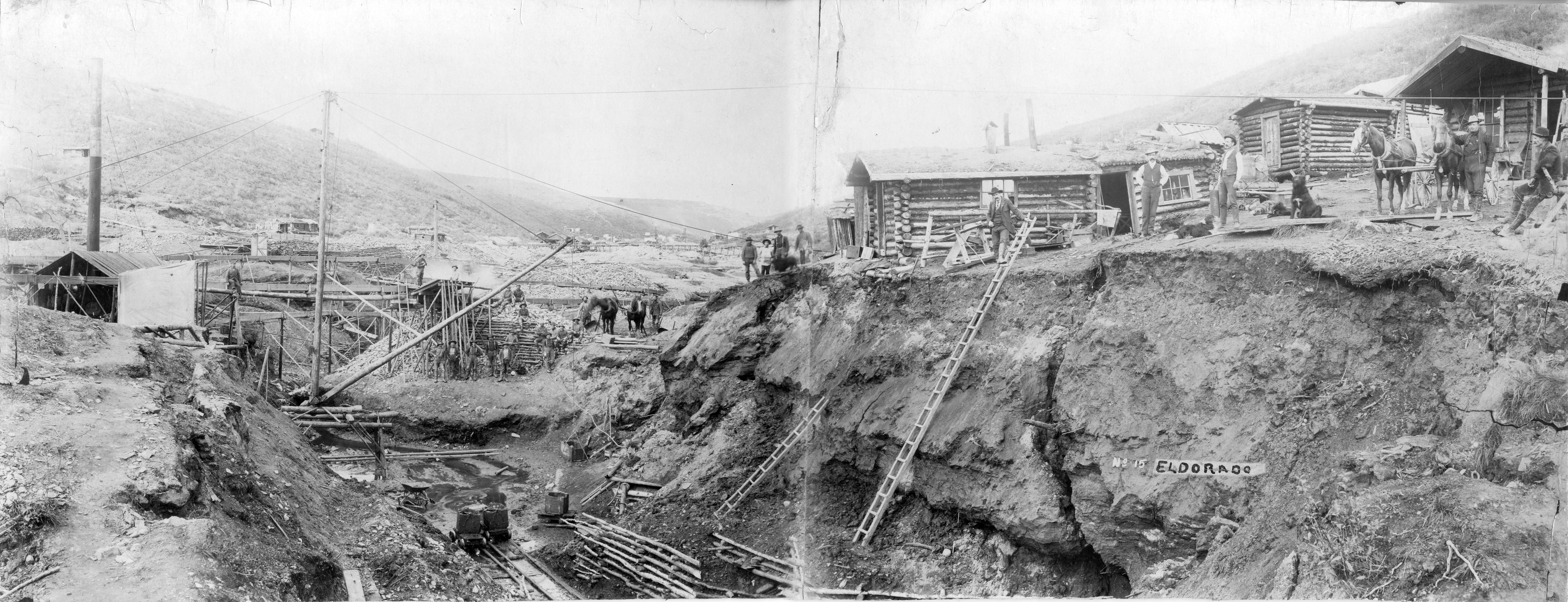
In 1860 gold was discovered on Keithly and Antler creeks to the North of Horsefly.  Other notable creeks of the region are Lightning, Lowhee, and Williams Creeks, the Quesnel River and Parsnip River.  Towns popped up all over the place with the most exciting being Barkerville.  That town was named after a British prospector named Billy Barker and had a popluaton of 10,000 at its peak.  His claim on Willams Creek was one of the greatest gold producers in history yielding an estimated 37,500 ounces of gold.  Barkerville was restored in 1997 as a tourist historic town that is a popular attraction in the area.

Barkerville1868
Barkerville circa 1868

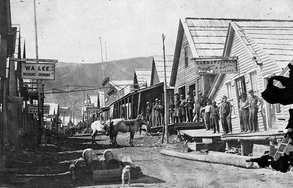
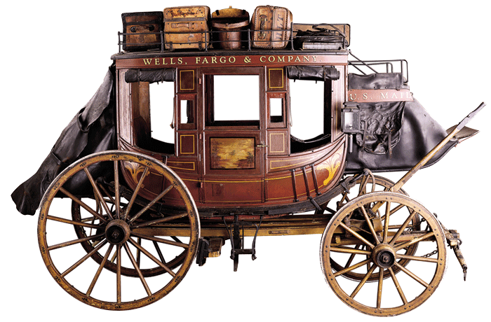
The Cariboo gold rush saw 100,000 people flood into the area during 1862-70 from all over the world.  By 1864 the Cariboo Wagon Road was completed from New Westminster all the way to Barkerville.  This allowed for easy travel of people and supplies, wich substantially brought down the costs.  It also allowed for stage coaches to securely move gold from the mines.  The stagecoaches operated on this road from 1863 to 1917 carrying people, mail, express packages and of course gold.  The stagecoaches saw surprisingly few hold ups, even though they carried literally tons of gold.  There are only five hold ups on record, two of which were successful.

stagecoach11

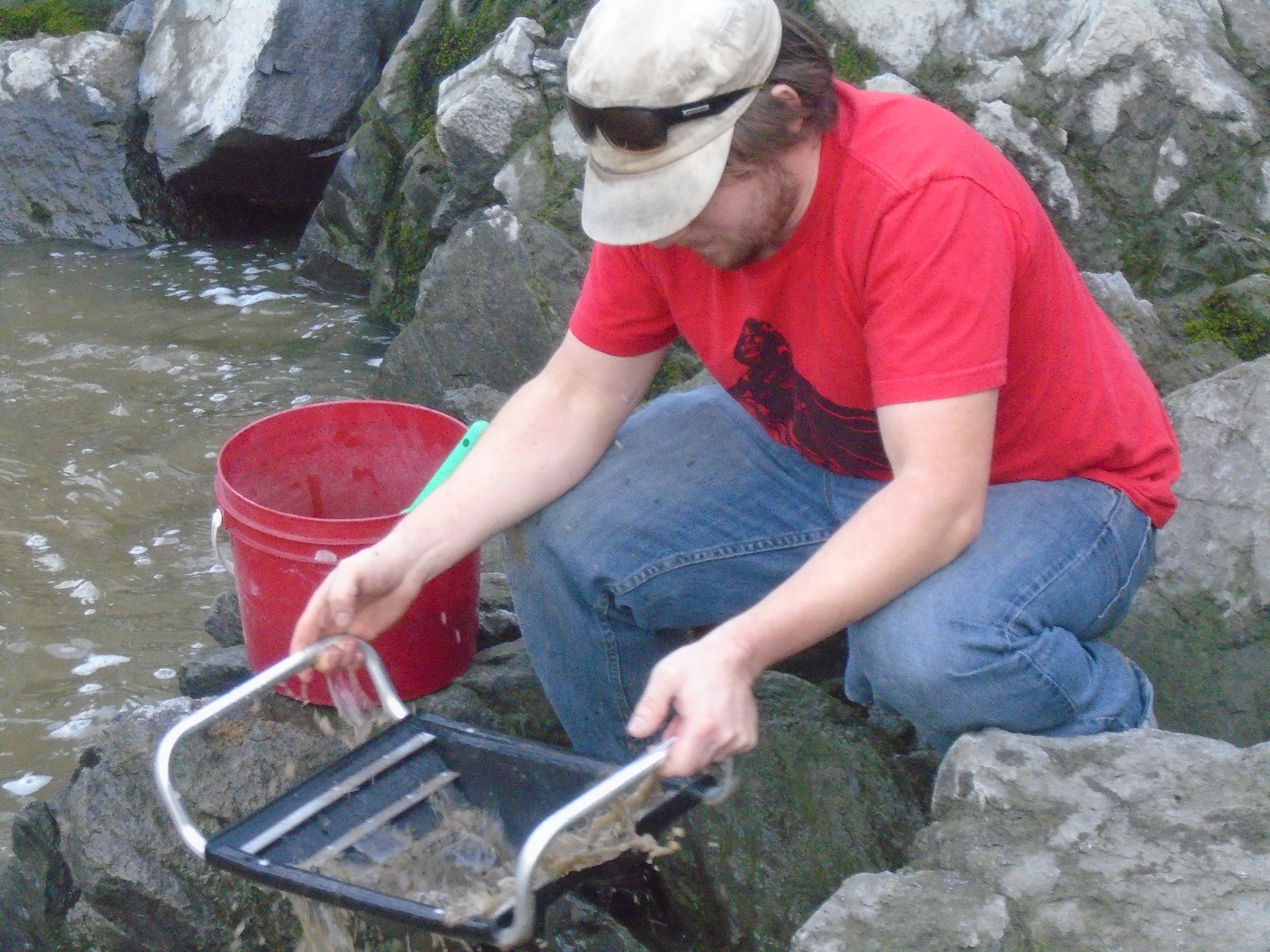
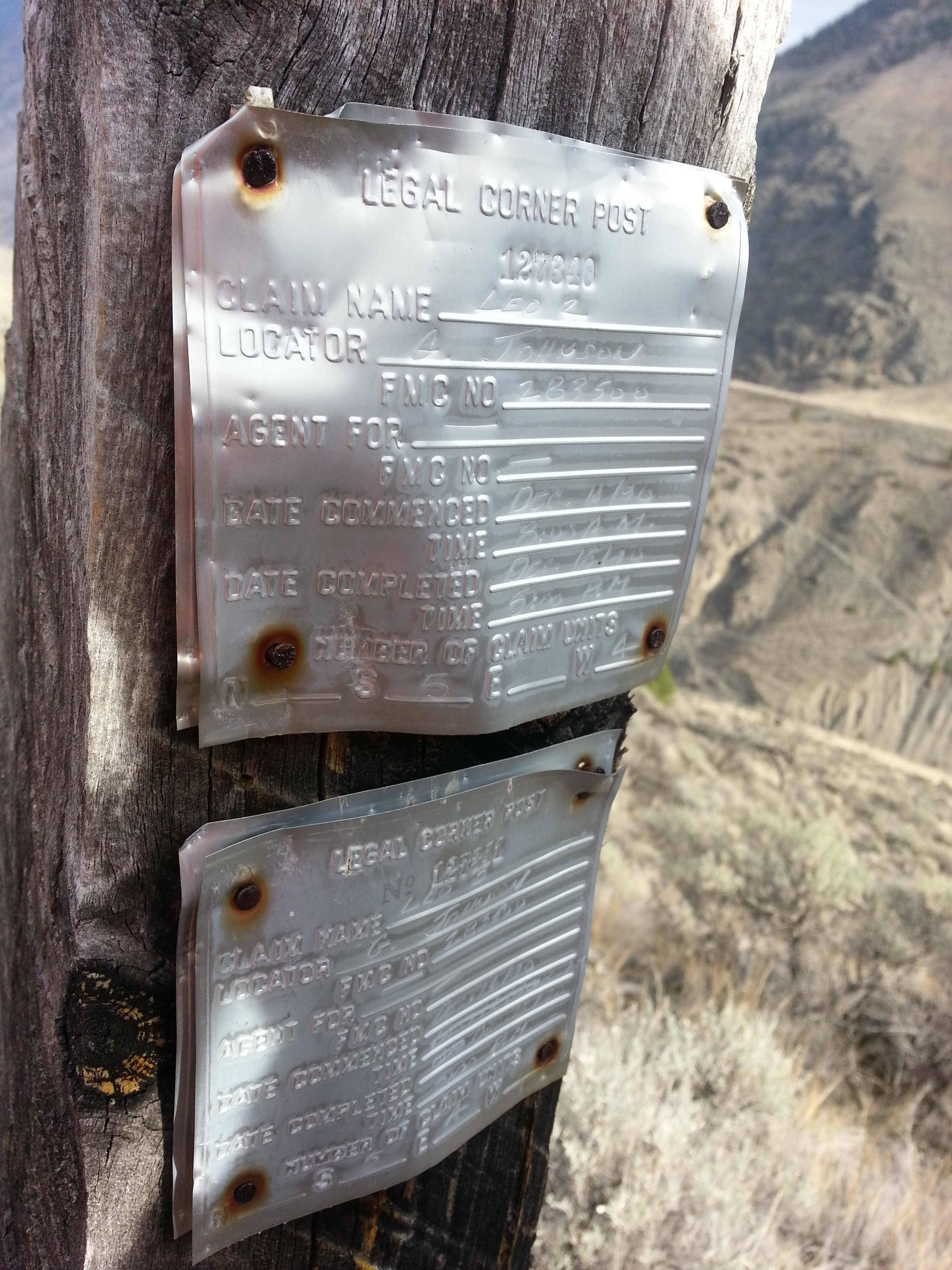
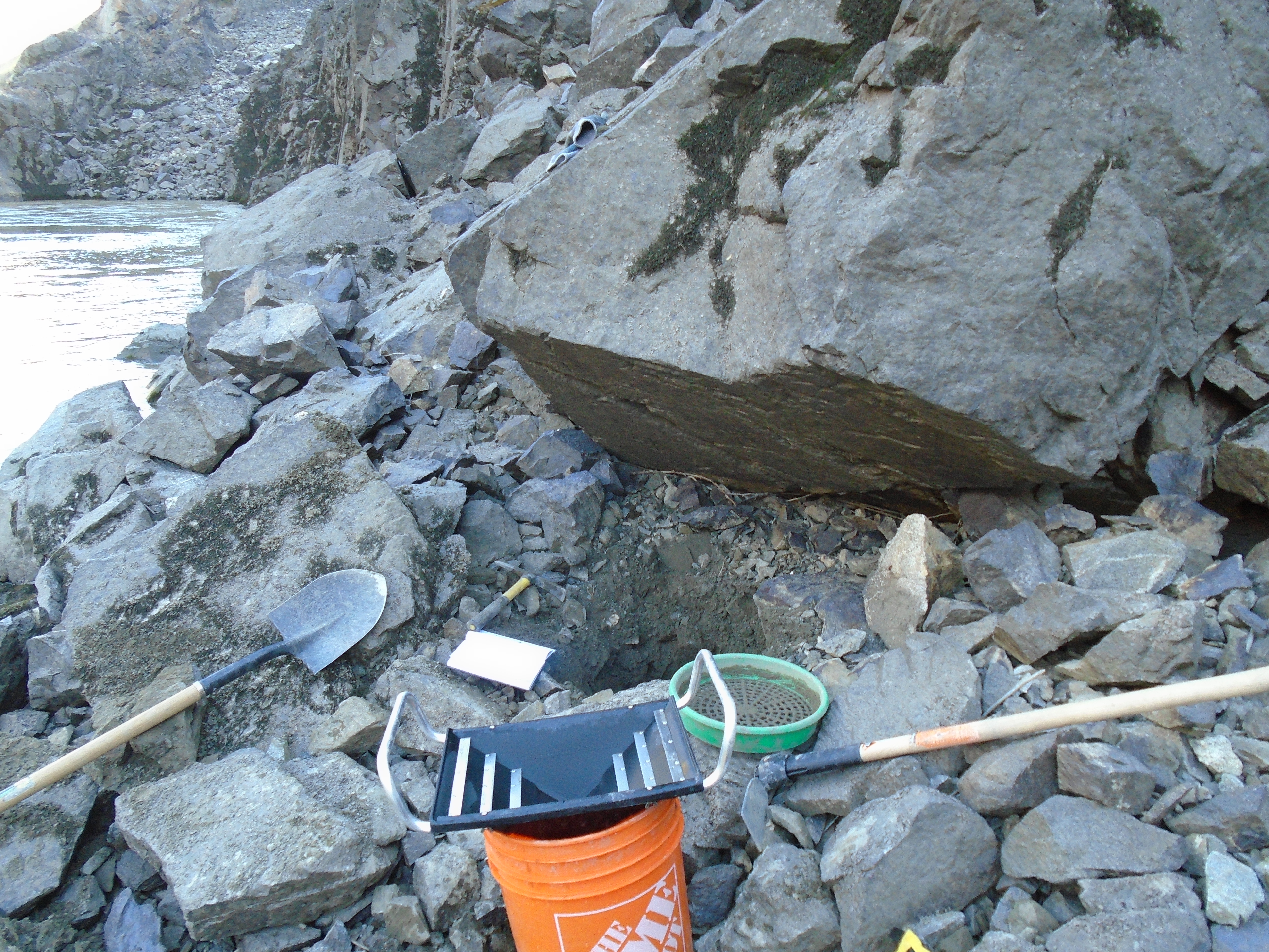
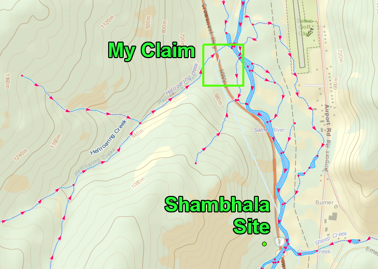
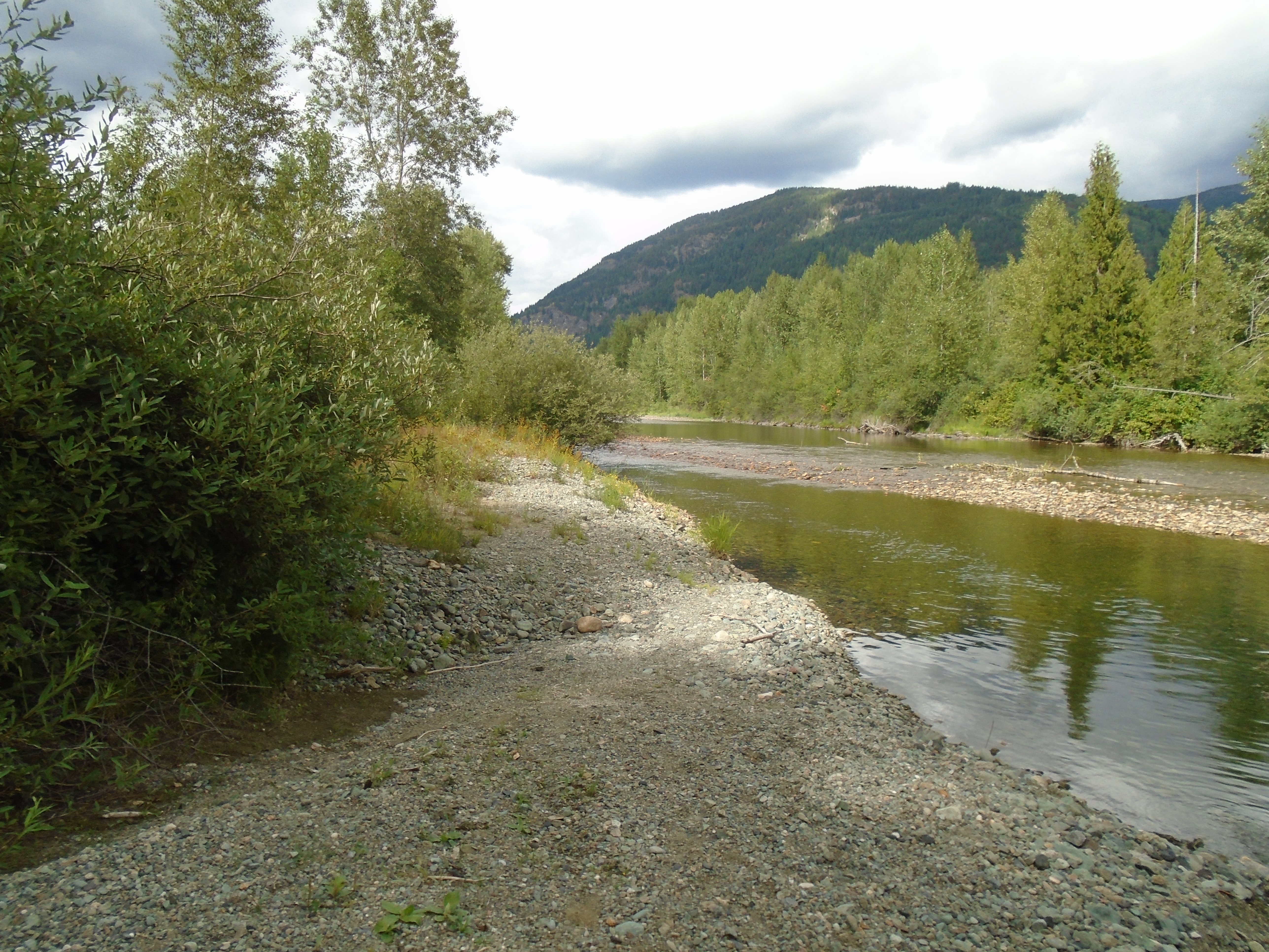
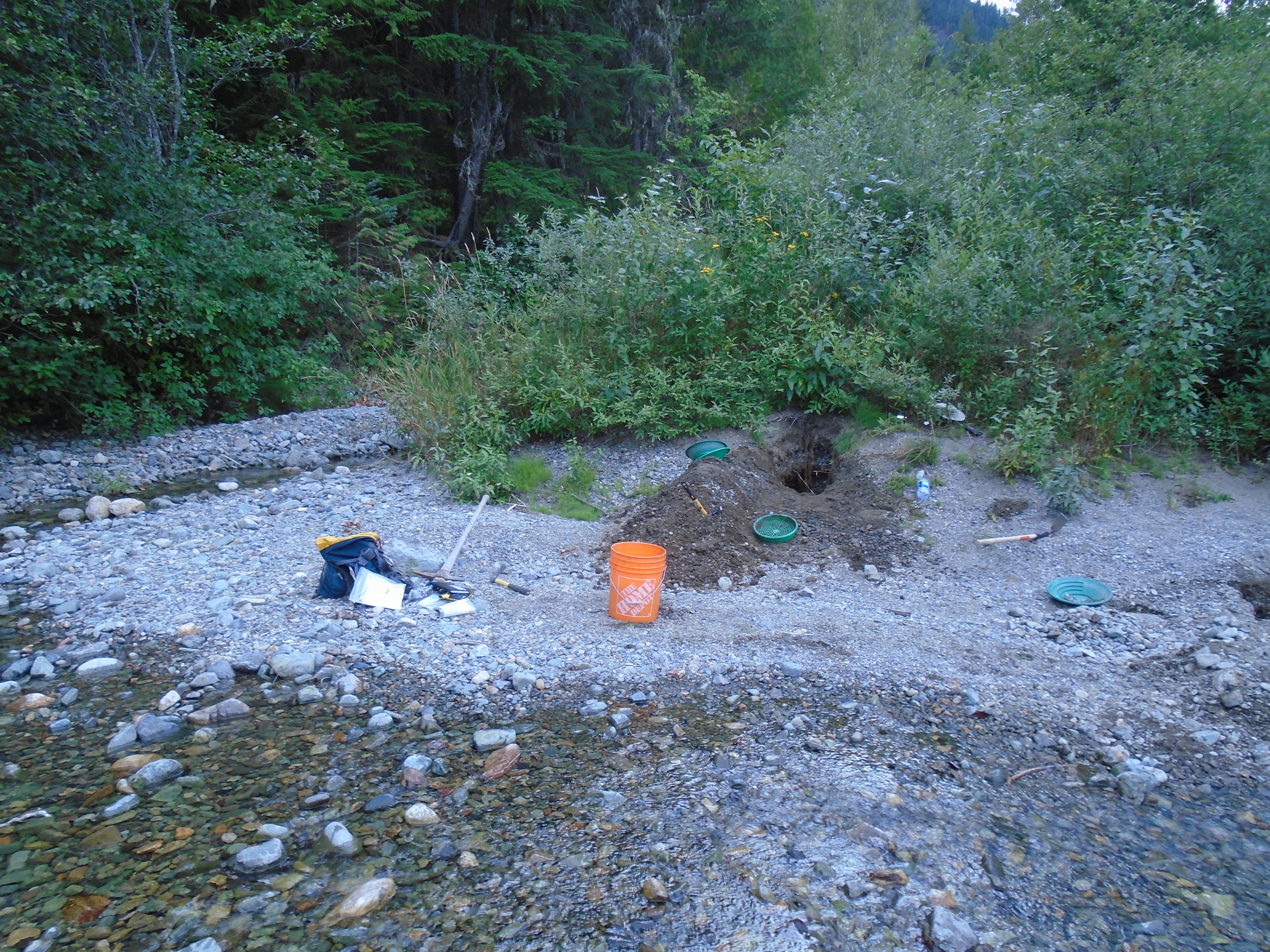
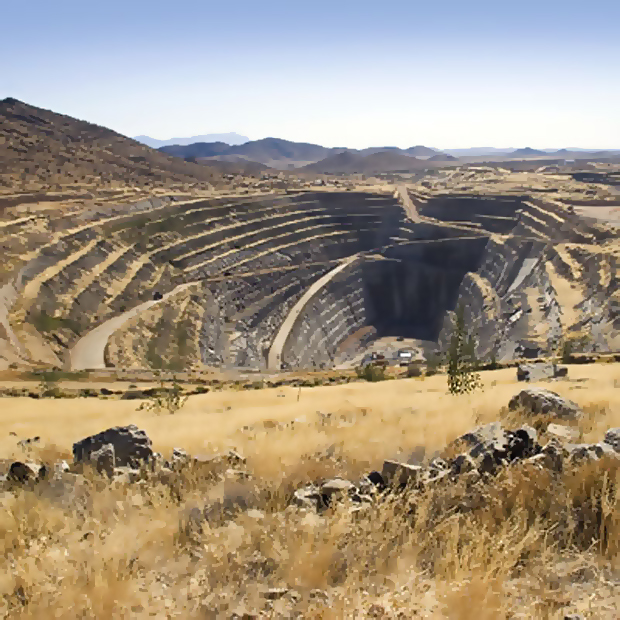
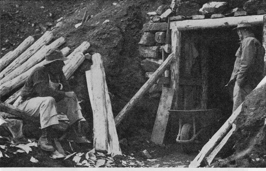
By 1870 the gold rush had largely fizzled out.  The good claims were now owned by mining companies who could gather the money needed to undertake underground drift mining.  Those who didn’t stick around to work in underground mines spread around other parts of BC’s North and some sparked gold rushes in new areas.  Others settled in and started up cattle ranches or logging companies.  Gold mining in the Cariboo is still active today, as a matter of fact I have a couple claims near Keithly Creek.

Cariboo Drift Mine
Cariboo Drift Mine

1863 Wild Horse River Gold Rush

Gold was discovered on the Wild Horse River in the Kootenay region in 1863 once again by American prospectors.  The Wild Horse held great gold reserves and still does today.  Early in the rush huge nuggets were found with the biggest tipping the scale at 36 ounces.  The first town that was built was called Fisherville.  Apparently after one resident found a nugget under his house the size of his fist the whole town burned their houses down to dig underneath.

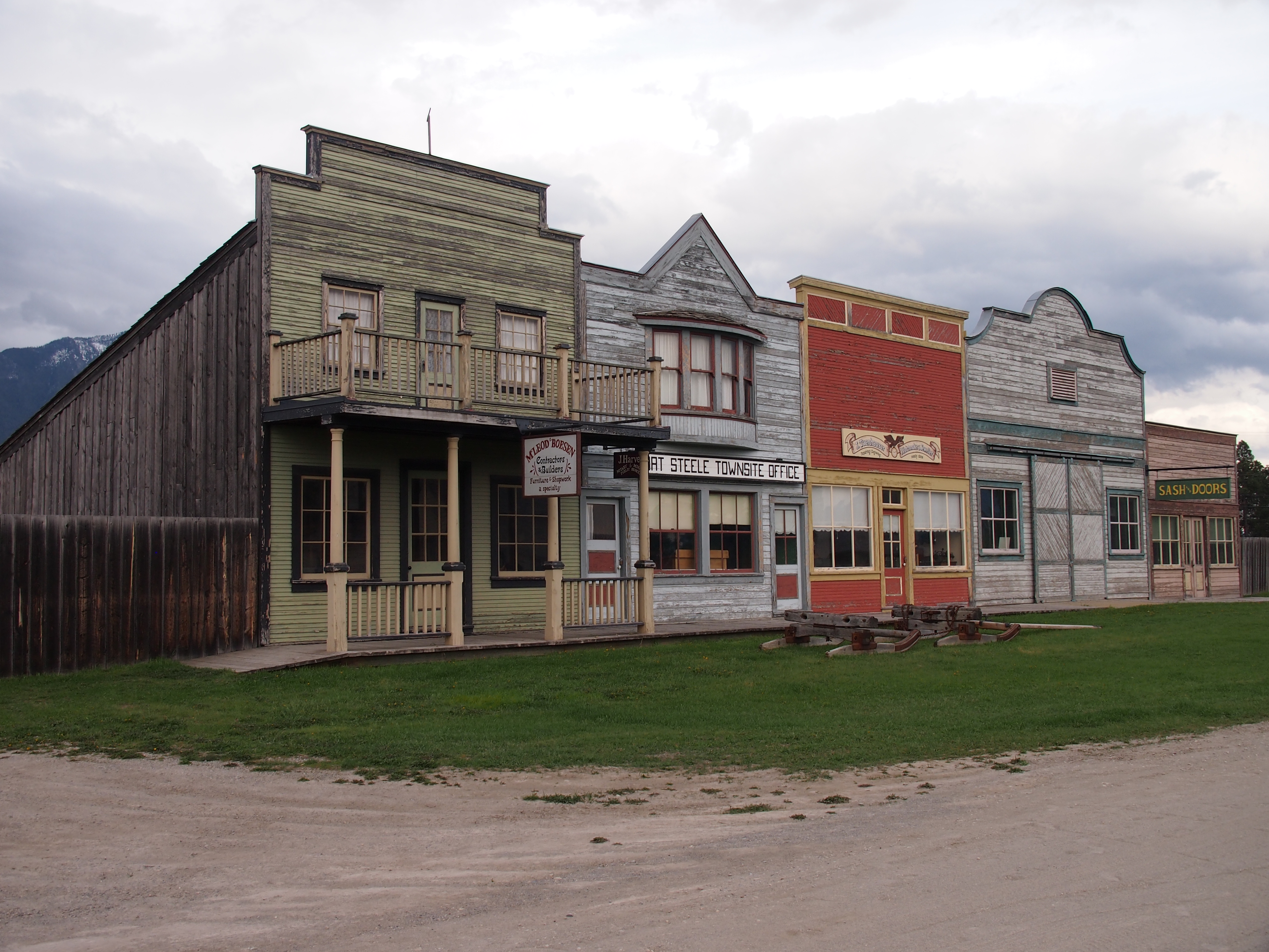
A town was erected named Galbraith’s Ferry, named after John Galbraith who operated a ferry across Kootenay lake.  Later the town was re-named Fort Steele after the legendary Sam Steele.  A second gold rush broke out in the same area in 1885.  Later hard rock silver rushes spread around the region.

The Wild Horse River is estimated to have produced over $7,000,000 in the initial gold rush which would be worth about $490,000,000 today.  There is a very well preserved historic town at Fort Steel that is a popular tourist spot with many actors playing the roles of old time blacksmiths, prospectors, sheriffs and so on.  It is located North of Cranbrook at the intersection between Highway 93 and 95.

The initial gold rush ended after about 6 years but soon the great silver rush would flood the region.  Places like Nelson, Kaslo, Slocan grew out of the silver rushes that blanketed the Kootenay region.


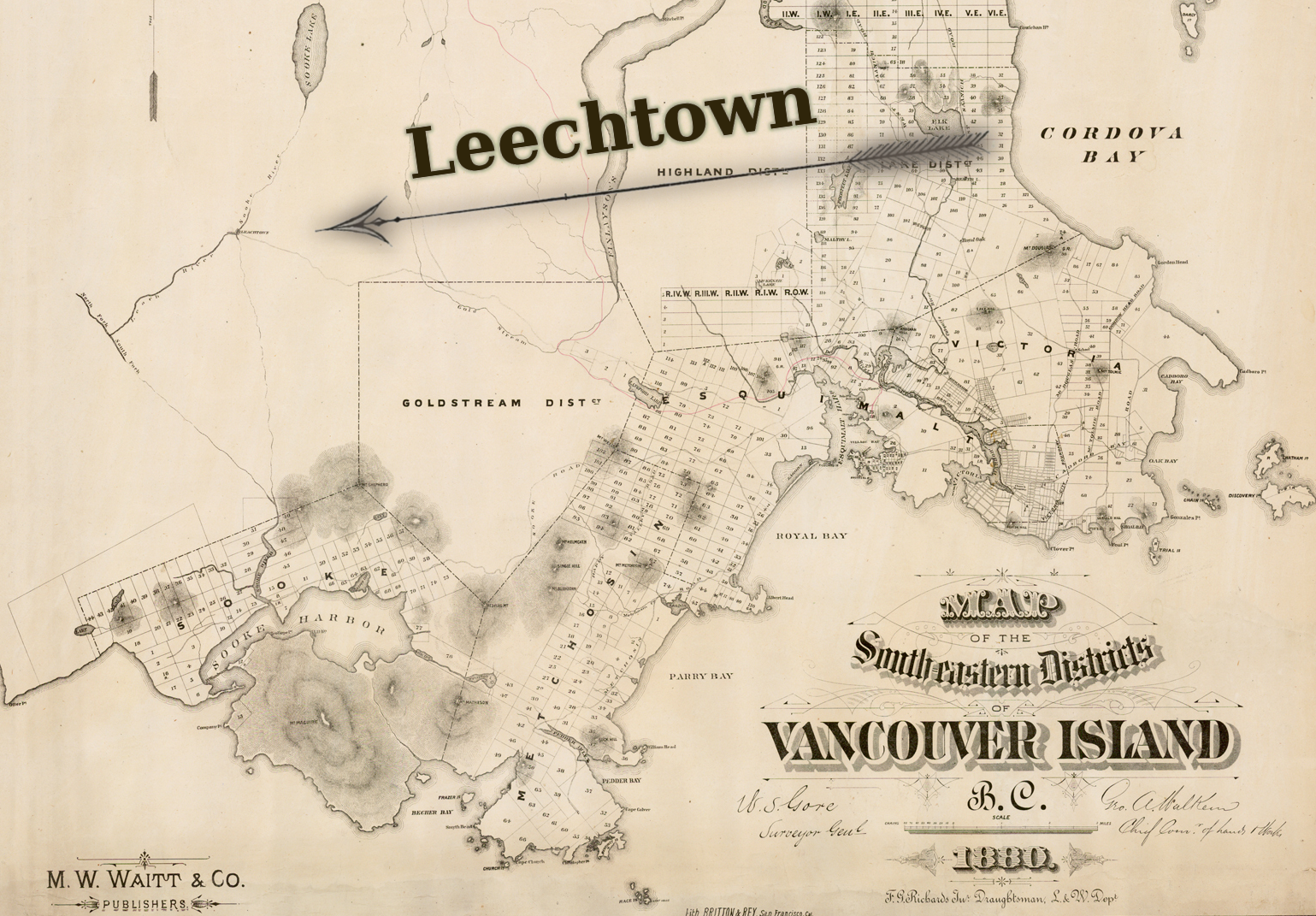
1864 Leech River Gold Rush

The Leech River gold rush started with a letter from Robert Brown who was Commander of the Vancouver Island Exploring Expedition.  Yes that was the correct name of the VIEE expedition.  The expedition was launched by the British government in Victoria.

1880Leechtown
1880 map depicting the locaton of Leechtown

A letter from Brown published in the British Colonist newspaper on July 29, 1864 ignited the rush.  Here are some exerpts from the letter:

..the intelligence I have to communicate is of too important a nature to bear delay in forwarding to you, even for one hour…

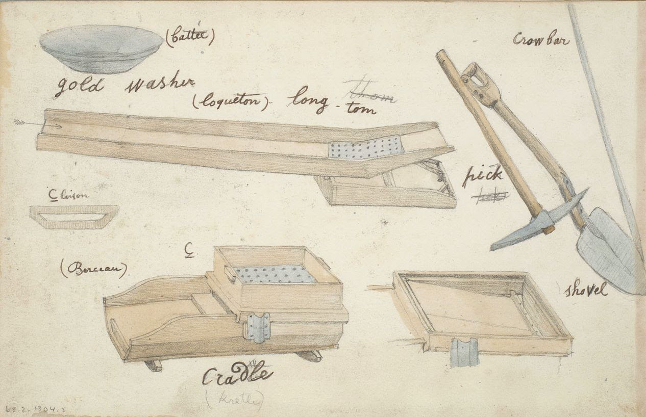
The discovery which I have to communicate is the finding of gold on the banks of one of the Forks of the Sooke River, about 12 miles from the sea in a straight line, and in a locality never hitherto reached by white men, in all probability never even by natives. I forward anquarter eighth of an ounce (or thereabouts) of the coarse scale gold, washed out of twelve pans of dirt, in many places 20 feet above the river, and with no tools but a shovel and a gold pan. The lowest prospect obtained was 3 cents to the pan, the highest $1 to the pan, and work like that with a rocker would yield what pay you can better calculate than I can, and the development of which, with what results to the Colony you may imagine.

Leechtown - Berks Hotel
Leechtown – Berks Hotel

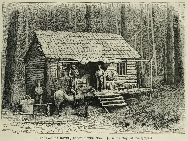
A town called Leechtown was built near the discovery.  By November that year there were an estimated 6 general stores, 3 hotels and over 1,200 miners at work in the area.  By 1866 an estimated 200,000 ounces of gold had been produced in the area and the gold rush had passed its peak.  It was over in a flash as the Leech and Sooke river placer deposits, although high grade, were limited in size.

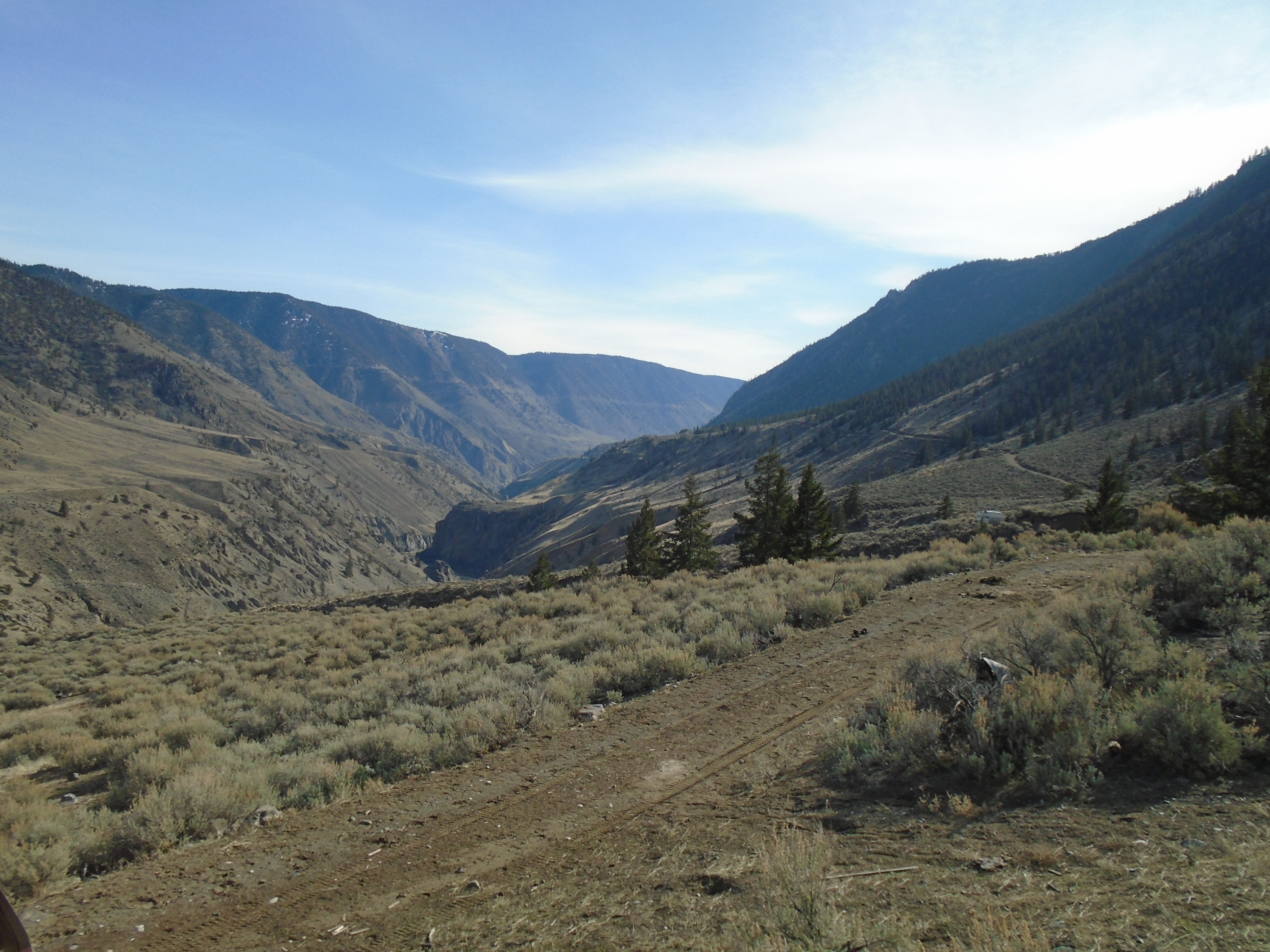
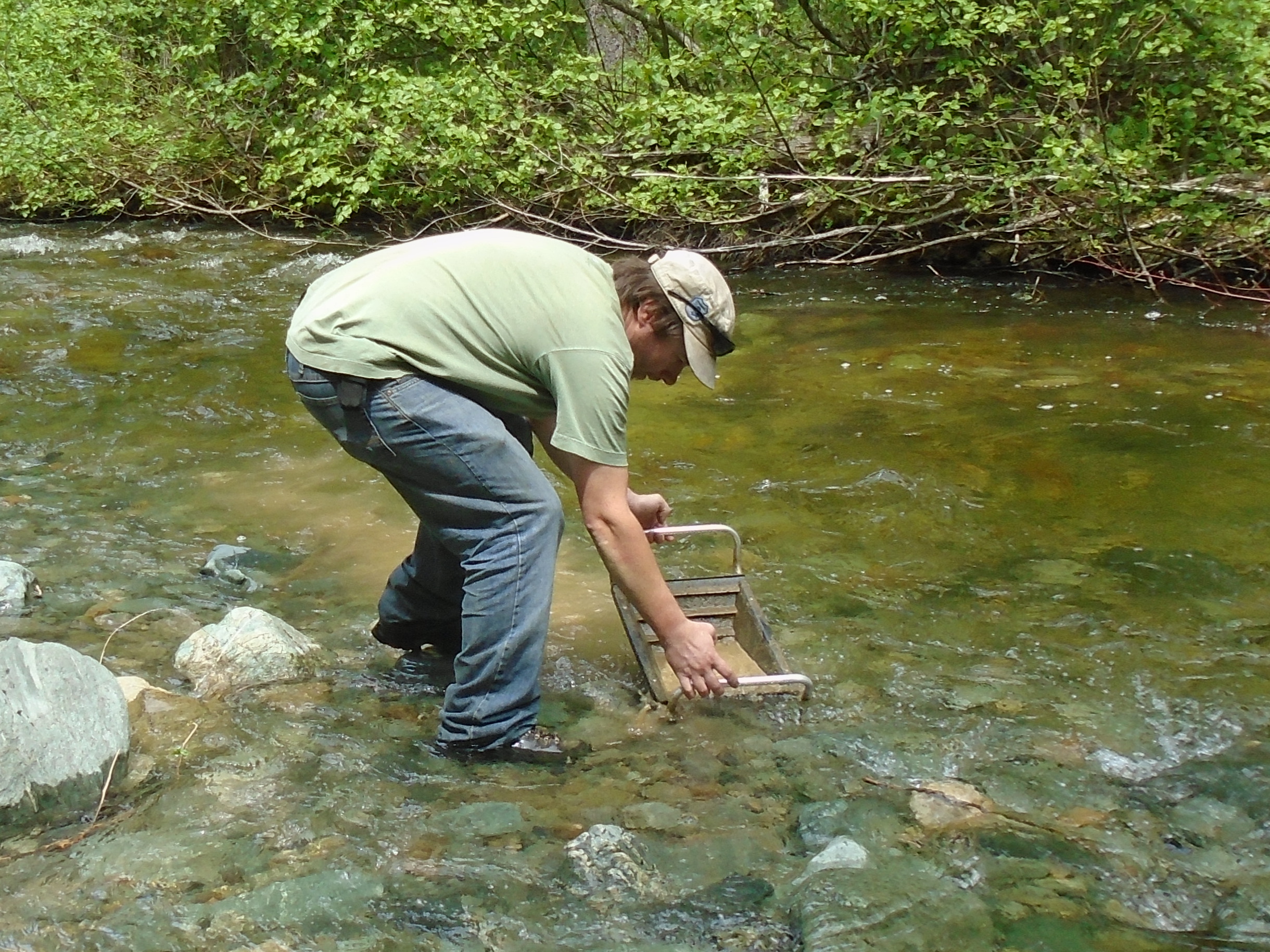
In the span of one decade gold rushes turned the vast unexplored fur trading district of New Caledonia into a sovereign British Colony.  By the end of the 1860’s the new region had gone from a population of under one thousand people to a colony with several major wagon roads and towns covering much of the Southern half of BC.  The gold rushes continued and led to more development in British Columbia.  Stay tuned for part 2.

Check out part two here:

Part 2: Top 10 Gold Rushes

Late Season Prospecting on the Fraser

Late Season Prospecting on the Fraser

This claim is located in the Cariboo-Chilcotin region of BC.  The location is fairly remote and there are no paved roads for quite a distance in any direction.  When you are out there you are definitely alone.  It has sort of an eerie feeling all day and night, it feels deserted.  There is a ghost town near the claim and some signs of a more active human presence from a distant time.  Check out this post for pics on of the ghost town, Southern Cariboo Prospecting Trip.

DSC00723

The hike down to the river is pretty tough.  There is about a 1000 foot elevation change from the access road to the river.  We went down there the first day to sample the beach.  We came across a couple of bedrock outcrops which prevented us from travelling any further.  The bedrock had some gold stored in the cracks and we were able to get some of it out.  Near the river we saw some decent colour in our test pans.  We marked the locations on my GPS and made our way back up to the camp.

DSC01373

We had some great burgers cooked on the campfire and a couple of beers.  It is getting pretty cold up there this time of year.  Once the sun goes down the temperature quickly falls below freezing.  We had a nice big fire and enjoyed the stars for the evening.  It was pretty tough to get out of our tents in the morning.  The moment when you unzip your sleeping bag and start putting on cold clothing is the worst.  I’d like to stay in my nice warm bag for a couple more hours but we came up here for a reason.
CreekRavine

We found an old claim post with tags from 1989/90 right in the center of the claim.  The post was actually carved out of a tree trunk and is the most creative claim post I have ever seen.  As far as industrial markers go this is a work of art.  I hope to find out more about this G. Johnson and what he had discovered on the claim.

20151106_101854  20151106_101753

As we were making our way down to the river for day two of prospecting we came across a creek that seemed to appear out of nowhere.  My partner noticed some gravel near the surface and we thought we might as well pan it.  In that pan we saw a small coarse chunk of gold.  This was pretty exciting since it was located several hundred feet above the river.  We took several more pans in that spot and found a little bit of gold in each one.  Now we have to find out where that mysterious little creek is getting the gold from.

Bazooka

My partner had a Bazooka Gold Trap and we tried it out on this little creek.  The gold trap seemed to work pretty well.  It’s an interesting design that has a chamber at the back and a water scoop underneath that forces water into the trap.


That was our last trip of the season to this area.  The weather forecast says snow is coming this week and it will probably stick until the spring.

Gear Review: Pyramid Pro Pan

Gear Review: Pyramid Pro Pan

Placer mining and exploration breeds innovation like no other activity.  Virtually every prospector that you talk to has their own idea of what the best tool, product or technique is.  If you ask three different miners what the best sluice is you’ll get three different answers.  Much of the innovation comes from the trial and error learning process of placer mining.  What works at one claim might not work at the next.  You just have to experiment until everything works the way you want it to.

PyramidPro

The history of placer mining has a long list of innovations and miners benefited with increased yields at each step along the way.  The gold pan was one of the first inventions, then followed the rocker box, sluice, variations of the sluice such as the long tom, hydraulicking water jets, dragline dredges and so on.  The miners in the Klondike gold rush learned to melt the permafrost using fires to reach the bedrock below.  Now they use modern excavators and bulldozers but it had to start somewhere.

Old Time Placer Tools

Every inventor claims that their product is the best.  It can be hard to distinguish the good from the not so good.  In the case of the Pyramid Pro pan developed by Dennis Katz at Fossickers.com it is a game changer.  I am not affiliated in any way with the manufacturer of this pan I just really appreciate the technology.  Fossicker is an unusual word, according to their website it is the Australian word for gold prospector.

There are other pyramid shaped pans on the market but this one has some very unique features.  First off it has insane riffles!  These riffles do two things.  They break up clay or hardpack along with the violent action of the pyramid panning motion.  And they prevent any dense material (ie.gold) from escaping.  The violent action must be emphasized.  In conventional gold panning you want to avoid too much force and splashing because you will force your gold right out of your pan but that is the essence of the Pyramid Pro.  The action is hard to describe and best seen in person.  Check out the developer’s own instruction video below to see how it works.

It is a little funny how the Fossicker keeps saying to “stratisfy” the material.  What he really means is stratify, maybe its an Australian thing too.  You hold the pan with those big handles almost like you’re holding a gas powered ice auger.  It is a bit of an arm workout when you are going through a lot of material but the Pyramid Pro is designed to do exactly that.  The experience is very unique and has little to do with conventional gold panning.  The Fossicker calls the neck of the pan a pre-mix chamber.  Once you get the technique down nothing will escape that chamber.

GranitePPan

The most important benefit for prospectors is that this pan is a lightweight unit that can concentrate a lot of material.  It can essentially replace a small sluice or highbanker for a similar amount of material.  Where it pays off the most is in places where you need to hike in to access a claim.  You are not going to hike with a trash pump, sluice and hose for any considerable distance.  With the Pyramid Pro there is no need to.  I’m not saying its going to replace a highbanker or dredge when it comes to production.  Technically it could but you would need forearms like Popeye.

Where this pan really shines is in volumetric sampling.  That means taking a sample of a set volume and using the gold values to estimate the pay over a larger area.  For example you can take a sample of 50 liters of raw gravel.  Concentrate it with the pyramid pan and then separate and dry your gold.  You can then weigh that gold and extrapolate that number to a cubic meter or yard.  As an example if you had 0.025 grams of gold recovered from your 50L sample that would equal 25g per cubic meter or almost an ounce.   With careful sampling you can be confident that the area is worth the time and money to mine it.

SamplesApril

The pressure plug at the bottom makes taking samples super easy.  Once you have concentrated your sample down, you just pull the plug and dump it into a container.  If you were doing the same thing with a highbanker you would have to do a full clean up for each location.  With this tool you can rapidly sample a large area in no time flat.  The plug can be easily replaced if you damage or lose it.  The plug is just a 1.5″ plumbing plug which is available at any hardware store.

The plastic is surprisingly tough.  I had my pyramid pan on the back of my pack on a particularly perilous prospecting mission.  I wiped out on a jagged rock outcrop and landed with my full weight on the pan.  I thought it was going to be toast but was relieved to see that no damage at all had occurred.  Likewise with my other plastic pans.  I don’t know what kind of plastic they use but it is unbelievably durable.  The Fossickers website claims that it has a lifetime guarantee just in case you did manage to break it.

The Pyramid Pro pan is the center of my sampling technique.  The fact that it is ultra-portable and can concentrate a lot of material makes it an indispensable tool for the modern prospector.  They are not cheap though, I paid $120 for mine and its worth every penny.

You can pick up a Pyramid Pro pan at:

SMI Electronics in Vancouver, BC
or
Motherlode Prospecting in Kelowna. BC

How Do Drones Work?

How Do Drones Work?

Five years ago you rarely heard the word “drone”.  When you did it brought up images of military air strikes and futuristic sci-fi movies.  In 2015 drones have become commonplace and are starting to be used in many industries.  A drone provides many advantages over traditional fixed wing data collection and the low cost makes it a practical solution to many problems.  Hobbyists are also quickly getting into the game due to dropping prices.  It is amazing how many people will drop $1000 or more on these high tech gadgets.

Drone FPV

Drones, also called Unmanned Aerial Vehicles (UAVs),  are flying robots that are able to execute a task autonomously.  They come in several different forms but they all have the same core components.  The four critical drone components are Autopilot, Propulsion, Sensors, Payload.

The Autopilot

The autopilot is the essence of what makes a drone.  In order for an aircraft to be called a drone it must have the capability to fly without human intervention.  The usage of the word drone has been misconstrued in recent years.  Just because an R/C aircraft has four rotors and a camera does not make it a drone, it muse have autonomous flight capabilities.  Autopilots are sort of the brain of a drone.  They monitor all the information coming in from the sensors and send signals to the control mechanisms based on their programming.

GlobalHawk

The autopilot software functions much like a thermostat.  For example if the drone’s alitutde is set at a certain number the autopilot will contol the aircraft to maintain that number.  If the drone rises higher the autopilot will adjust the controls so that the drone descends, if its too low it will set the controls to climb.  The autopilot operates in this way for hundreds of different parameters such as airspeed, altitude, GPS position, attitude (3D orientation), and many more.

The use of autopilots goes back to at least the late 1940s when experimental aircraft were able to operate completely by computer control.  Modern commercial airliners actually employ autopilots that can control the aircraft from takeoff to landing, the only thing they can’t do is taxi.  Every time you fly on a commercial jet you are riding a large autonomous robot.

For a flight to be successful the autopilot must have the parameters for the flight such as flight path, altitude, flight restrictions and settings stored in its memory before takeoff.  Once in flight the autopilot will use the preprogrammed information to follow a flight pattern and land at a predetermined location.  Watching an autonomous drone in action is quite an experience, they can give the impression that they are thinking for themselves.

PitotInvestigation001
Pitot Tube

The Sensors

Sensors on a drone connect it to the real world.  They perform the functions that the eyes, ears, nose and other senses do in a human.  A drone can only know what the sensors tell the autopilot, much a like a human’s concept of the world is based on what we can see, smell, hear and touch.  For example a drone will not have any idea it is heading directly for a tree unless it is equipped with an obstacle avoidance system.  The same is true of hitting the ground or a person who walked in front of the aircraft.  The pitot/static system is used to measure the current airspeed and altitude.  This sensor measures air pressure from a forward facing tube, as air speed increases so does the pressure.  The static tube measures the change in barometric pressure which decreases with altitude.  The pitot system also measures the wind speed by comparing the airspeed to the GPS speed.

drones-Communication

Most drones have a GPS system which is the basis for autonomous flight plans, and in the case of very accurate GPS systems altitude can be measured.  Drones also have a 3 axis accelerometer which monitors the aircraft’s orientation relative to the horizon.  Accelerometers are also used in smart phones, they are the device that senses when you shake or tilt the phone.  More complex drones have fancy inertial measurement units (IMUs) which use gyroscopes and other methods.  Drones have servos which monitor and adjust the position of control surfaces such as ailerons, or rudders.  Servos are electric motors that are calibrated to precisely place their control arm.  There are countless optional sensors which can add new capabilities to a drone.  Some optional sensors are altitude lasers or radar, trasnponders, voltage sensors, magnetic compass, and obstacle avoidance sensors.

killerDrone

The Propulsion System

There are a variety of propulsion techniques in use in drones today.  The majority of drones use electric motors.  The typical drone that most people would think of is a multirotor helicopter.  These use electric motors with a propeller on each.  Thrust of each motor is carefully controlled to maintain the correct speed, altitude and attitude of the drone.  Small fixed wing drones often use electric motors too although usually just one.  They are typically propeller driven as well and they work together with the control surfaces to make a flight successful.  Electric motors rely on battery power and can fly as long as the batteries hold a charge

Gas or heavy fuel motors are used on larger fixed wing drones and are still usually propeller driven.  There are a few drones out there using jet and turboprop engines such as the Reaper (armed version of Predator).  Rocket engines have been used for decades in target drones.  Targets were one of the first uses of drones by the military.  Its hard to believe but military forces around the world routinely shoot target drones which cost $20,000 and up each.  Gas or rocket drones run on a fuel source and their flight duration depends on how long the fuel lasts.  Gas drones also have batteries for their electric components and some of them have an on board generator.

I was part of the team that developed this drone

The Payload

Quad
Payload is often the area where the most development work is focused.  After all these robots are flying for a purpose.  The most common payload is some form of a camera.  The majority of drones out there are either taking photos or video.  Most small drones consist of a multirotor with a GoPro camera on a gimbal.  Mapping drones like the one used by WestCoastPlacer have a down facing high resolution camera that is triggered by the autopilot.  Mapping drones also record the GPS position and aircraft orientation with each photo for use in processing.  Different kinds of cameras can be used such as infrared, multispectral and hyperspectral.
Camera mounts that I designed in 2012

LiDAR laser scanners are starting to be mounted on drones too.  It has taken a long time to miniaturize LiDAR sensors to the point that a small-medium sized drone can carry one.  Drone LiDAR sensors to date have not been able to provide classification so that a bare earth model can be produced.

Magnetometers are being mounted on drones too (Pioneer Exploration, GEM).  These are geophysical sensors used to measure changes in Earth’s magnetic field.  This sort of data is used in mineral exploration and location of land mines and submarines. There are many more payloads out there such as air quality sensors or wifi internet repeaters.

8451894_orig

The Communication System

Another important component of a drone is the communication system.  It is technically possible to operate a drone without real time communication since they fly autonomously however it is irresponsible and in most places illegal to do so.  An unmanned aerial system will include some form or radio communication with the operator.  The operator will have a radio link hooked up to a field computer with base station software to program the drone and monitor in during flight.  On board the drone will be some form of two way radio system which will transmit data to the base station as well as allow the operator to issue commands.  Telemetry data received from the drone allows the operator to monitor the flight and make sure that everything is working properly.  Examples of telemetry data are things like airspeed, battery health or fuel level, position and orientation.

Typical radio frequencies that are used are 900 Mhz, 2.4 GHz or 5 Ghz.  Range of a standard system is 5-10 km.  Factors that affect radio range are frequency, transmit power, antenna choice and terrain.  Some drone operators have had great success using directional and helical antennas.  Some helical antenna systems are capable of communicating up to 100km away. Cheaper drones communicate via WiFi (also a form of radio) to a smartphone or tablet.  WiFi range is limited to several hundred meters but can be extended with directional antennas.

HelicalAntenna
Helical Directional Antenna with Tracker

Cellular modems are used in some drones utilizing LTE/GSM networks and can greatly increase the operating range.  Essentially you can fly anywhere there is cell coverage.  Satellite systems are also used which operate on a satellite phone network such as Iridium.  Theses communication systems have virtually no limit on range but have slow throughput and expensive by the minute billing.

All the individual parts of drones work together to execute a flight and achieve the goal of the operator.  New uses are being discovered for this technology every day.  The low price and superior data quality make the UAV a powerful tool for collecting aerial data.   In the coming years we are going to see drones used in more and more industries.  It just makes sense.


Check out our drones page to see the drone services provided by WestCoastPlacer.

Southern BC Prospecting Road Trip

Southern BC Prospecting Road Trip

Earlier this month I made a prospecting road trip to check out some of my claims in Southern BC. I was joined by my brother, Mike from Alberta and a couple friends met up with us in Salmo. We prospected three gold cliams in near Coalmont, Hedley and Salmo.

AugustProspectingTrip

The Coalmont claim is close to the other Tulumeen claims that I checked out earlier this year on Granite Creek.  This one is a few kilometers down river from the confluence of Granite Creek and the Tulumeen River.  The old Kettle Valley railroad line actually passes right through the claim and the railbed gives excellent access.  Its apparently a popular hiking and cycling route, I ran into a guy who walked all the way there from Princeton which is about 30 km.

Coalmont Claim Location

There was evidence of previous work on the claim which is to be expected in an area with a rich placer mining history.  There were some old dredge hoses, plastic pails, and machine dug pits.  There were also signs indicating active mining.  We sampled the banks of the Tulumeen river taking advantage of the extremely dry summer that BC has had this year.  The river is so low that you could easily walk across it.

We test panned along the beach and took some volumetric samples with my pyramid pan.  We saw some decent gold in the test pans, especially in one spot where we hit shallow bedrock.  The drought also resulted in a province wide fire ban which makes for an unusual vibe when you are camping.  Without a fire you are just sitting there in the dark, thank goodness for beer!

UseCoalmont
My brother panning the Tulumeen

The next stop was at a claim near Hedley, BC. Hedley has a long history of gold mining. The historic Nickel Plate and Mascot mines produced from the 1880’s till about 1950. Several smaller mines are in operation today.  My claim is on the Similkameen river but is also covered by private land.  In BC a claim gives you the rights to the minerals but you don’t own the land.  Fortunately the land owner was there when we showed up and was pretty cool.

HedleyClaimLocation
Hedley Claim Location

The Similkameen like the Tulumeen is super low this year.  This provided good access to the beach and areas that would usually be under water.  We panned and sampled some promising locations.  We saw some small gold in the pans and took some concentrated samples home to process later.

Hedley PanningHeldey Sample Location
We went to Salmo next.  This claim is very close to the site of the Shambhala music festival.  There was no shortage of hitchhikers wearing animal print clothing and other bizarre outfits.  Near the claim there were several hippies with signs up asking for tickets.  I actually picked up a hitchhiker on the way there since I had an empty seat.

SalmoClaimLocation

Some friends met me up there to help search for gold and work on their prospecting technique.  This claim is known to have gemstones of the beryl variety.  Emeralds are the green form of Beryl, caused by a chromium impurity.  Aquamarine is the light blue/green form.  Sadly we didn’t see any emeralds in our pans and we only saw trace amounts of gold.  We took some larger samples which I haven’t processed yet so hopefully there are some gemstones there, and gold.  I’ll head back there as soon as I get a chance the allure of beryl is just too strong.
Salmo RiverDSC01303
After prospecting the Salmo claim my brother and I joined a group at Koocanusa Lake for a houseboat bachelor party adventure.  That is another story though.

Search for Slumach’s Lost Gold Mine – Part 2 Expeditions

Search for Slumach’s Lost Gold Mine – Part 2 Expeditions

Searching for a legendary lost gold mine is a little different from a typical prospecting trip.  Instead of picking an area based solely on its mineral potential our clues were derived largely from literature and first person accounts from decades ago.  It was half treasure hunt and half geological prospecting.  Before the first trip we did a lot of research reading up on the legend and accounts of previous explorers of the area.  Some background is mentioned in “Part 1 – The Legend”. We also consulted as many topo maps, aerial photos, geological reports and other information as we could get our hands on.  It always blows me away how much different terrain can be than what it shows on the map.  A topo map can show you several contours close together over 2 or 3 cm of paper but when you get out there it’s a different story.

The Map Lies

We chose to check out the area around the Terrarosa and Stave glaciers in Southern BC.  The legend says the mine is somewhere North of Pitt Lake, and Volcanic Brown’s last camp was found just below the Stave Glacier.  In the early 20th century there was a lot activity on Fire Mountain which is just East of that area so we know that gold has been found close by.  Geological maps show the boundary between several geological units at a large fault in the valley between the Stave and Terrarosa glaciers and we wanted to check that out. On both trips we took rock samples for lab assay and panned some of the best looking areas.

Flame Peak

In 2012 we launched the first trip to the area with myself, my brother and a trusted friend.  To access the area we travelled up the side of Harrison Lake and took the 4×4 roads up to Fire Lake which is beside Fire Mountain.  Several historical high grade hard rock mines are located there.  From the end of the road we began our trek to our planned campsite at Terrarosa Lake.  The walking distance from the parking spot to Terrarosa Lake was about 17km. Right off the bat we had a very steep incline towards a ridge that would keep us in the alpine as we headed towards the lake.  I much prefer alpine over bushwacking up creeks.  Its a bit of a push to get up there but no real vegetation to deal with once you do.  This ridge offers amazing views of Glacier Lake and the mountain peaks all around.  You can see several large glaciers from up there.  Non stop postcard quality views.

Access RidgeDSC00129_crop

It took us two days to reach Terrarosa Lake.  We took a pretty sketchy route to an unnamed lake above Terrarosa.  We had to do some rock climbing to get up there which is not easy with backpacks loaded with gear.  On the 2014 trip we took a much better route.  The terrain up there is extremely rugged, you are either climbing a talus field, an insanely steep slope or descending on ice most of the time.  Coming into Terrarosa Lake was an amazing sight, perhaps the greatest view I have ever been rewarded with.  It kind of reminds me of a job I was on once near Atlin, BC.  When the company sent me out there my boss told me it was going to be “scenic” and my co-workers all started snickering.  I later found out what they meant.  The camp had no showers, no floors in the canvas tents and no toilet, it was beautiful though.

Terrarosa Ridge

Before we reached our main camp site at Terrarosa we had to cross the run off from the glacier.  There was no way through without crossing a maze of alder bushes and several knee deep streams of ice cold glacial melt.  I always hated alders but after the first trip they will forever be on top of my list of plants that I hate.  It was quite a relief to reach the camp.  We spent three days checking out the area around the lake and tried to make our way into the valley to the West.  Unfortunately we were not able to make it into the valley on that trip.  We did find some great samples of mineralized rock but not the placer that we had hoped for.  After exploring as much of the area as we could we departed on the two day hike back to the logging road.  Once we reached my SUV though we were unpleasantly surprised to find my battery dead.  After several failed attempts to bump start it we had to make the 20km hike out to get a boost.  It was pretty heartbreaking after 7 days of hiking in some of the roughest terrain there is.

Fuel SUVDCIM100GOPRO

On the return trip in 2014 our primary target was the valley to the West of Terrarosa Lake.  On the way up we spent a night at the Sloquet hot springs and had our last real food and beer before the 9 day trek ahead.  For backpacking we use the freeze dried astronaut food and other lightweight foods. The logging road up to Fire Lake had been fully deactivated since the 2012 trip.  There were deep drainages to cross and pushed the limit of my SUV, I bent my hitch somewhere along the way.  This time we were more confident in our hiking route as we had learned by trial and error on the previous trip.  Instead of camping up above at the lake we moved our camp right down in the valley.  It took three days to get in and another three days to get out of the valley and added some even uglier slopes.  It also rained for five of the nine days that we were out there which only added to the difficulty.  We did have a better planned route though.

TalusFlame

The valley had some amazing rock with lots of quartz veins and signs of gold.  There are several creeks down there that have potential for placer gold as well.  We saw several waterfalls too.  It was tough going and to reach one of our targets we had to wrestle our way through the worst alder bushes I hope I ever see.  They have sideways branches the size of a human thigh filled in with smaller bushes.  It was like some kind of cruel jungle gym on a steep mountain slope.  We managed to reach all of our targeted spots this time with a few mishaps along the way.  At one point my brother had to jump naked into a freezing creek because he dropped his rock hammer.

TerraRockClimb

The climb out of the valley was very treaterous.  It was almost too steep to walk up, we spent a lot of the time crawling and holding on to vegetation like a climbing rope.  There were a couple of close calls but we made it up OK.  We hiked back around the lake and set up a camp for the night.  It took two more days to reach the SUV again.  This time I disconnected the battery to prevent a repeat of the previous situation.  After a couple of well deserved warm beers and some clean clothes we hit the road.  We took the long way around and stopped in Whistler for one of the most rewarding hamburgers of our lives.


GlacierCross

The trips we took up into Slumach country were some of the most memorable of my life.  The scenery and sense of accomplishment from mastering that kind of terrain will forever be etched in my memory.  Both expeditions had numerous challenges but we made it out alive and well.  I have everything mapped out in GIS but because of the time, sweat and money investment I won’t post it publicly. Slumach’s curse did not take us yet.  As for the gold?  I’m not going to give away too much info on what we found up there.  I have every reason to believe that the legends are true.

Where Does Placer Gold Come From? – Part 3 Placer

Where Does Placer Gold Come From? – Part 3 Placer

Placer gold mining has been practiced for thousands of years with evidence dating back as far as 2600 BC in ancient Sumeria and Egypt.  The technology required is minimal with only a gold pan you can refine gold in a placer deposit.  The word “placer” comes from the spanish word meaning “pleasure”.  Perhaps an allusion to the delight of finding precious metal in a river bank.  The word was spread as gold bearing gravels were discovered in parts of North America colonized by Spain.  In fact the discovery of gold the primary motivation for Spanish explorers to dig deeper and deeper into the newly discovered continent.

Big Al Jig

As we discussed in the part 1 and part2 gold is created in fantastic cosmic explosions.  It has traveled across the universe and made up a small part of the material that the earth formed from.  Tectonic and volcanic forces collected gold in concentrated lode deposits where it can be mined.  The concept of how gold transfers from lode deposits to placer deposits is pretty straightforward.  Rock holding the gold bearing veins or ore is slowly chiseled and broken by weathering and erosion.  The erosive forces of water, wind, and ice transport rock fragments into drainage systems such as streams and rivers.  Gold and other heavy minerals will settle out in areas in the stream where the water loses momentum or creates a trap.  These traps form into placer deposits over time.

Erosion

Placer deposition is driven by gravity.  Gold is very dense, meaning that compared to another substance of the same volume it experiences a stronger pull of gravity.  There are other principles of physics that apply to placer deposition.  The property of inertia is the resistance of any physical object to any change in its state of motion.  Less dense objects require less force to move them and in the case of a stream will travel farther and faster than heavy objects.  Gold has a density that is twenty times that of water and about 8 times the density of sand.  Another factor in the formation of placer deposits is Archimedes’ principle which states that the force of buoyancy on an object is  equal to the weight of the displaced fluid.  This principle was historically used to measure density of gold by Archimedes himself.  As gold is many times more dense than water the force of buoyancy on submerged gold particles is much less than the force of gravity.  So gold in a stream is held in place by gravity and resists movement due to its weak buoyancy and strong inertia.
Nuggets

There are several types of placer deposits.  There are alluvial placers, eluvial placers, beach placers, eloian placers and paleo-placers.  For each type of deposit there are miners who specialize in that type of deposit.  All placer deposits have concentrated gold from its source in some kind of trap.  The vast majority of the placer gold that is mined in the world is of the alluvial variety.

Alluvial placer deposits are formed in watercourses such as creeks, rivers, streams and deltas.  The gold is eroded from lode deposits and carried into the watercourse through rains and melt.  Once into a stream it can be moved great distances.  Gold does not move easily in a stream due to the inertia and buoyancy forces described above.  It takes many years for gold to make its way into a stream and to travel within it.  The gold will move along the bottom of the stream until it reaches a point where the water loses velocity or it is physically trapped.  Typically gold will accumulate on the inside bends of a river where the water velocity is lower.  Large rocks or outcrops can create a natural riffle or eddy where the water slows down and dense material will accumulate.  Waterfalls are another great trap for gold.

Alluvial placers can be broken into several groups.  Flood gold is placer gold that moves during annual floods or other flood events.  Gravel bars and upper sections of stream sediment are where flood gold is usually found.  This type of deposit generally consists of small flake and flour gold since they move more rapidly than nuggets.  Flood gold is actively being deposited and will replenish year after year

StreamSediment

Streambed placer deposits are essentially the same as flood deposits except that they no longer move.  Streambed placers are found in a current watercourse.  These deposits typically consist of gravel that is settled in the stream bed.  To produce a streambed placer you have to mine under the water.  Techniques that can be used are sniping, suction dredge, or diverting the water using a dam such as a wing dam.

The third type of alluvial placer deposit is a bench placer.  Bench deposits are part of the old stream bed before it cut into a deeper channel.  Benches can contain huge amounts of gold if the river carried gold at that time.  A bench is typically flat on top and may appear like steps coming down the valley side.  Benches can be mined using conventional mining equipment since they are usually high and dry above the current river.

OldSchool

Eluvial placer also known as residual placer deposits are formed before any water transportation has taken place.  These deposits form close the source of hard rock gold.  Eluvial placers will contain much large particles of gold than other types because it takes a lot of energy to move large nuggets.  Often quartz will be found with gold still attached in Eluvial placers.  These types of placers are formed by weathering and decay of the host rock that holds gold.  Areas where there is a lot of iron can break down rapidly as the iron oxidizes.  The lighter overburden is generally washed away and unsorted gravel and heavy material is left in place.  These deposits are generally small and very attractive to small miners they also are close to gold bearing veins which can be very exciting.

Beach placers are deposits that occur on the edges of large lakes or the ocean.  The wave action on the beach is the mechanism that concentrates gold and other dense minerals.  Gold can either be carried to the beach by an alluvial system or eroded directly by waves.  A famous beach placer is the deposit in Nome, Alaska which is featured in the TV reality show “Bering Sea Gold”.

CreepSaltSusp

Eolian placers form in areas where wind is the main mechanism of erosion and not water.  Eolian placers are similar to Eluvial placers in some ways, they occur close to the hard rock source, and are poorly sorted.  Wind does a terrible job of moving gold.  In Eolian placers the overburden is swept away by strong winds and leave the heavy ore behind.  They occur primarily in desert regions such as the arid regions of Australia.

The last type is paleo-placer deposits.  These are any of the above placer types that happened a long time ago.  By a long time we are talking about millions of years.  Paleo-placers were once placer deposits but over time they have been hidden and covered in sediment.  There is often no sign at the surface of ancient river systems below.  Paleo-placers can be ancient river channels, benches or sedimentary rock formed from old placers such as quartz pebble conglomerate.  This kind of deposit can amount to huge quantities of gold and make you very rich.  The largest known gold deposit in the world in Witwatersrand, South Africa is one of these.  Over 1.5 billion ounces of gold has been mined in Witwatersrand.  Deposition occurred approximately 3 billion years ago in Witwatersrand, and it is estimated that 50% of all the gold mined on earth came from that deposit.

Witwatersrand

That’s the story of where placer gold came from.  It was created in incredibly powerful explosions from dying stars.  It made up the earth as it formed and was squeezed into concentrated deposits by volcanic processes.  The veins eroded into river systems and hopefully made its way into your gold pan.  Gold’s unique properties of density and its resistance to corrosion and most other chemical reactions allow it to build into the kind of deposits that we can find and mine.


Gear Review: Baofeng Handheld Radio

Gear Review: Baofeng Handheld Radio

Communication is essential for any placer gold operation to be successful.  It is also important for safety, in the event of an emergency communication can make the difference between life and death.

When out prospecting you are usually away from cell service.  So you need another way to communicate.  For person to person communication you can’t beat a handheld radio.  Even if you are within cell range radios are more convenient because of their field ruggedness and long battery life.

baofenguv-5r

The Baofeng UV-5R is an entry level dual band ham radio manufactured in China.  You can buy these radios for under $30 on Amazon.com!  In larger commercial operations, and even smaller ones, companies will use much more expensive radios such as the Kenwood TK-3402.  Those radio retail over $300 and have way less features.  Also to program a Kenwood radio you usually have to take it to a dealer.  You can program them yourself with the right cable and software but almost everyone brings them to a dealer.

BaofengFeatures

The Baofeng is a hidden gem.  After years of using much more expensive radios I had low expectations for a sub $30 Chinese unit.  I was blown away when I got these radios.  The biggest advantage that the Baofeng has is the ability to program radio frequencies on the fly.  When you roll up to a BC forest service road or active logging road they have the frequency posted at the start and you are supposed to call out the kilometers as you travel up the road.  The reason you want to do this is because there are large logging trucks and other equipment working up there.  When you are able to communicate with them you can prevent getting hit or trapped on a tight road with a logging truck.

You’ll wonder why other radios don’t allow field programming.  That is because you legally require a licence to transmit on many channels.  You could get in a lot of trouble with the Baofeng radio because you can program any channel that you want.  It is easy to listen in on police or ambulance channels.  I do listen to the police and other people some times for entertainment.  You can also transmit which is illegal.  That being said in the event of an emergency it would be worthwhile to contact help directly.

The range on these radios is also impressive.  They transmit at 4 watts, compared to the 5 watts of the commercial grade Kenwoods.  I’ve tested the range on the Baofeng radios at over 10km, they could potentially go further with good line of sight.  There is a dual watch feature which allows you to monitor two channels at the same time.  When you hit the PTT button it will transmit on the last channel that had activity.  There is a scan feature on the radio but it is very slow.

51hIZkiz13L

The stock battery will last up to 20 hours.  That is pretty decent, I wouldn’t expect any other radio to last longer.  I bought spare batteries for mine, they are also available for a reasonable price.  They are available for about $6.00 each at amazon.  The UV-5R features VOX capability which is usually only available on much more expensive radios.  VOX gives it the ability to trigger the PTT by your voice, basically hand free operation.

The Baofeng can easily be programmed to work with repeaters, such as the BC Forestry repeaters.  This feature adds to the versatility of this radio as an emergency communication device.  Programming on the handheld can be a little confusing although entirely possible.  I recommend using a PC and some free software.  There is a great program called CHIRP that makes programming these radios as easy as filling out a spreadsheet.  You can download CHIRP for free here.  There is also a great manual put together by the Chinese radio project.

51l3l5BpKkL

The UV-5R has memory for up to 128 channels.  It also has FM radio capability meaning you can listen to terrestrial FM radio stations.  There is a bright LED light included as well which is a nice feature.  The small form factor is kind of nice, I often forget I have it on me.  It has a belt clip but can fit nicely in a pocket as well.

In the box is the radio itself, the AC drop charger, the antenna, battery, belt clip, headset (works with VOX) and an english manual.

The Baofeng UV-5R is available on Amazon.com for an amazing price.

Baofeng UV-5R ($27.63)baofengSmalluv-5r

I’d also recommend:

Baofeng USB Cable ($5.99)

Extra Battery ($5.89)


Update:

Baofeng has released a new version of this radio with 8 watts of transmit power.  That gives it much more range than most commercial handheld radios such as the Kenwood TK series which operate at 5W and sell for over $300.

BaoFeng BF-F8HP ($62.89)