This claim is located in the Cariboo-Chilcotin region of BC. The location is fairly remote and there are no paved roads for quite a distance in any direction. When you are out there you are definitely alone. It has sort of an eerie feeling all day and night, it feels deserted. There is a ghost town near the claim and some signs of a more active human presence from a distant time. Check out this post for pics on of the ghost town, Southern Cariboo Prospecting Trip.
The hike down to the river is pretty tough. There is about a 1000 foot elevation change from the access road to the river. We went down there the first day to sample the beach. We came across a couple of bedrock outcrops which prevented us from travelling any further. The bedrock had some gold stored in the cracks and we were able to get some of it out. Near the river we saw some decent colour in our test pans. We marked the locations on my GPS and made our way back up to the camp.
We had some great burgers cooked on the campfire and a couple of beers. It is getting pretty cold up there this time of year. Once the sun goes down the temperature quickly falls below freezing. We had a nice big fire and enjoyed the stars for the evening. It was pretty tough to get out of our tents in the morning. The moment when you unzip your sleeping bag and start putting on cold clothing is the worst. I’d like to stay in my nice warm bag for a couple more hours but we came up here for a reason.
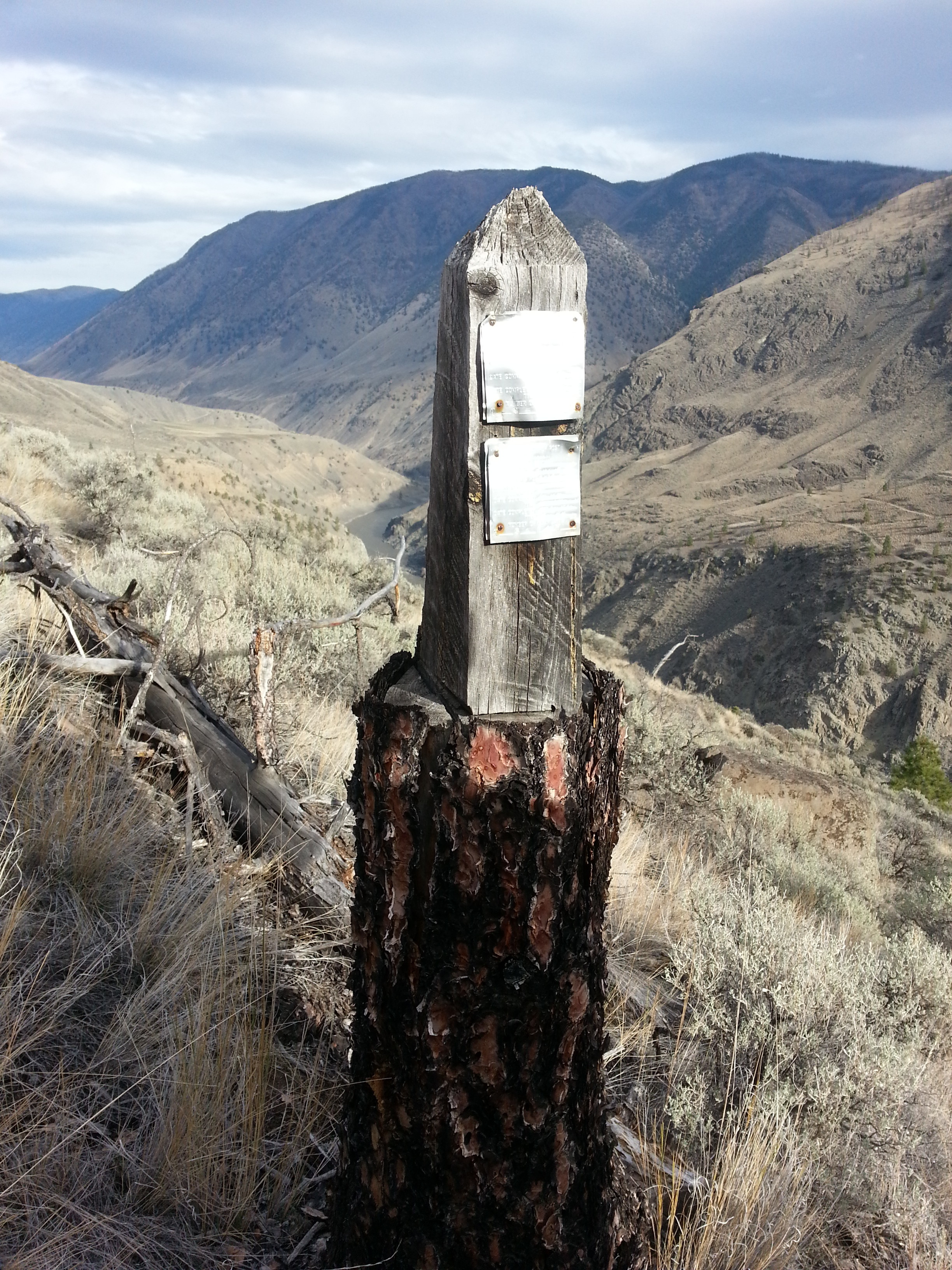
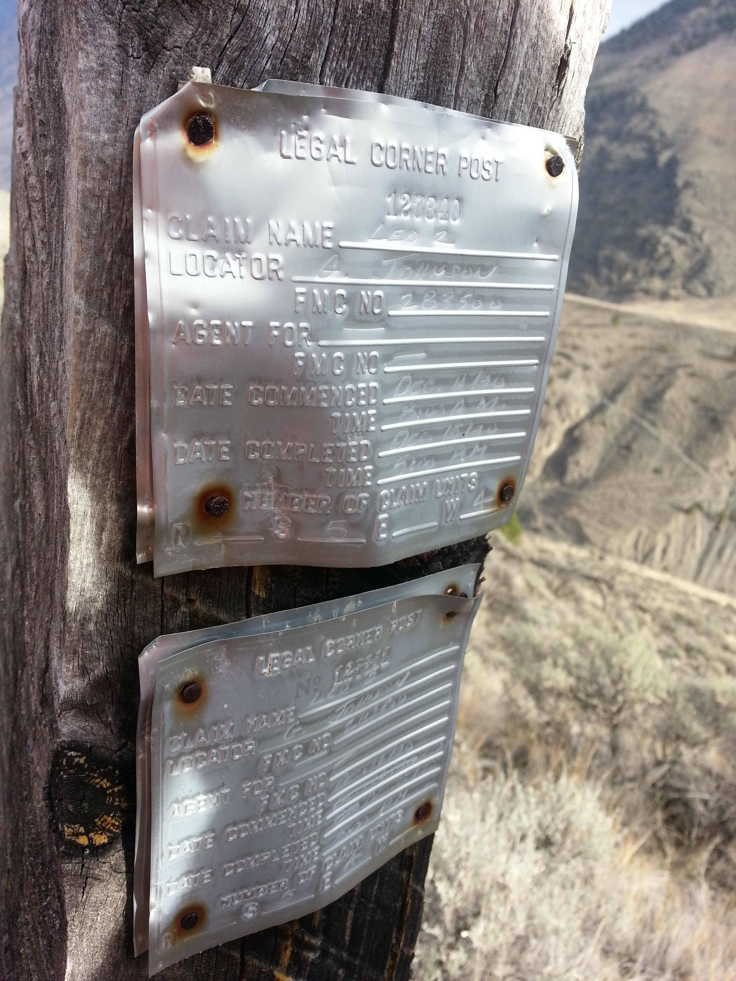
We found an old claim post with tags from 1989/90 right in the center of the claim. The post was actually carved out of a tree trunk and is the most creative claim post I have ever seen. As far as industrial markers go this is a work of art. I hope to find out more about this G. Johnson and what he had discovered on the claim.
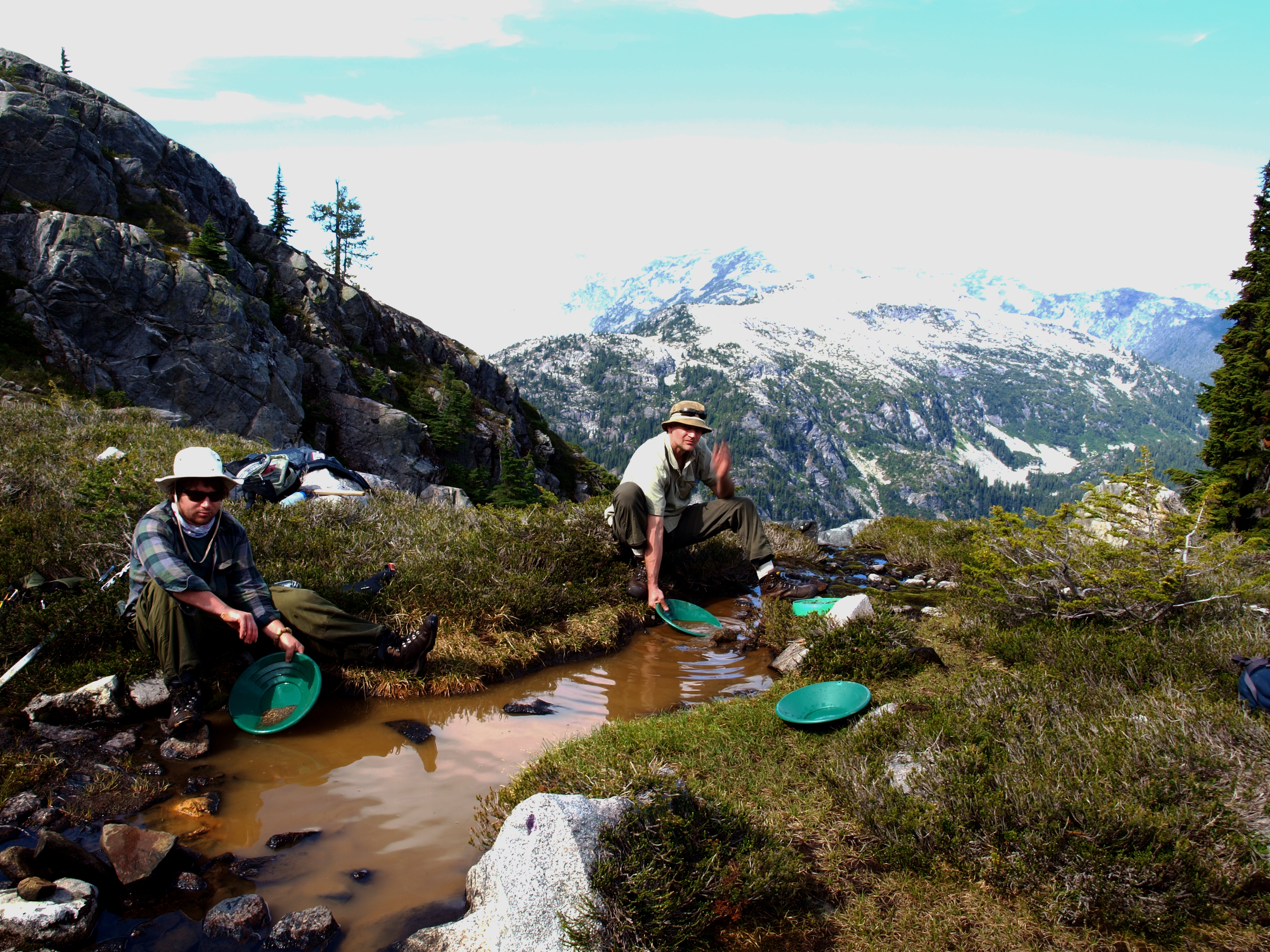
As we were making our way down to the river for day two of prospecting we came across a creek that seemed to appear out of nowhere. My partner noticed some gravel near the surface and we thought we might as well pan it. In that pan we saw a small coarse chunk of gold. This was pretty exciting since it was located several hundred feet above the river. We took several more pans in that spot and found a little bit of gold in each one. Now we have to find out where that mysterious little creek is getting the gold from.
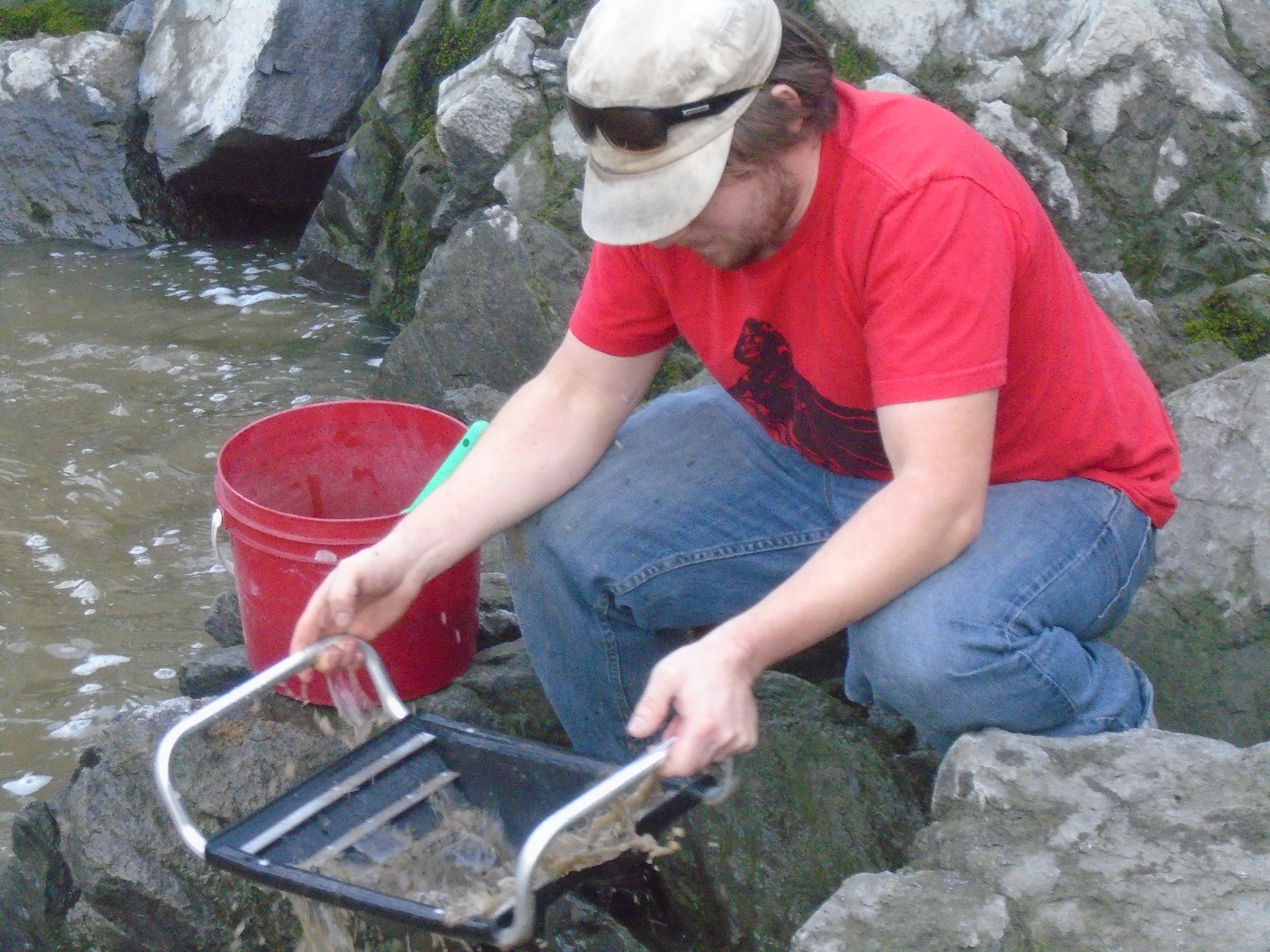
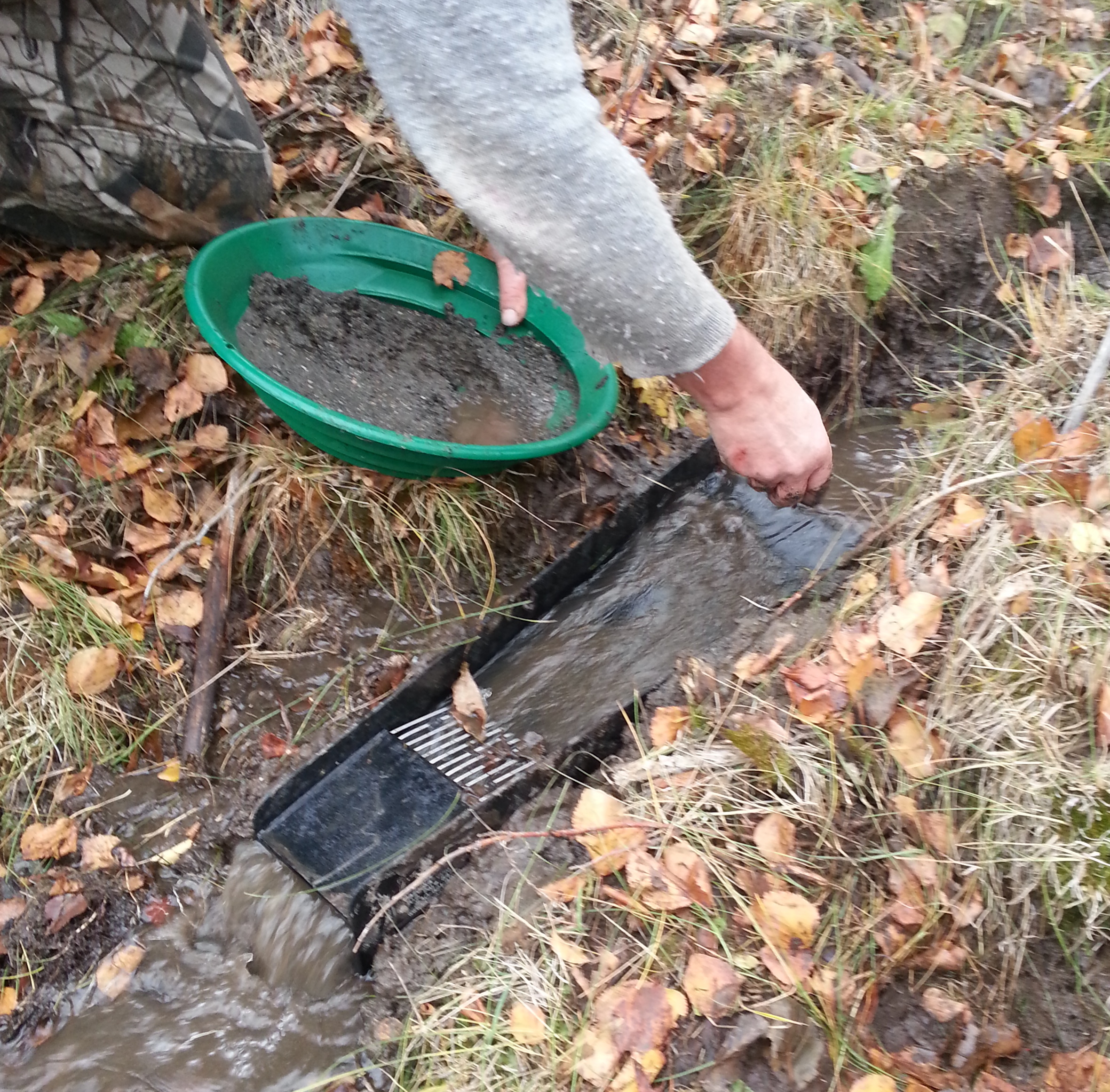
My partner had a Bazooka Gold Trap and we tried it out on this little creek. The gold trap seemed to work pretty well. It’s an interesting design that has a chamber at the back and a water scoop underneath that forces water into the trap.
That was our last trip of the season to this area. The weather forecast says snow is coming this week and it will probably stick until the spring.
Searching for a legendary lost gold mine is a little different from a typical prospecting trip. Instead of picking an area based solely on its mineral potential our clues were derived largely from literature and first person accounts from decades ago. It was half treasure hunt and half geological prospecting. Before the first trip we did a lot of research reading up on the legend and accounts of previous explorers of the area. Some background is mentioned in “Part 1 – The Legend”. We also consulted as many topo maps, aerial photos, geological reports and other information as we could get our hands on. It always blows me away how much different terrain can be than what it shows on the map. A topo map can show you several contours close together over 2 or 3 cm of paper but when you get out there it’s a different story.
We chose to check out the area around the Terrarosa and Stave glaciers in Southern BC. The legend says the mine is somewhere North of Pitt Lake, and Volcanic Brown’s last camp was found just below the Stave Glacier. In the early 20th century there was a lot activity on Fire Mountain which is just East of that area so we know that gold has been found close by. Geological maps show the boundary between several geological units at a large fault in the valley between the Stave and Terrarosa glaciers and we wanted to check that out. On both trips we took rock samples for lab assay and panned some of the best looking areas.
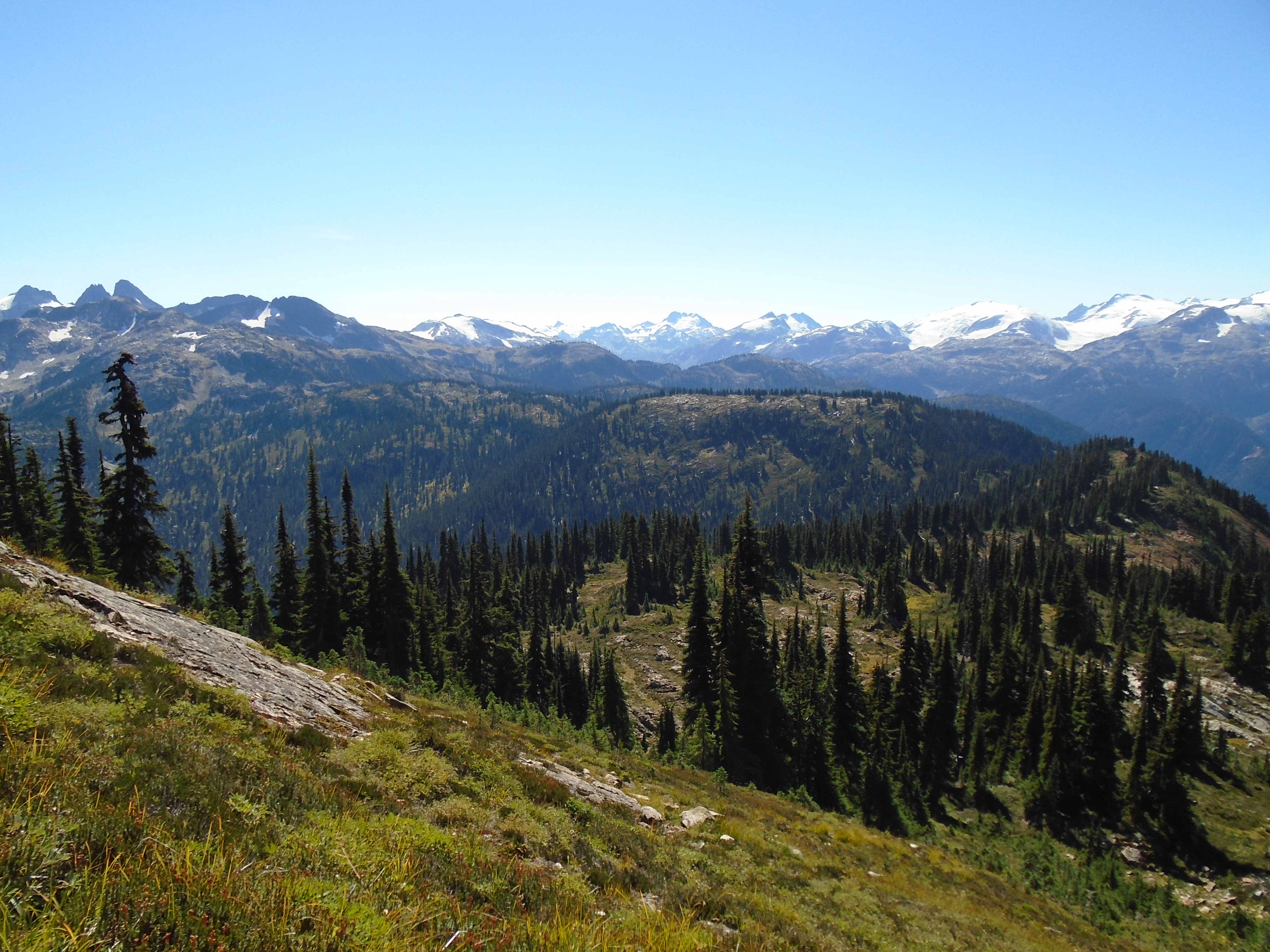
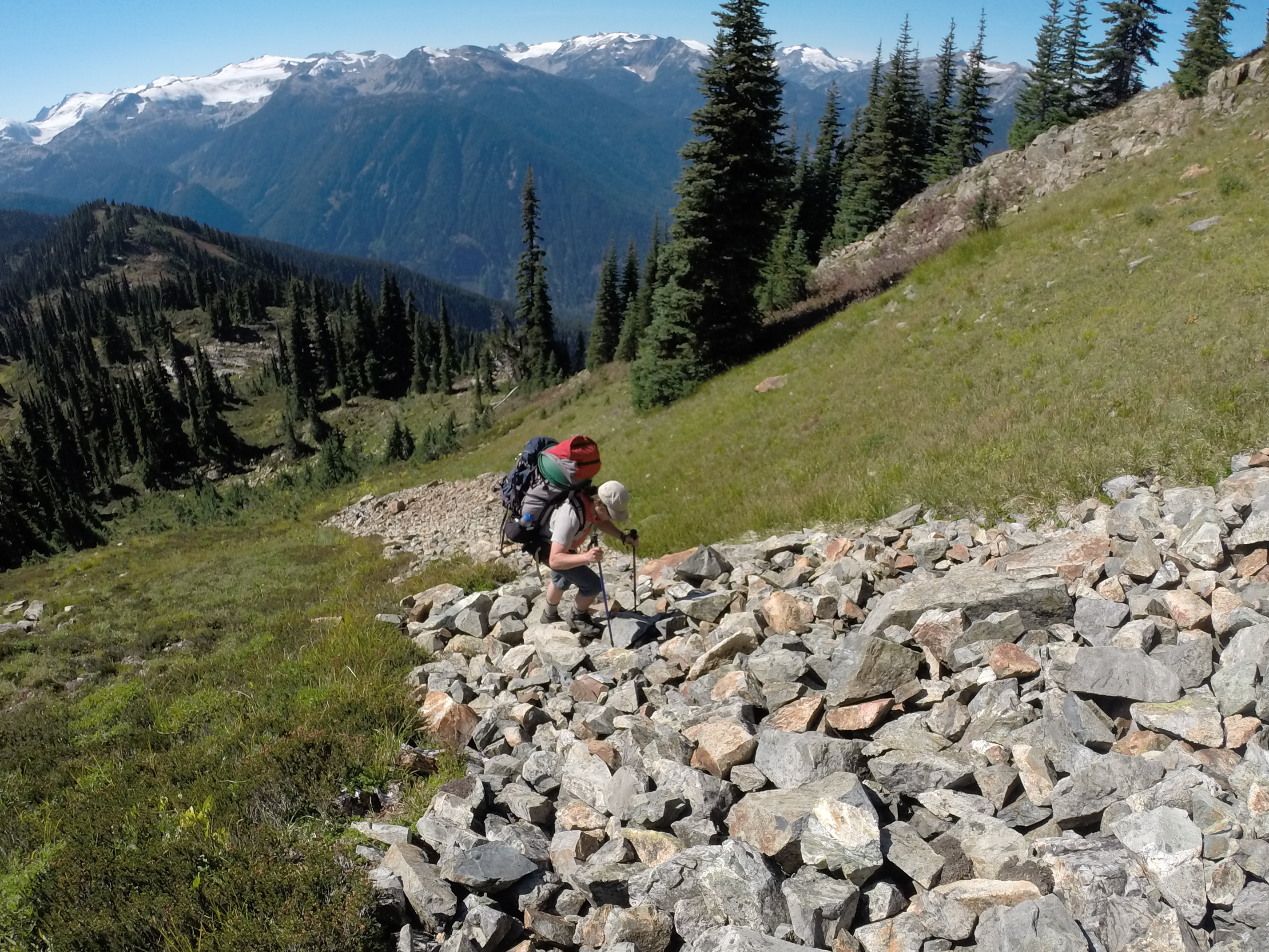
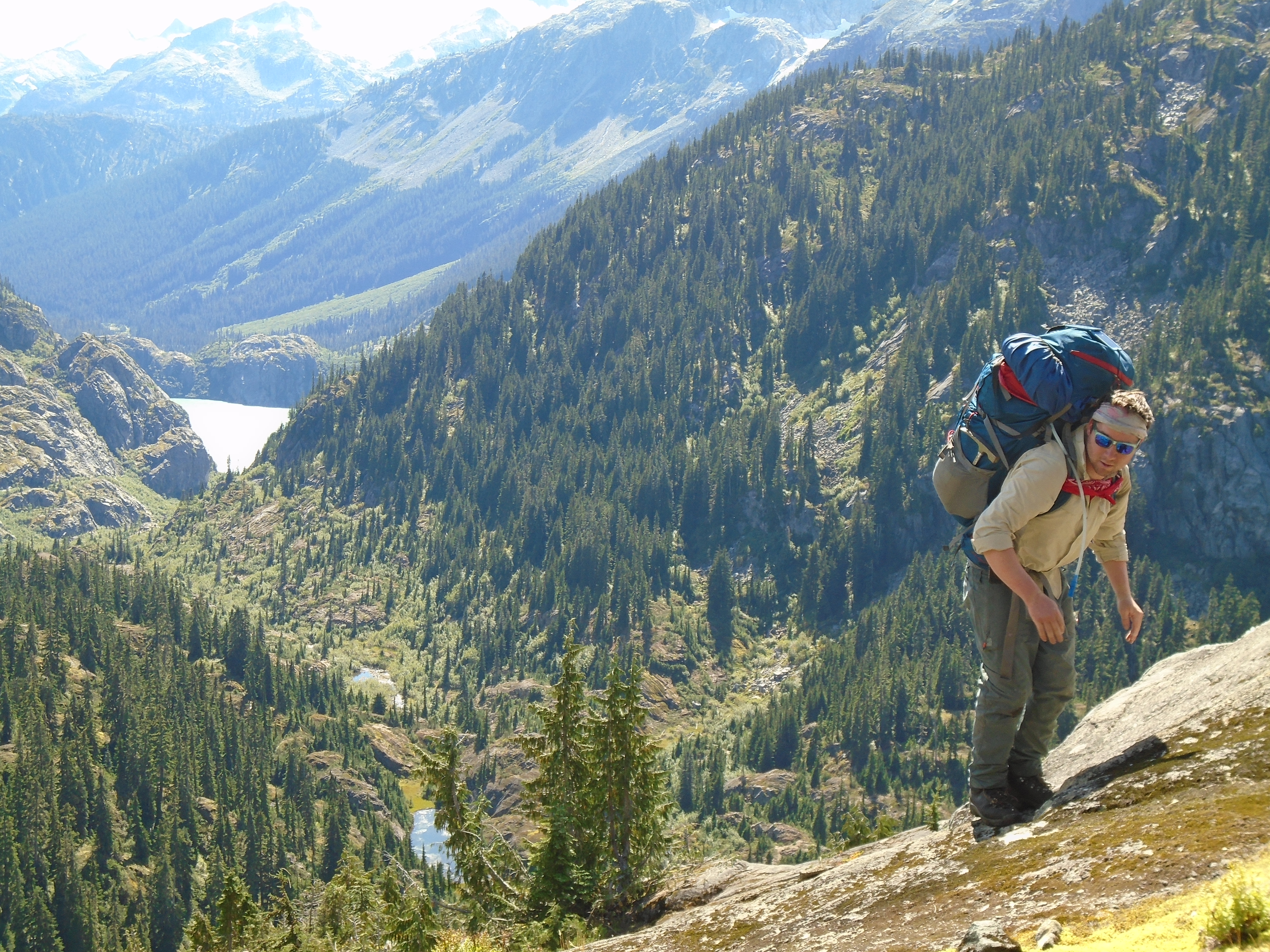
In 2012 we launched the first trip to the area with myself, my brother and a trusted friend. To access the area we travelled up the side of Harrison Lake and took the 4×4 roads up to Fire Lake which is beside Fire Mountain. Several historical high grade hard rock mines are located there. From the end of the road we began our trek to our planned campsite at Terrarosa Lake. The walking distance from the parking spot to Terrarosa Lake was about 17km. Right off the bat we had a very steep incline towards a ridge that would keep us in the alpine as we headed towards the lake. I much prefer alpine over bushwacking up creeks. Its a bit of a push to get up there but no real vegetation to deal with once you do. This ridge offers amazing views of Glacier Lake and the mountain peaks all around. You can see several large glaciers from up there. Non stop postcard quality views.
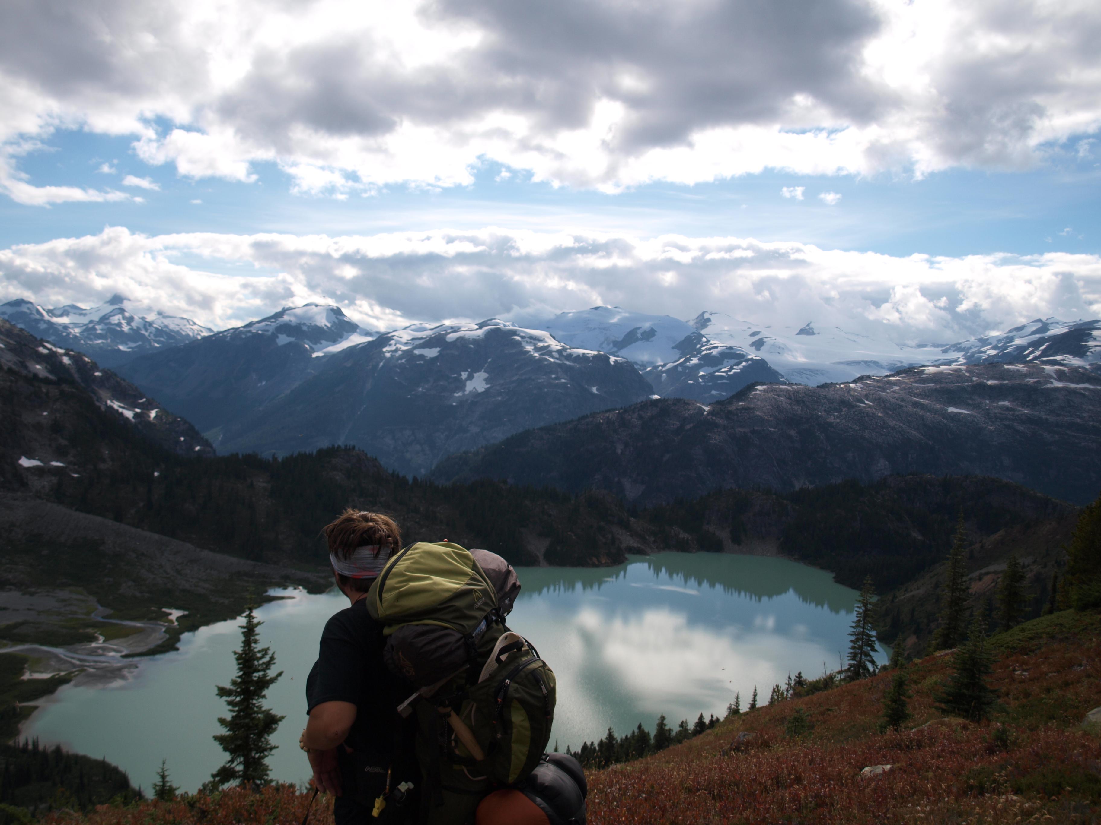
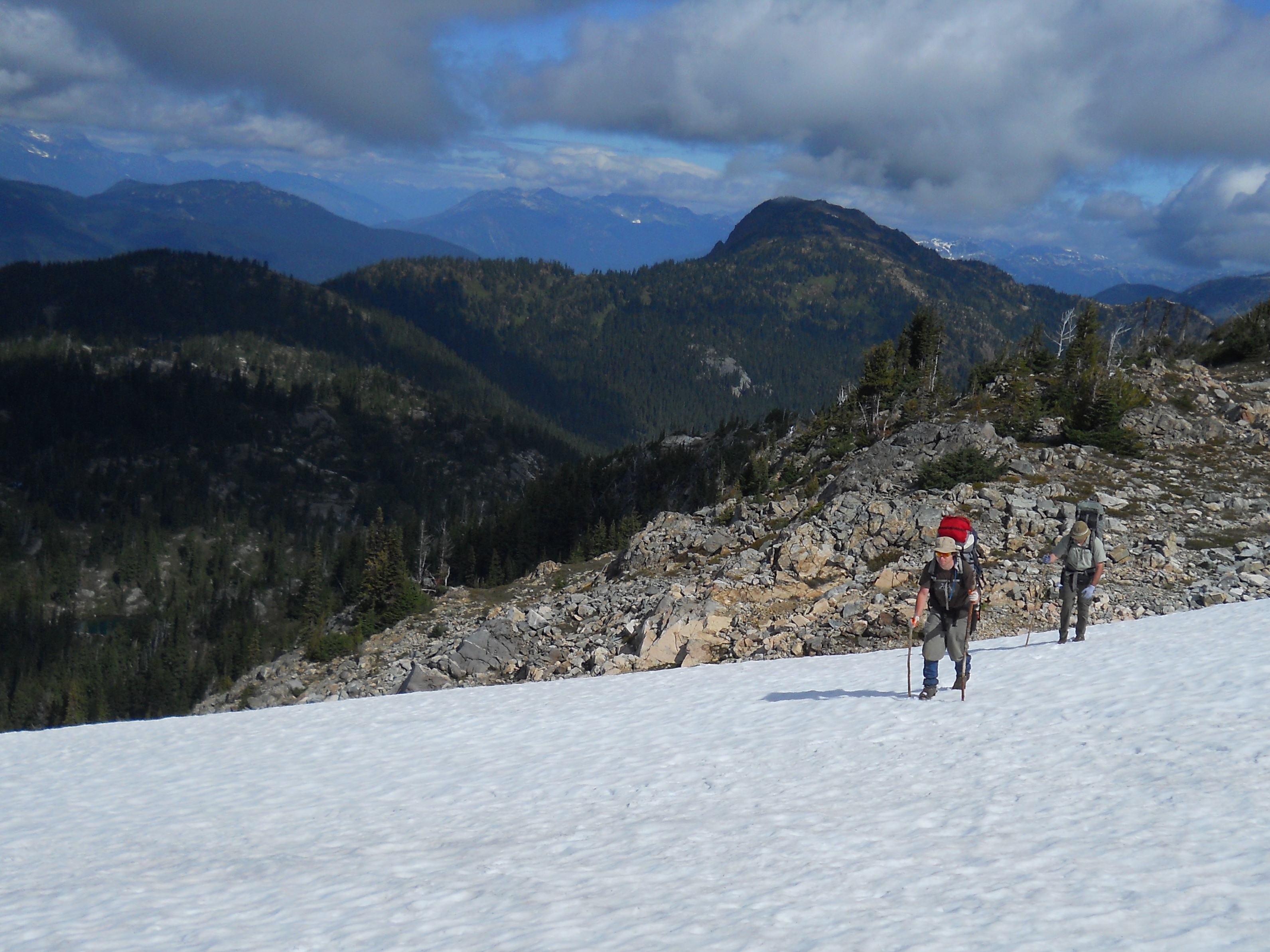
It took us two days to reach Terrarosa Lake. We took a pretty sketchy route to an unnamed lake above Terrarosa. We had to do some rock climbing to get up there which is not easy with backpacks loaded with gear. On the 2014 trip we took a much better route. The terrain up there is extremely rugged, you are either climbing a talus field, an insanely steep slope or descending on ice most of the time. Coming into Terrarosa Lake was an amazing sight, perhaps the greatest view I have ever been rewarded with. It kind of reminds me of a job I was on once near Atlin, BC. When the company sent me out there my boss told me it was going to be “scenic” and my co-workers all started snickering. I later found out what they meant. The camp had no showers, no floors in the canvas tents and no toilet, it was beautiful though.
Before we reached our main camp site at Terrarosa we had to cross the run off from the glacier. There was no way through without crossing a maze of alder bushes and several knee deep streams of ice cold glacial melt. I always hated alders but after the first trip they will forever be on top of my list of plants that I hate. It was quite a relief to reach the camp. We spent three days checking out the area around the lake and tried to make our way into the valley to the West. Unfortunately we were not able to make it into the valley on that trip. We did find some great samples of mineralized rock but not the placer that we had hoped for. After exploring as much of the area as we could we departed on the two day hike back to the logging road. Once we reached my SUV though we were unpleasantly surprised to find my battery dead. After several failed attempts to bump start it we had to make the 20km hike out to get a boost. It was pretty heartbreaking after 7 days of hiking in some of the roughest terrain there is.
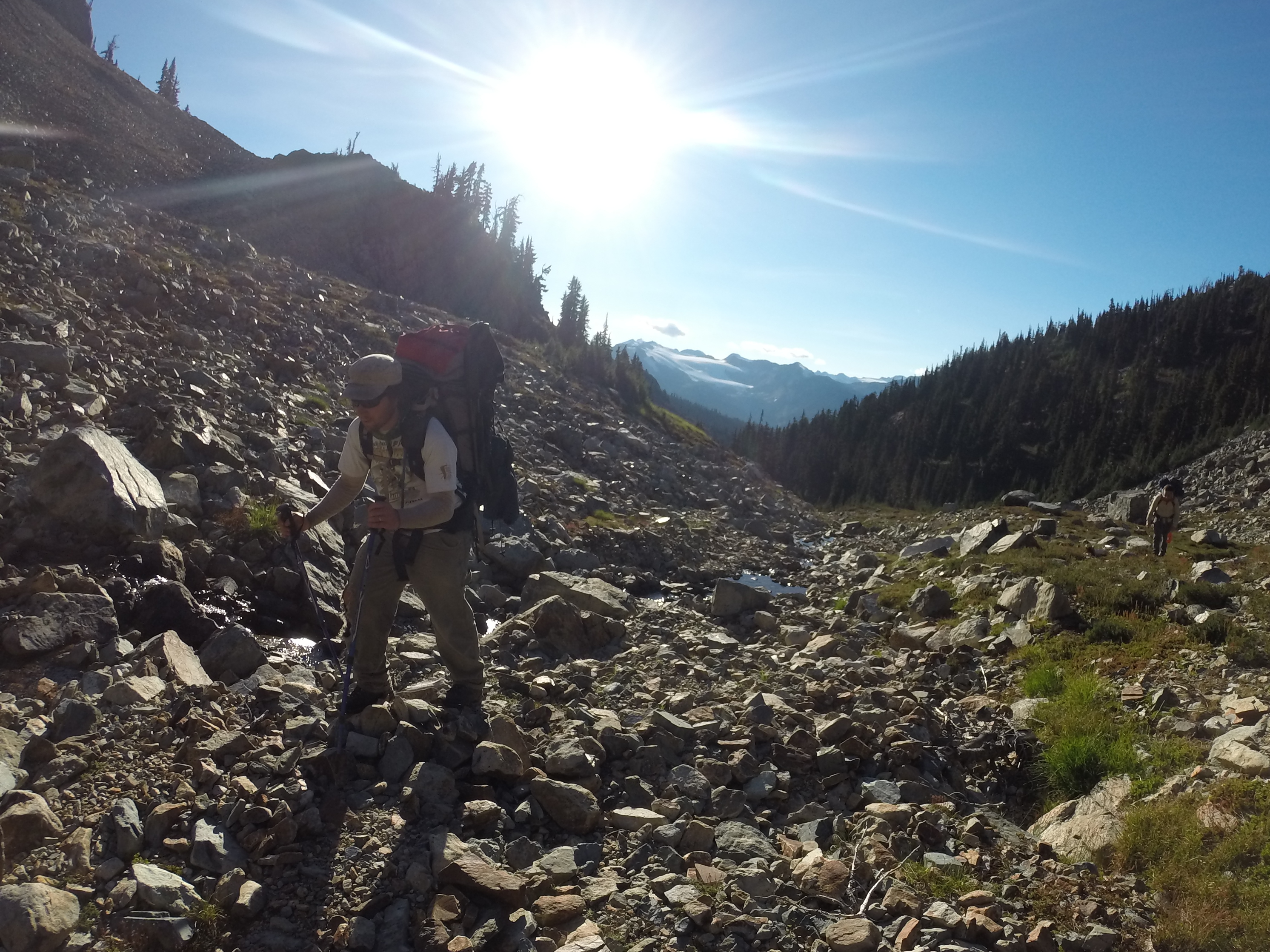
On the return trip in 2014 our primary target was the valley to the West of Terrarosa Lake. On the way up we spent a night at the Sloquet hot springs and had our last real food and beer before the 9 day trek ahead. For backpacking we use the freeze dried astronaut food and other lightweight foods. The logging road up to Fire Lake had been fully deactivated since the 2012 trip. There were deep drainages to cross and pushed the limit of my SUV, I bent my hitch somewhere along the way. This time we were more confident in our hiking route as we had learned by trial and error on the previous trip. Instead of camping up above at the lake we moved our camp right down in the valley. It took three days to get in and another three days to get out of the valley and added some even uglier slopes. It also rained for five of the nine days that we were out there which only added to the difficulty. We did have a better planned route though.
The valley had some amazing rock with lots of quartz veins and signs of gold. There are several creeks down there that have potential for placer gold as well. We saw several waterfalls too. It was tough going and to reach one of our targets we had to wrestle our way through the worst alder bushes I hope I ever see. They have sideways branches the size of a human thigh filled in with smaller bushes. It was like some kind of cruel jungle gym on a steep mountain slope. We managed to reach all of our targeted spots this time with a few mishaps along the way. At one point my brother had to jump naked into a freezing creek because he dropped his rock hammer.
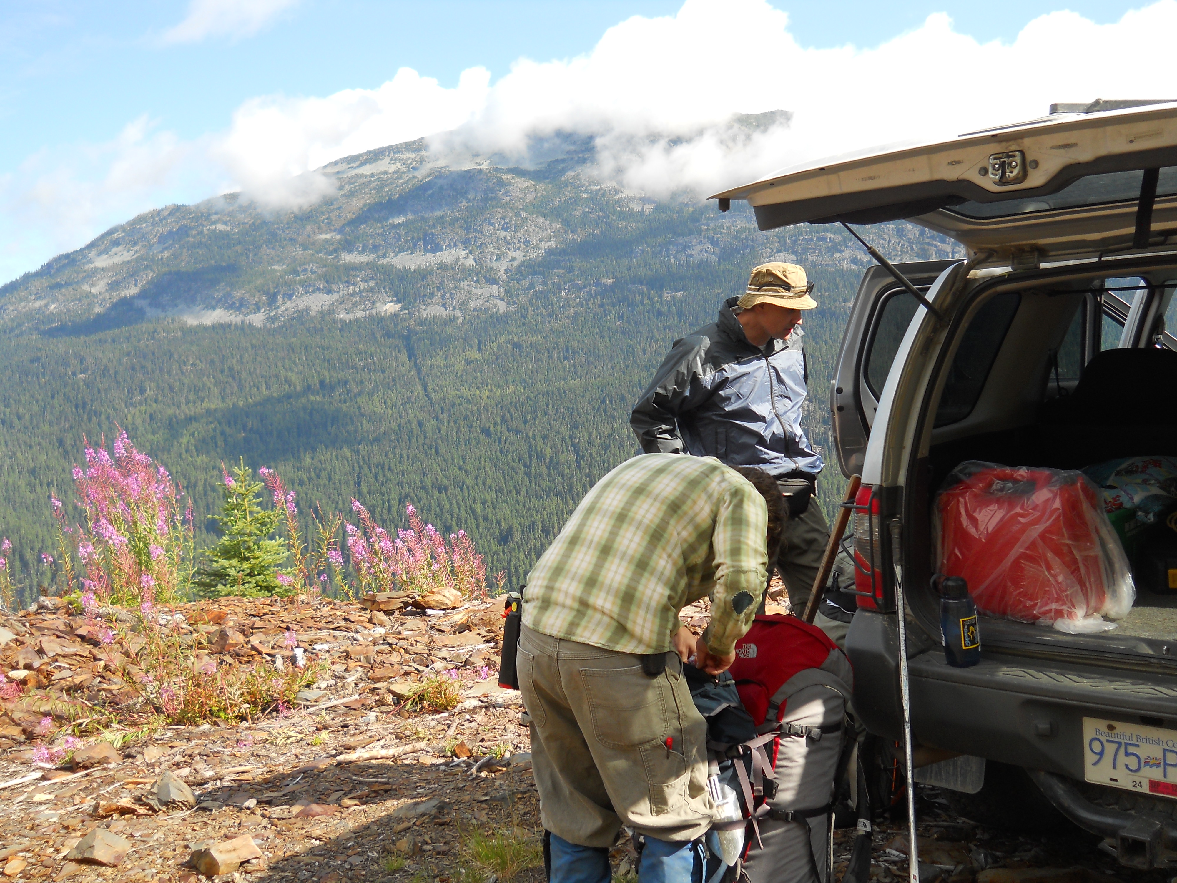
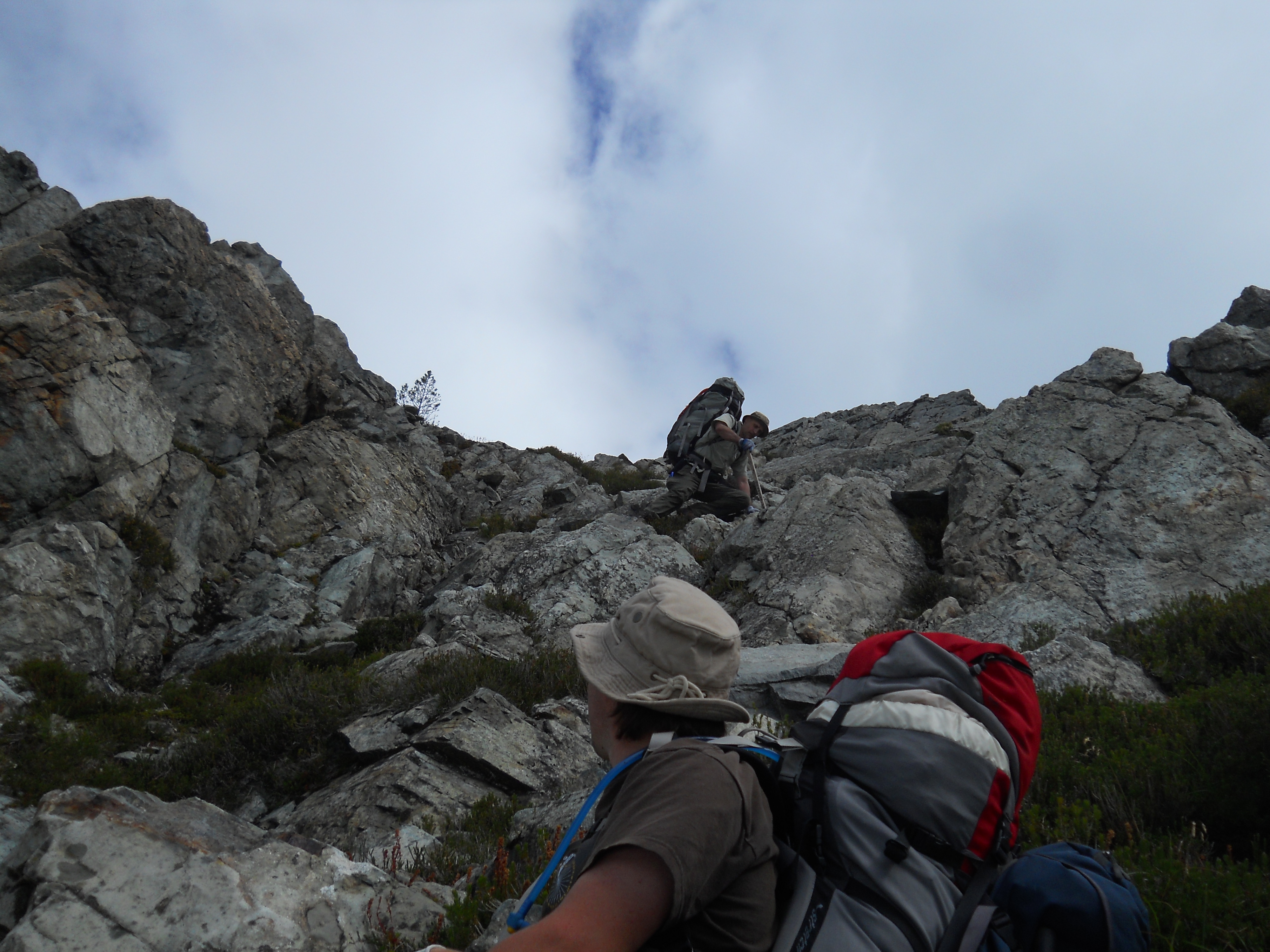
The climb out of the valley was very treaterous. It was almost too steep to walk up, we spent a lot of the time crawling and holding on to vegetation like a climbing rope. There were a couple of close calls but we made it up OK. We hiked back around the lake and set up a camp for the night. It took two more days to reach the SUV again. This time I disconnected the battery to prevent a repeat of the previous situation. After a couple of well deserved warm beers and some clean clothes we hit the road. We took the long way around and stopped in Whistler for one of the most rewarding hamburgers of our lives.
The trips we took up into Slumach country were some of the most memorable of my life. The scenery and sense of accomplishment from mastering that kind of terrain will forever be etched in my memory. Both expeditions had numerous challenges but we made it out alive and well. I have everything mapped out in GIS but because of the time, sweat and money investment I won’t post it publicly. Slumach’s curse did not take us yet. As for the gold? I’m not going to give away too much info on what we found up there. I have every reason to believe that the legends are true.
There are many legends on the West Coast of lost treasure, mines, and caches of precious metal. They are entertaining and spark our adult imagination the same way fantasy novels did when we were kids. I have to admit that I am fascinated with theses stories and the lure of stumbling upon a huge reserve of gold is hard to ignore. The closer to home the legends are the more tantalizing they become. One pervasive legend is the legend of Slumach’s lost gold mine. I have been part of two expeditions to find this mine in 2012 and 2014.
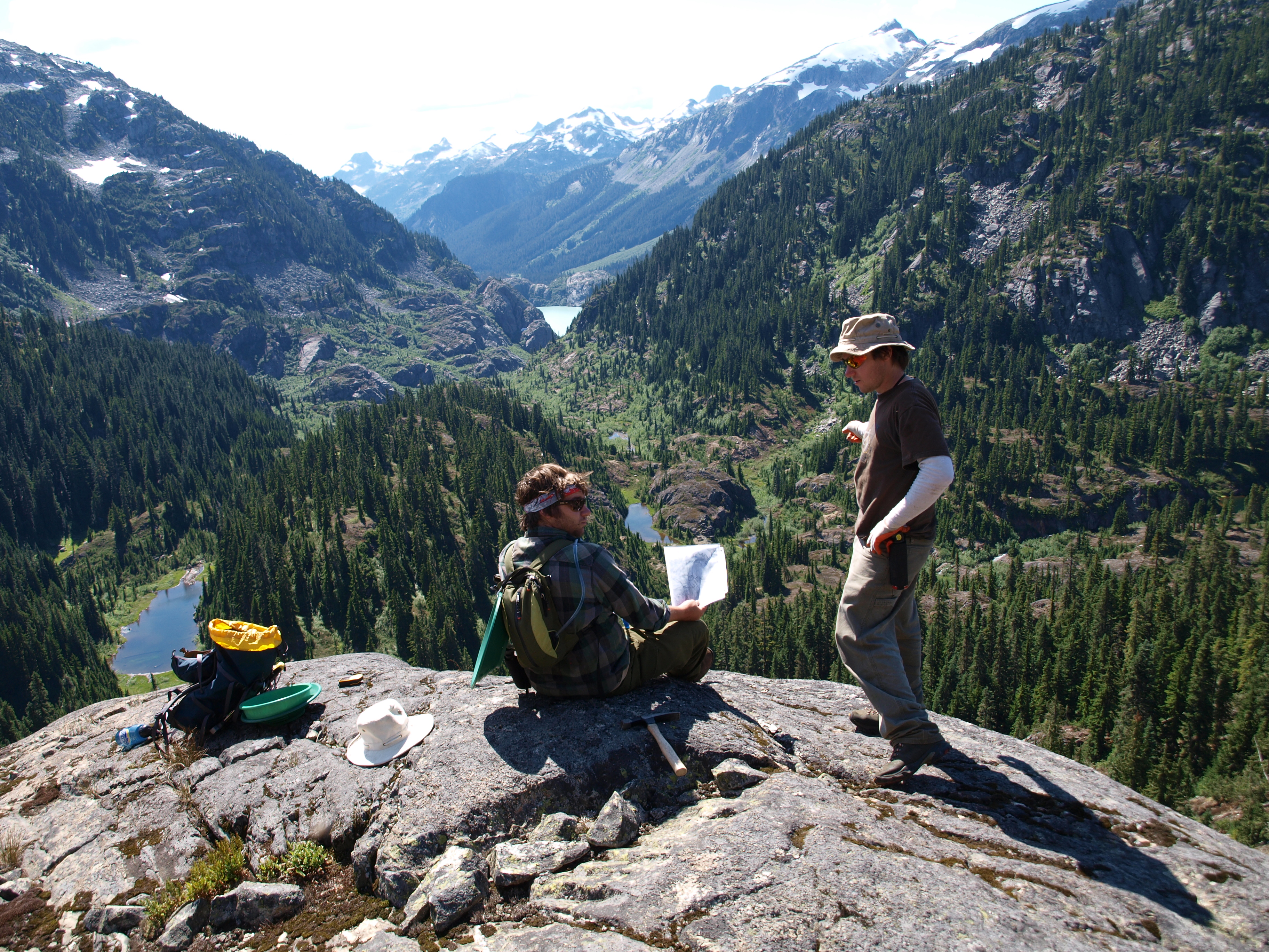
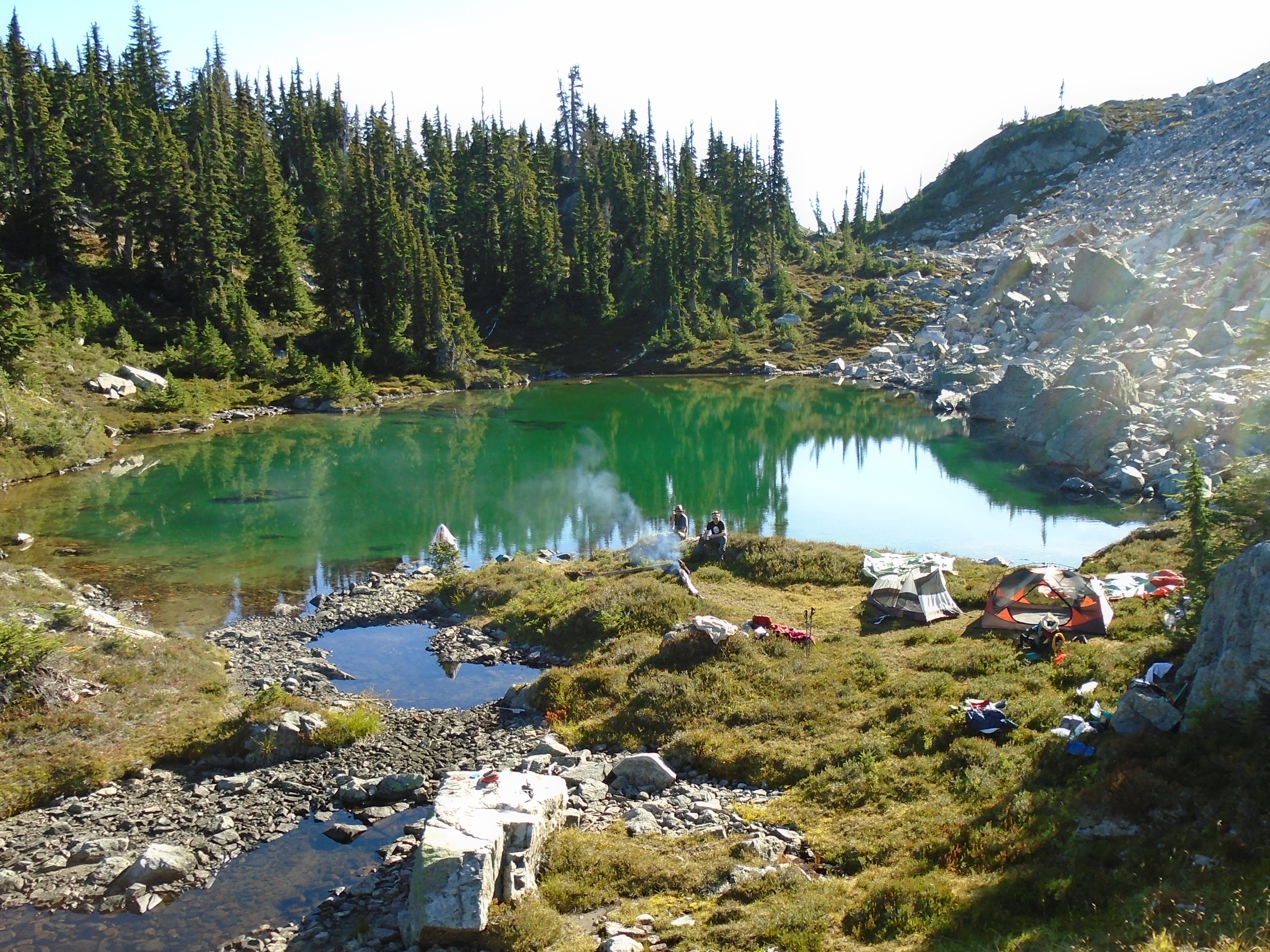
Panning Above Stave Valley
On the West coast this legend is well known. Books have been written about this legend so I’m not going to regurgitate the whole story here, this is about my own search for the treasure. I first read of the story in a book called “Lost Bonanzas of Western Canada”. There was a description of the legend and stories of historic attempts to find the mine. Another great book on the subject is “Slumach’s Gold: In Search of a Legend“. There is lots of info online as well.
The legend states that in the late 1800s a Coquitlam native named Slumach would occasionally come into New Westminster with a bag full of gold nuggets. He would blow the wealth on liquor and brothels and eventually return to his cabin on Pitt Lake. Slumach allegedly would never tell the location of his mine to anyone. In 1890 Slumach was found guilty of the murder of man named Louis Bee and hanged a year later for the crime. There is a lot of debate around the circumstances of the murder, it may have been self defence but that is irrelevant as far as the gold is concerned. It is said that prior to being hanged Slumach put a curse on the mine in the Chinook language “Nika memloose, mine memloose”. When translated into english the curse means “No man who finds the gold will live long enough to bring it out.”
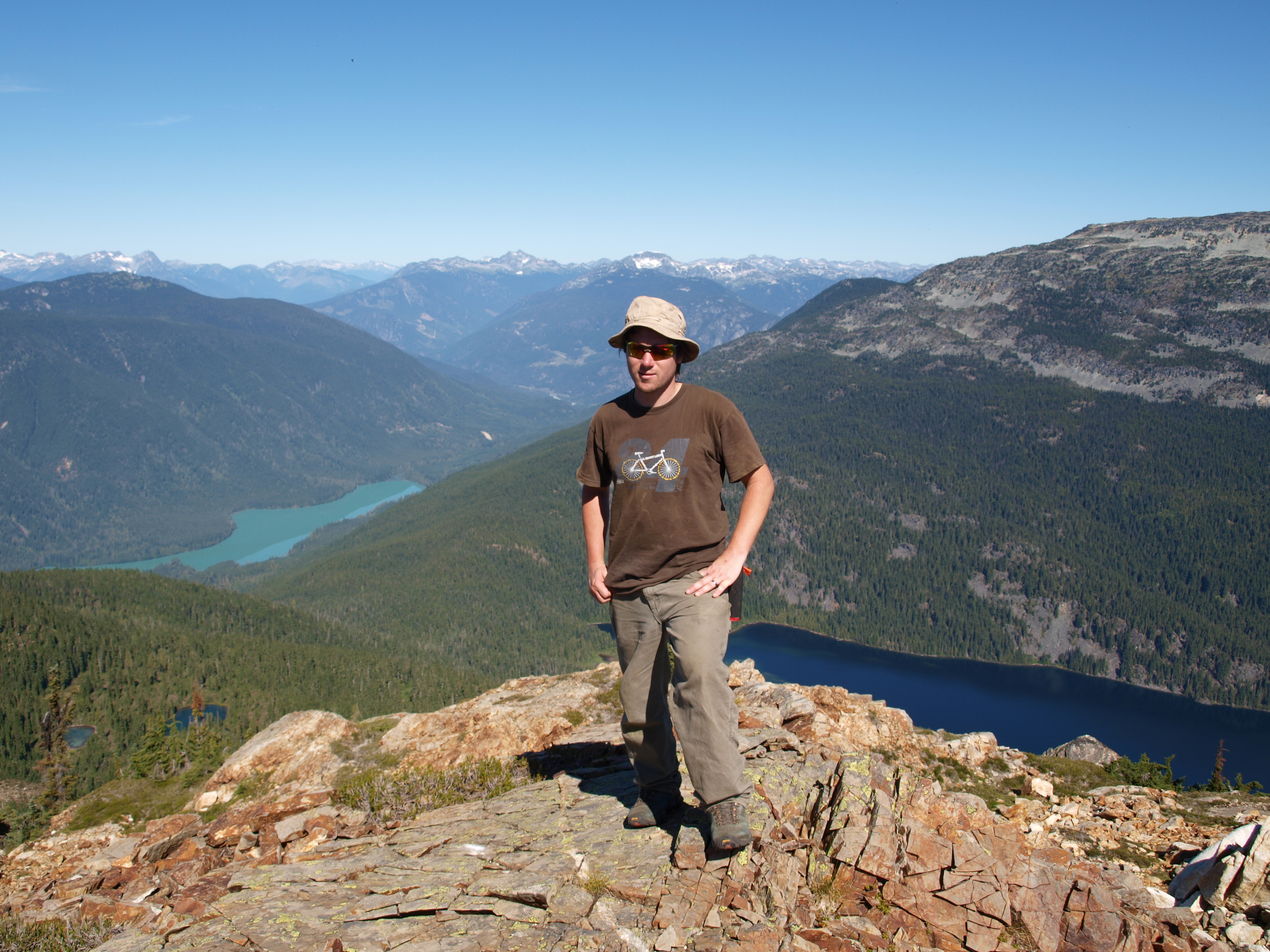
Hiking Out of Stave Valley
There are all sorts of ideas about the facts surrounding Slumach’s trial, his life and so on. The truth is there isn’t much recorded history about the guy. Some say he took women up the mine to cook for him and murdered them to hide the location. Others believe their is no mine at all and he got his gold from robbing other miners in the area. None of that really matters as far as finding a rich gold deposit in the mountains North of Pitt Lake.
There are other characters in the ongoing story that hold much more compelling evidence. Not least of which is a prospector known only as “Jackson”. He left a letter vaguely describing the location of a creek rich with nuggets. Apparently Jackson found a very rich gold bearing stream somewhere North of Pitt Lake. He carried as much gold with him out and buried the rest due to the weight under a tent shaped rock. Jackson seemingly wrote the letter from his death bed in San Fransisco unable to return to claim his gold. Here is the text of the Jackson letter:
Dear Friend,
It will come to you as a surprise after all these years to hear from me for no doubt you have long since forgotten me. But you will remember the old man you so kindly grub staked with money and provisions at Guytos. Since then I have prospected with the varied success that usually goes with the life of a prospector.
In 1901 I went to B.C. and it is of this trip I want to tell, and hope you will gain by it untold thousands for your kindness to me. I heard you went broke like most everyone else at Guytos but had lost all trace of you since then except that you had gone to Washington. Well, I made a great discovery in New Westminster but after coming out for supplies and tools was taken down with a severe attack of rheumatism that ever since has left me almost bedfast until a short time ago, when I recovered sufficiently as though to make the trip again.
I made up my mind to hunt you up and take you with me. In hunting over a Seattle directory I found your name and address and concluded to come to Seattle and talk the matter over with you. A few days after arriving here from my little place in the hills, I was suddenly stricken down again and the Doctors say that I will never recover and may drop off any time for my heart is badly affected. So I will tell you of my trip and what I found and direct you to the best I can to find it. It is too great to be lost to the world and I know with you it will be in good hands.
Well, I arrived in Vancouver about the first of July and hired a couple of natives to take me to the headwaters of the ____ then dismissing the natives I struck out in the mountains, and they are rough ones. I prospected up beyond the lake but found nothing of importance. But the formation looked all right. I concluded to prospect back towards ____ Lake. I kept well up on the mountains but was often compelled to make long trips down before crossing could be found on the deep canyons.
I had been out about two months and found myself running short of grub. I lived mostly on fresh meat for one can’t carry much of a pack in those hills. Found a few very promising ledges and some color in the little creeks, but nothing I cared to stay with. I had almost made up my mind to light out the next day. I climbed to the top of a sharp ridge and looked down into a little canyon or valley about one mile and a half or two miles long, but what struck me as singular, it appeared to have no outlet for the little creek that flowed at the bottom. Afterwards I found the creek entered a ______ and is lost.
After some difficulty I found my way down to the creek. The water was almost white. The formation for the most had been slate and granite but there I found a kind of schist and slate formation. Now comes the interesting part. I had only a small prospecting pan, but I found colors at once right on the surface and such colors they were. I knew then I had struck it rich at last.
In going up stream I came to a place where the bedrock was bare and there you can hardly believe me, but the bedrock was yellow with gold. In a few days I gathered thousands and there were thousands more in sight. Some of the nuggets were as big as walnuts and there were many chunks carrying quartz. After sizing up carefully I saw that there were millions stowed away in the little cracks. On account of the weight I buried part of the gold at the foot of a large tent shaped rock facing the creek. You can’t miss it. There is a mark cut out in it. Taking with me what I supposed to be about $10,000 proved to be over $8,000. After three days of extreme hard traveling it would not be over 2 days of good going but the way was rough and I was not feeling well. I arrived at the lake and while resting there at the Indian Camp was taken sick and have never since been able to return and now I fear I never shall. I am alone in the world. No relations, no one to look to me for anything.
Of course I have never spoken of this find during all this time for fear of it being discovered. It has caused me many anxious hours but the place is so well guarded by surrounding ridges that it should not be found for many years unless someone knew its being there.
Oh, how I wish I could go with you and show you to the wonderful place for I find I can’t give any exact directions and it may take you a year or more to find it but don’t give it up. Keep at it and you will not fail and you will be repaid beyond your wildest dreams.
I believe any further directions only tend to confuse so I will only suggest further that you go alone or at least take one or two Indians to pack food and no one need to know but you were going on a hunting trip until you find the place and get everything fixed up to suit yourself.
When you find it, and I am sure you will, should you care to see me advertize in the “Frisco Examiner” and if I am living I will either come and see you or let you know where to find me but once more I say to you don’t fail to look this great property up and don’t give up till you find it. I am very sorry I can’t give you more definite instructions. Of course I expected to have gone back long since. I have drawn a rough sketch that will help you. Success and happiness.
Yours truly,
W. Jackson
Not much else is known about Jackson. There is another character called Volcanic Brown also known as R.A or “Doc” Brown. Unlike the previous two Volcanic was well known in BC in the early 1900s. Volcanic was a respected healer and prospector with many successes. There is even a ghost town from a mine that was discovered by Brown that is called Volcanic City. He discovered the large scale Copper Mountain mine outside of Princeton that is still operating today. Volcanic Brown is said to have gained a copy of the Jackson letter and started looking for the lost mine in the late 1920s. He would go each summer and stay out there for several months. In 1928 he got frostbite and amputated one of his toes and continued to hike out. I can tell you after hiking this area myself I would not have come back after that.
Volcanic Brown
Volcanic Brown would check in at the small logging community of Alvin at the head of Pitt Lake at the end of his season. In 1931 he did not check in and soon after a search party went out looking for him. The search party trekked over the Stave glacier in November to find Volcanic (no small feat in itself). They didn’t find the man but they are said to have found a collapsible pup tent, some cooking utensils, a double barreled shotgun, a notebook containing herbal remedies, and a glass jar containing eleven ounces of course gold. The gold is said to have contained traces of quartz and was believed to have been hammered out of a solid vein. The rescue attempt was well recorded, it even made the newspaper. So Volcanic Brown definitely found some nice gold out there. His last camp was found in the valley at the beginning of the Stave river near Upper Stave Lake. My expeditions were in a similar area.
The final character is Stu Brown, no relation to Volcanic. For me the Stu Brown story is what made the Slumach legend believable. Brown had several science degrees and was a world war two air force veteran. He apparently used stereoscopic air photos to identify the area described in Jackson’s letter. The area that he identified was inside Garibaldi provincial park. Stu Brown wrote numerous letters to the government asking for permission to claim the site and extract the gold. He was unsuccessful in persuading them to allow him to mine, he even sent a letter to Teck mining corporation.
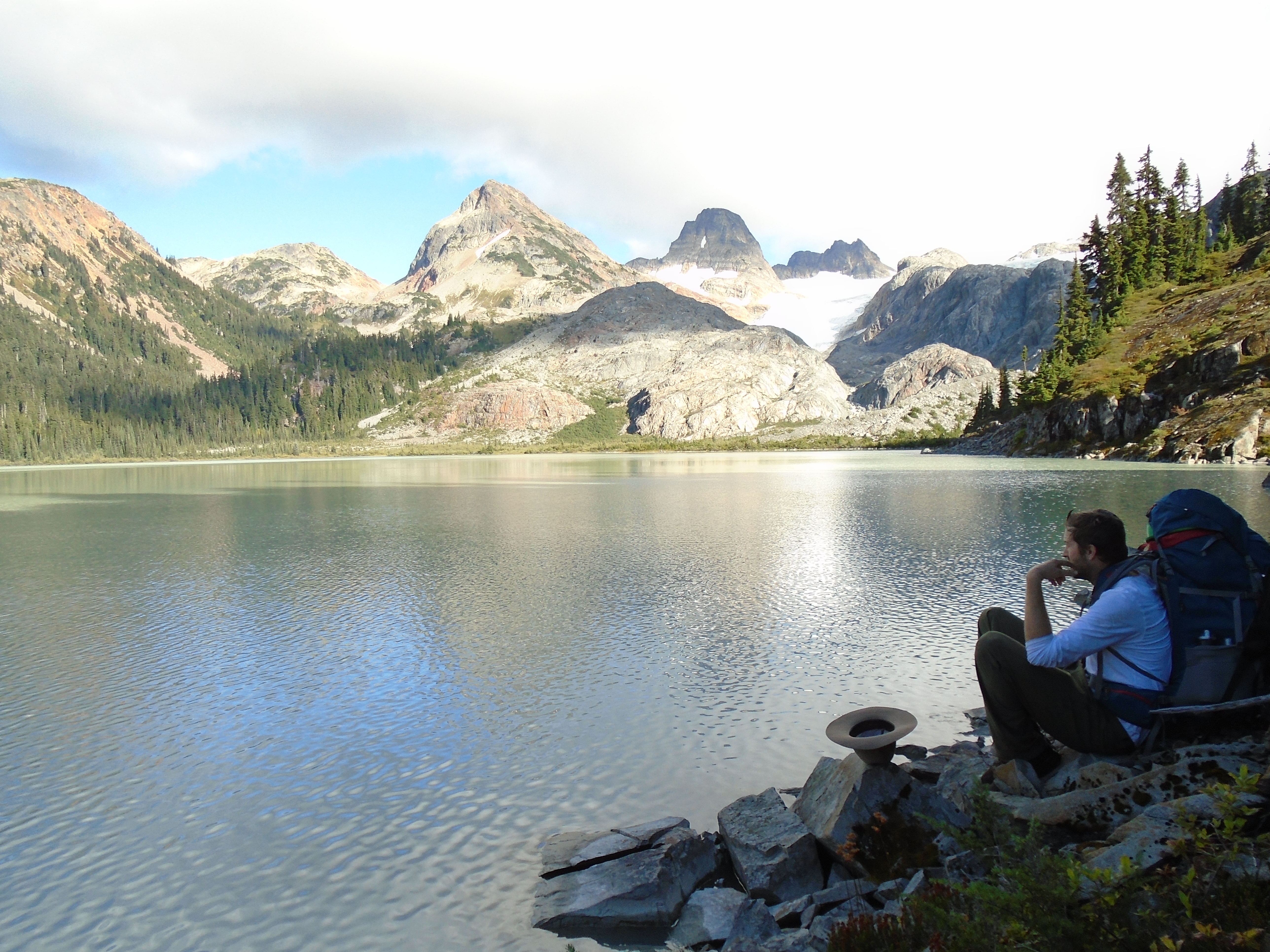
Terrarosa Lake
Stu described a 100′ high natural rock dam blocking a stream where water shoots out of a hole in the dam. He described a pool at the base of the dam that is ankle deep in gold. Stu was never able to give accurate directions to the spot however.
In 2012 I embarked on our first expedition to Terrarosa lake which is at the foot of the Terrarosa glacier and near the Stave glacier. We did some gold panning and sampling in the area of interest. This area was selected because it is near Volcanic’s last camp and vague clues that Stu Brown gave out seemed to fit in this area. The geology of the area is very favourable for epithermal gold as well with a huge fault passing through from Glacier lake marking the boundary between two geological units. In 2014 we reached a lower area in the valley between the Stave and Terrarosa Glaciers. 2012 took us 8 days and 2014 took 9 days of unsupported backpacking and rock climbing in very rugged terrain. My next post will describe the details of the expeditions.
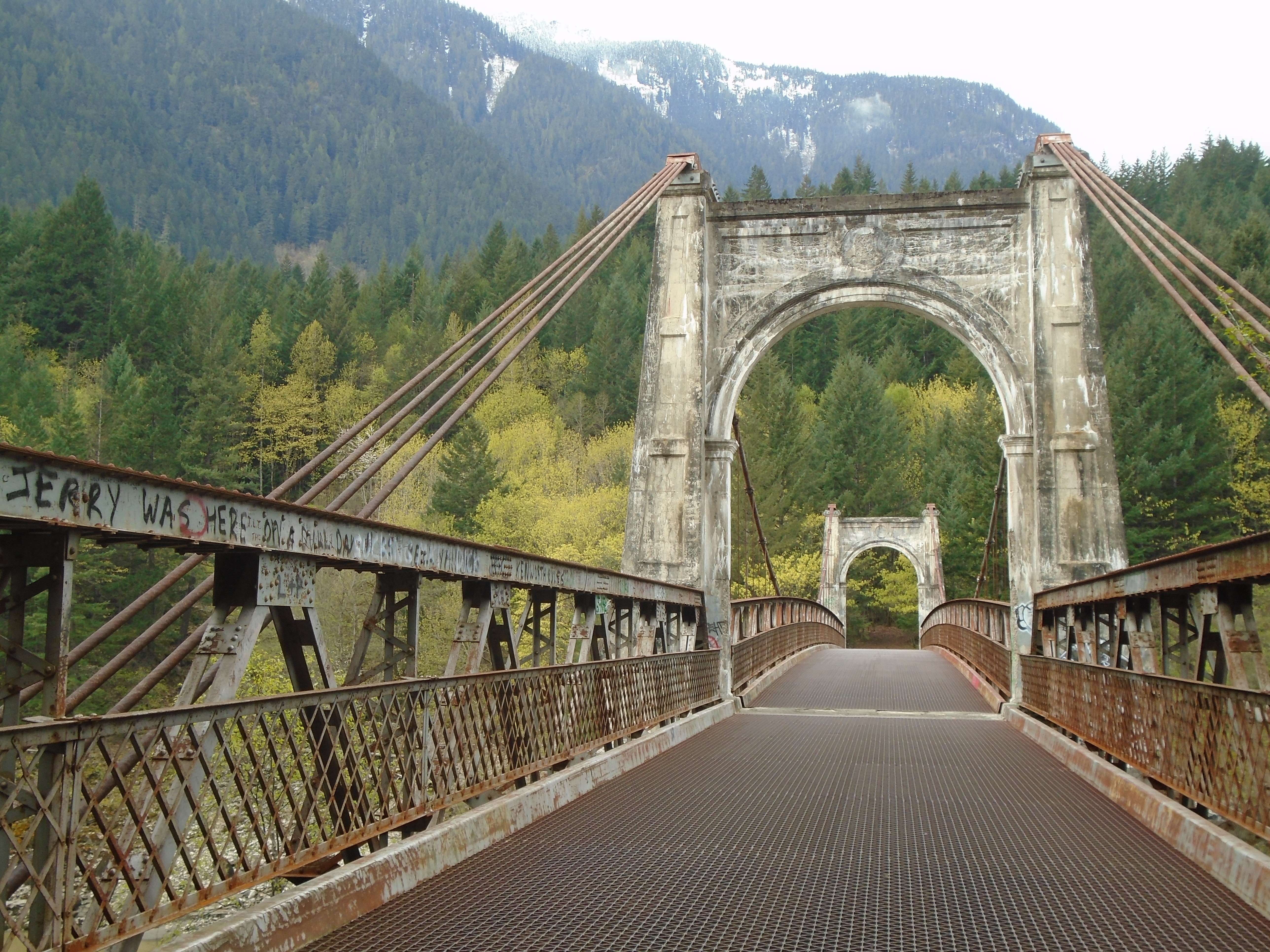
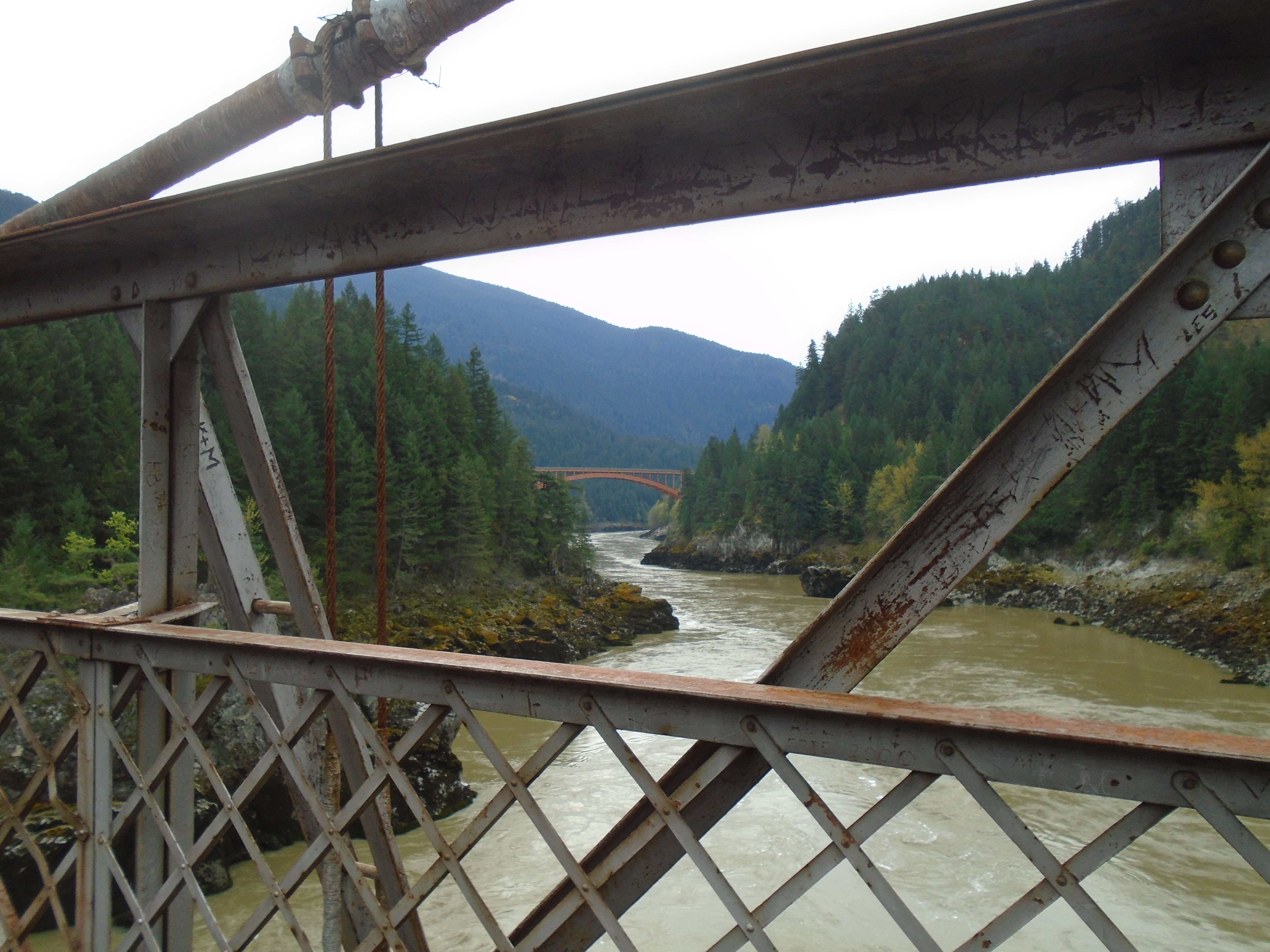
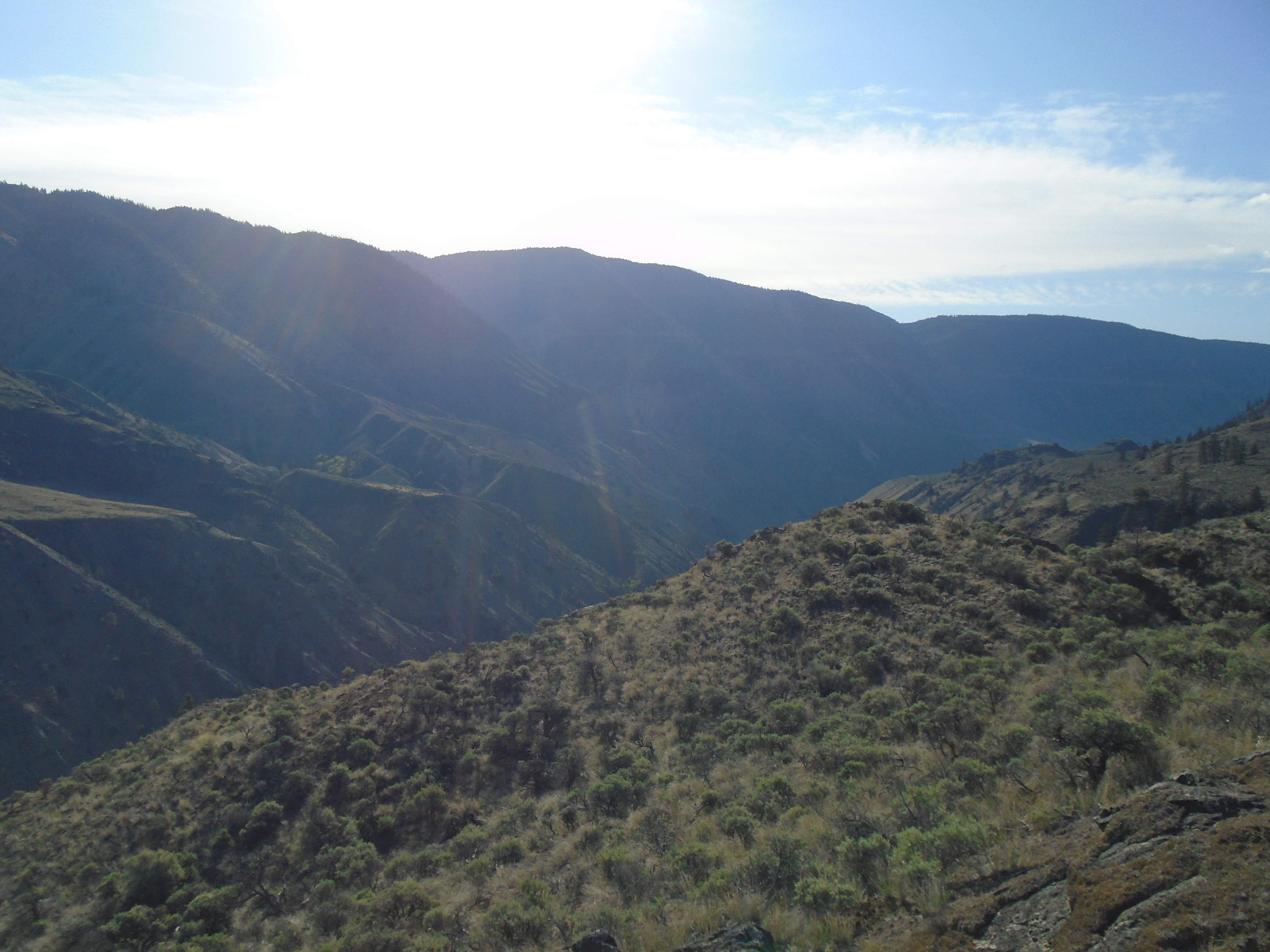
In April I went to check out two claims in the area North of Lillooet, BC. These two claims are close to the one that I wrote about in my Southern Cariboo Prospecting Trip. On the way up the Fraser Canyon I stopped at the old Alexandra bridge to get a peep at a claim that I have on the other side of the river. The old bridge is part of the original Cariboo wagon road that serviced the gold rushes of the Fraser and Cariboo. The Alexandra bridge that stands today was built in the exact same spot of the original bridge from in 1861. The current bridge was completed in 1926. There’s a lot of history here.
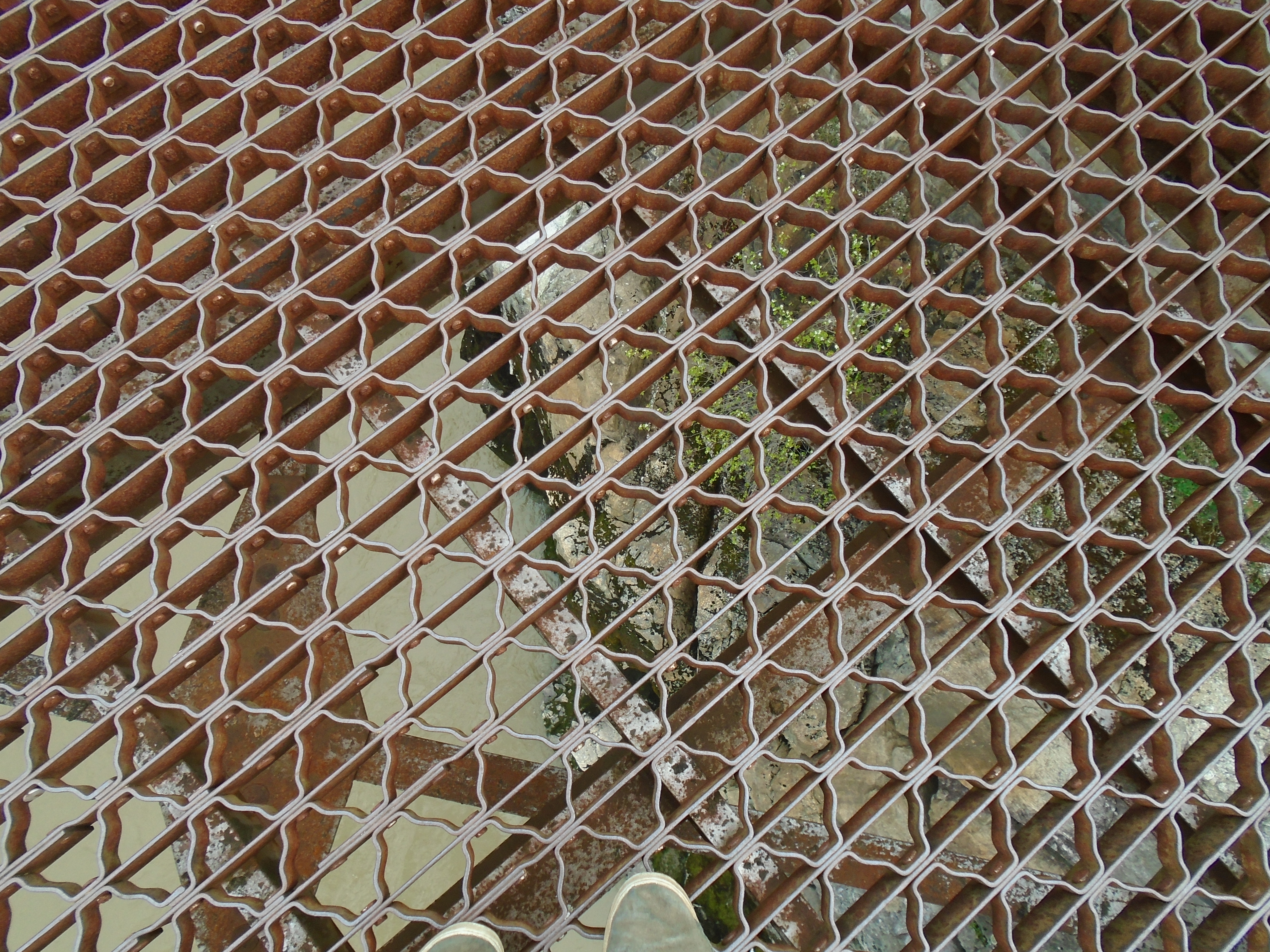
In the second photo you can see the latest bridge in the distance that replaced the old suspension bridge in the 1960s. The old bridge has an open grate for a bridge deck. I’m not afraid of heights but it is a little hard to trust a bridge that has been decommissioned. There has to be a reason right?
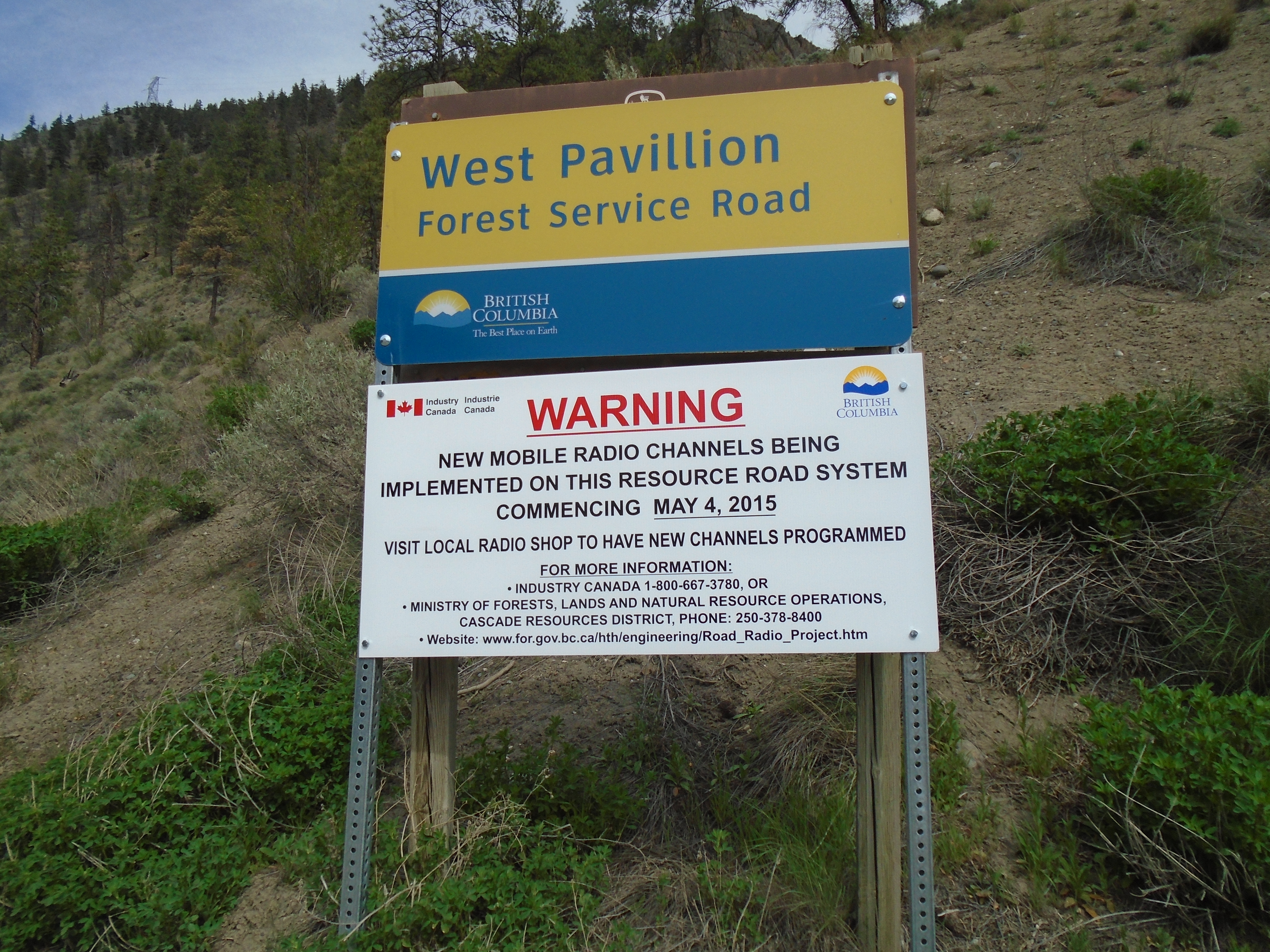
Once again I travelled up the West Pavillion forest service road to do some gold panning. This time though the road frequency had been changed, and the new one wasn’t posted yet.
There were some phone numbers and a website posted but this area is outside of cell range so that is not really helpful. I had a my trusty Baofeng but it wasn’t any good without the proper channel. Here’s a link to the new posted channels for the area, FYI. According to that site the new channel is 150.11 MHz. Fortunately it was a quiet day on the road and I didn’t see anybody.
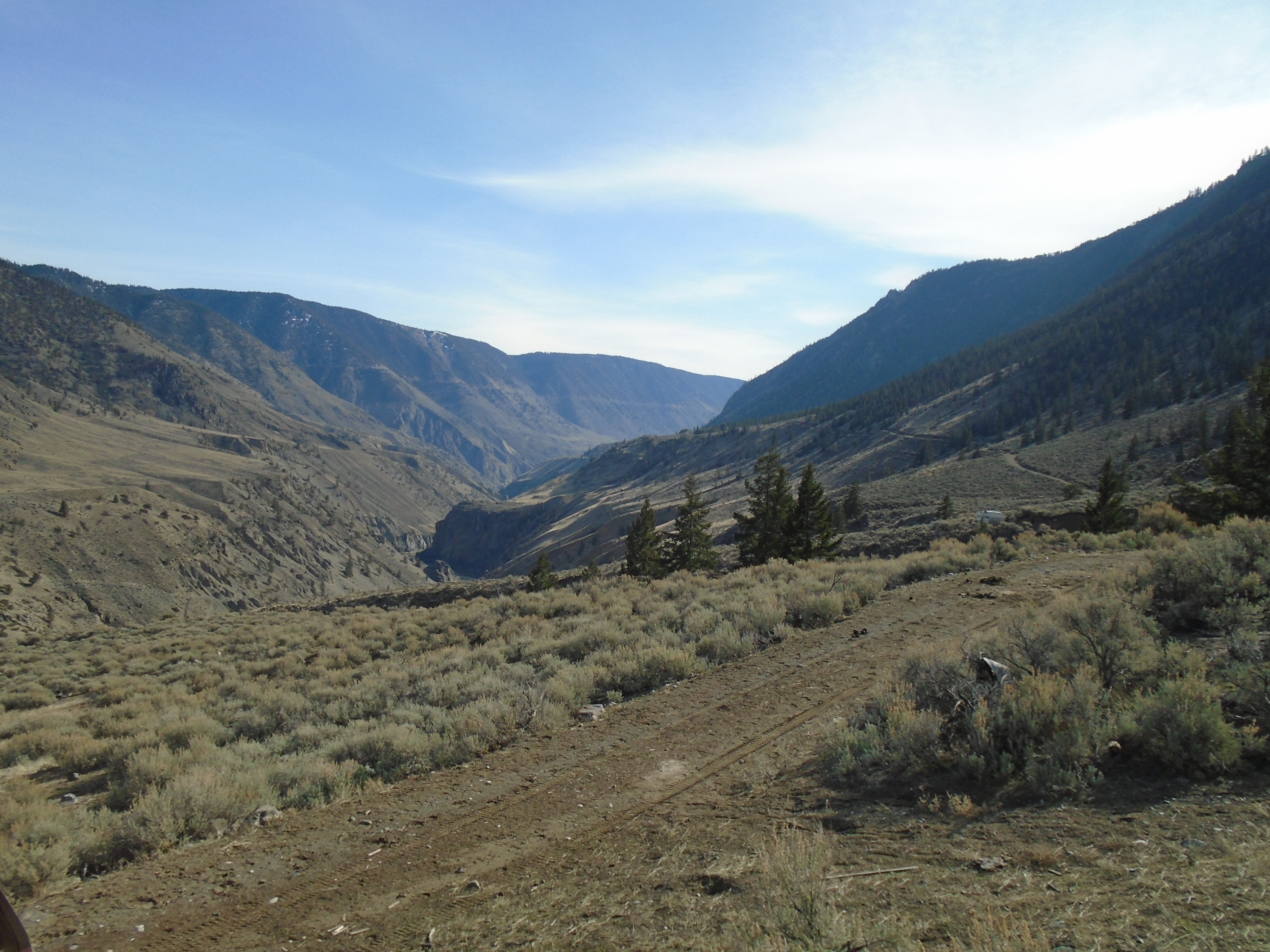
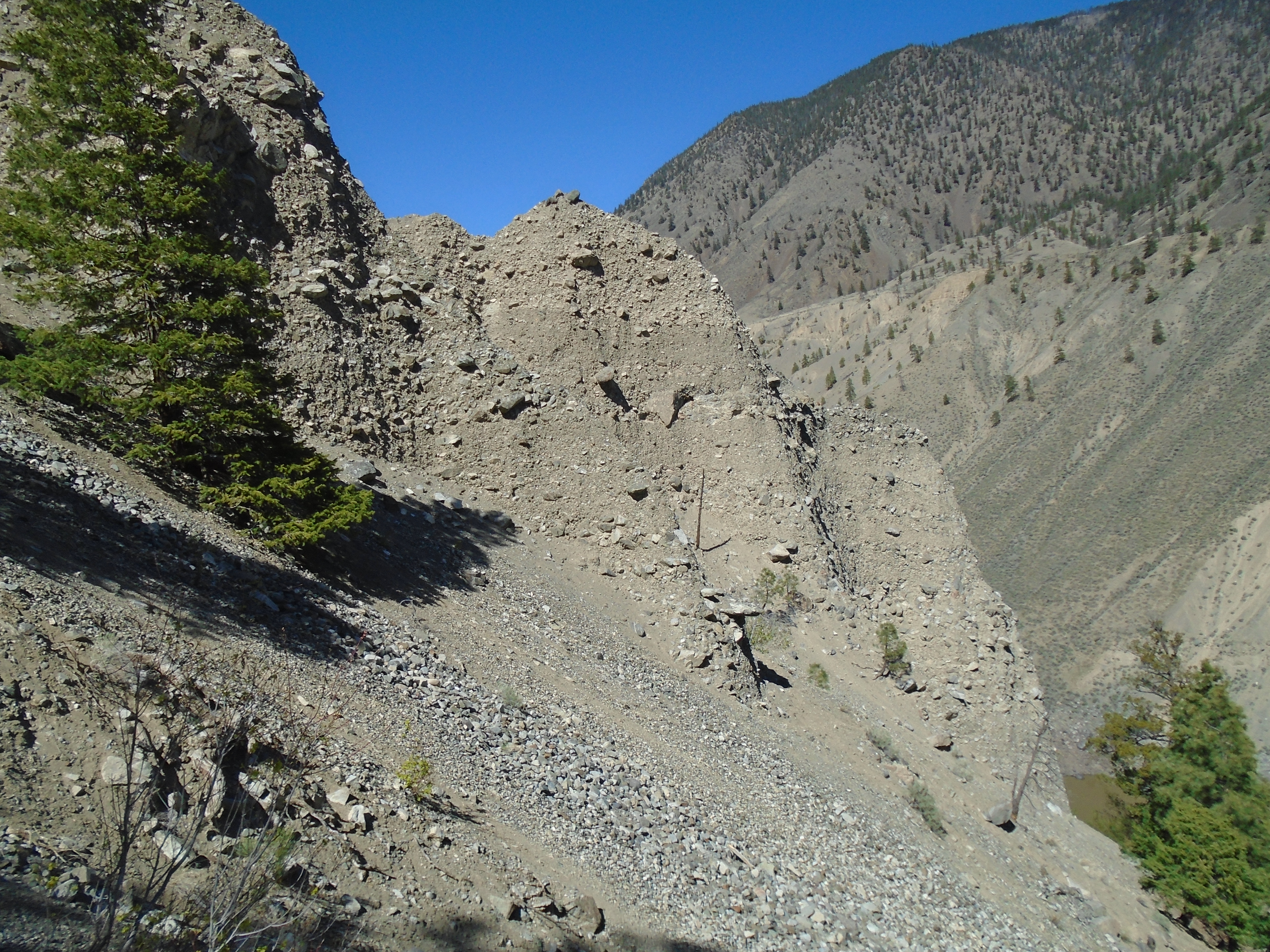
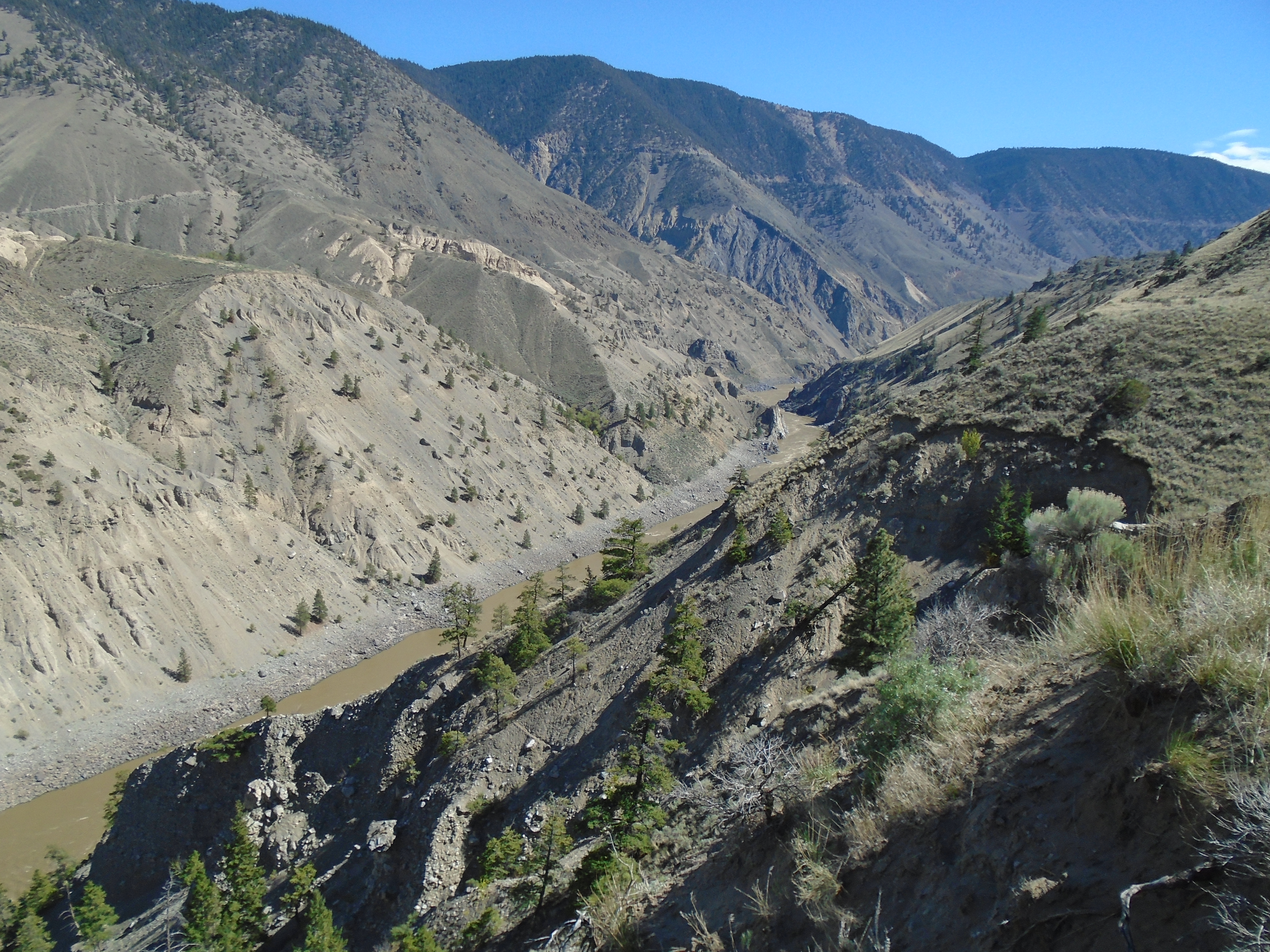
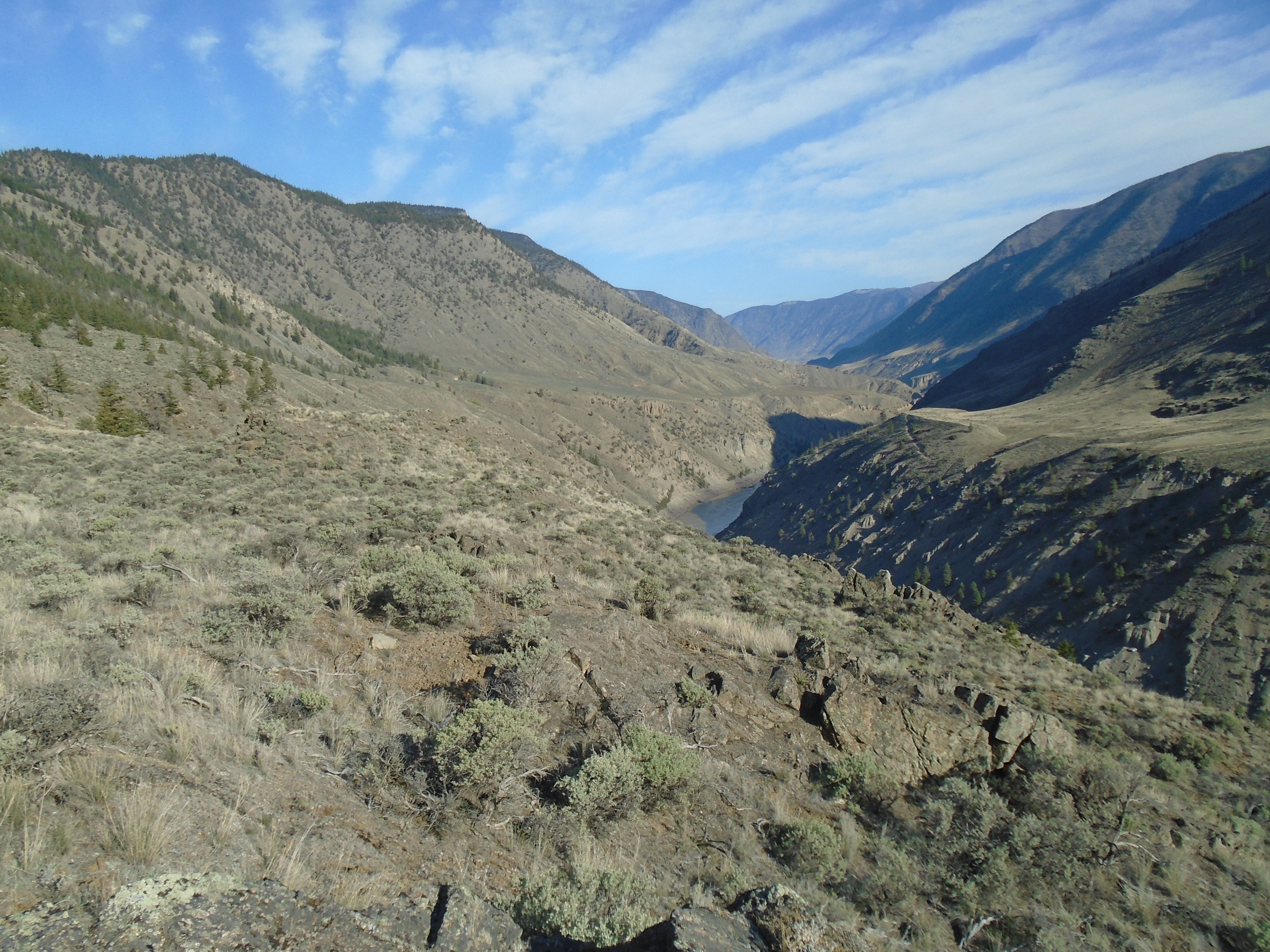
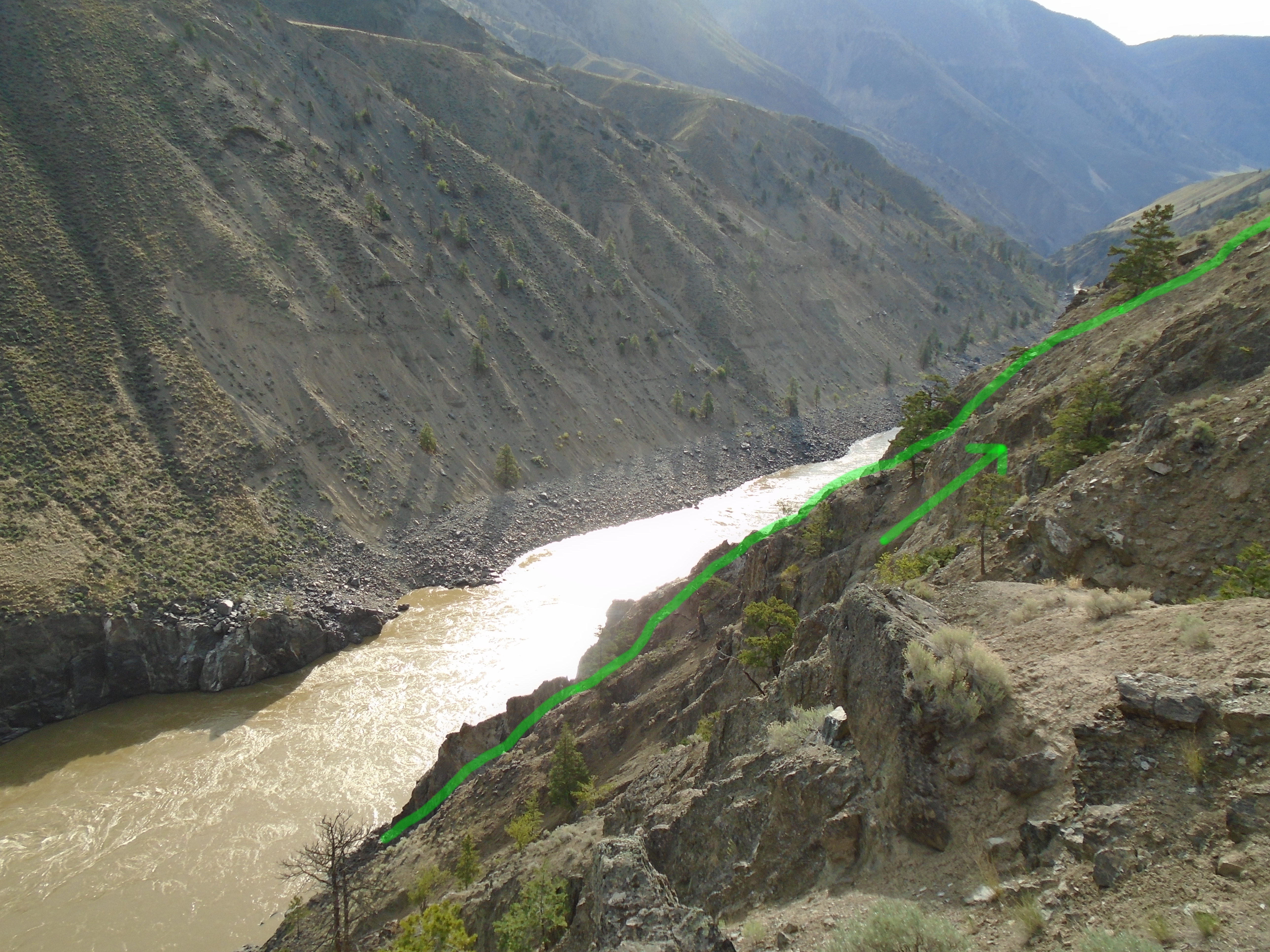
I got to the first claim later that day. I found a nice camp site near the dirt road and eagerly began hiking down to the river to take my first samples. It looked pretty steep on the topo maps and with my prior experience in the area I was expecting it to be. The maps were accurate and it was at least as ugly as I had imagined. Loose gravel and significant slope on the way in. I was hoping to find a more civilized route up once I got down to the river.
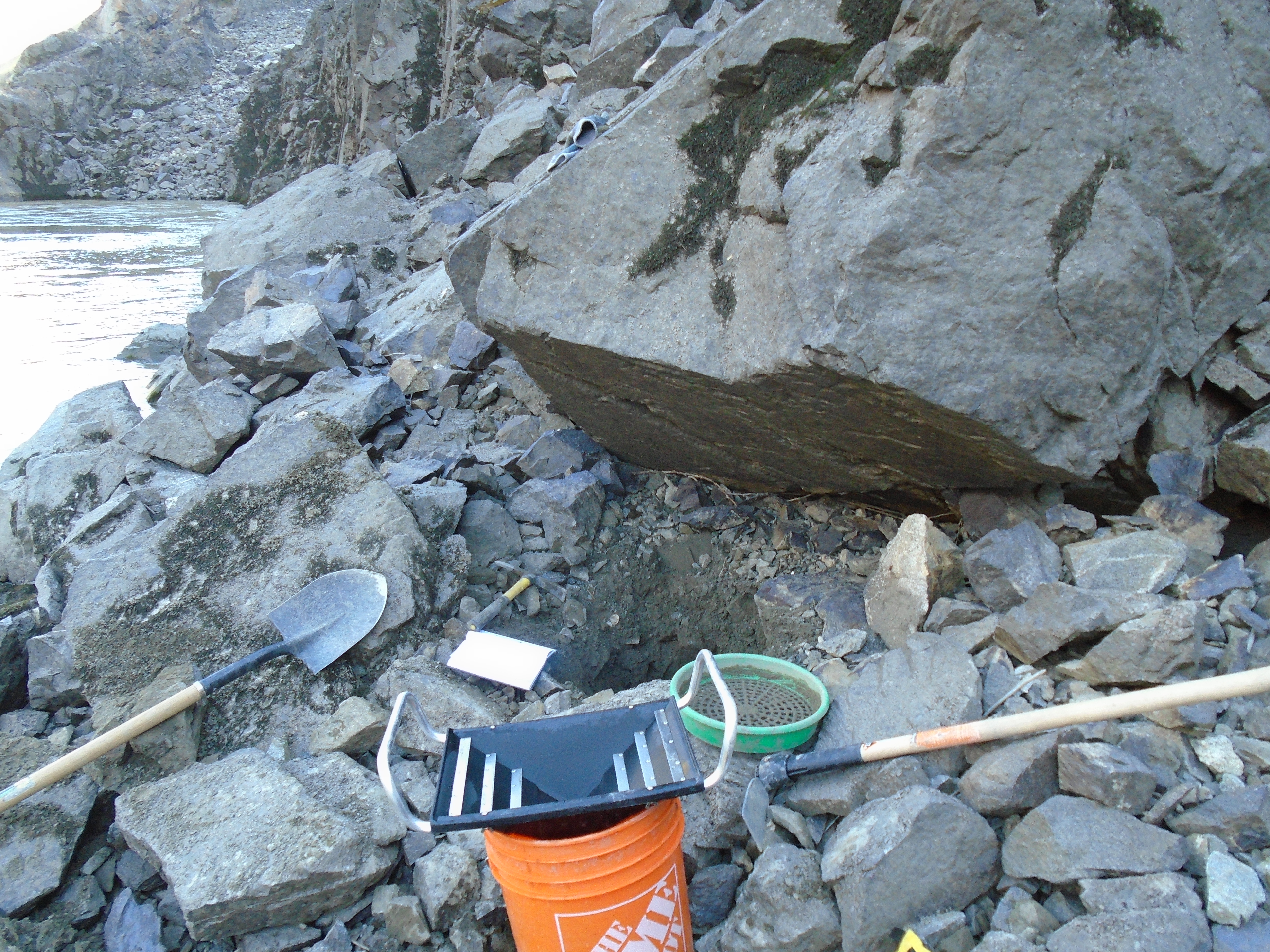
I managed to get a couple samples before the light started to fade. The samples that I take consist of two full pails each, and partially processed on site. I use the pyramid pan to concentrate that down to about 1L and store the samples in a waterproof zip lock bag for the hike out. It takes at least an hour to excavate each test hole in this area due to the abundance of large rocks making up the beach.
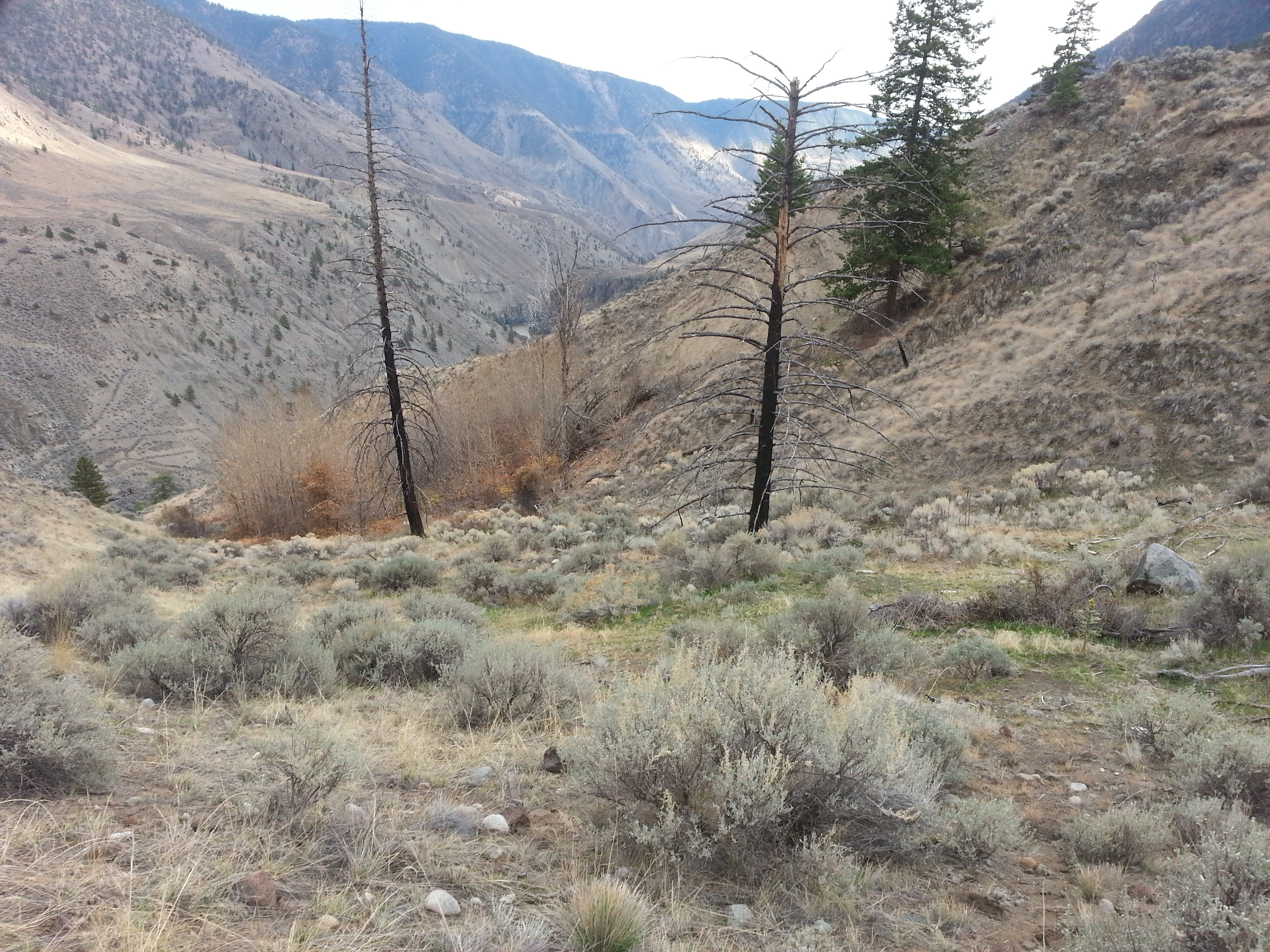
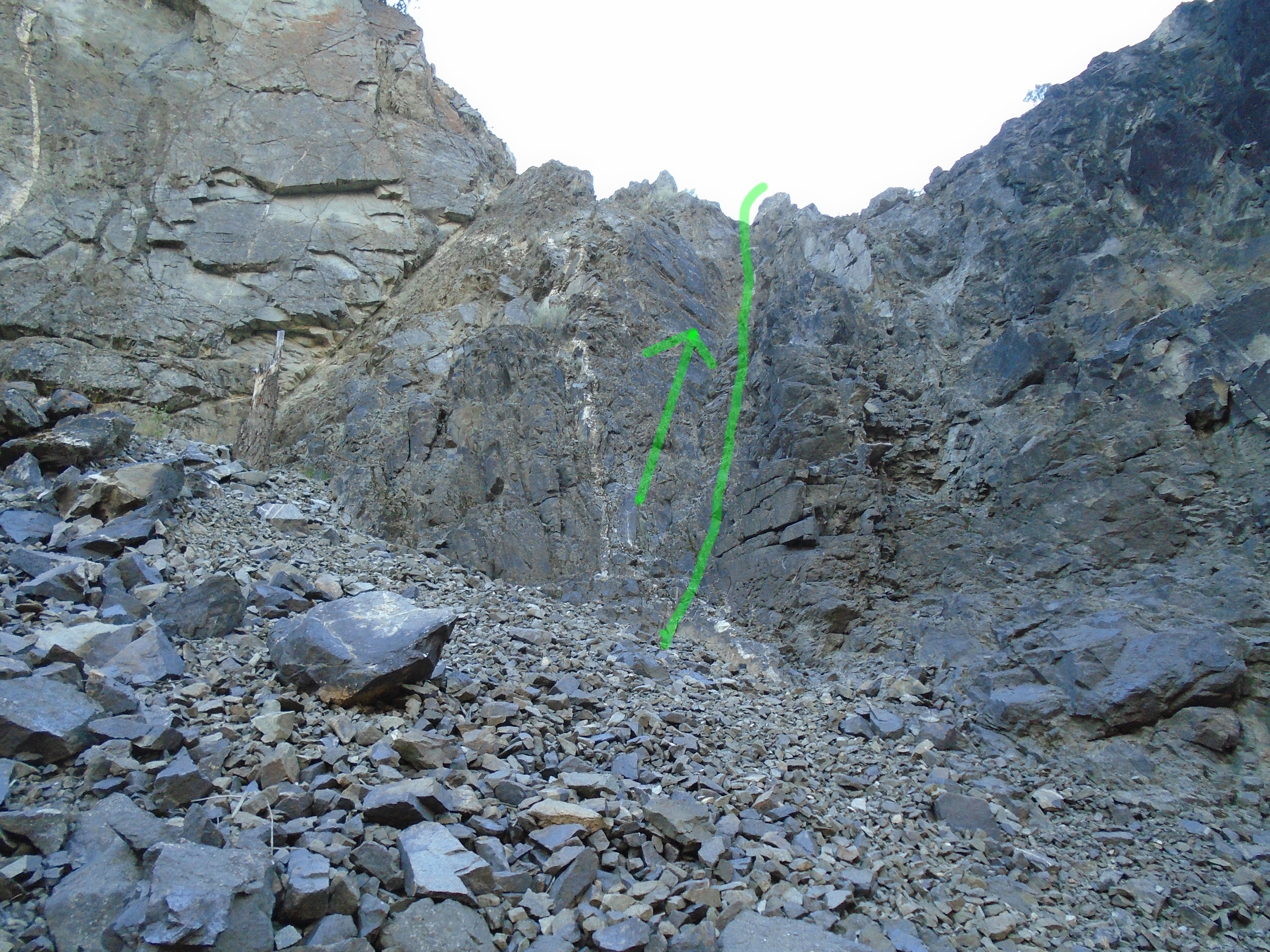
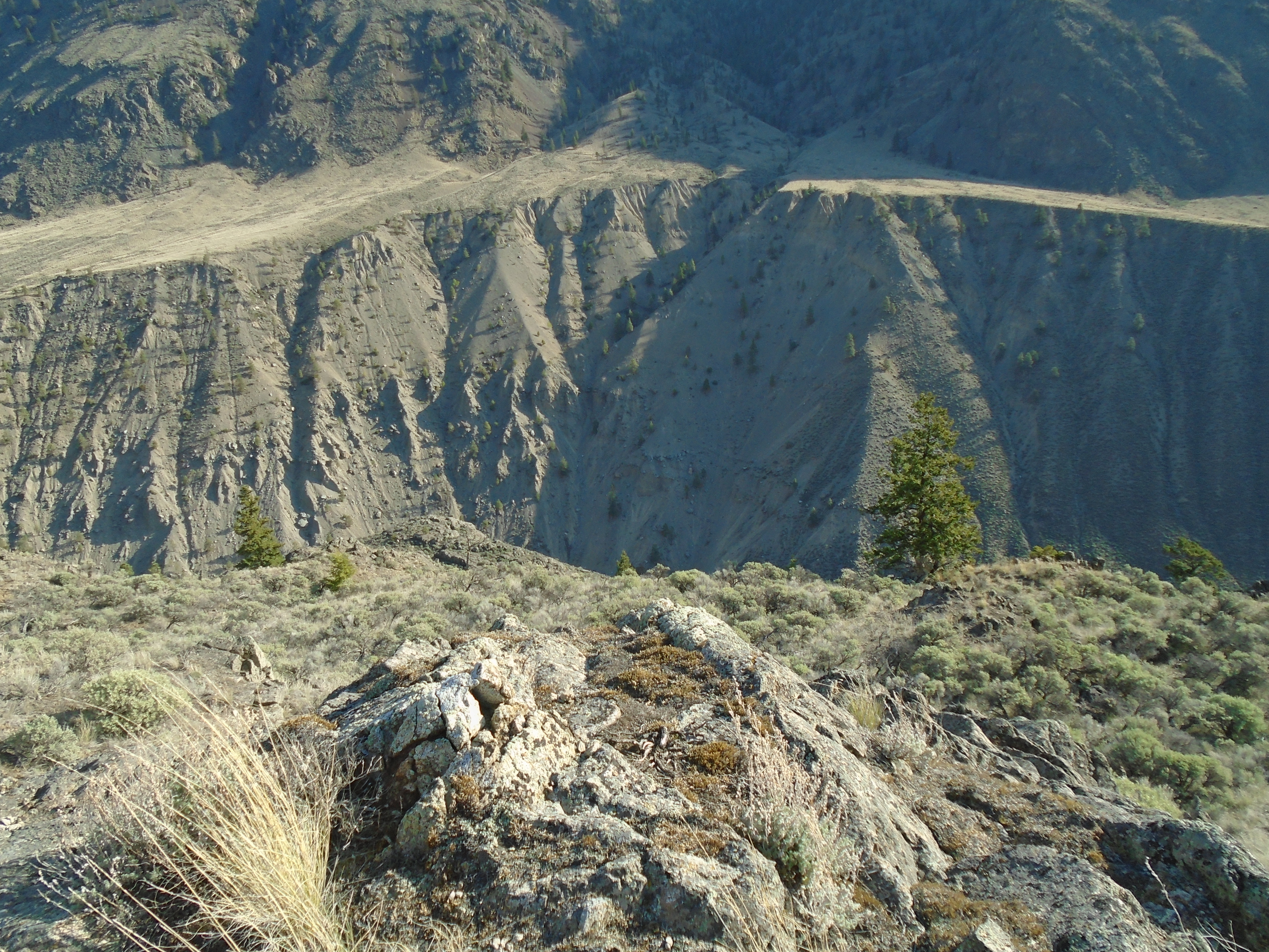
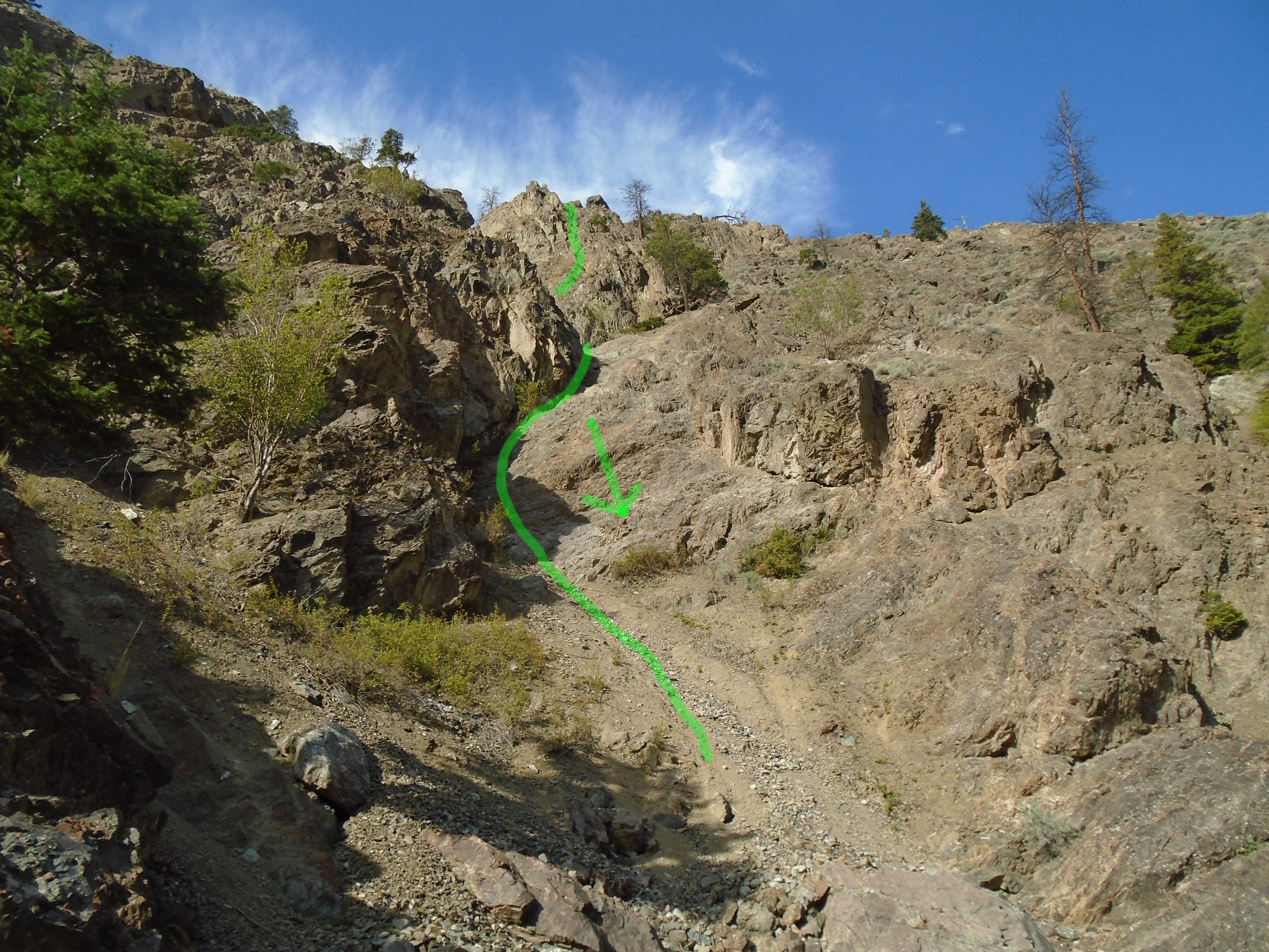
My hope of finding a “civilized” route was not fulfilled, I marked the climbing route in the above photo. I was faced with either hiking up the super steep talus slope or rock climbing up some exposed rock. I chose the rock climbing. I must mention that I am experienced with rock climbing and don’t recommend this course of action if you aren’t comfortable. Its not exactly safe, especially with a backpack loaded with a pick axe, shovel, 5 gallon pail, samples, gold pans and all the other prospecting gear. Not to mention no rope.
I made it up OK, with a little bit of a gut check at the top, then hiked the rest of the steep slope up to the camp for some well deserved beer and food. Little did I know that was just the beginning of the unexpected climbing on this trip. On the previous trip to this area we thought that climbing ropes and gear might be needed for these claims but it was impossible to tell until you come over the edge towards the river.
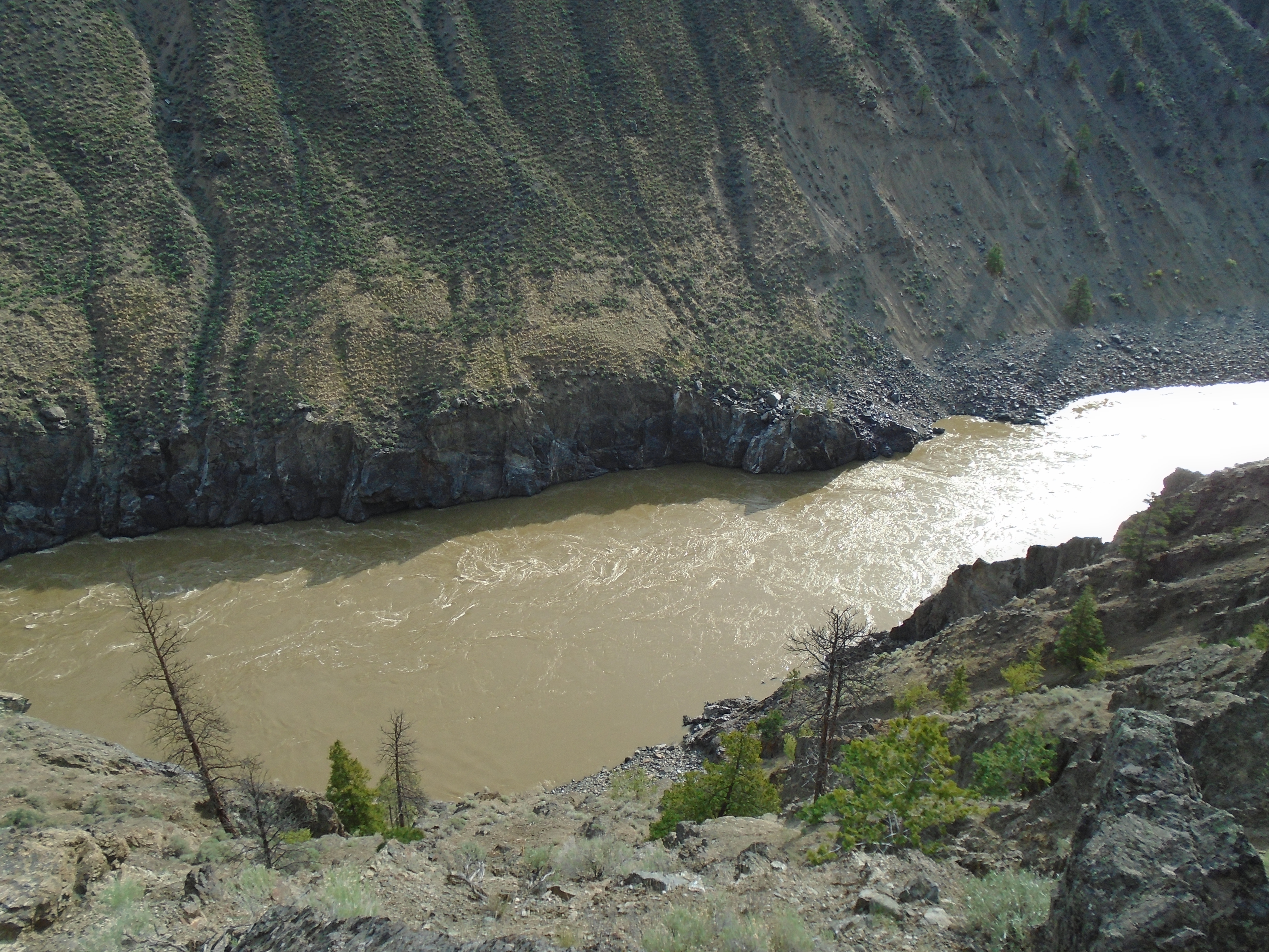
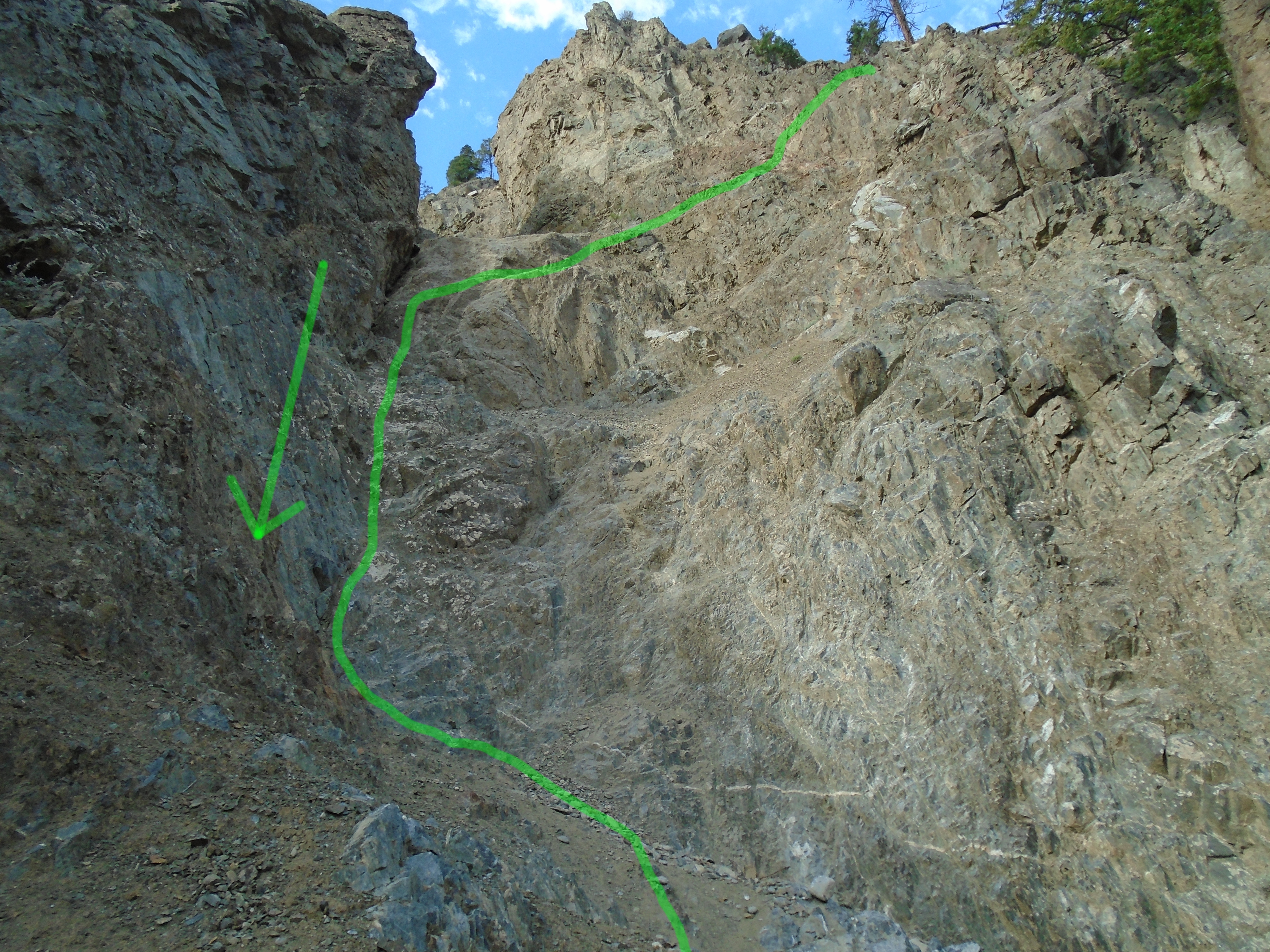
The second claim was just down river from a small canyon. This is a good thing for trapping gold but it does not make for easy access. It all looked good on the way down but it dropped off steeply as I descended towards the river. Pretty soon I found my self perched on top of what was a near vertical drop. I spotted a line down but I couldn’t see the whole path. At this point I was committed. The further I descended the worse it got and next thing I knew I was reverse rock climbing down to the beach.
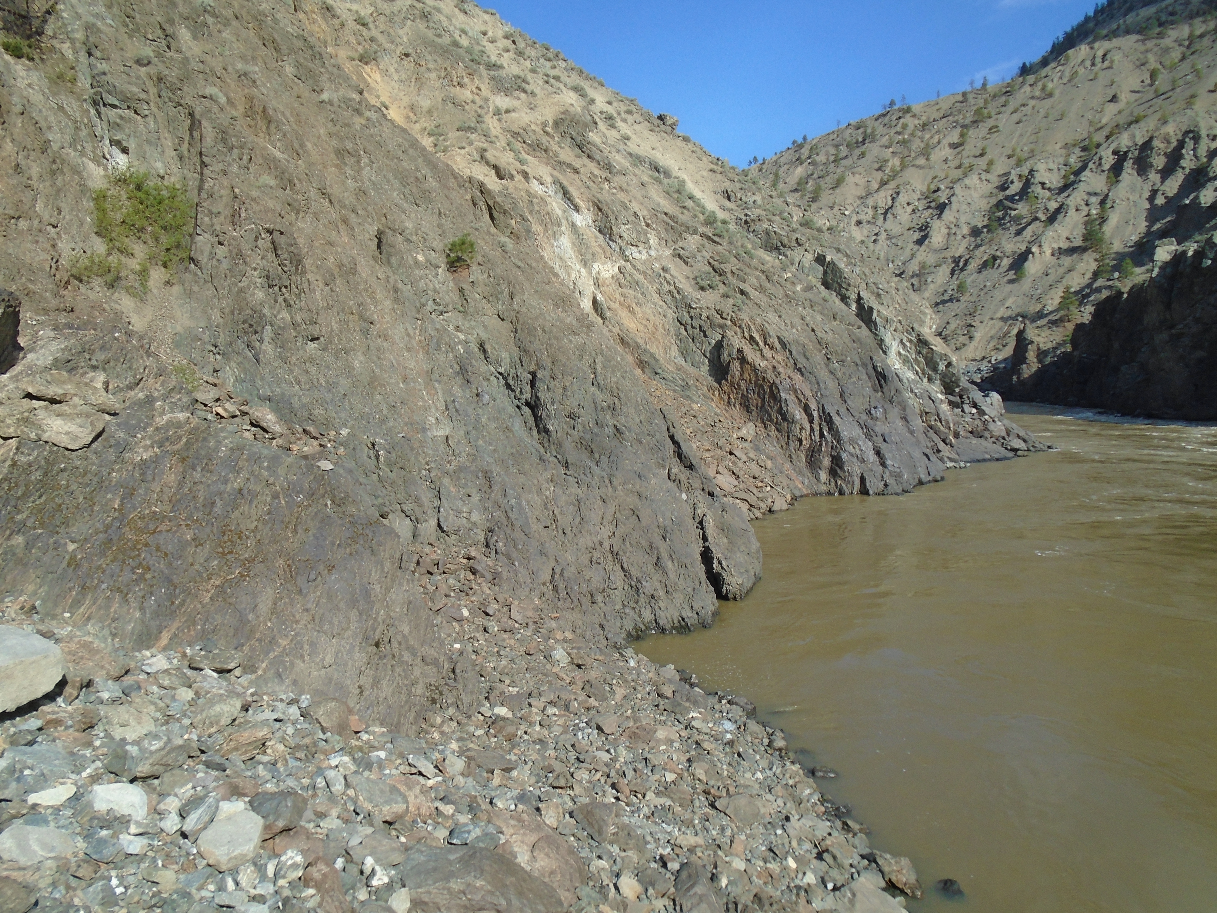
Once again I hoped that I would find a better route up. This time around I knew it wasn’t going to be easy. I had a whole day of sampling to do so I’d worry about climbing out when the time comes. I managed to get three good samples from the beach and inevitably the time came to climb out. I knew the way in was very dangerous and didn’t know if I even could climb back up. The photos below show the route to the beach.
I spotted a route to rock climb out but it was nasty too. It looked like solid rock with good holds so I went for it. It turned out not to be solid and almost every hold I grabbed broke loose and slid down the slope. I got to a point about 3/4 the way up the rock climb section where I was certain that I was screwed. No way up and no way down. Not a good feeling. After several minutes of gathering my courage I decided I had no choice and went for it. Once I was on top and able to walk on my feet I was relieved and more than happy to hike up the rest of the steep slope to my camp. I didn’t get a great picture of the route up from the beach. The photo below shows the approximate route.
I’ve gotten myself into these sort of situations more times than I’d like to admit. Honestly though the unexpected situations are one of the most exciting parts of prospecting. At the time you are terrified and wonder how you ended up in this situation but afterwards those are some of your best memories. Without a sense of adventure who would go out to these places looking for gold? As luck would have it, these claims actually had some decent gold. The trouble is how am I going to get in there next time?