Hey guys, I am pleased to announce that West Coast Placer is starting a mining club. There have been a number of inquiries from people who want to prospect and mine on WCP claims. So we’re starting a club that will provide the opportunity for members to use our claims.
Club members will have access to all of West Coast Placer’s claims. Currently that includes 12 placer claims and two mineral claims in BC. Access to some of my partner’s claims is also available. We have claims all over BC including the Tulameen, Similkameen, Fraser River, Cariboo and Kootenays.
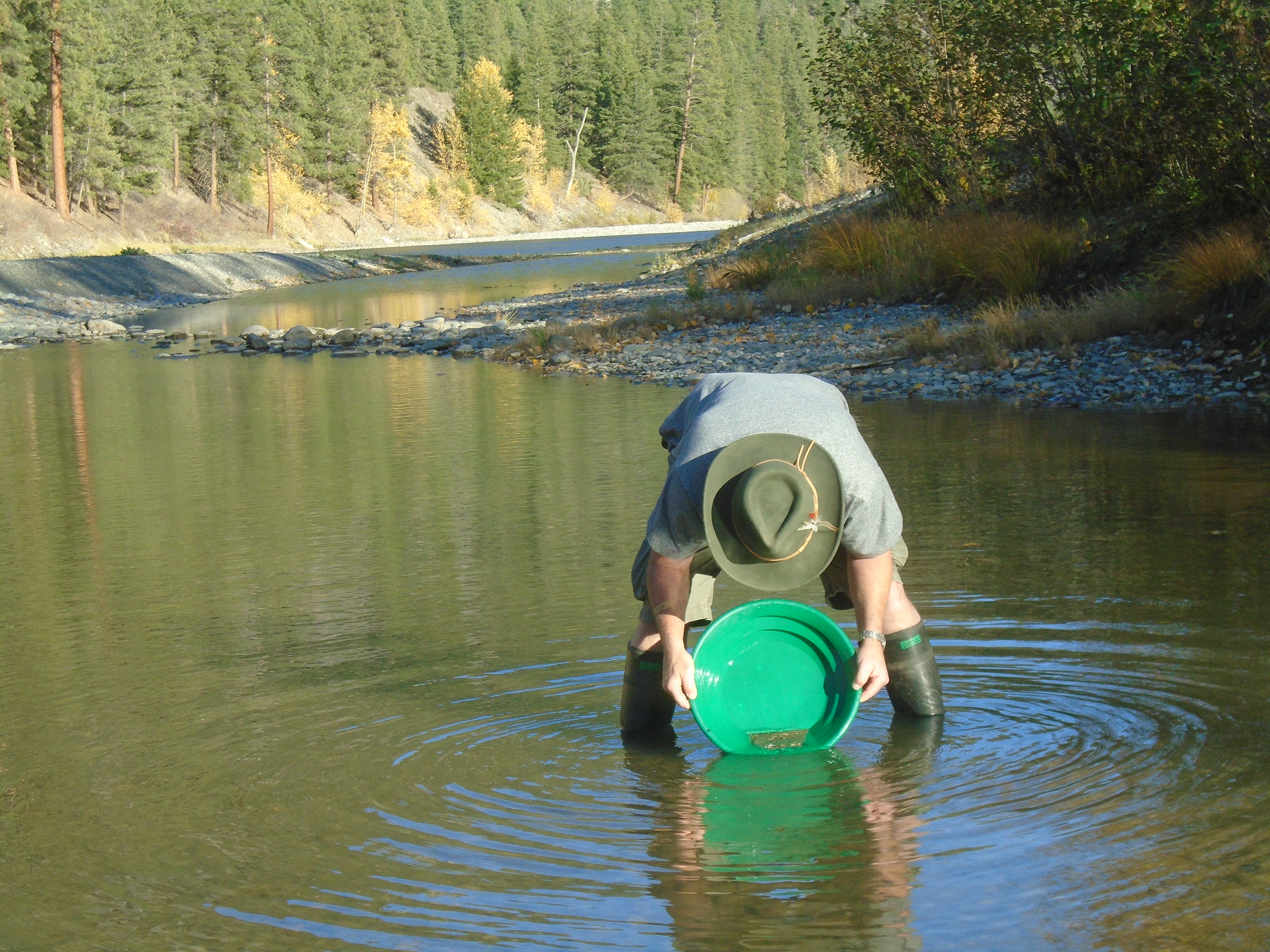
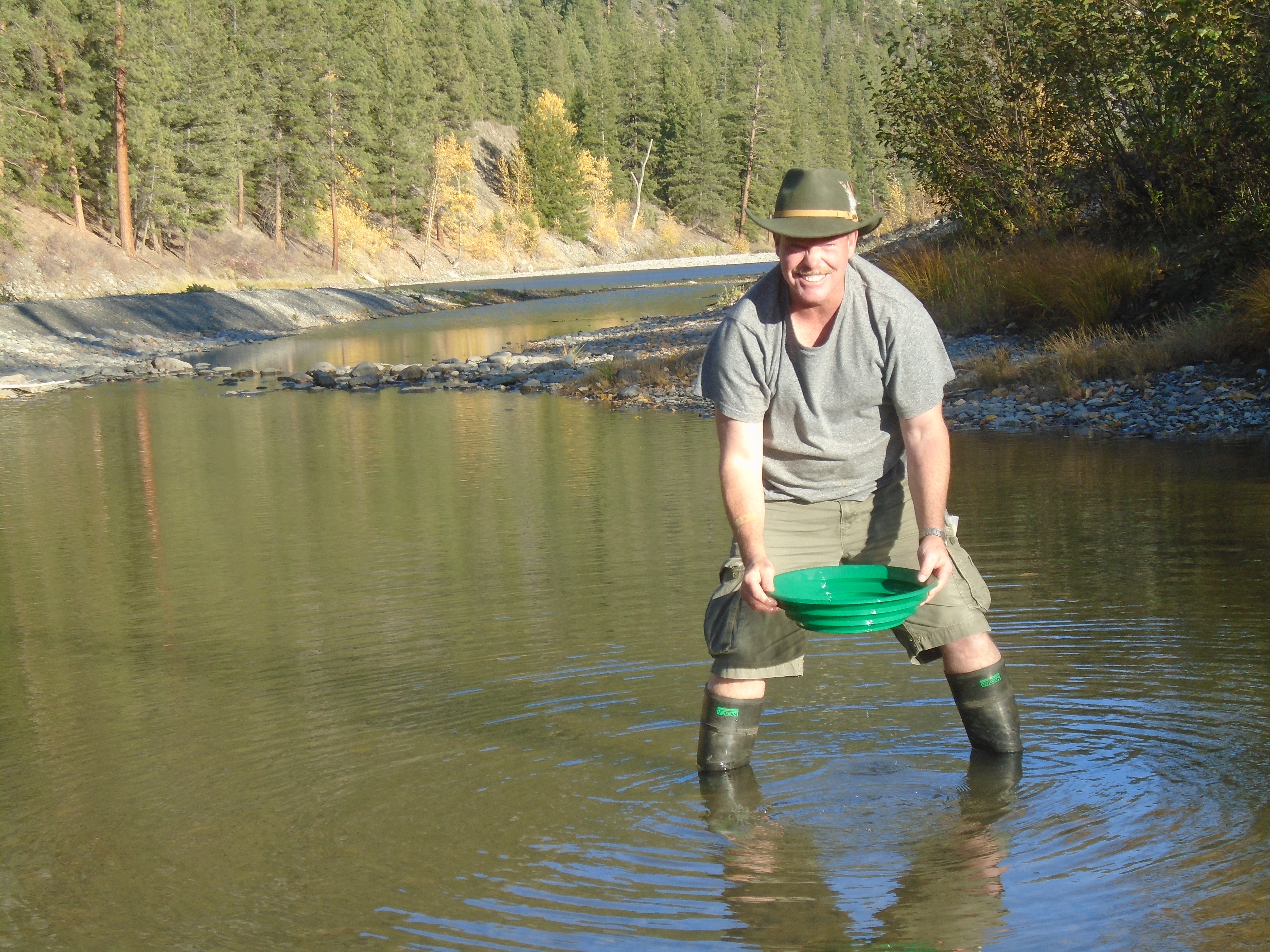
Members will be able to work the claims as if they own them. You can run a sluice, pans or whatever you want. Of course members can keep all the gold that they find.
You will be able to camp on the claims in tents or with an RV (where accessible). Family members are automatically included in your membership. Gold panning is a great activity for the whole family, kids love it. You can bring your friends too, the more the merrier.
There are a few obligations that will have to be met.
The first rule of prospecting club is you do not talk about prospecting club. Just kidding I had to throw that in there.
Members must follow all the regulations regarding placer mining in BC. If you don’t know all the regs don’t worry, information will be provided.
Activities will have to be recorded. This will help with our reports to the MTO. It’s not much work, just keep some notes on the work that you do. Keep track of things like, hours spent working, size and location of holes, and take pictures. This information will also be shared with the group.
If you plan on running a sluice or highbanker you will need to have a Free Miner’s Certificate. If you need help getting one, just ask.
There will be an annual fee of $50. Why a fee? That is required to limit club membership to people who are truly interested. $50 is pretty much free compared to similar clubs. The others are looking for $300 and up. We’re not interested in making money off of memberships.
As a member you will also have the opportunity for instruction in the art of gold prospecting. This is great for novice miners. You can join myself and more experienced members on prospecting trips. That is the best way to learn, you can watch youtube videos and read books all day but nothing beats hands on training.
Members will have support from experienced miners. You can even get help with your own MTO reports for your own personal claims. You can ask advice at any time and we’ll try our best to get back to you as soon as possible.
As a member you will be entitled to a discount on the purchase any of West Coast Placer’s claims. There will be more perks as the club grows.
Update 2021
The club has been active for 5 years, we have a good group of recreational miners. We are still accepting applications for new members.
If you are interested please send an email through the WCP contact form on this link, Contact Form. Explain why you want to join the club and we will consider your application. Not all applications will be approved.
We will not accept applications made through the comments section. See instructions above.
In part one of the top ten gold rushes of BC we covered the early gold rushes primarily in the Southern regions. As time went on gold hungry adventurers pushed further in the wild North of the Canadian West coast. Their adventurous spirit was rewarded greatly and eventually led them into the Yukon and Alaska.
1865 Big Bend Gold Rush
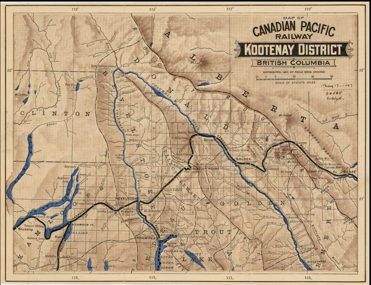
1897 Map of the Big Bend Area
The Big Bend refers to the shape of the Columbia River as it makes a huge detour at the continental divide. This region encompasses several different mountain ranges including the Selkirks, the Cariboo Mountains, the Monashees and the Rocky Mountains. In 1865 gold was discovered on French Creek which is straight North of Revelstoke. As in other gold rushes a town was quickly erected named French Creek City. Within the first year the town reached a population of over 4000 people. Nothing is left today but during the rush French Creek had a general store, saloons with cabaret shows, barber shops and of course brothels. Other important towns of the rush were La Porte and Downie Creek. The inhabitants came mostly from the Wild Horse area and other areas in BC.
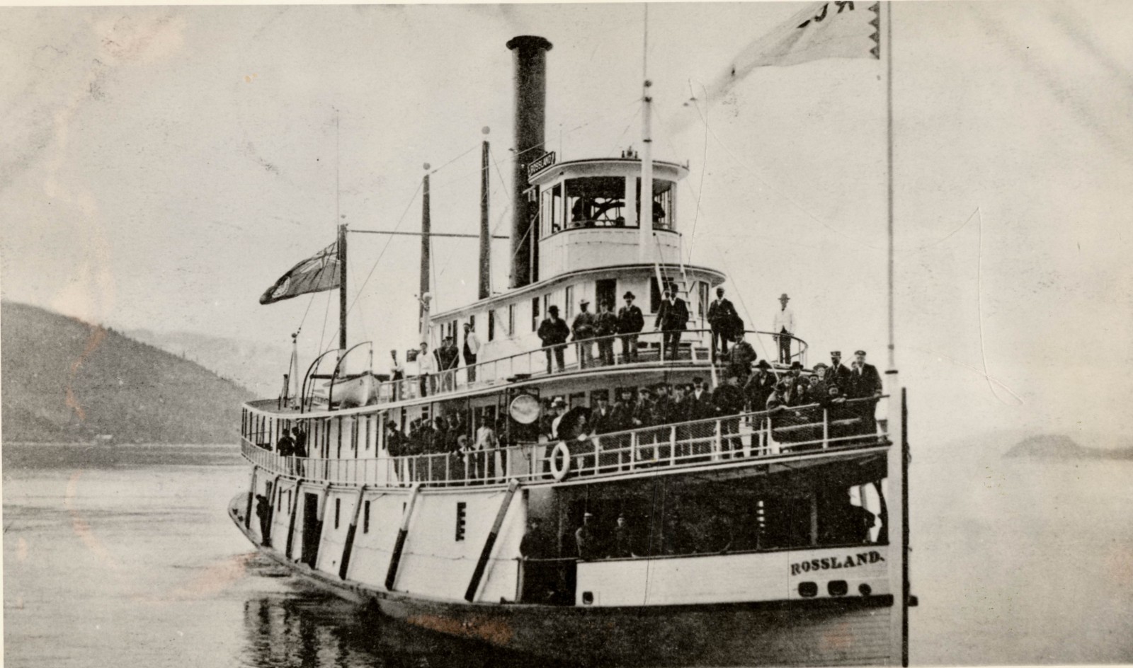
Steamboats were a major factor during the big bend gold rush. Many of the prospectors reached the area on steamboats via the Arrow Lakes which make up part of the Columbia River. The lake network allowed boat passengers to travel from areas as far South as the US border.
Columbia River Steamboat, the “Rossland”
Other notable creeks in the area are Carnes Creek, Downie Creek, McCullough Creek, and the Goldstream River. A 14 ounce nugget was reported to be found on French Creek and numerous smaller nuggets were also found. In 1865 miners were bringing out multiple ounces per day to the man on some claims. On McCullough Creek pay streaks averaged 1/8 of an ounce per yard for many years. Just like other places in the late 1800s hydraulic and drift mining driven by mining companies and syndicates quickly replaced hand mining techniques. The big bend gold rush only lasted two years but mining in the area continues to this day. Several large projects and proposed mines are located in the big bend.
1869 Omineca Gold Rush
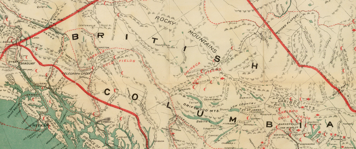
The Omineca is a huge region in Nortn-Central BC. The southern boundary is marked today by the Yellowhead highway the North boundary is the Liard Mountains. Gold was first discovered in the Omineca in 1861 but the rush didn’t take place until eight years later. The original discoveries were made on the Finlay River. In the early days there were very few people in the area due to a complete lack of trails, roads or maps and unforgiving terrain and weather. Much of the area is still wild today.
Northern BC circa 1898, red symbols are known gold discoveries
One of the first claims on the Finlay called Toy’s Bar produced 4 ounces to the man each day. Several expeditions were launched though the area searching for gold. One such party, the Peace River Prospecting Party, found a great discovery on Vital Creek in 1869. The creek was named after one of the party members, Vital Laforce who was also instrumental in exploring the Cariboo region. Vital Creek produced nearly 5000 ounces in the years following the rush.
Manson Creek and the Germansen River held the best gold deposits in the Omineca. Gold discoveries were also made on Blackjack Creek, Kildare Creek, Mosquito Creek, Slate Creek and Nugget Gulch. In the early days of the gold rush anything less than an ounce a day was considered unworthy. Many creeks were paying 100 ounces per week. If the gold rush happened today that would be well over $100,000 every week. I’d be finding my way up there any any means possible. Travelling to the Omineca in the 1800s was a feat in itself.
The discovery of gold in the Cassiar in 1873 spelled the end of the Omineca gold rush. As with all gold rushes those who held good ground stayed and kept mining while everyone else headed on to the next boom town. The Omineca is one of the least explored regions in BC today and there are still gold strikes waiting to be found.
1873 Cassiar Gold Rush
Gold was discovered on the Stikine River in 1861 and a minor rush developed. A few hundred prospectors ascended the river in search of gold. There was an existing fur trading fort at the mouth of the river called Fort Stikine which later became Wrangell, Alaska. Not enough gold was found to entice more adventurers to the region but the excitement was enough to prompt Britain into claiming the region as a colony in 1862.
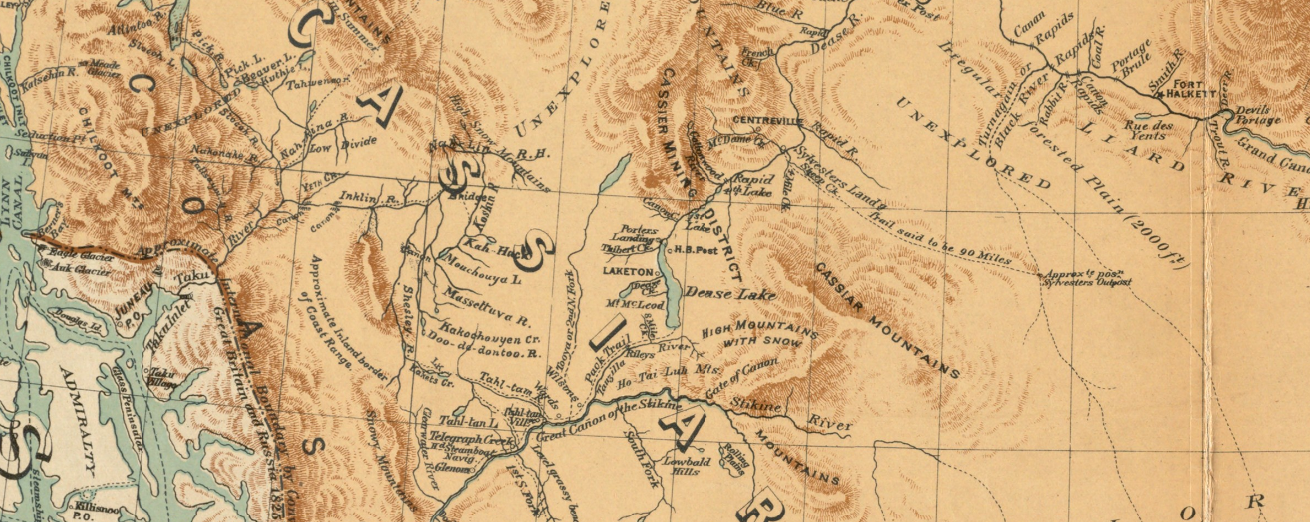
Cassiar region circa 1893
The Cassiar gold rush really took off once the high grade gold deposits in the extreme North of BC were discovered. This part of the country is extremely rugged with huge mountains, glaciers and a very cold winter. The discovery was made in the summer of 1872 by Henry Thibert and Angus McCulloch on a creek that drains into Dease Lake. The creek was named after Thibert who froze to death the following winter. Thibert Creek was very rich, in the first year miners were getting up to three ounces to the pan.
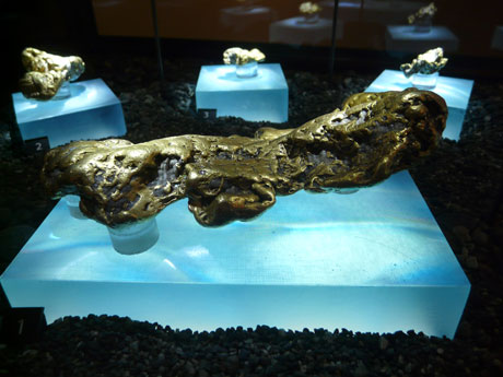
The 52 oz “Turnagain Nugget” from Alice Shea Creek in the Cassiar
In 1874 an even bigger discovery was made further North on Mcdame Creek. The largest gold nugget ever found in BC was taken from Mcdame Creek tipping the scale at 73 ounces! Another giant nugget was found on Alice Shea Creek that weighed 52 ounces.
Several towns sprung up near the gold discoveries such as Laketon, Porter Landing and Centerville. They are all ghost towns now but in the height of the rush thousands of people were passing through the shops and saloons of the Cassiar. Like the Omineca much of this region is just as wild today as it was 150 years ago.
The Cassiar’s rich gold reserves have not been forgotten. There are many large mining projects under way in the region. Due to the high grade mineral deposits the area is known as BC’s “Golden Triange”.
1885 Granite Creek Gold Rush
Granite Creek is a tributary to the Tulameen River. In the gold rush era of the late 1800s the Tulameen was still a remote and wild area. Like many of the best discoveries the Granite Creek gold was found by chance. In this case it was actually found by a cowboy named Johnny Chance. In the summer of 1885 Chance was delivering some horses to New Westminster and took a route through the Tulameen. True to his lazy nature he took a nap at a spot on Granite Creek on a hot day. When he woke up he happened to notice the reflection of some gold nuggets in the water.
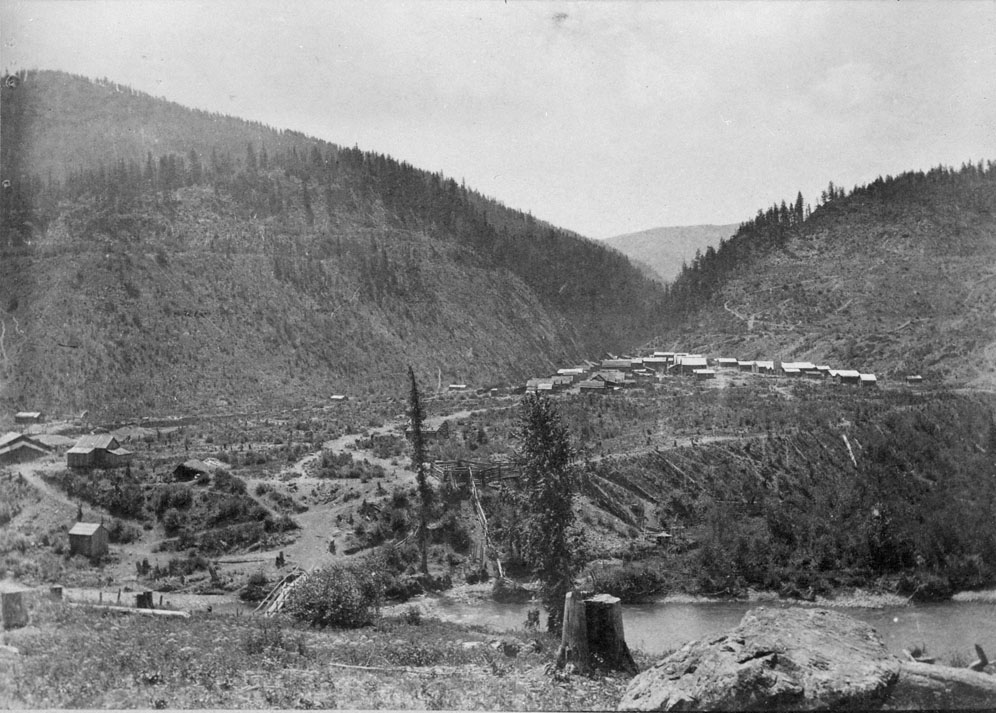
Granite City in 1888
Within a year of the discovery the once vacant valley at the mouth of Granite Creek had over 2000 people living there. At the time Granite City was the third largest town in BC. There were over two hundred buildings, 13 of which were saloons. The town never had a school or a mayor though. The bars in Granite ran flat out and never closed down. It was known as one of the wildest towns in the West.
In the early days gold nuggets weighing 5-10 ounces were commonly found. Platinum was also prevalent on the creek. Miners were producing equal weights of platinum and gold. Interestingly for the first few years the Granite Creek miners had no idea what platinum was and most of them threw it back into the creek. At today’s prices gold is going for $1077/oz and platinum is at $870/oz.
Granite City in 2015
The Granite Creek rush brought attention to the surrounding area as well. Other notable creeks in the Tulameen are Slate Creek, Lawless Creek, Lockie Creek and the Tulameen River. Gold and platinum are still being produced today. I heard from a Princeton local that the biggest nuggets to come out of the Tulameen this year were over an ounce. I have some claims on Granite Creek and the Tulameen River myself. Check this post from earlier this year Tulameen Prospecting Trip.
By the end of the 1890s the population of Granite City began to decline. The easy gold was all claimed and in the process of being mined. Those that didn’t already hold good ground headed North to try their luck in the Atlin and Klondike gold rushes that followed.
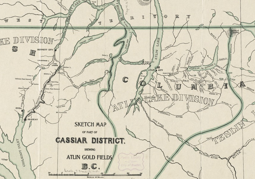
1898 Atlin Gold Rush
Atlin area map 1898
The Atlin gold rush was the last one to take place in BC. It was a direct offshoot of the Klondike gold rush that took the world by storm. The Klondike was the mother of all gold rushes, over 100,000 adventurers poured into Dawson City, YK from all over the world. Some of the adventurous prospectors took a different route and ended up in Atlin.
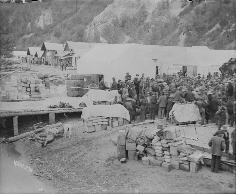
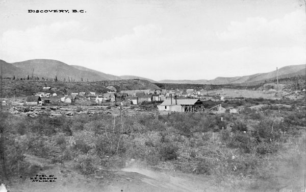
The first big discovery was on Pine Creek. A town was set up on Pine Creek aptly named Discovery. At it’s peak there were over 10,000 people living in Discovery which was rivalled only by the infamous Dawson City. Discovery had all the excitement of Dawson. There were saloons, brothels, and gambling available at all hours of the day. Discovery is a ghost town today, it was replaced by the town of Atlin.
Discovery Townsite in 1909
The gold that was found in the Atlin area was truly legendary. It is estimated that over 1.5 million ounces of placer gold have been produced from the creeks. Some giant nuggets were found too. Several creeks are known to have produced nuggets in excess of 50 ounces! The best placer gold creeks were Pine Creek, Spruce Creek, Ruby Creek, McKee Creek, Birch Creek, Boulder Creek, Otter (Surprise) Creek, and the McDonnel River.
Atlin is a beautiful town, I had the pleasure of working up there a few years ago. In the early 1900s it was nicknamed the “Switzerland of the North” due to the picturesque mountain setting. In many ways Atlin is like Dawson City’s little brother. The music festival is smaller, the gold rush was smaller, less gold was produced but the Klondike is nowhere near as scenic.
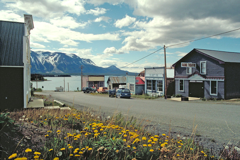
Atlin Today
Gold mining in Atlin has never stopped. Every time the gold price spikes the area receives another mini gold rush. There are a lot of large hard rock mining prospects in the area as well. The region is not far from the golden triangle and benefits from similar underlying geology. Due to its remote location the area is very under explored and has outstanding potential for exploration.
The BC gold rush period lasted just 50 years. Many of the participants experienced more than one rush in their lifetime. It would have been an amazing time to be a prospector. Here’s a recap of the top ten BC gold rushes:
1851 Haida Gwaii Gold Rush
1858 Fraser River Gold Rush
1858 Rock Creek Gold Rush
1859 Cariboo Gold Rush
1863 Wild Horse River Gold Rush
1864 Leech River Gold Rush
1865 Big Bend Gold Rush
1873 Cassiar Gold Rush
1885 Granite Creek Gold Rush
1898 Atlin Gold Rush
The history of British Columbia is the history of gold and the men who hunt for it. It was the Fraser River gold rush that led to BC becoming a colony and later a province. Our towns, overland trails and roads, and much of the early infrastructure was built to support gold mining activity. Without our lust for precious metal men would not have risked their lives to explore the rugged and unforgiving wilderness of this beautiful province.
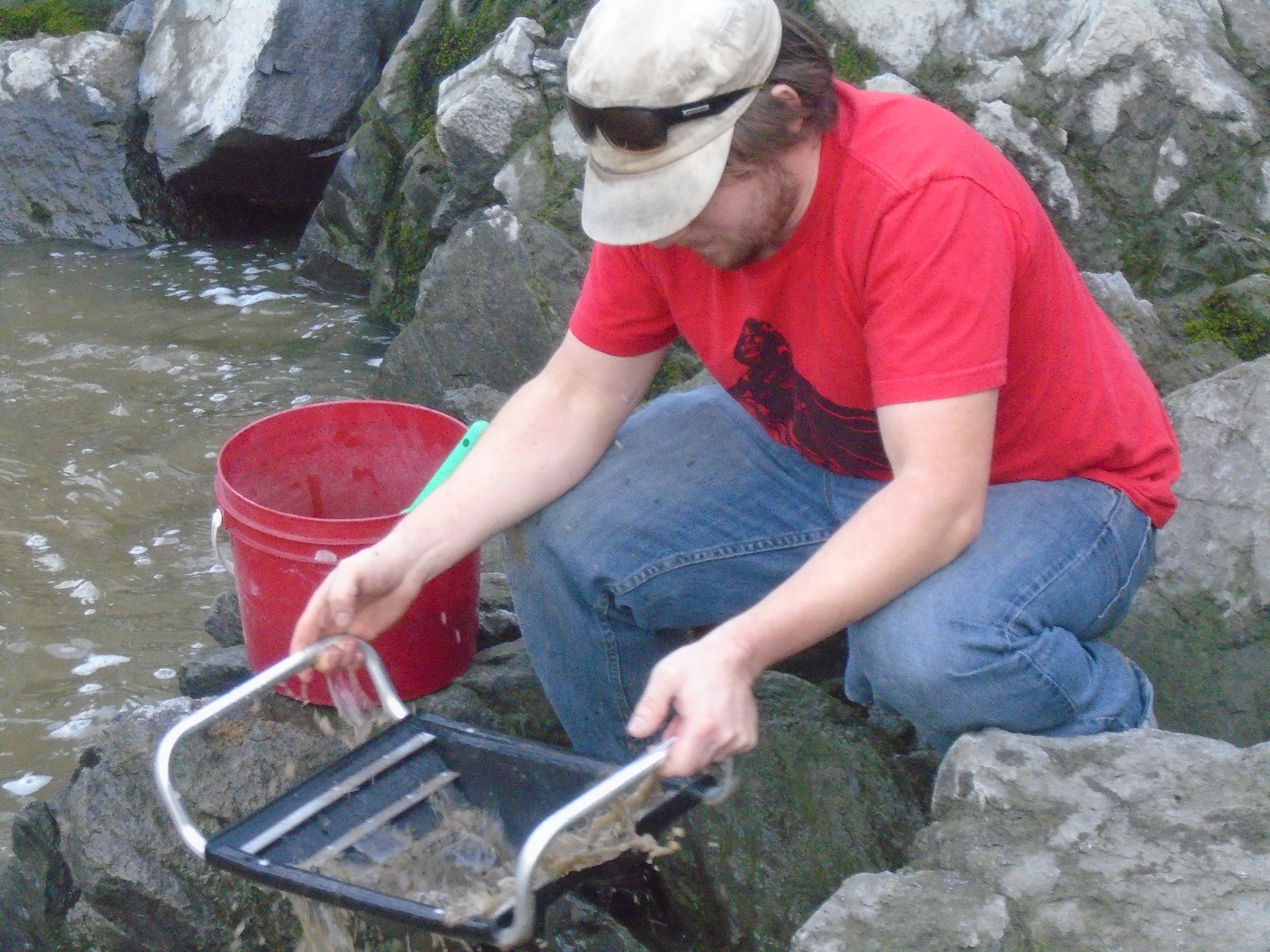
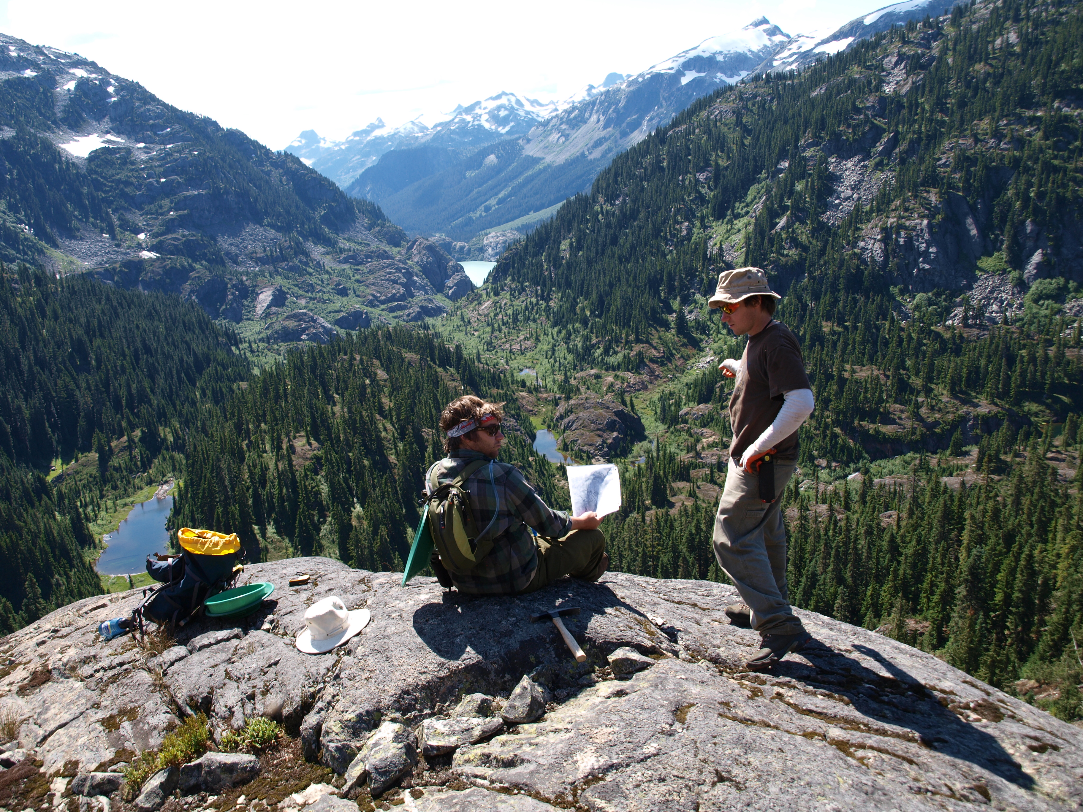
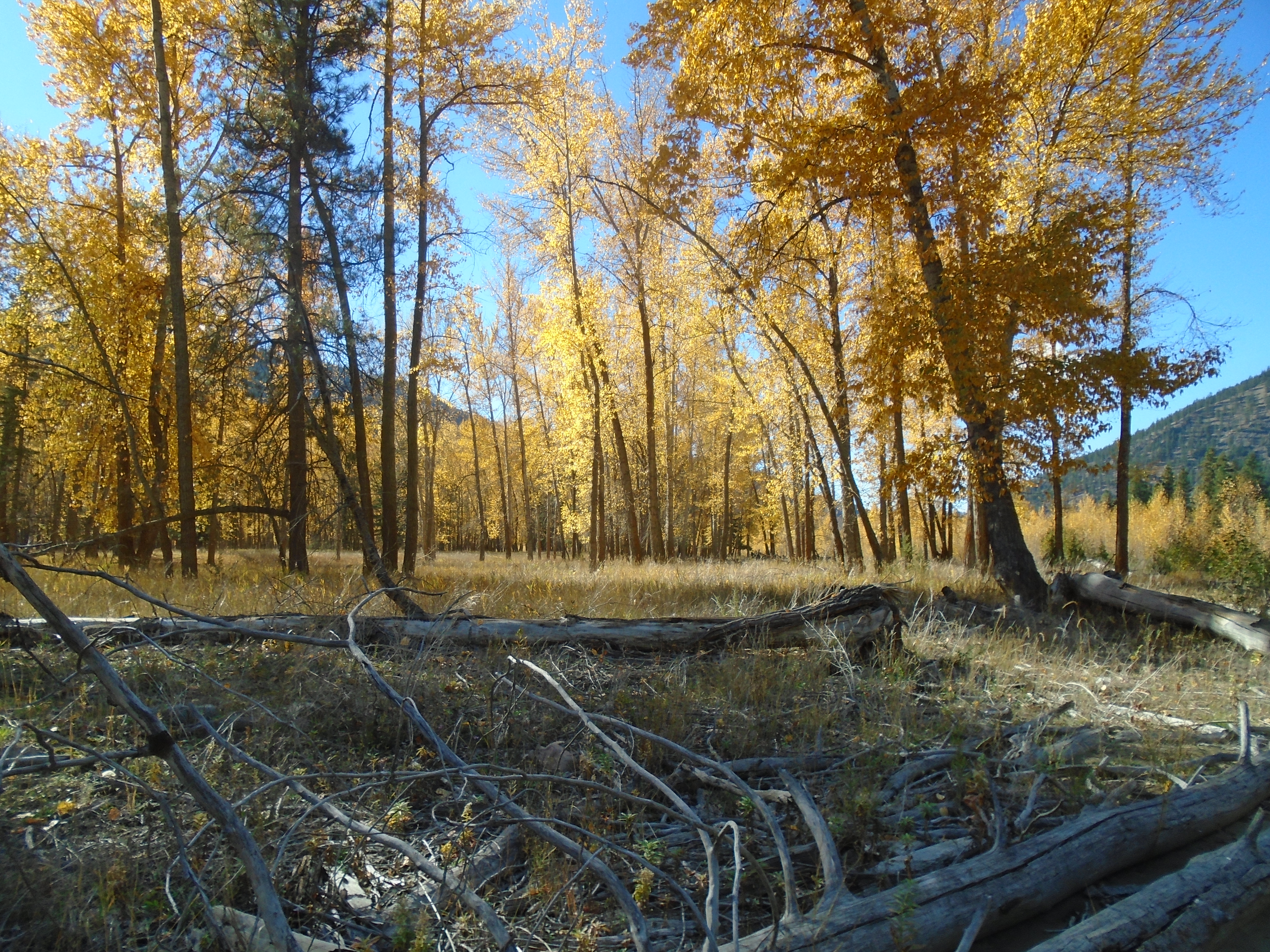
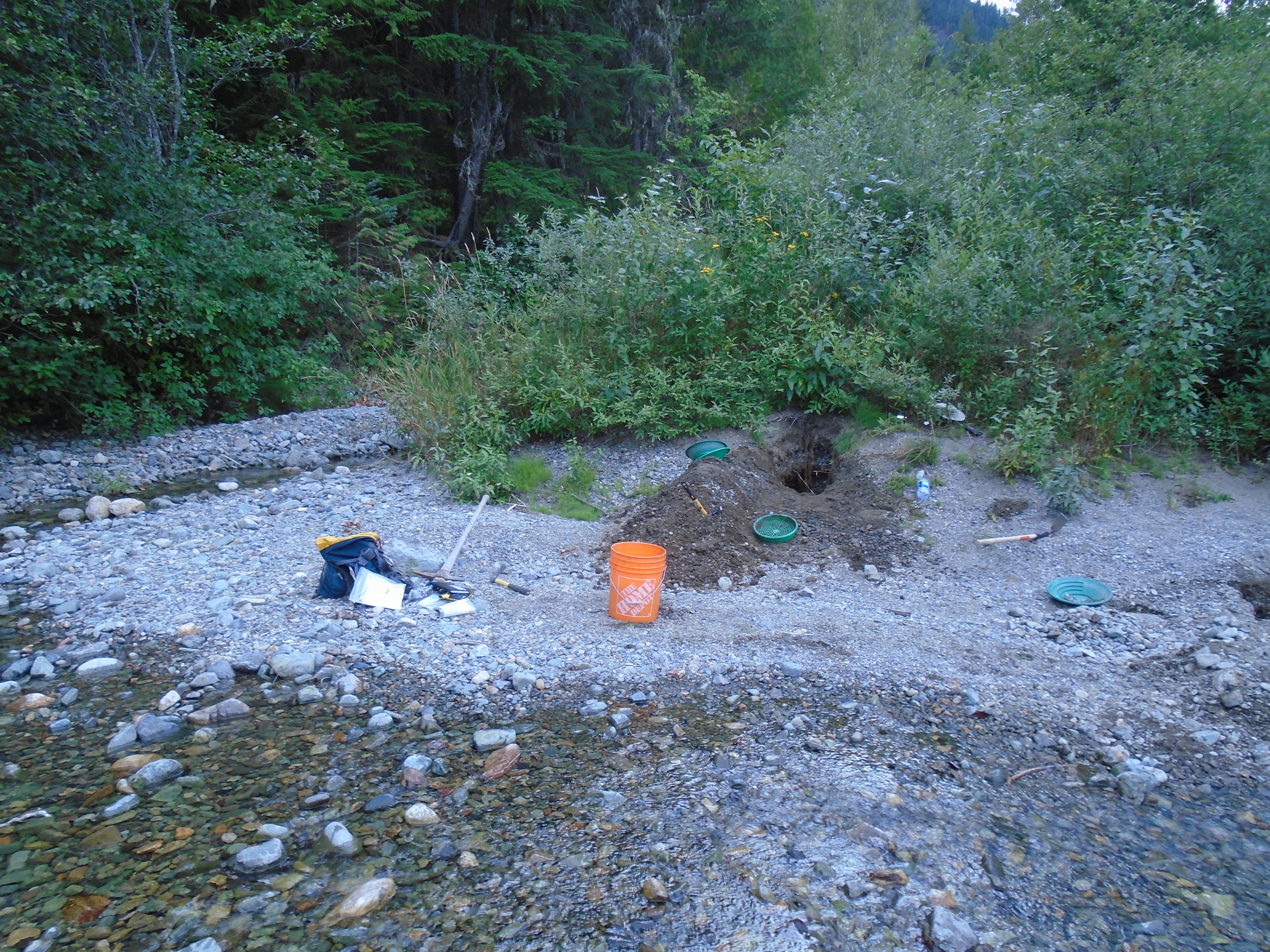
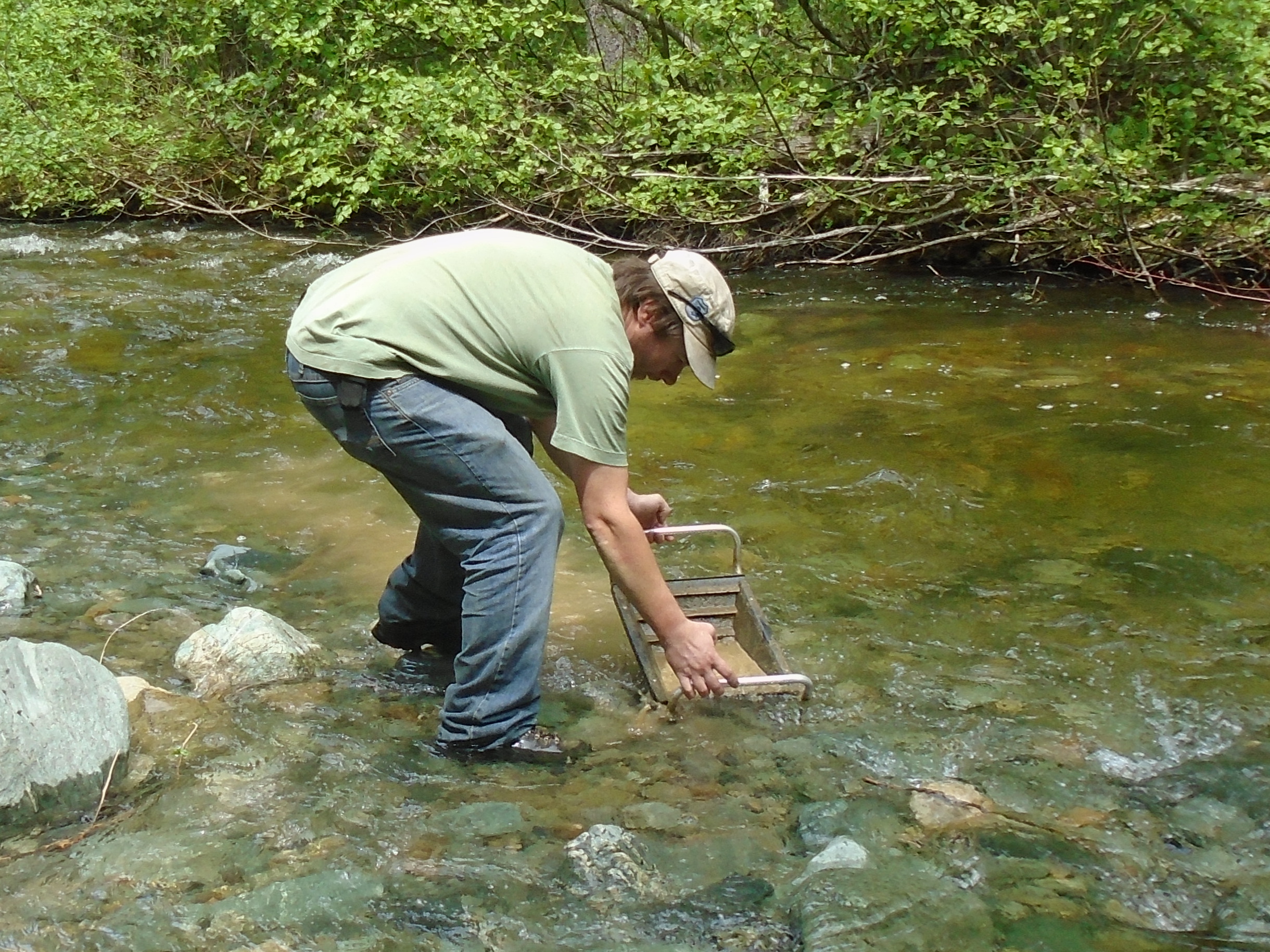
Earlier this week I traveled to the Similkameen to prospect a gold claim. I was joined by Bernie, who I met on the internet. The goal of the trip was to due some reconnaissance prospecting of this claim to determine where to focus our efforts in the future. We were prospecting using hand tools and gold pans. In addition to gold panning we took several large samples using a pyramid pan to concentrate the material on site.
This claim is located a short drive to the East of the town of Princeton. The weather in October is a bit of a gamble but we had great conditions for this two day trip. It was sunny both days and slightly below room temperature. The scenery is spectacular this time of year with the bright colors of the fall leaves contrasting the evergreen trees and the surrounding mountains.
The Similkameen river has a long history of placer mining and exploration. Prospectors began digging in the area soon after the Fraser River gold rush that began in 1858. By 1860 prospectors had found gold on the Similkameen and men were soon staking claims. The area experienced a gold rush and a town called Blackwood was created just South of present day Princeton. Prospectors descended on the Similkameen again during the Tulameen gold rush of 1885. People have been pulling gold and platinum out of the river ever since.
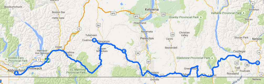
The first day we made the two and a half hour journey from Abbotsford early in the morning. There is a small farm between the highway and the claim. We stopped to talk to the land owner and the refused to allow us to access the claim through their property. This meant that we had to hike an extra 2km to access the claim without trespassing.
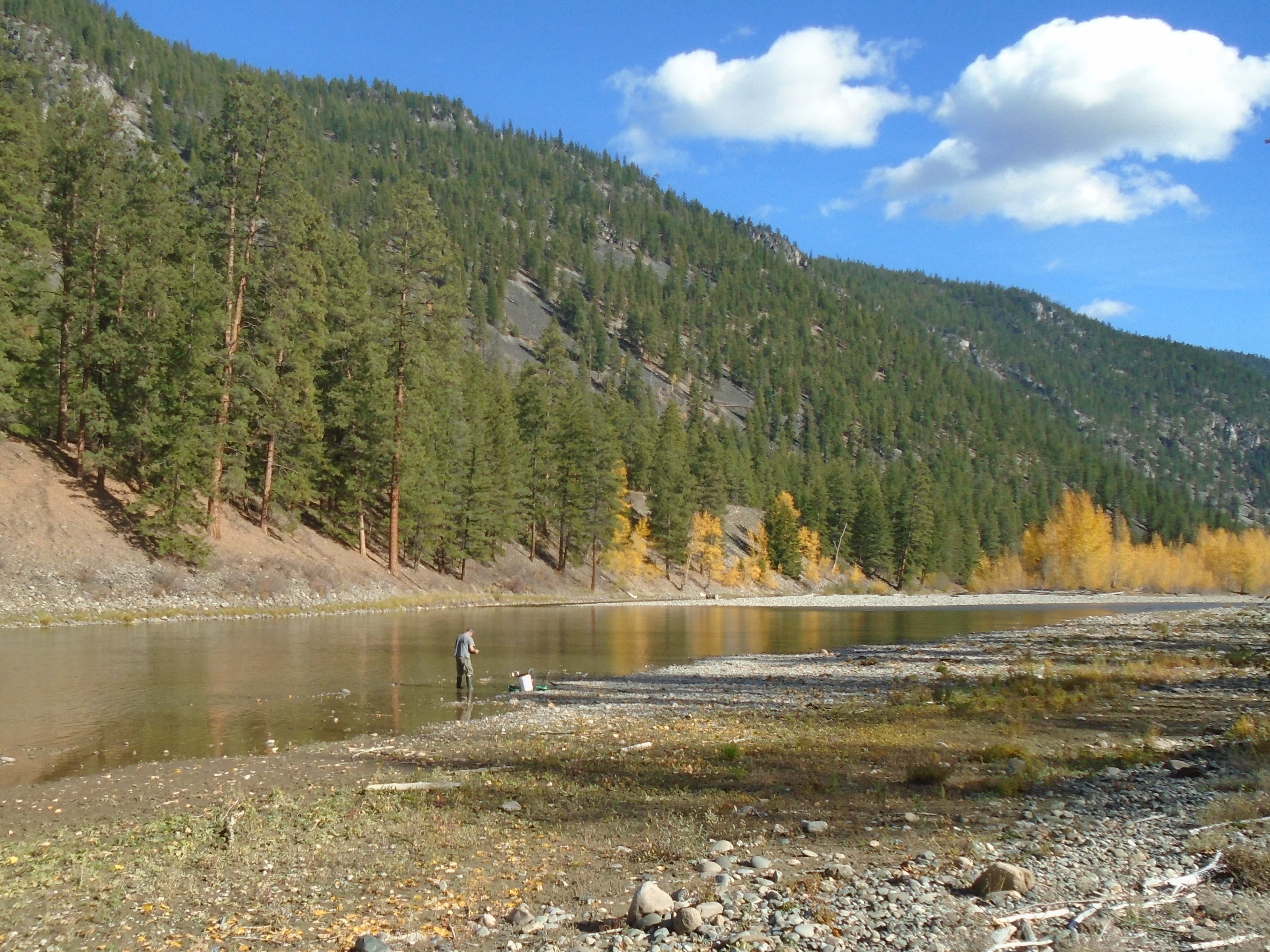
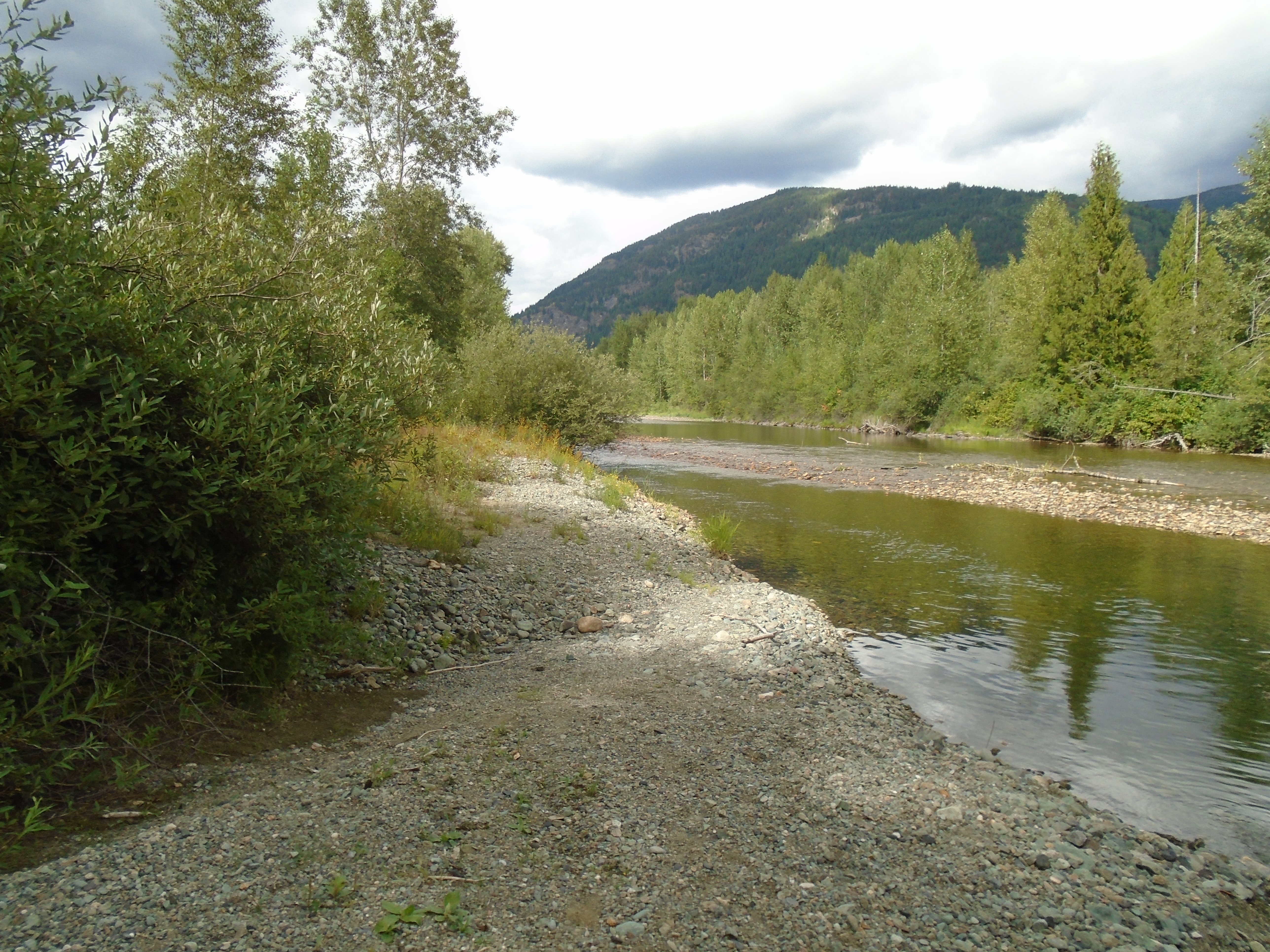
We began digging test holes right away focusing on the gravel bars and floodplain above the beach. It was easier digging than expected which allowed us to dig deeper holes to get closer to the bedrock. This area has numerous channels that show evidence of water flowing during the spring melt. The area close to the river is a bit of maze of channels and will take several trips to sample them all.
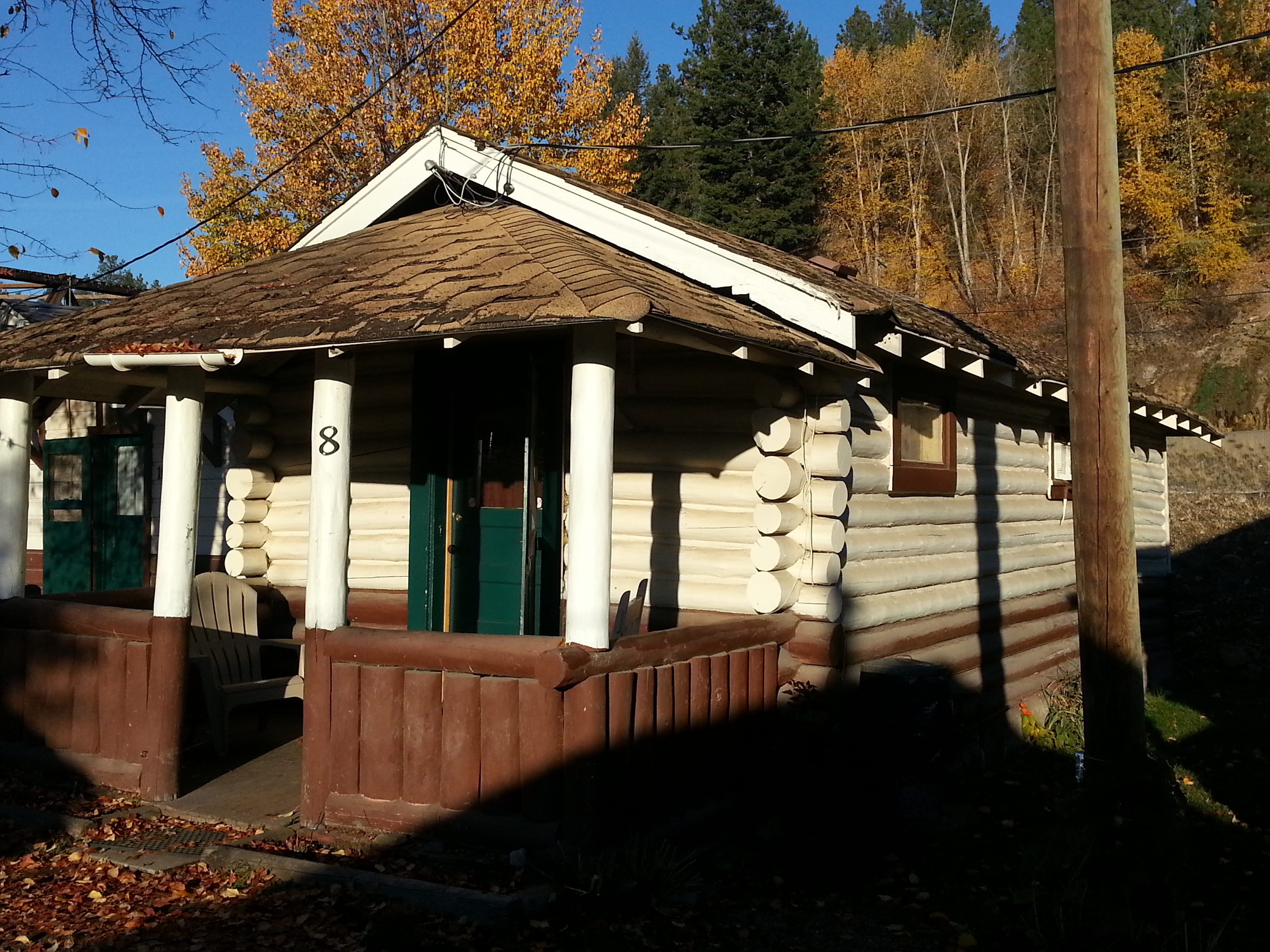
Usually I camp right near the work site on a claim but this time we went for the glamping approach due to the unexpected hike into the claim. We stayed in a historical cabin in Princeton that was built in 1937. The owners have upgraded the interior over the years with power, hot water and so on but the structure is original. These log cabins only cost $65/night, definitely worth it if you are staying in Princeton.
We were at it again the next day covering more ground. We managed to dig some big holes and take some volumetric samples and lots of gold panning. During the two days we did see some color but no platinum. This area has produced a significant amount of platinum in the past.
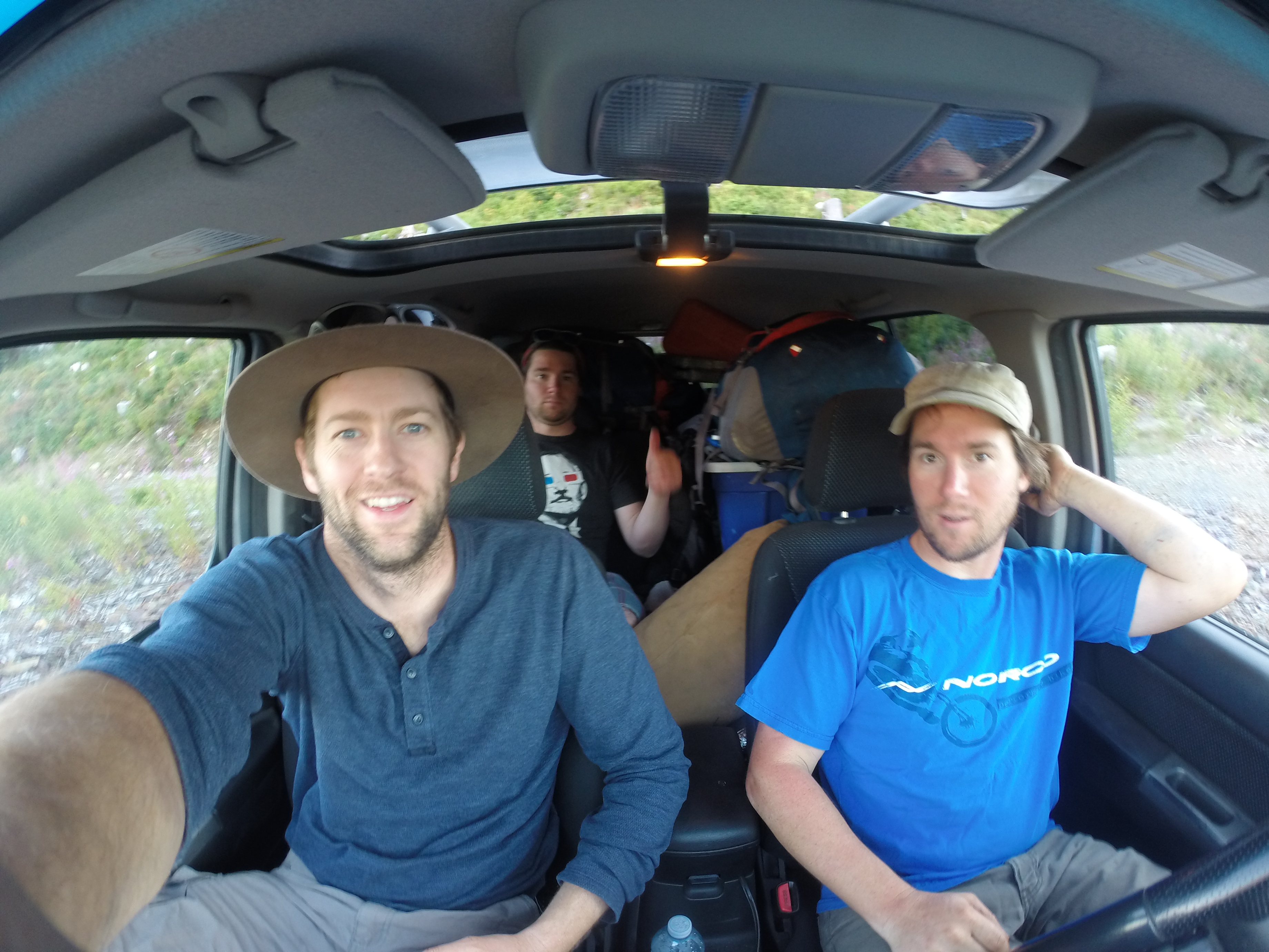
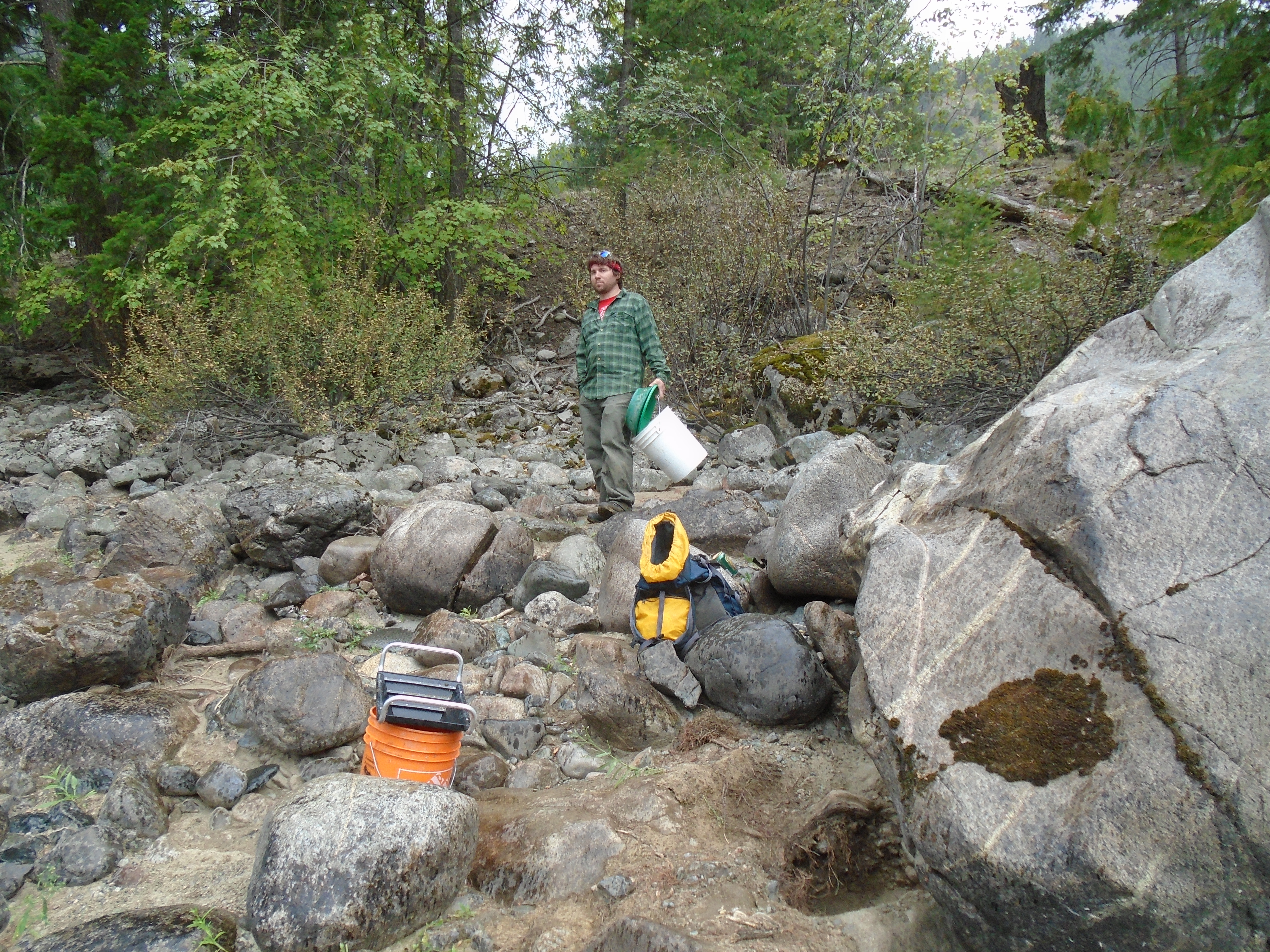
Earlier this month I made a prospecting road trip to check out some of my claims in Southern BC. I was joined by my brother, Mike from Alberta and a couple friends met up with us in Salmo. We prospected three gold cliams in near Coalmont, Hedley and Salmo.
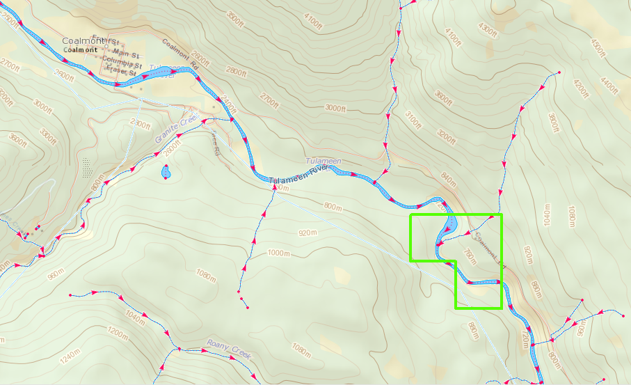
The Coalmont claim is close to the other Tulumeen claims that I checked out earlier this year on Granite Creek. This one is a few kilometers down river from the confluence of Granite Creek and the Tulumeen River. The old Kettle Valley railroad line actually passes right through the claim and the railbed gives excellent access. Its apparently a popular hiking and cycling route, I ran into a guy who walked all the way there from Princeton which is about 30 km.
Coalmont Claim Location
There was evidence of previous work on the claim which is to be expected in an area with a rich placer mining history. There were some old dredge hoses, plastic pails, and machine dug pits. There were also signs indicating active mining. We sampled the banks of the Tulumeen river taking advantage of the extremely dry summer that BC has had this year. The river is so low that you could easily walk across it.
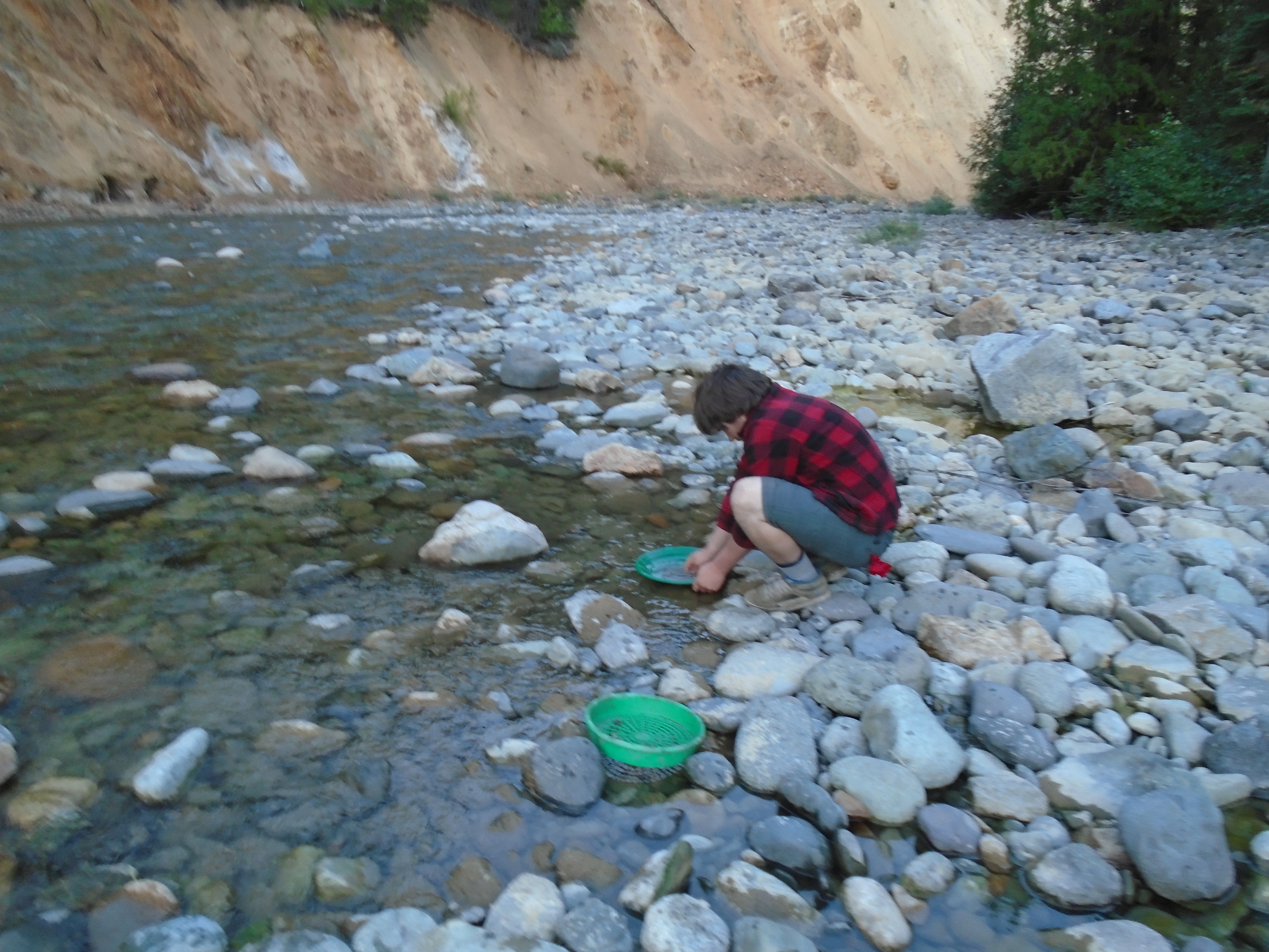
We test panned along the beach and took some volumetric samples with my pyramid pan. We saw some decent gold in the test pans, especially in one spot where we hit shallow bedrock. The drought also resulted in a province wide fire ban which makes for an unusual vibe when you are camping. Without a fire you are just sitting there in the dark, thank goodness for beer!
My brother panning the Tulumeen
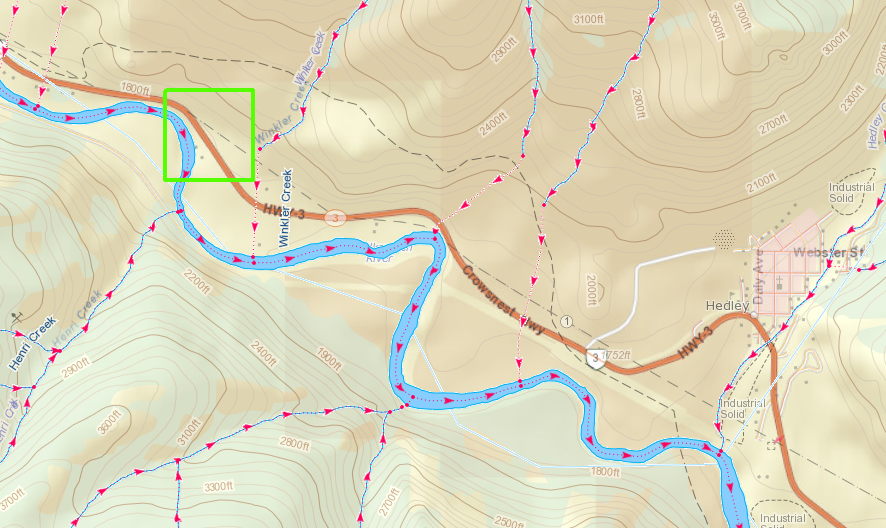
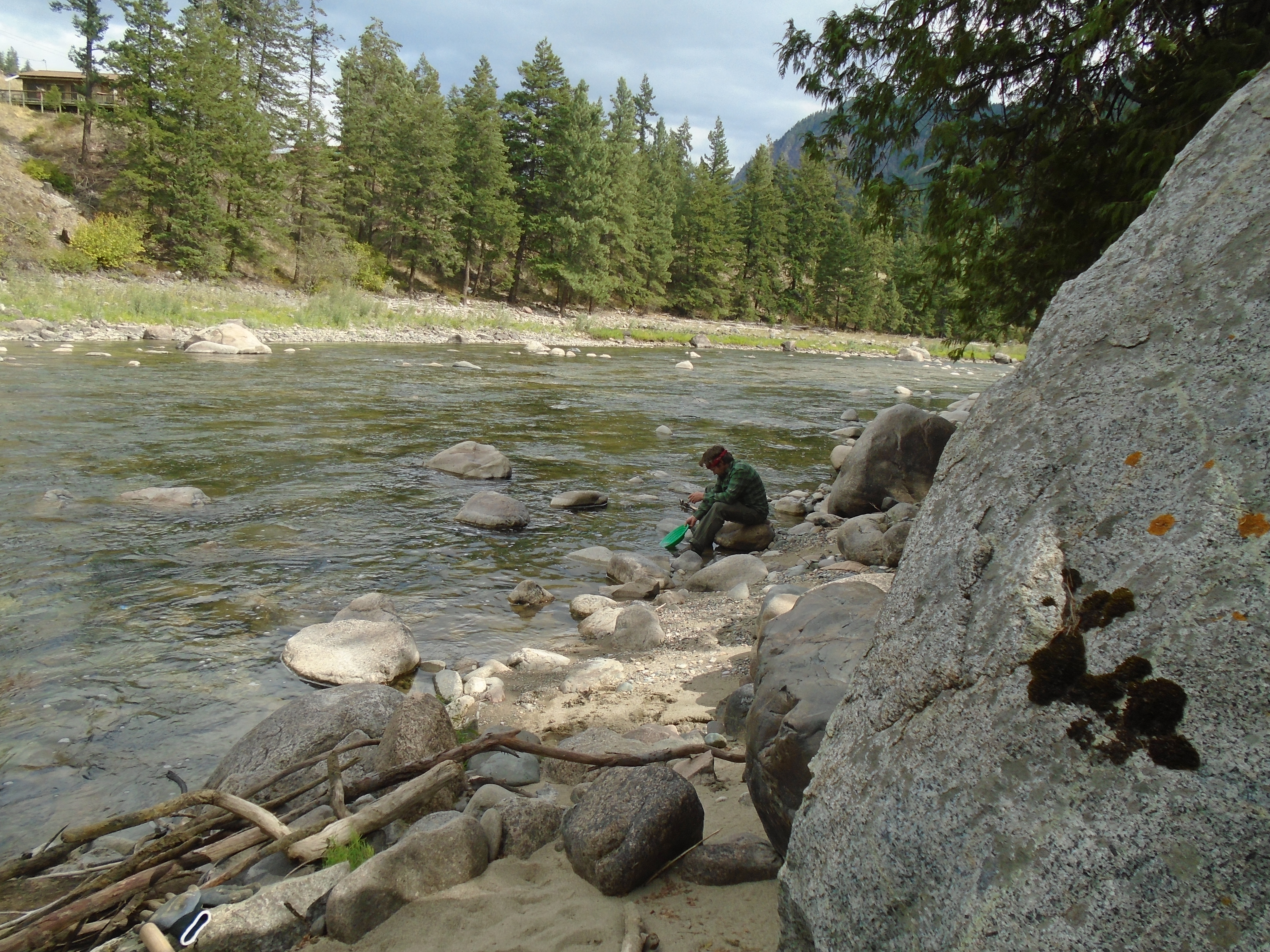
The next stop was at a claim near Hedley, BC. Hedley has a long history of gold mining. The historic Nickel Plate and Mascot mines produced from the 1880’s till about 1950. Several smaller mines are in operation today. My claim is on the Similkameen river but is also covered by private land. In BC a claim gives you the rights to the minerals but you don’t own the land. Fortunately the land owner was there when we showed up and was pretty cool.
Hedley Claim Location
The Similkameen like the Tulumeen is super low this year. This provided good access to the beach and areas that would usually be under water. We panned and sampled some promising locations. We saw some small gold in the pans and took some concentrated samples home to process later.
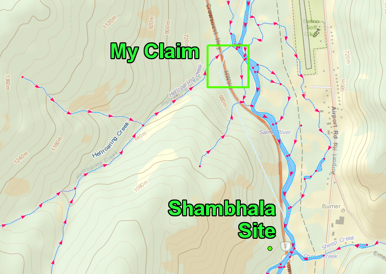
We went to Salmo next. This claim is very close to the site of the Shambhala music festival. There was no shortage of hitchhikers wearing animal print clothing and other bizarre outfits. Near the claim there were several hippies with signs up asking for tickets. I actually picked up a hitchhiker on the way there since I had an empty seat.
Some friends met me up there to help search for gold and work on their prospecting technique. This claim is known to have gemstones of the beryl variety. Emeralds are the green form of Beryl, caused by a chromium impurity. Aquamarine is the light blue/green form. Sadly we didn’t see any emeralds in our pans and we only saw trace amounts of gold. We took some larger samples which I haven’t processed yet so hopefully there are some gemstones there, and gold. I’ll head back there as soon as I get a chance the allure of beryl is just too strong.
After prospecting the Salmo claim my brother and I joined a group at Koocanusa Lake for a houseboat bachelor party adventure. That is another story though.
Last weekend I went out to check out some claims on Granite Creek. This creek experienced a significant gold rush in 1885. The ghost town of Granite city is at the mouth of the creek, what’s left of it anyway. Our GPS track is below.
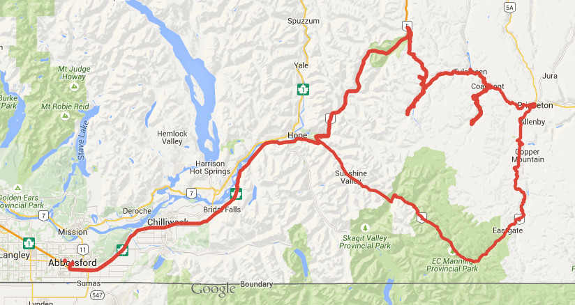
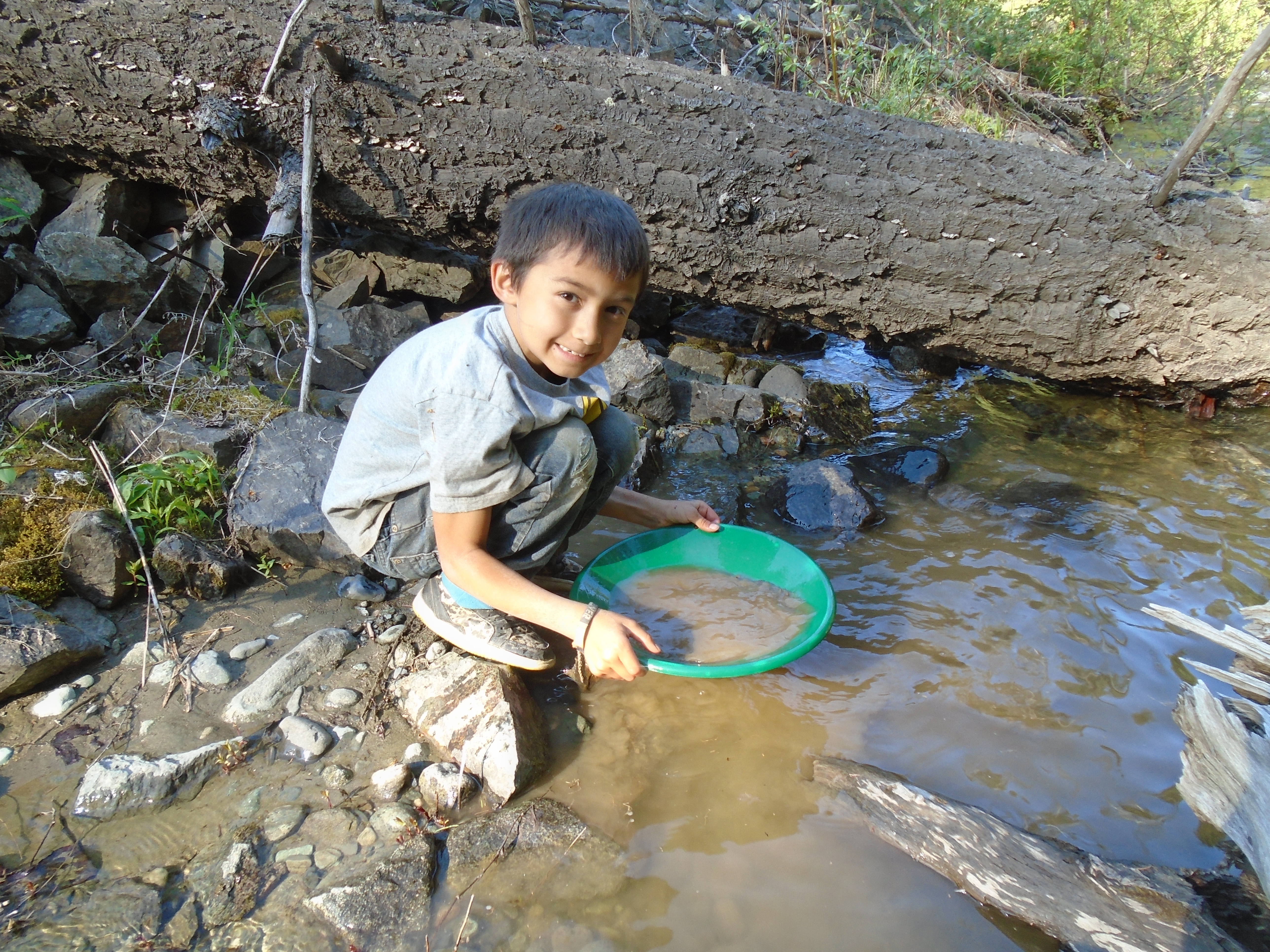
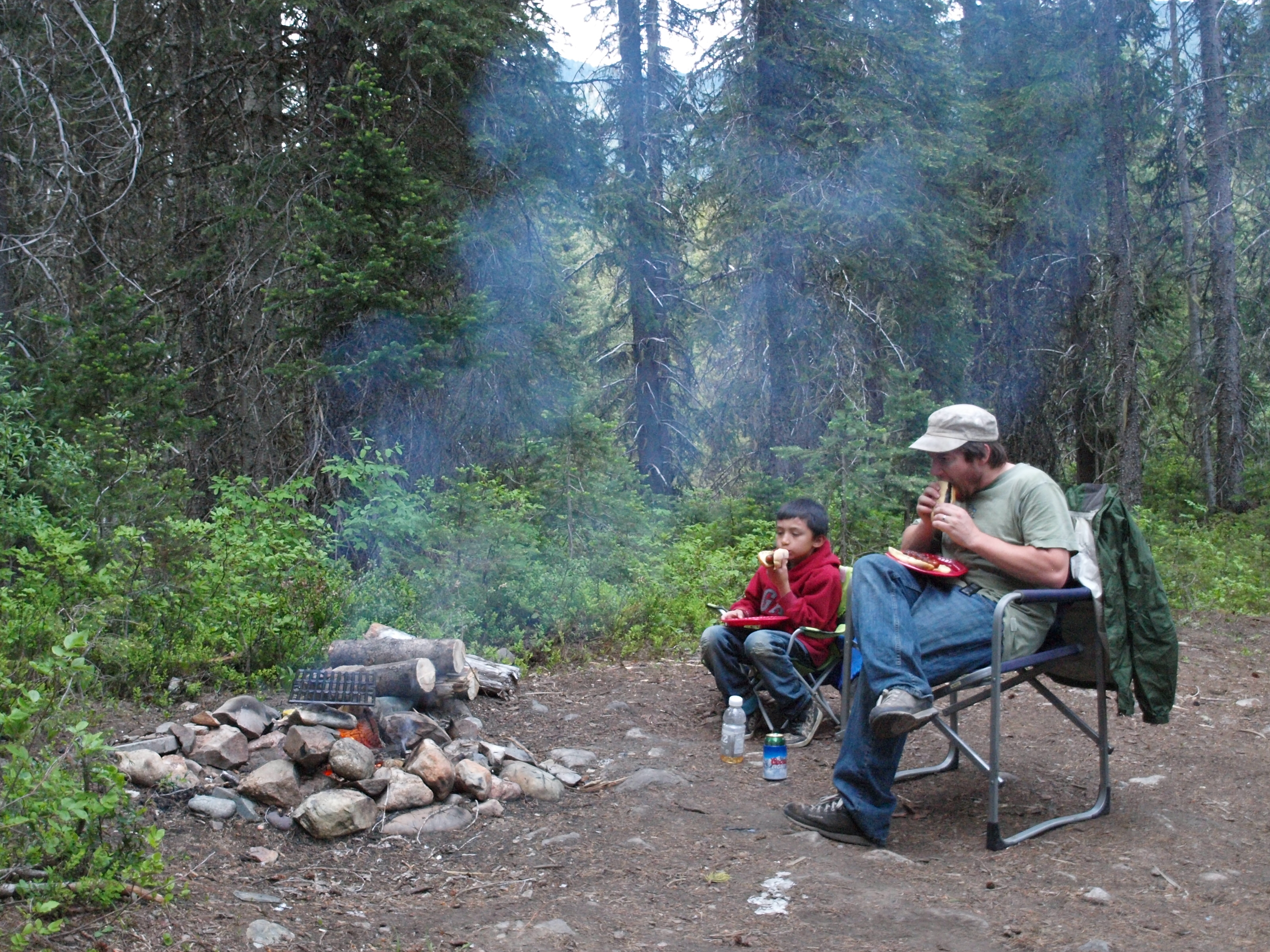
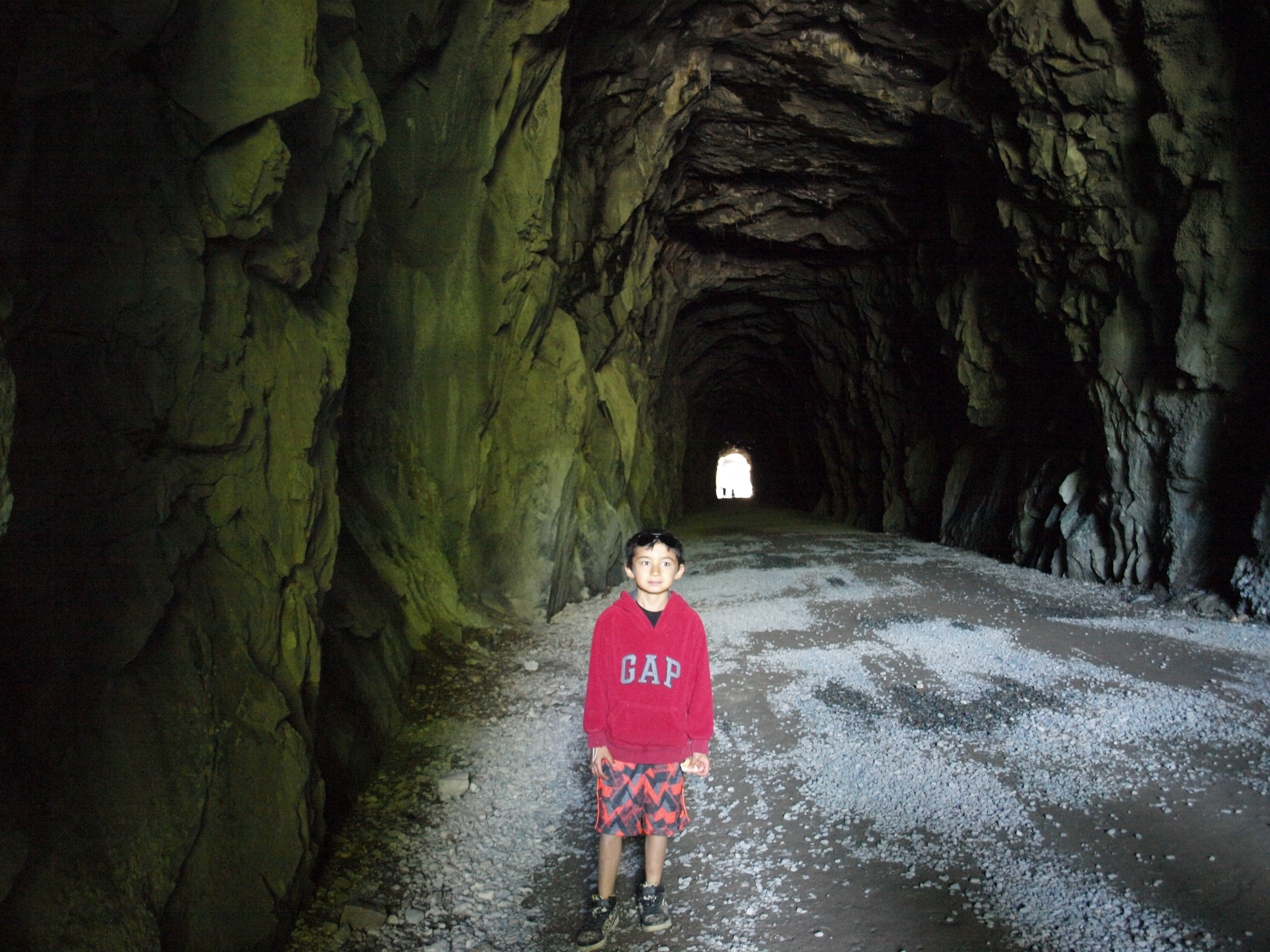
We took Highway 3 from Hope to Princeton then took the backroads through the Tulameen. The first stop was the Granite City ghost town, then up Granite Creek to my claims. Later we drove up through the town of Tulameen up the Forestry roads to see Tulameen falls. We camped nearby and exited the dirt roads at Britton Creek on the Coquihalla highway. We checked out the Othello tunnels on the way home. The whole trip was approximately 470km. My 8 year old son accompanied me on this trip because he had a geography report for school and decided to do it on the history of this area.
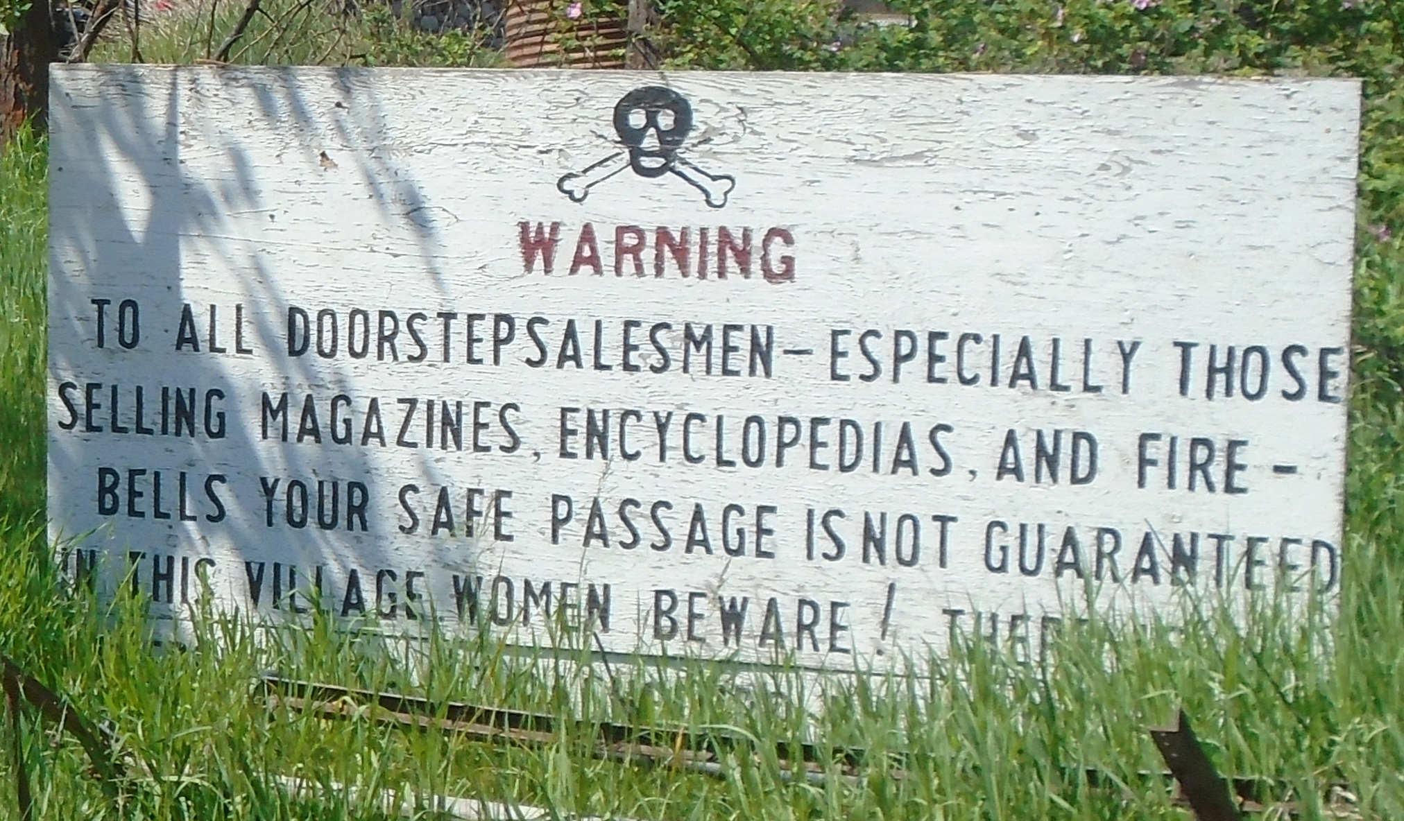
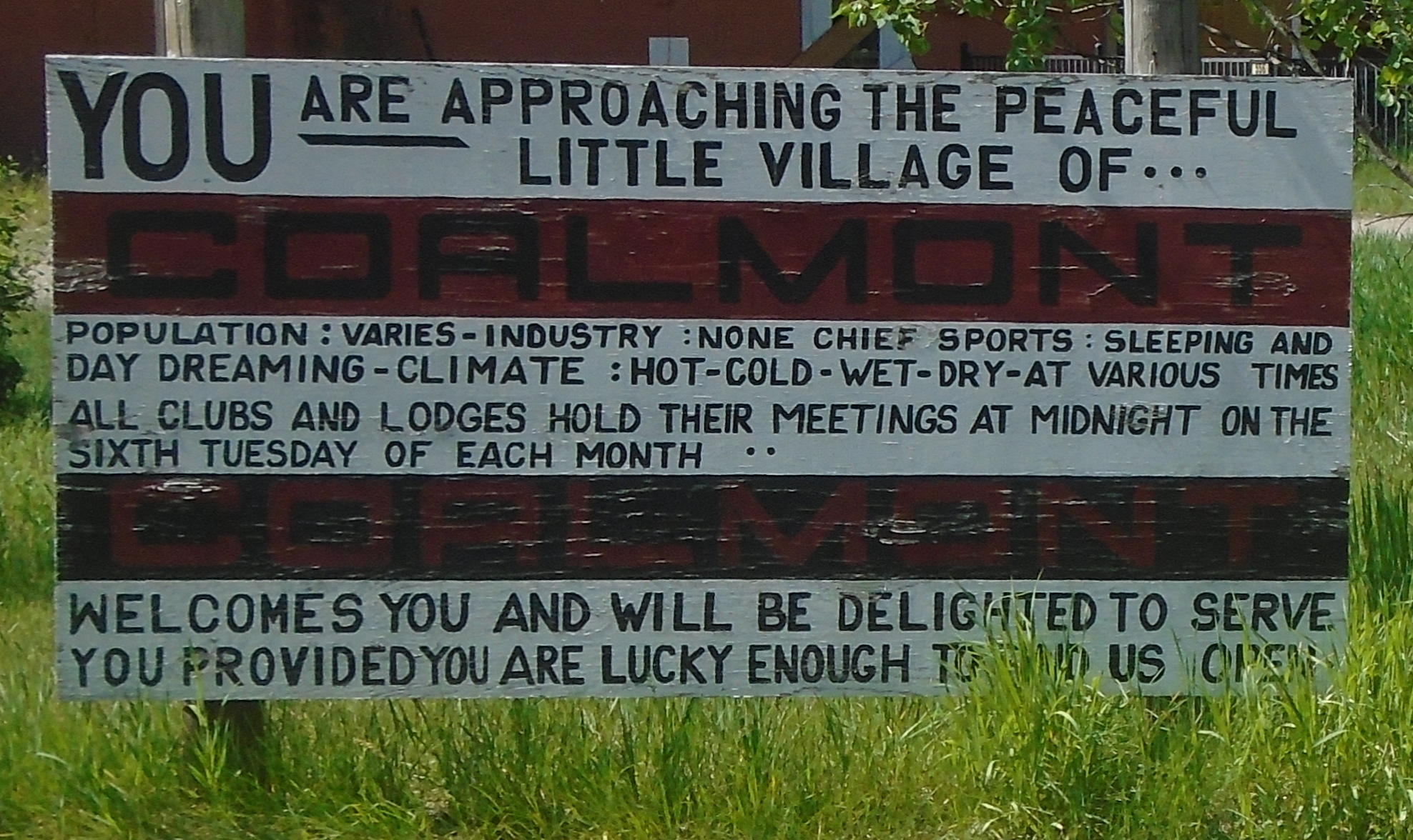
We passed through the hamlet of Coalmont on the way to Granite Creek. There’s not much there except for a couple of streets with some old buildings and these funny signs.
I had been waiting a long time to check out the Granite City ghost town. It was quite a large city at the height of the gold rush. There were over two hundred buildings, 13 of which were saloons. The bars in Granite ran flat out 24/7. This was a real frontier town with all the ingredients for a great western movie, gunslingers, gamblers and prospectors. With a population of over two thousand in 1885 Granite City was the third largest city in BC, even larger than Vancouver at the time.
There are many stories about Granite City, such as the lost platinum cache. It is interesting that the tributaries of the Tulameen, including Granite Creek, are one of two places in the world where both platinum and gold are found in the creeks. The other is the Amur river in Russia. At the beginning of the gold rush in this area the miners were collecting platinum in their gold pans and rockers but they didn’t know what it was. Platinum is very dense and will sit in the bottom a gold pan the same way gold does. I have found platinum in my pan before and it took me a couple seconds to realize what it was. Most miners kept their platinum but many threw it away with their black sands.
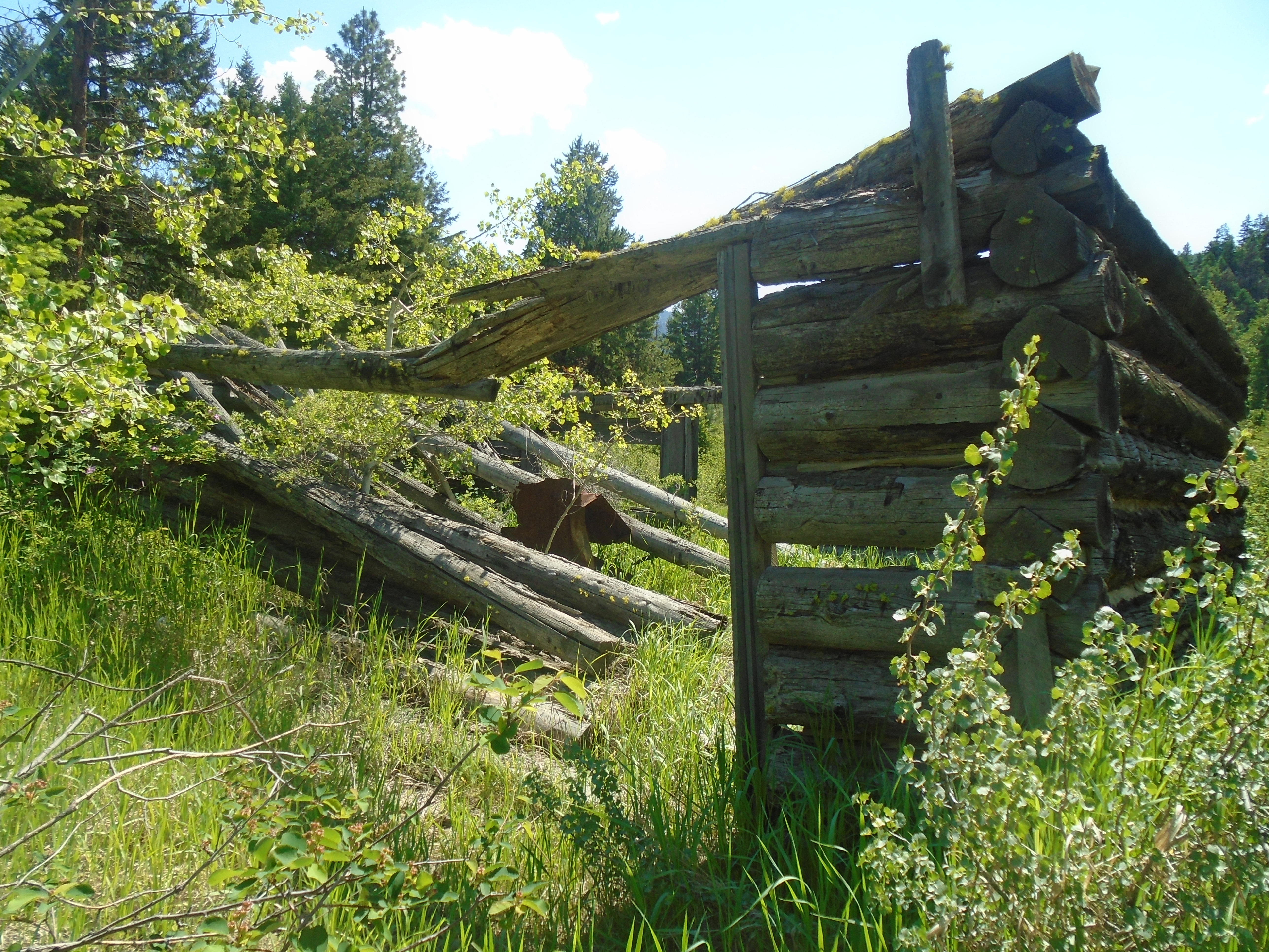
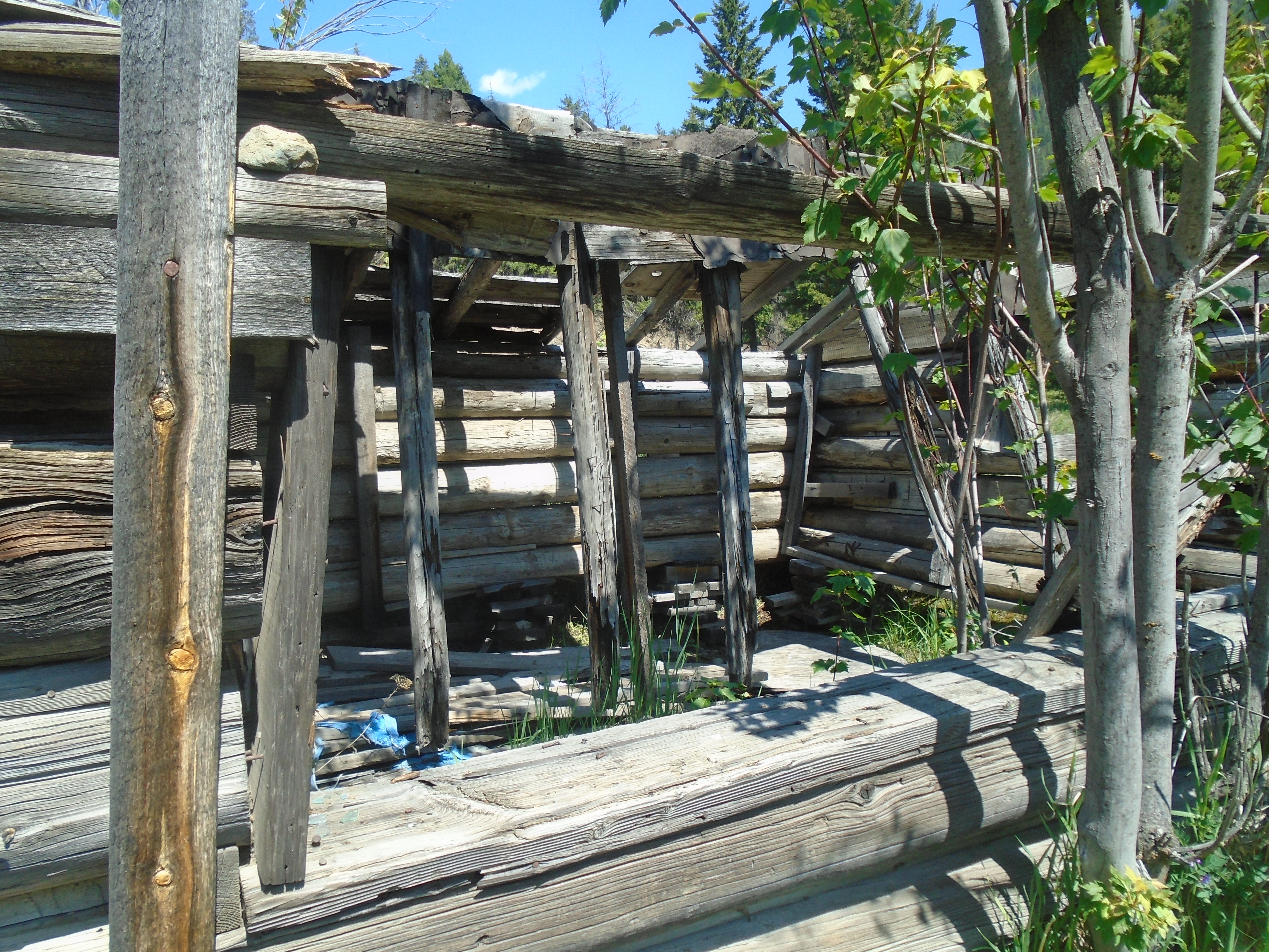
The lost cache legend states that a prospector named Johannson collected platinum from the miners and build up several tin cans full. He apparently buried his cache within sight of the front door of his cabin with the intention of returning to collect it. He was never heard from again. At any rate there is not much left of this gold rush town today. There are a handful of cabins in various states of decay, a monument and a graveyard.
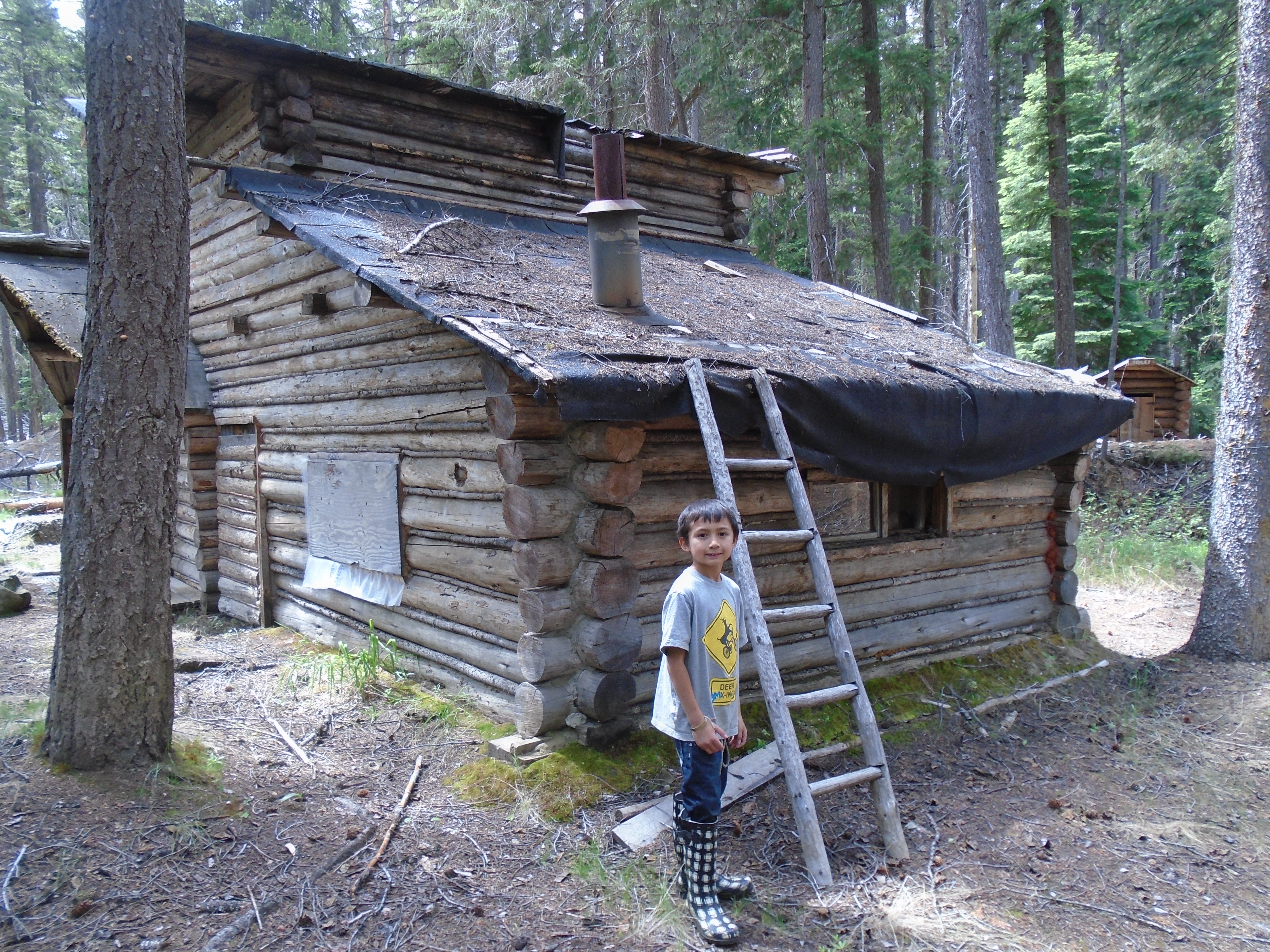
My claims are about 17 kilometers up the road from the old townsite. We took the Arastra creek forest road up to the confluence of Arastra and Granite creeks. I met a local prospector while we were up there and he told me Arastra creek got its name because the chinese miners built a large water wheel crusher called and Arastra. The claims that I have are not directly on the water so we had to bring our samples to the creek to pan. It was very labor intensive.
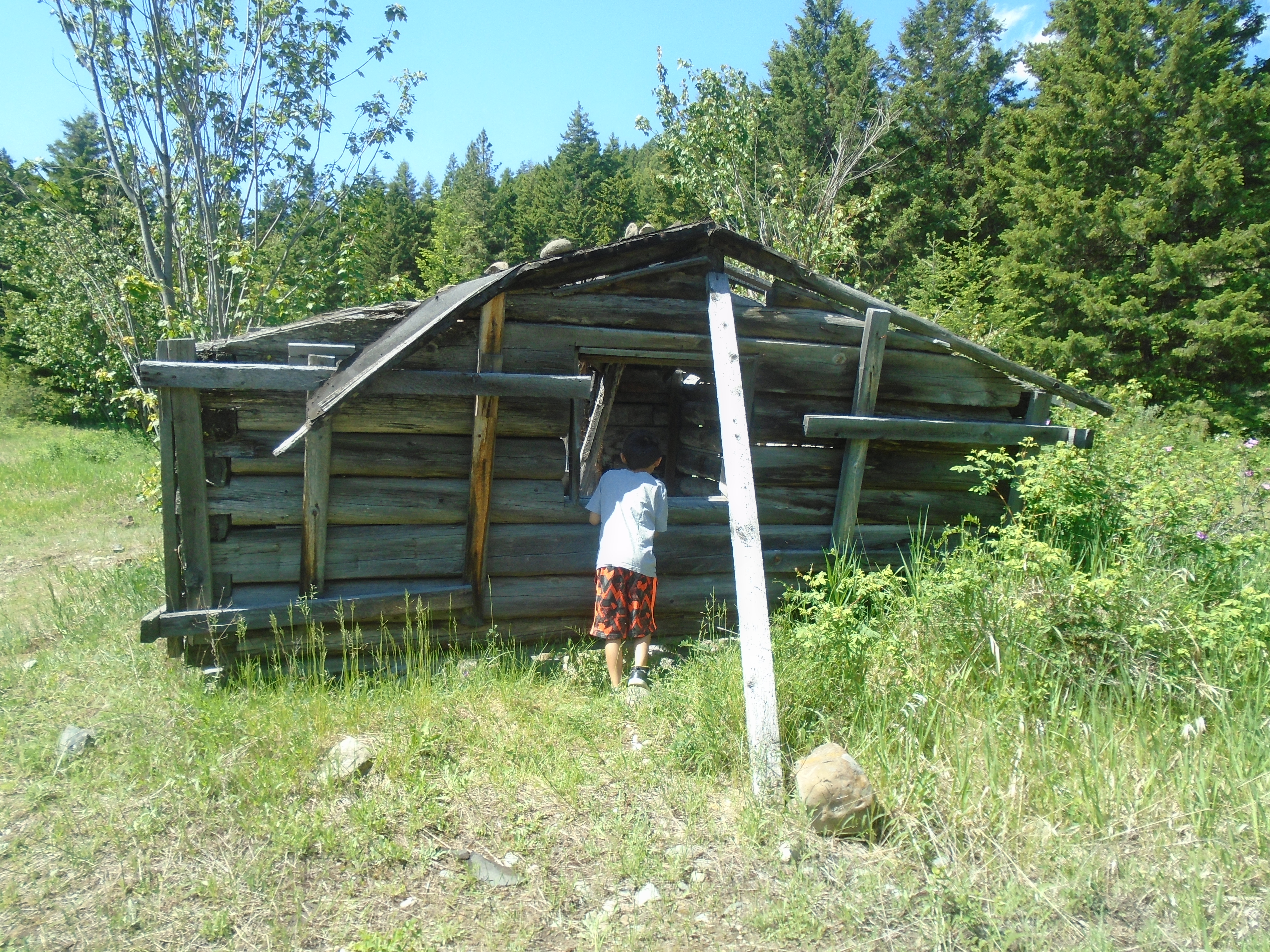
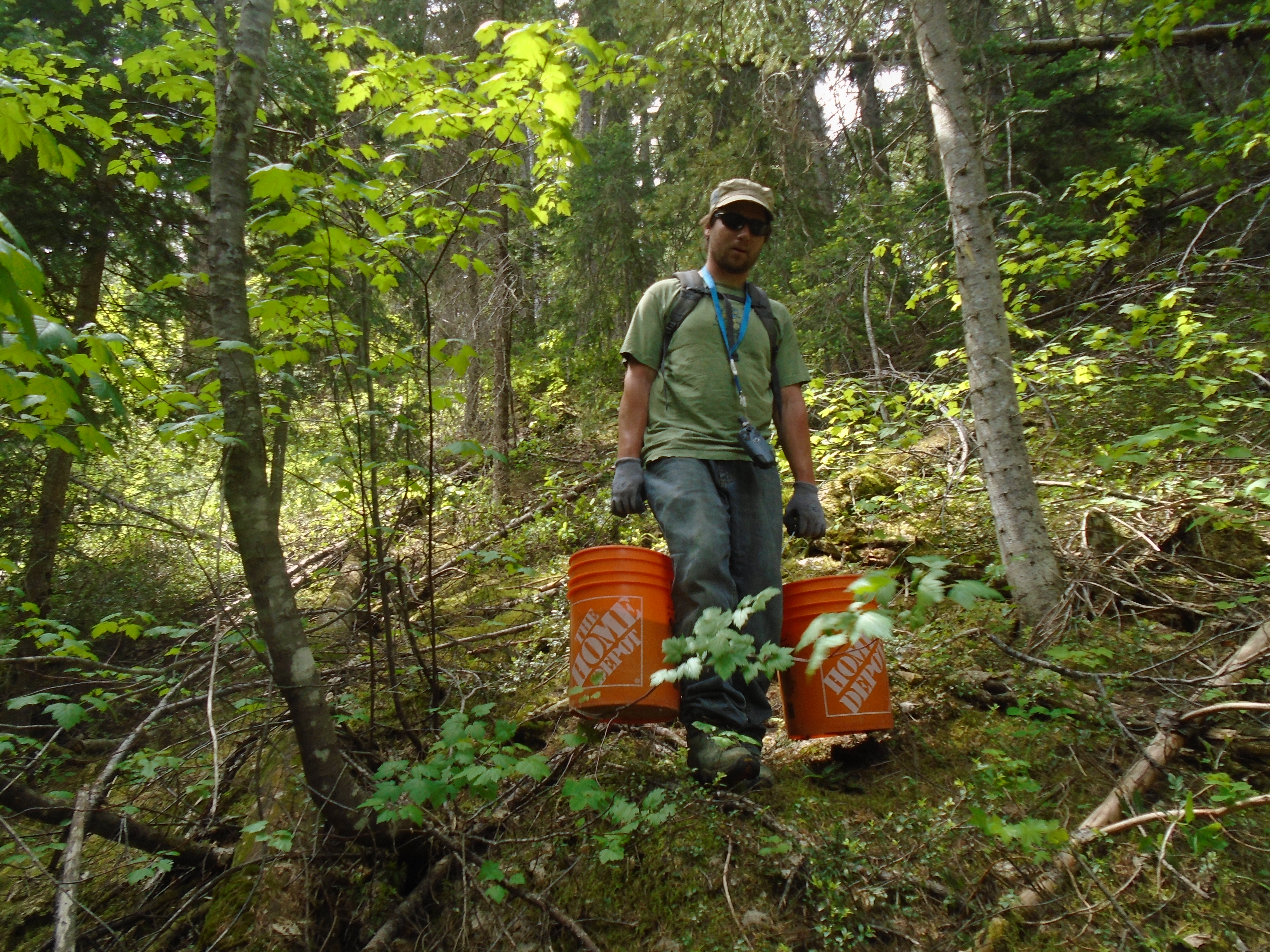
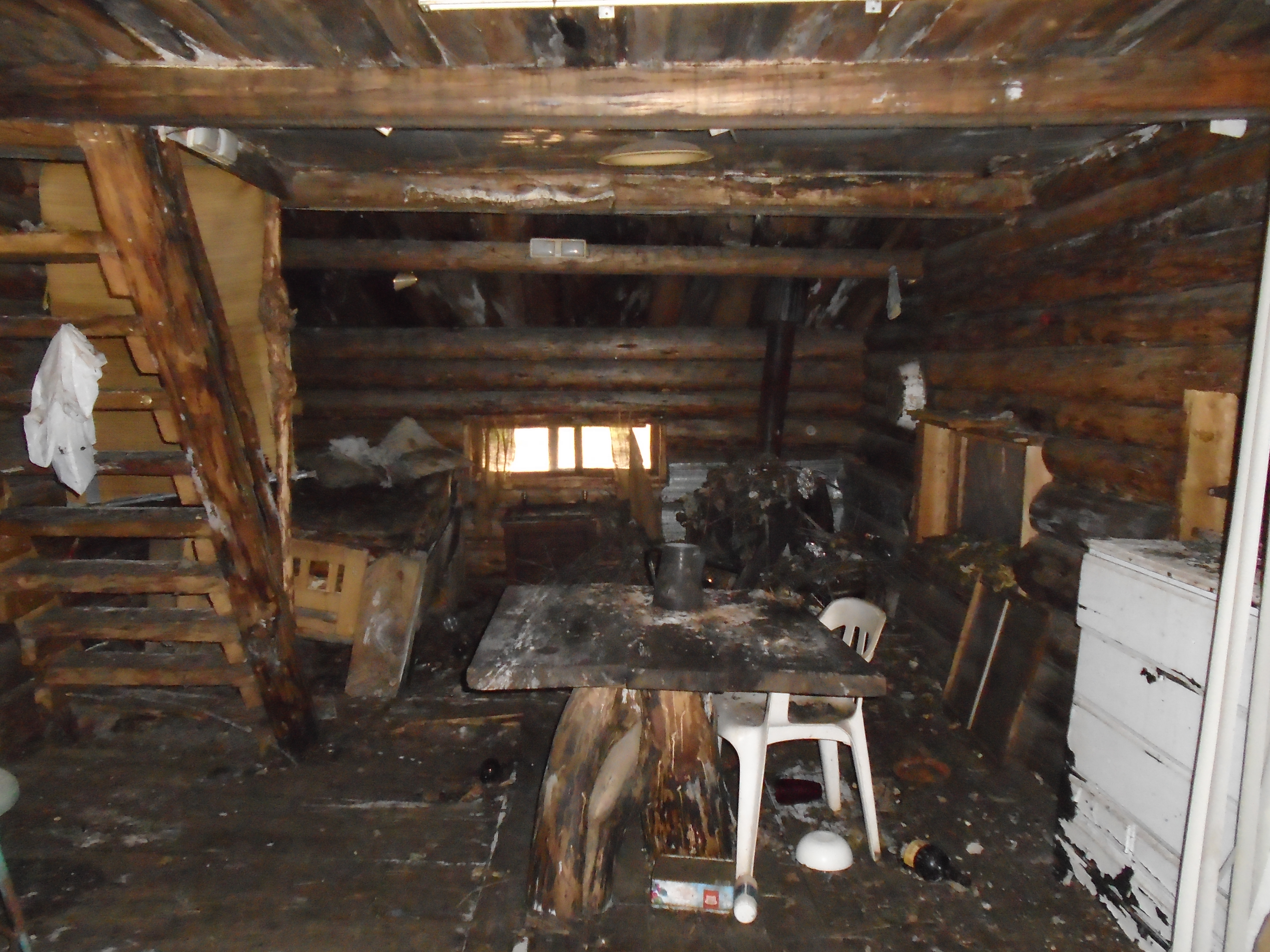
One claim was right off the road so we were able to use my truck to drive the buckets of gravel to the creek. The second claim required that we hike along Granite creek on a very old trail. While hiking along the 2km section to my claim one can’t help but imagine what it would have been like out here in the 1880s. There was evidence of old camps and such all along the way. We even found an old miner’s cabin that had long since been deserted.
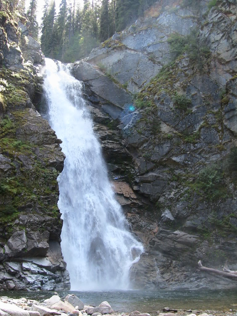
We managed to get a few samples of 20L each. I concentrated the samples on site with my pyramid pan so I only had to hike out with 1L bags. We did a few test pans around the area and saw some color. No platinum though. After finishing the work on my claims we packed up our camp and headed up the Tulameen to check out an awesome waterfall called Tulameen falls.
The waterfall is located approximately 30km up the river from the townsite of Tulameen. The Similkameen tourist pamphlet that we picked up in Princeton said the waterfall is accessed by a 1km moderate hiking trail with two river crossings. That doesn’t sound too bad. When we got to the trail head it looked like nothing was there it seems that a forestry operation has moved the road an piled banks of large rocks over the old recreation site. We found the trail marked by spray paint on a tree. The first part was not too bad, then we crossed the river in our bare feet to keep our boots dry. There were signs to only cross in low water but it seemed low enough. The water was up to my mid thigh but a lot higher on my son. After that the trail was pretty bad with some sections of no trail at all. It looked like it was a well maintained trail once but must have been hit with a flood or something. The waterfall is amazing, it has over 1400 feet of drop and a lot of water pouring over it.
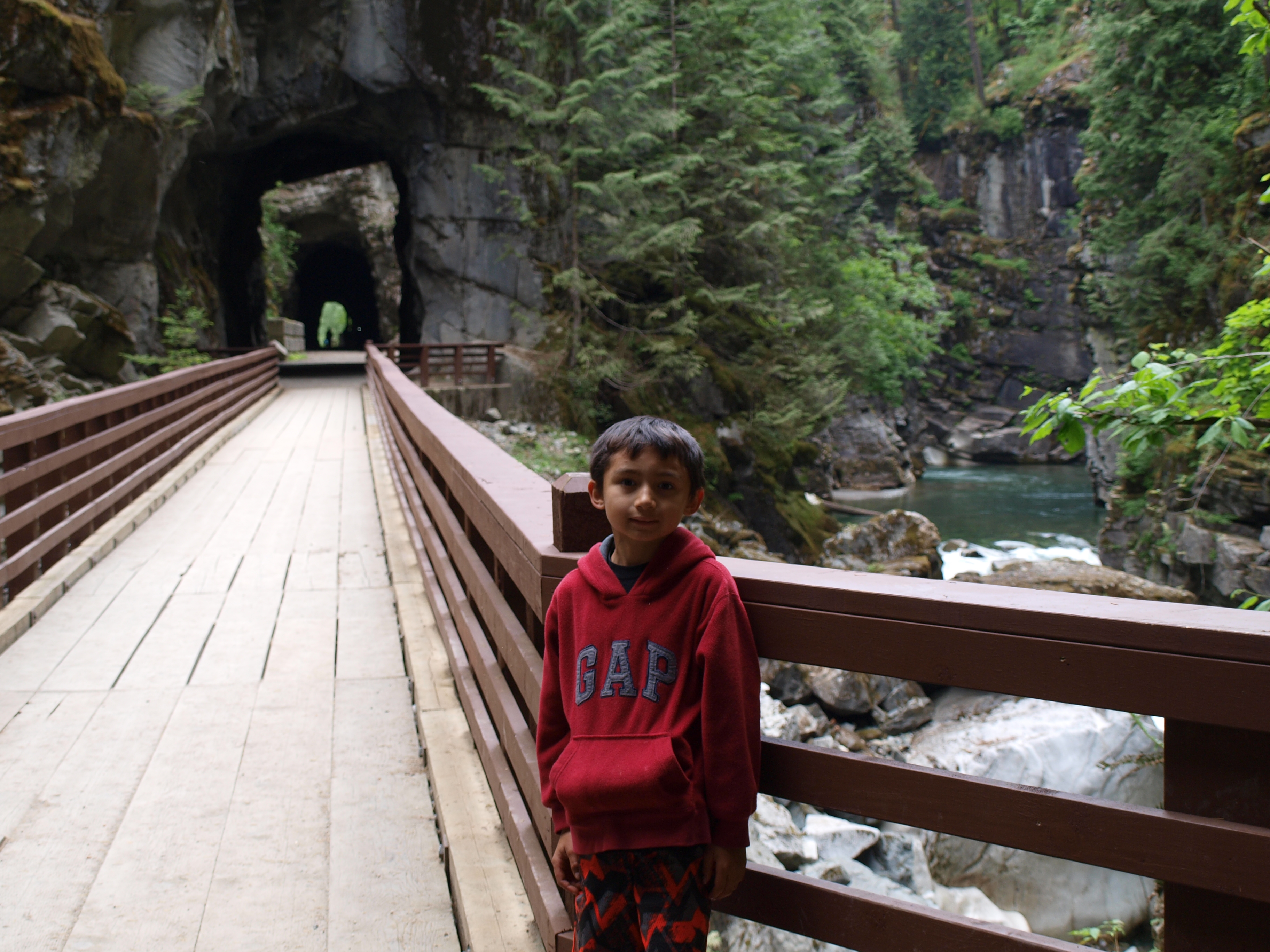
We found a really nice free camp site a few kilometers up the road from the trailhead. It is called Sutter Creek Recreation Site. After staying the night we headed back to civilization with one more stop on the way. We checked out the Othello tunnels just North of Hope. These tunnels were part of the old Kettle Valley railroad. The KVR was a steam railroad the serviced the region from Hope to present day Kelowna. There are five tunnels close together and several bridges to make it possible to access this section of the Coquihalla canyon. Apparently the lead engineer was a Shakepeare nut and named several of the stations after characters from Shakepeare plays. There were Othello, Romeo, Juliet, Lear, Jessica, Shylock and Portia.
Overall it was a great trip. We did some initial sampling on two claims and saw some cool parts of Southern BC. I have other claims in the area and will be back soon. There’s something about the Tulameen that gives an eerie feeling when you are out there. It could be the remoteness or the history of the area. Maybe its the platinum, whatever it is I like it and can’t wait to explore the region in the future.