The Search for Klondike Lode Gold

The Search for Klondike Lode Gold

In the summer of 2010 I was hired to work with a team to find hard rock gold in the Klondike.  We explored a group of claims on the Indian River.

IMG_1741My crew stayed at a camp operated by a character called Big Al.  That name might sound familiar because he has been featured on the popular TV show Yukon Gold on the History Channel.  Of course at that time we had no idea he was going to be a celebrity.  During the trip we heard a rumour that Hoffmans working a few claims over were filming for a TV show, it turned out to be the hit series Gold Rush on Discovery.  We were surrounded by gold mining TV stars but didn’t know it yet.

Klondike Tailings Piles

Indian River Yukon

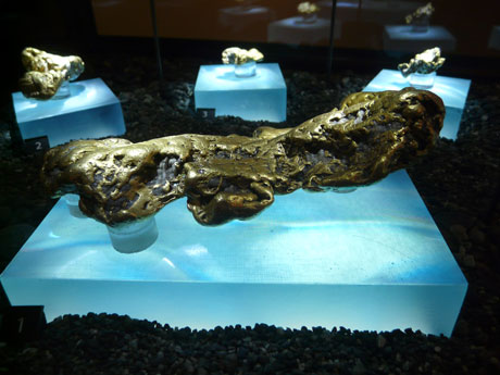
The Klondike is a place that has a very storied history and was the site of the greatest gold rush of them all.  California, Oregon, and British Columbia had their gold rushes and stories but the Klondike was like no other.  Between 1896 and 1899 over 100,000 adventurers made the journey from all over the world to the largely uninhabited Yukon territory in search of gold.  What made this rush different is the long journeys and overall inexperience of the Argonauts.  At the time of discovery El Dorado and Bonanza creek were the richest creeks in the world.  Some claims on El Dorado were getting $27 to the pan once they hit the pay streak.  That is equivalent to about $750 per pan in today’s money.

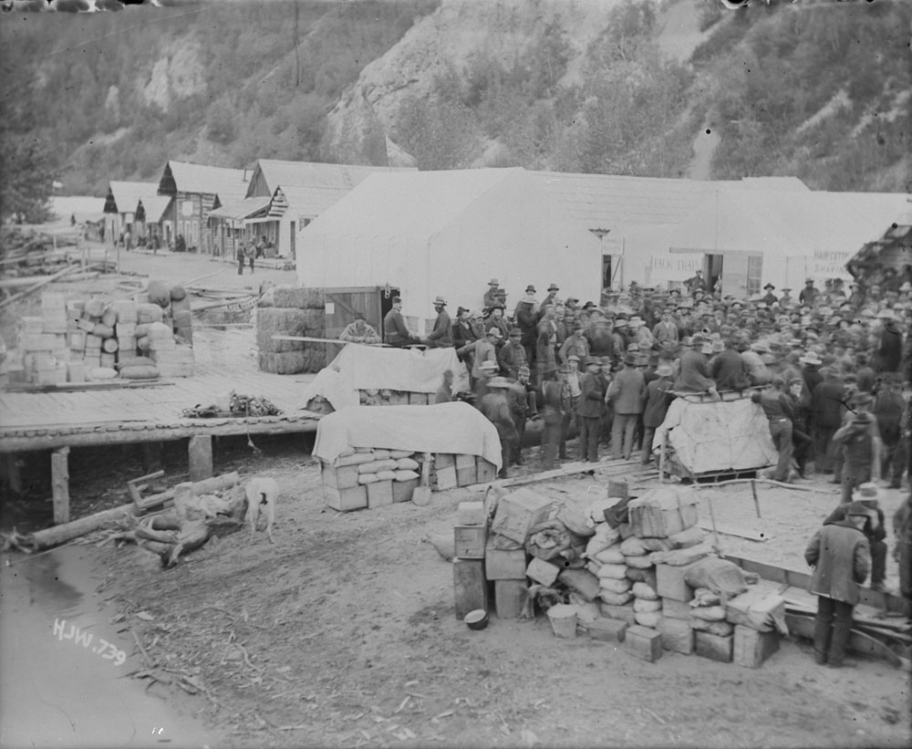
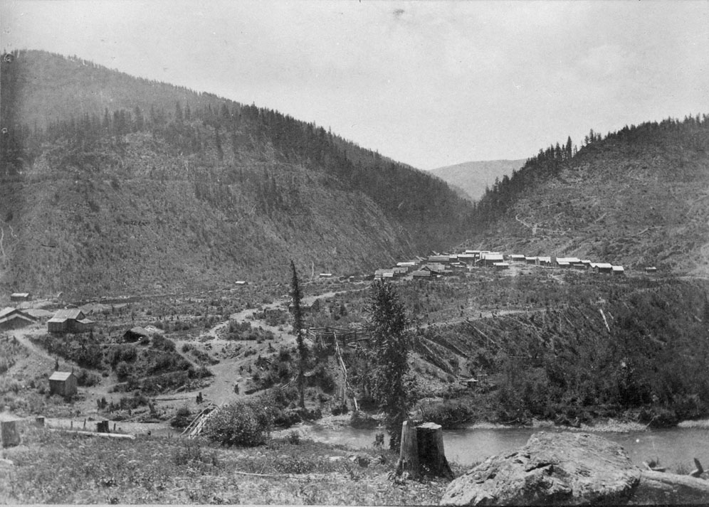
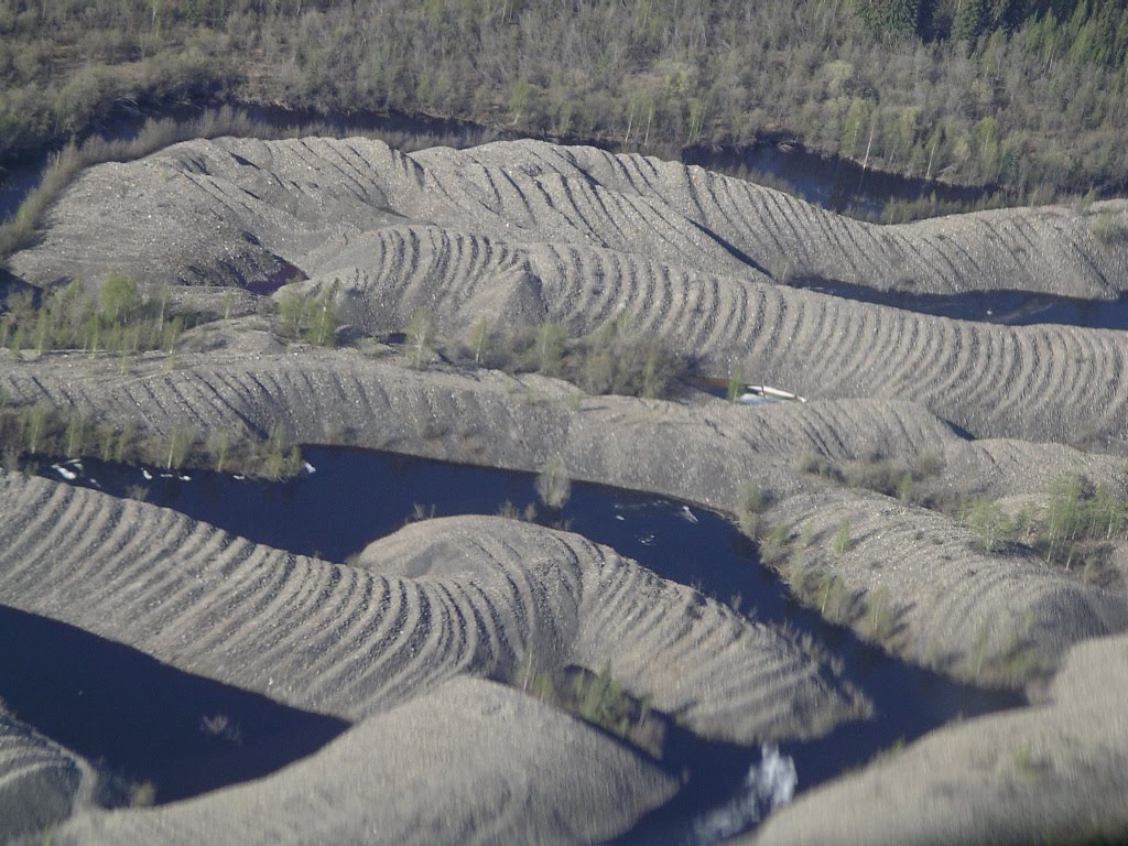
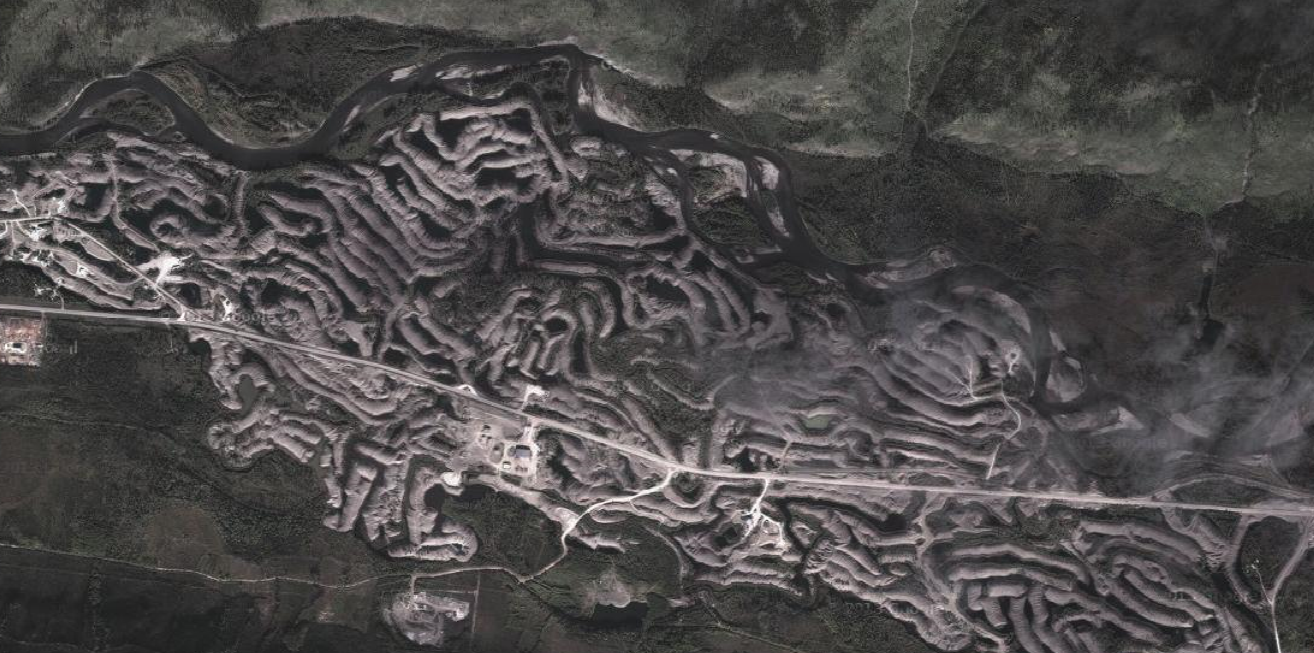
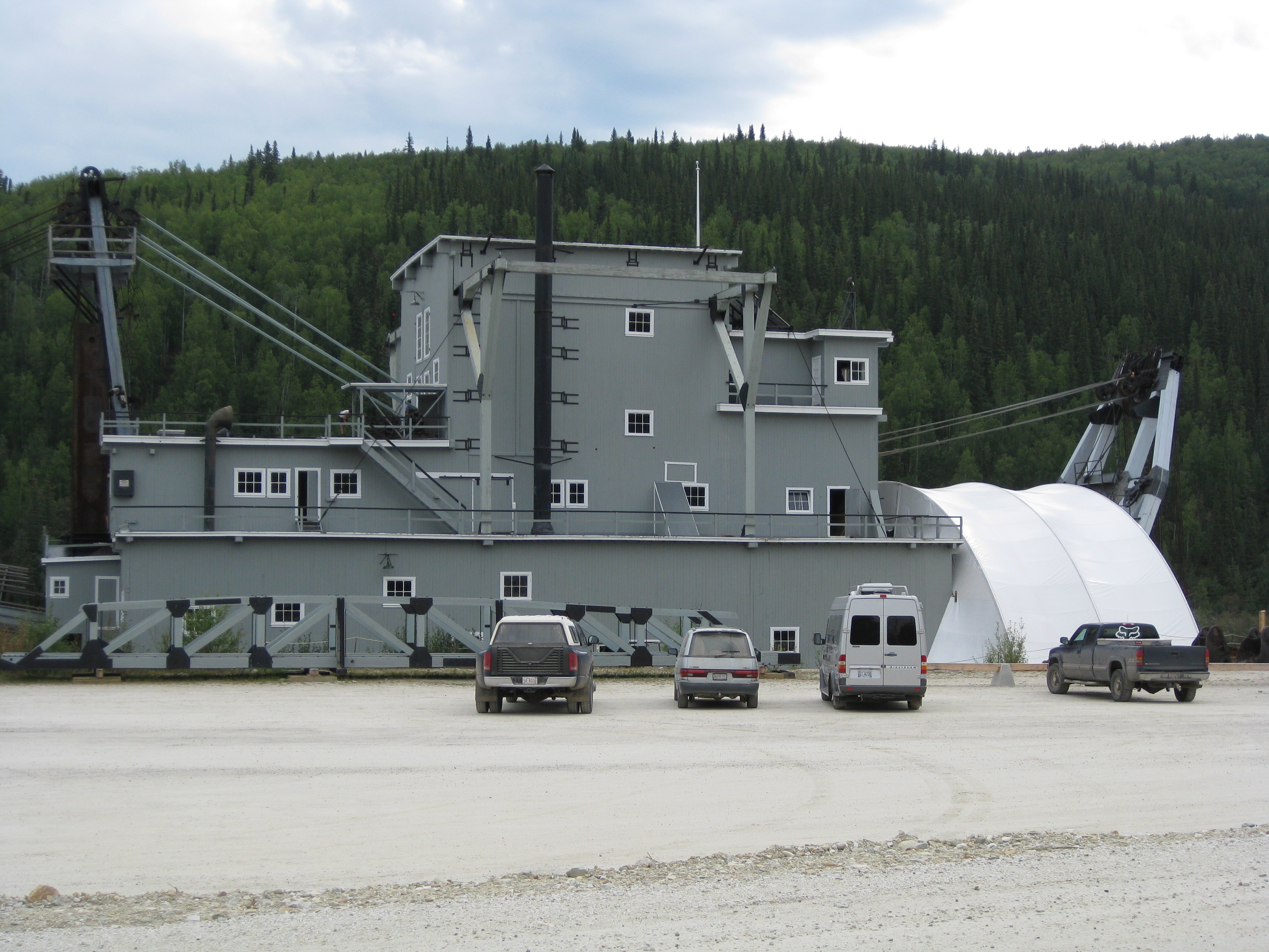
My team met up in Whitehorse the capitol city of the Yukon Territory in early August 2010.  We then rounded up some remaining gear and drove in a rented truck up to Dawson City.  As you arive in Dawson City you can see the remains of over 100 years of placer gold mining. Before you reach the town you can see large tailings piles lining the sides of the highway.  When looked at from above they look like something that was produced by a giant insect.  The tailings piles were put there by humongous dredges that scoured the Klondike drainages until 1966.  It is estimated that each of the dredges were producing as much as 800 ounces of gold per day!

Aerial View of Kondike Tailings
Aerial View of Klondike Tailings

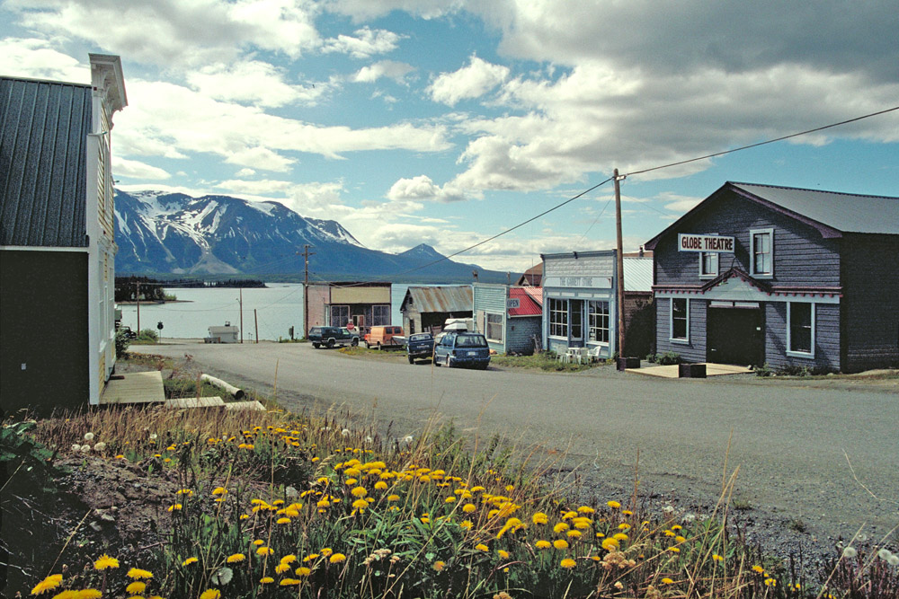
Dawson City is a cool town.  The residents have maintained the look and feel of Dawson’s heyday during the Klondike gold rush.  The streets are dirt with wood plank sidewalks.  Most of the buildings are original in the downtown area and many commercial buildings have the false front that was the norm during the gold rush era.  There is even a law that all signs have to be hand painted.

OLYMPUS DIGITAL CAMERA

OLYMPUS DIGITAL CAMERA

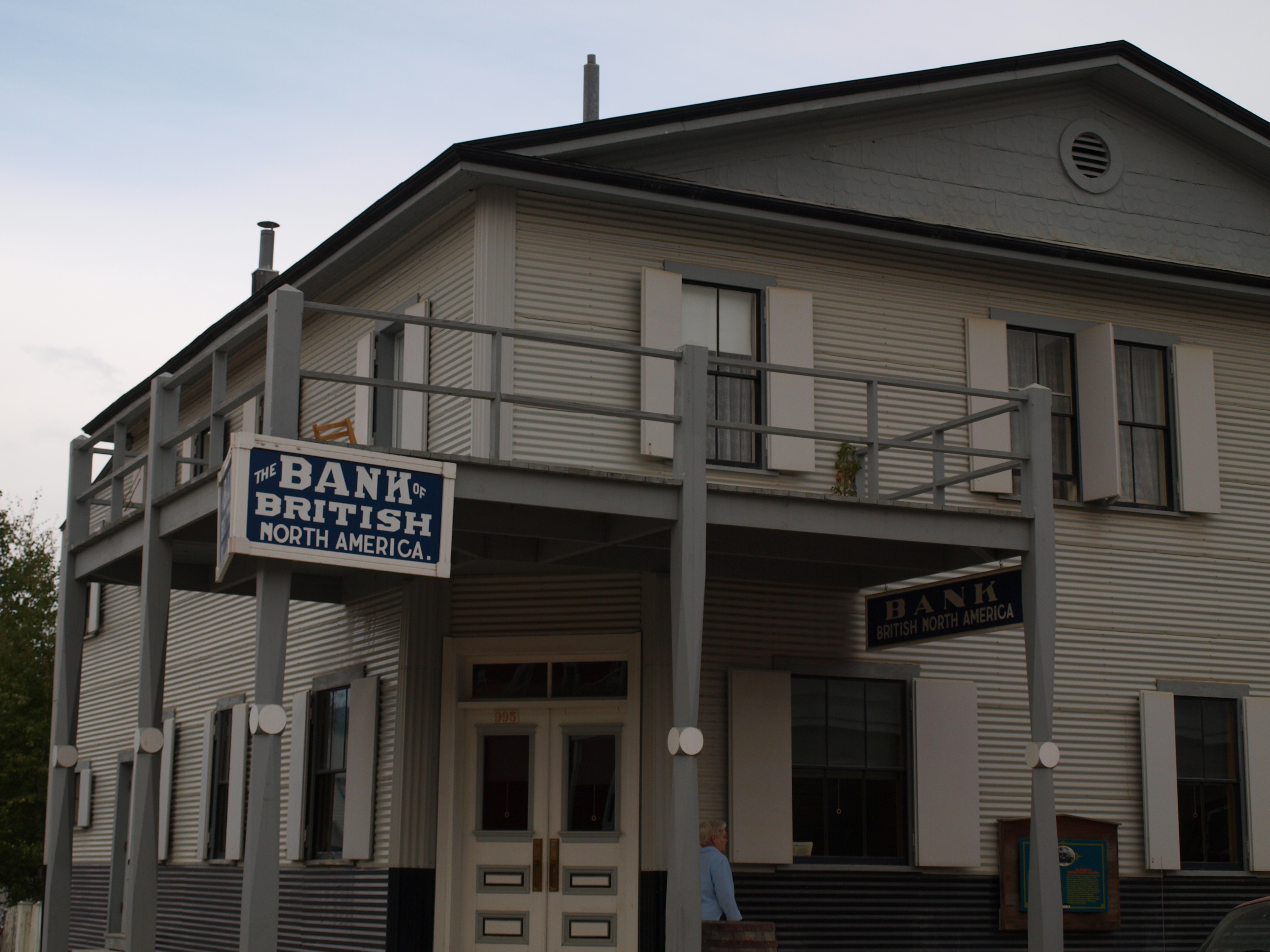
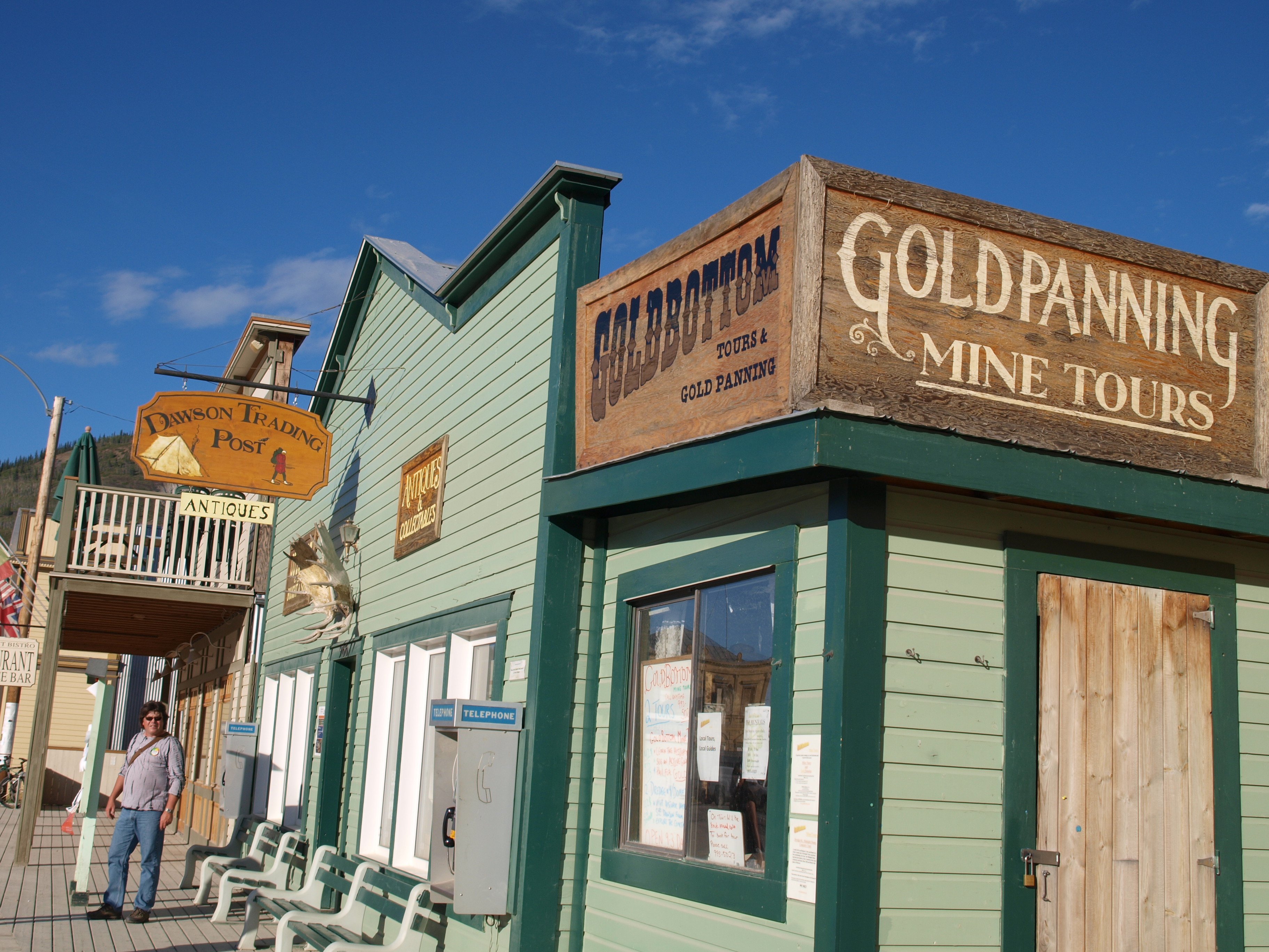
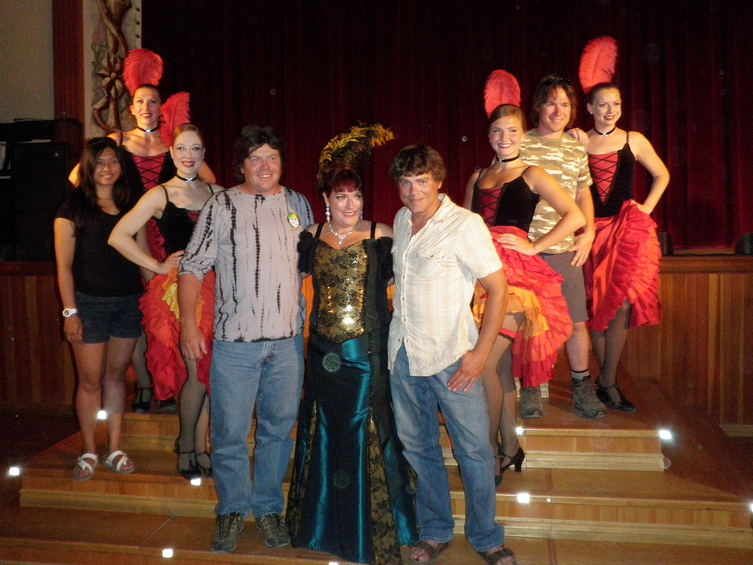
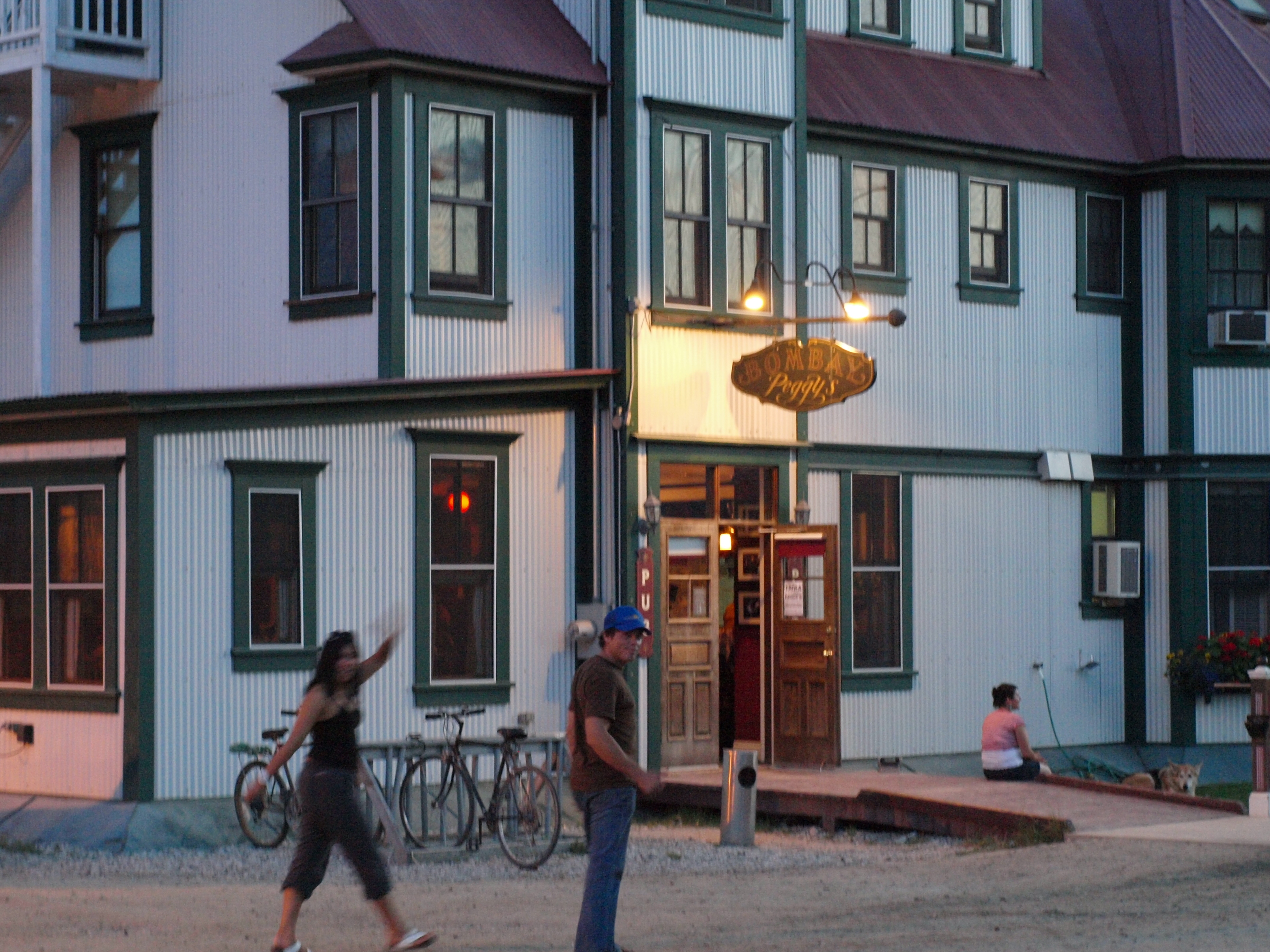
There are no corporate stores or businesses in Dawson.  Everything is locally owned and operated.  Some of the original establishments from the 1890s are still in operation today.  Diamond Tooth Gerties is one such establishment which offers games of chance and nightly can can dancers 7 days a week.  Anouther is Bombay Peggy’s which operated as a brothel during the gold rush.  It has turned into a classy bed and breakfast now.

OLYMPUS DIGITAL CAMERA
My Crew posing with the Can-Can girls

OLYMPUS DIGITAL CAMERADtHotel

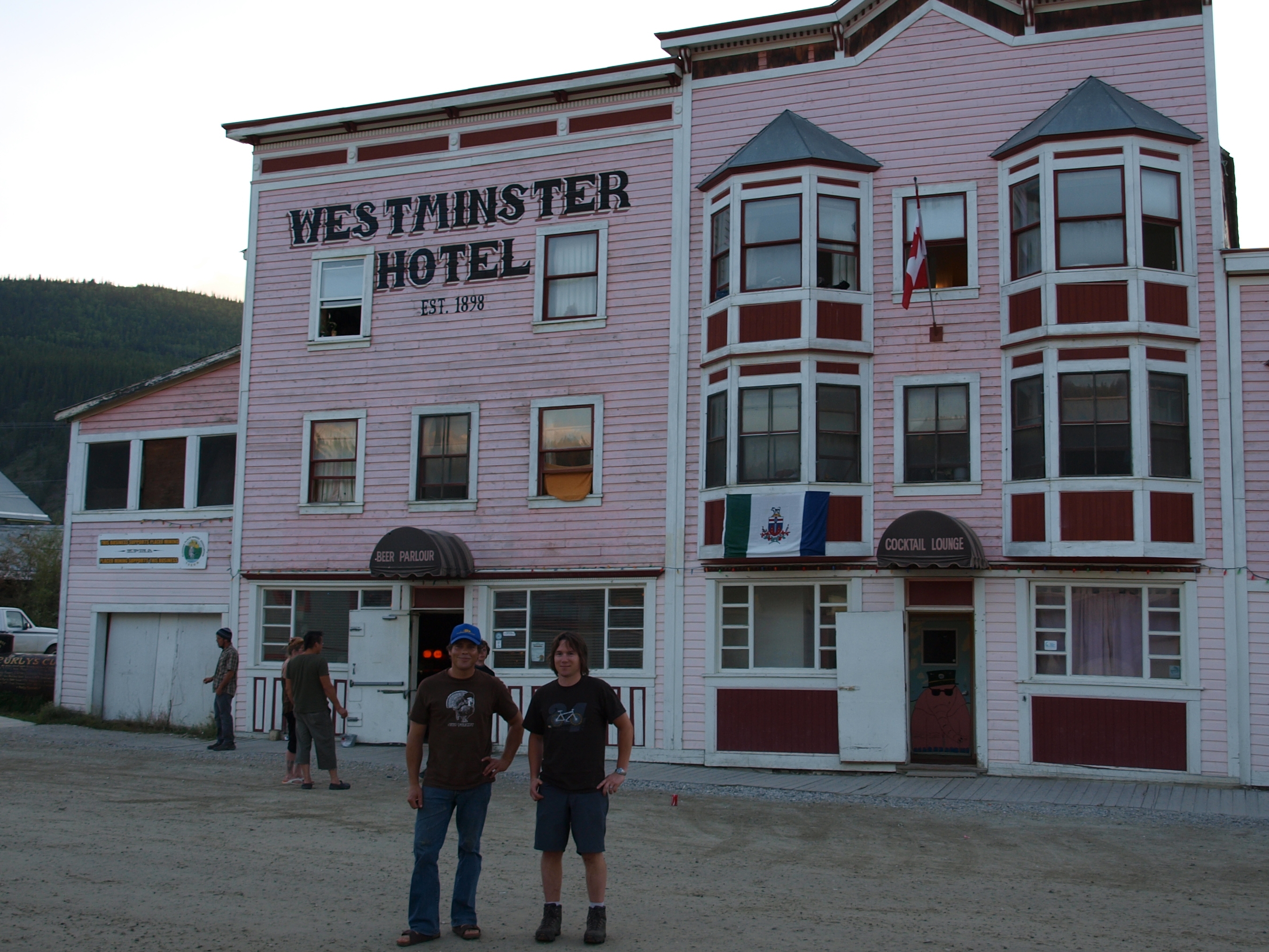
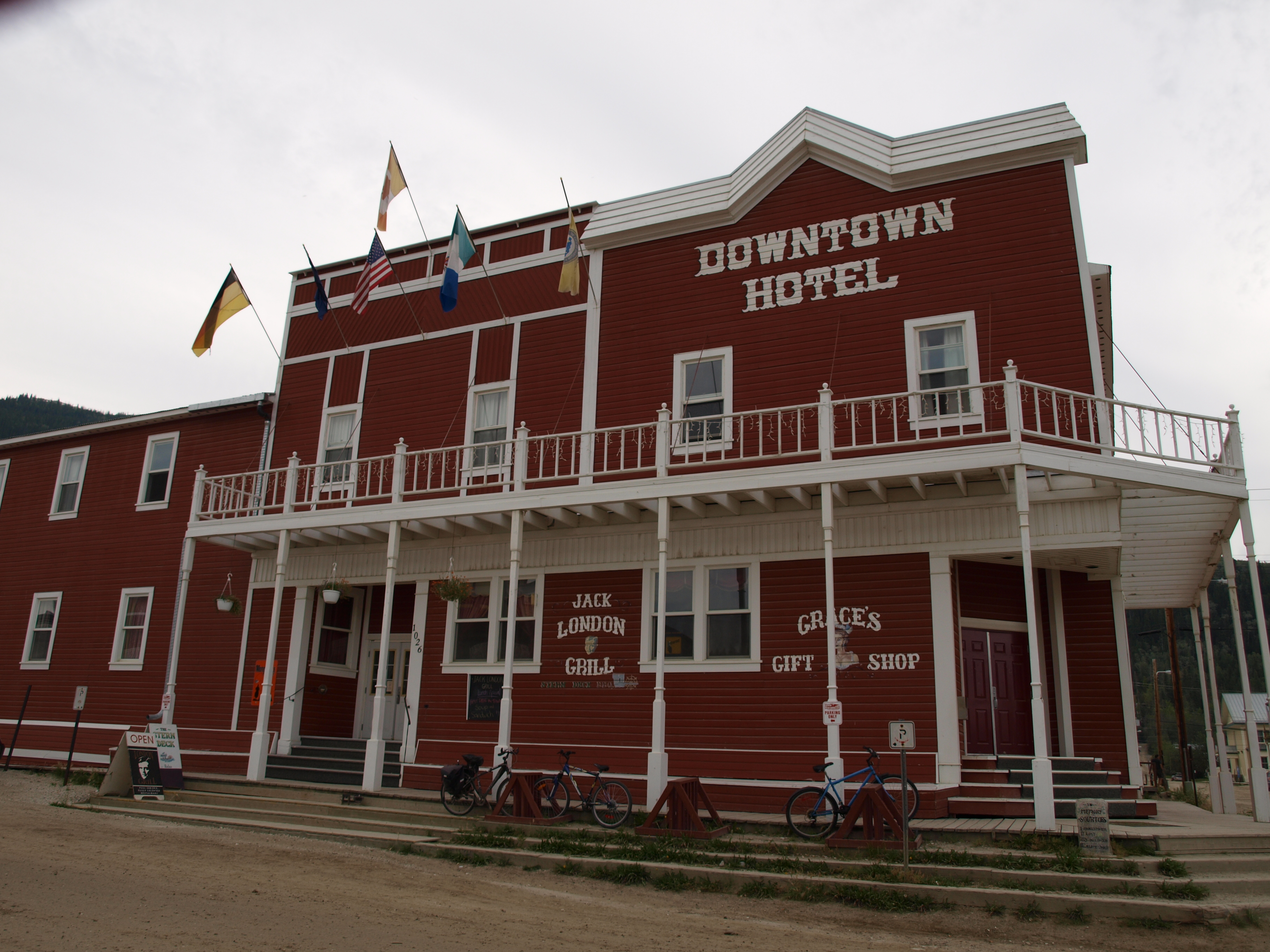
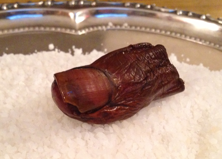
Dawson has several historic bars as well.  One such bar is the Downtown Hotel.  We stopped in there one night after visiting several other bars and took part in a local tradition.  It is called the Sourtoe Cocktail.  Only one of my crew was willing to take the shot with me.  The Sourtoe Cocktail is a shot of Yukon Jack whiskey taken with an amputated human toe in the glass.  They keep the toe in a jar of salt above the bar.  Apparently the tradition started with a bootlegger losing his toe due to frostbite.  I was informed that this was their 6th toe which makes you wonder where they new ones came from.

Bombay Peggy'sThe Toe

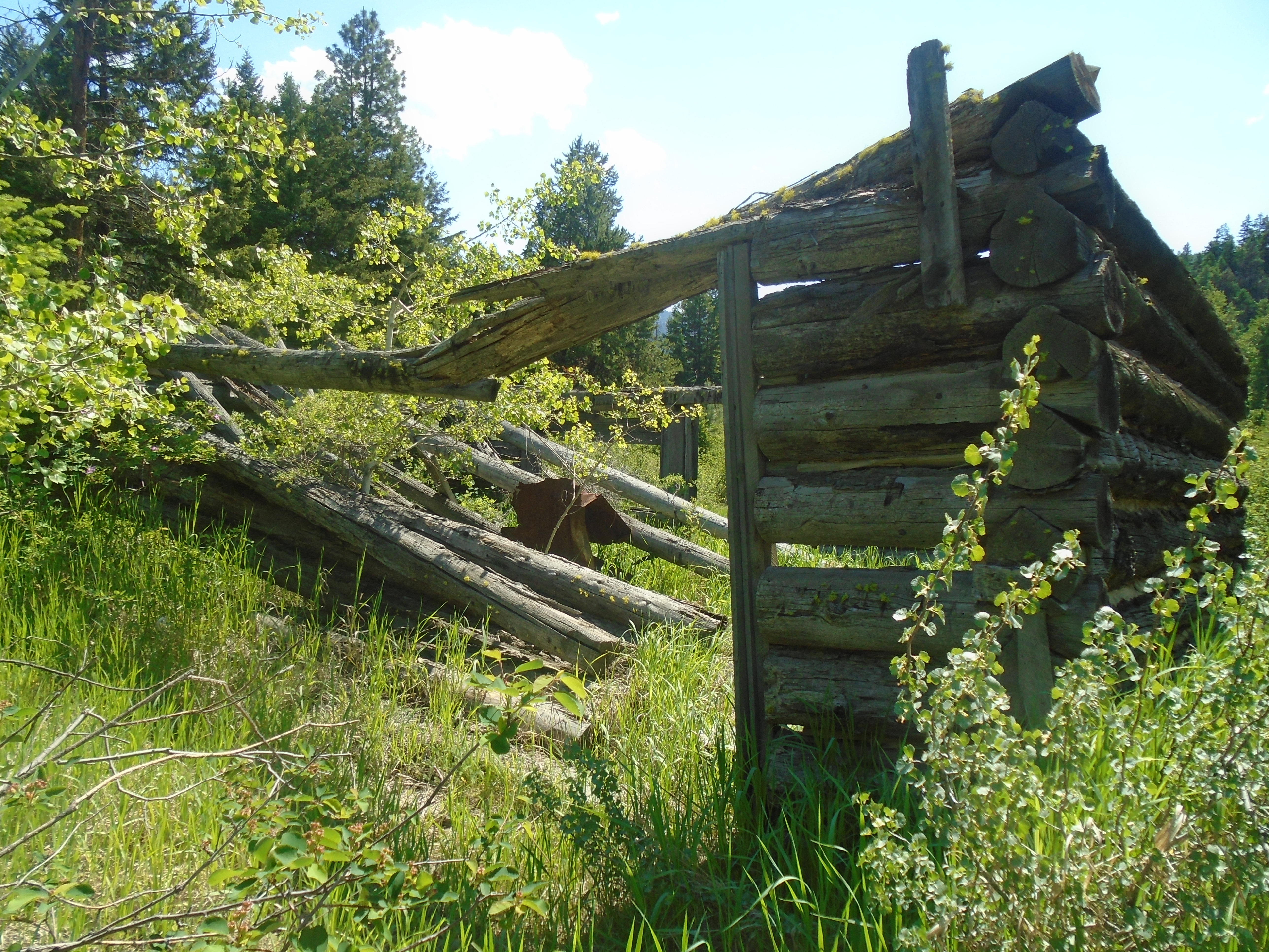
The Bonanza Creek Road is the main access to Indian Creek.  Along this historic route there are plenty of relics of past mining adventures.  Most notably the historic Dredge No. 4 which mined Bonanza Creek until 1959.  There are other dredges as well and plenty of old heavy equipment that was abandoned by miners of the past.  There are abandoned bulldozers, excavators, trucks and other random big machines.  There is such a surplus of iron that many bridges use large dozer shovels as retaining walls.

Dredge No. 4
Dredge No. 4

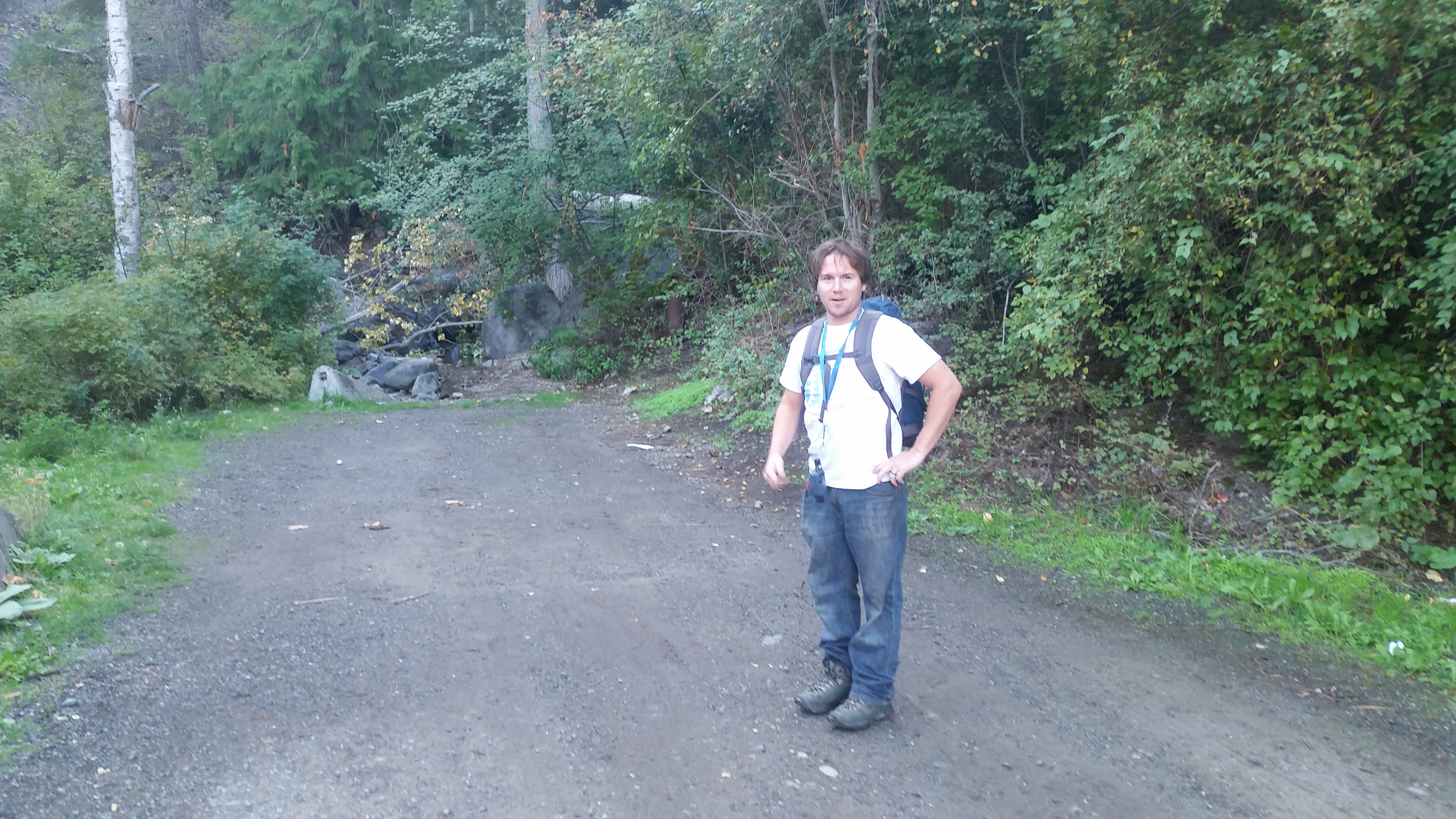
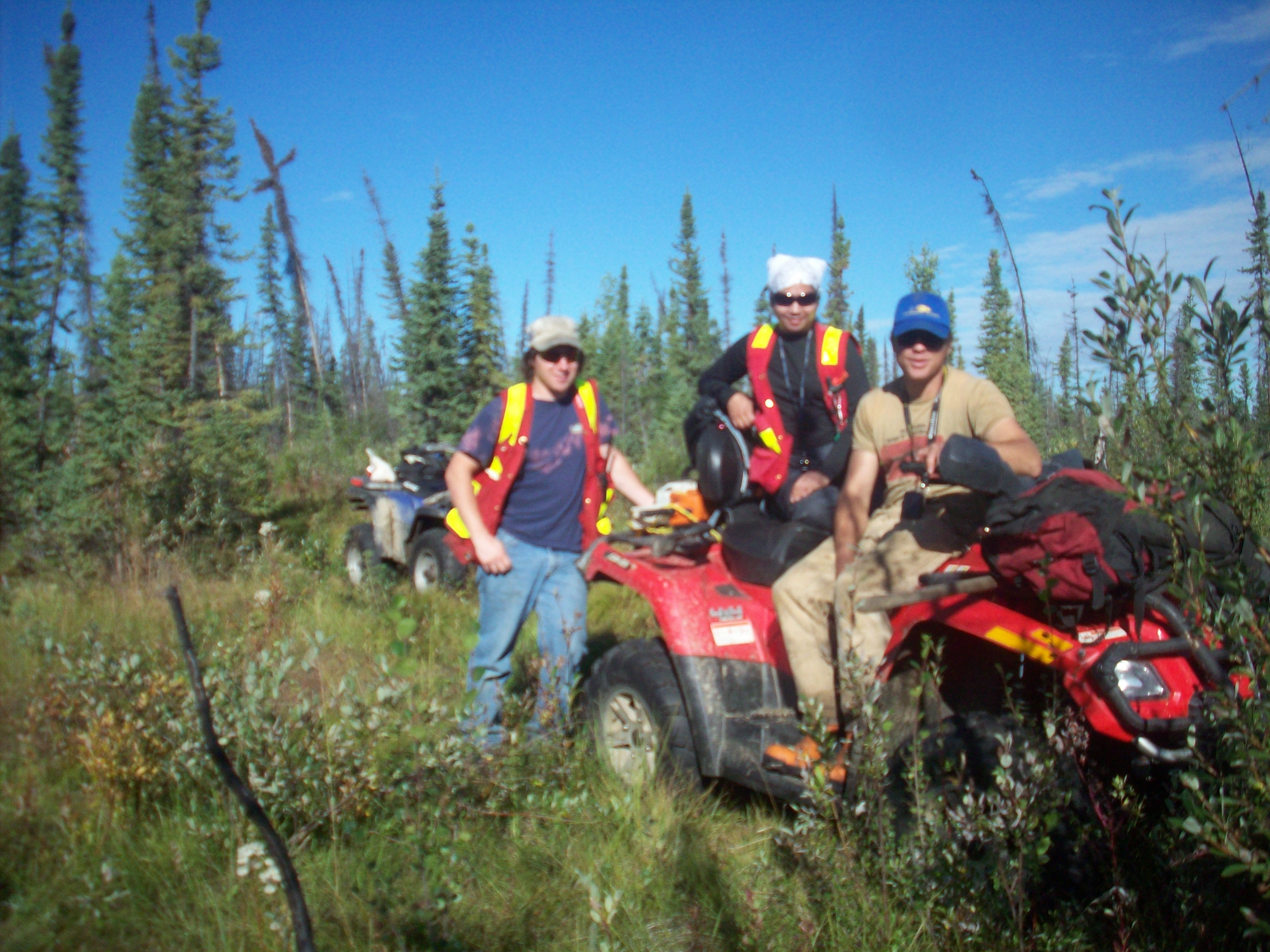
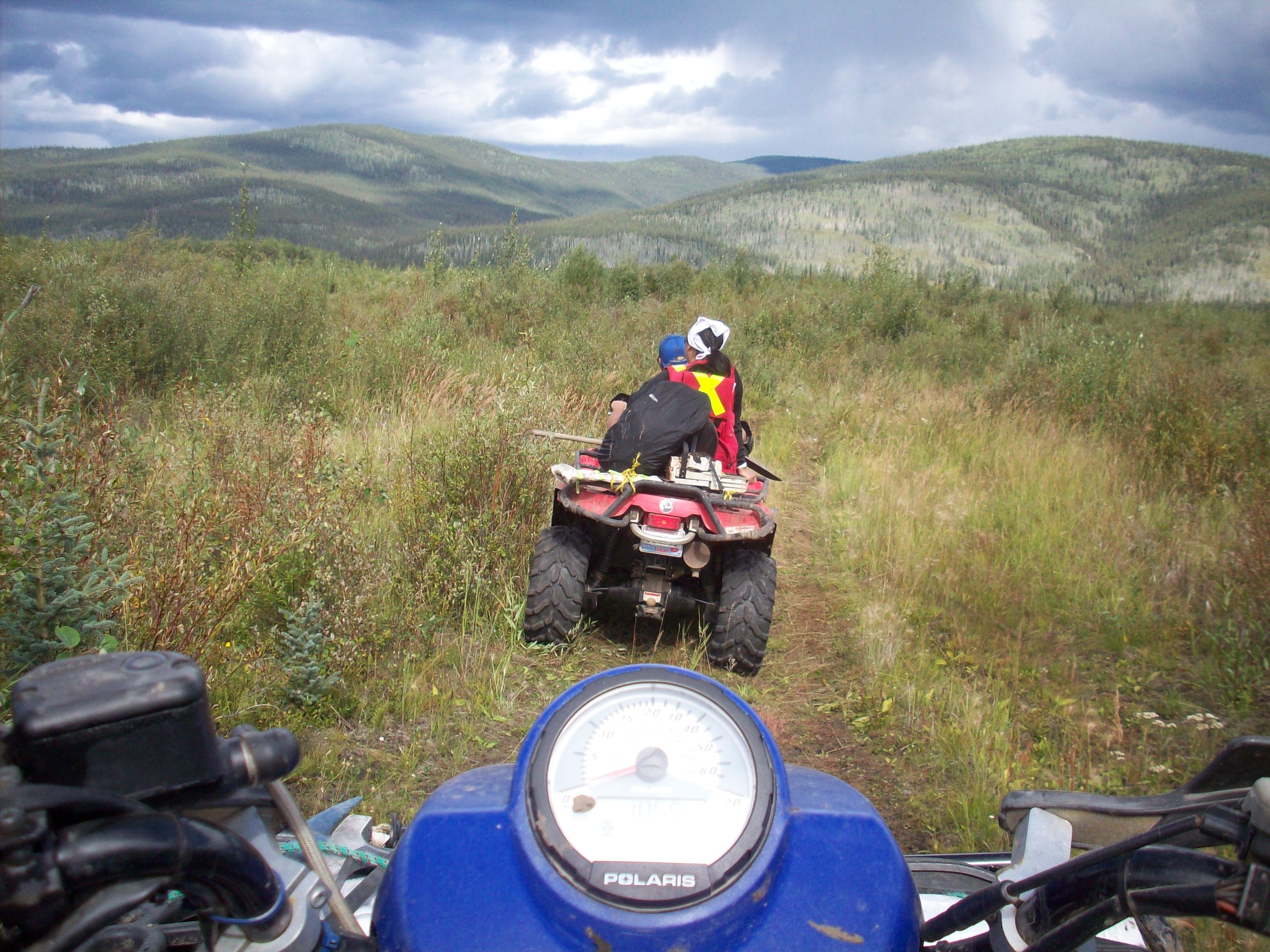
We were tasked with finding the source of the placer gold in the Indian River.  We stayed at Big Al’s camp and were exploring mineral claims that overlapped his placer claims.  His knowledge of gold bearing benches as well as historical research was very important in our search.  Likewise our findings were beneficial to Al in exploring new placer areas.  Most of our time was spent exploring old miner’s trails on quads and by foot.  I’d be lying if I said it wasn’t a great time.

14 17

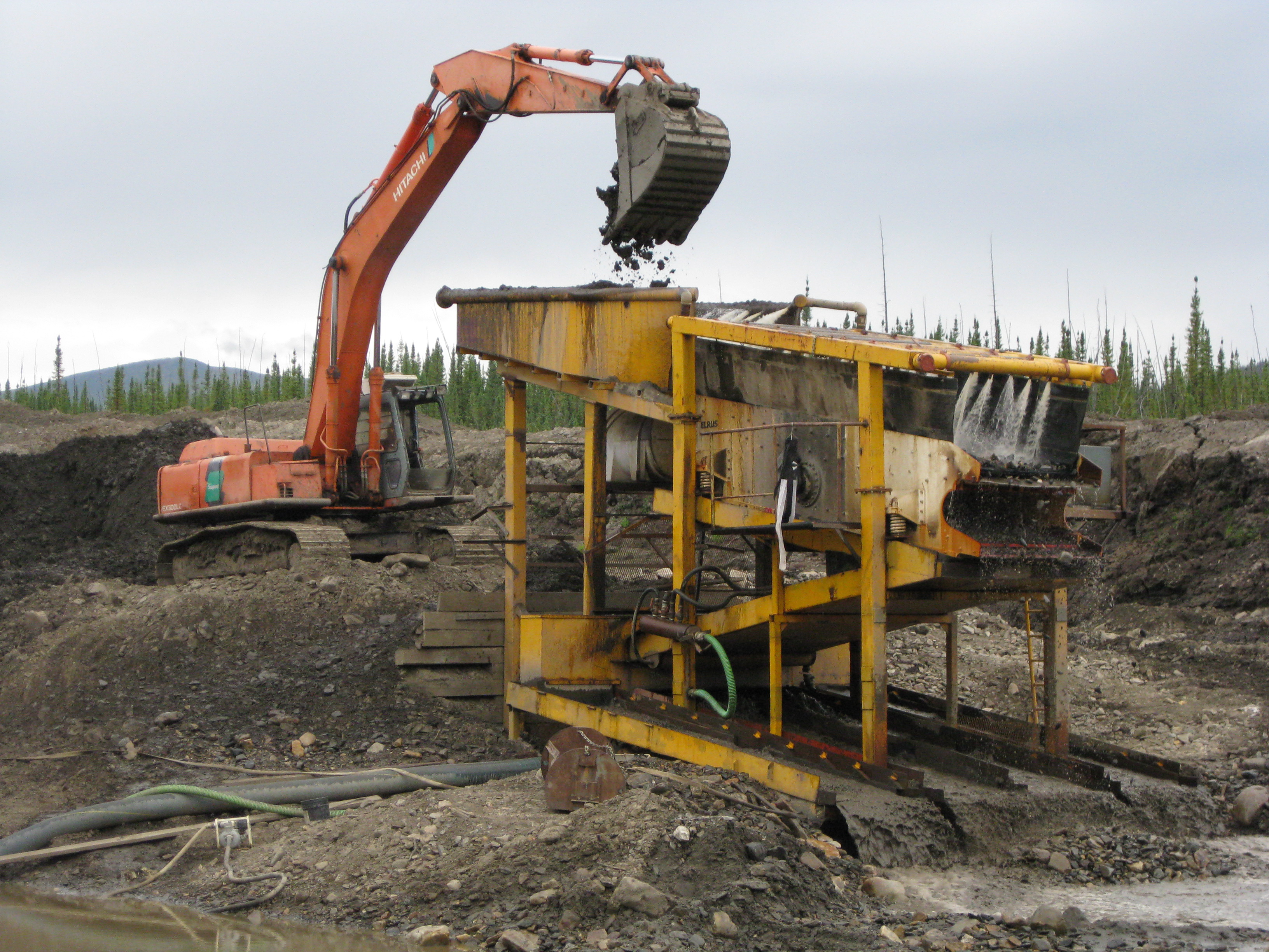
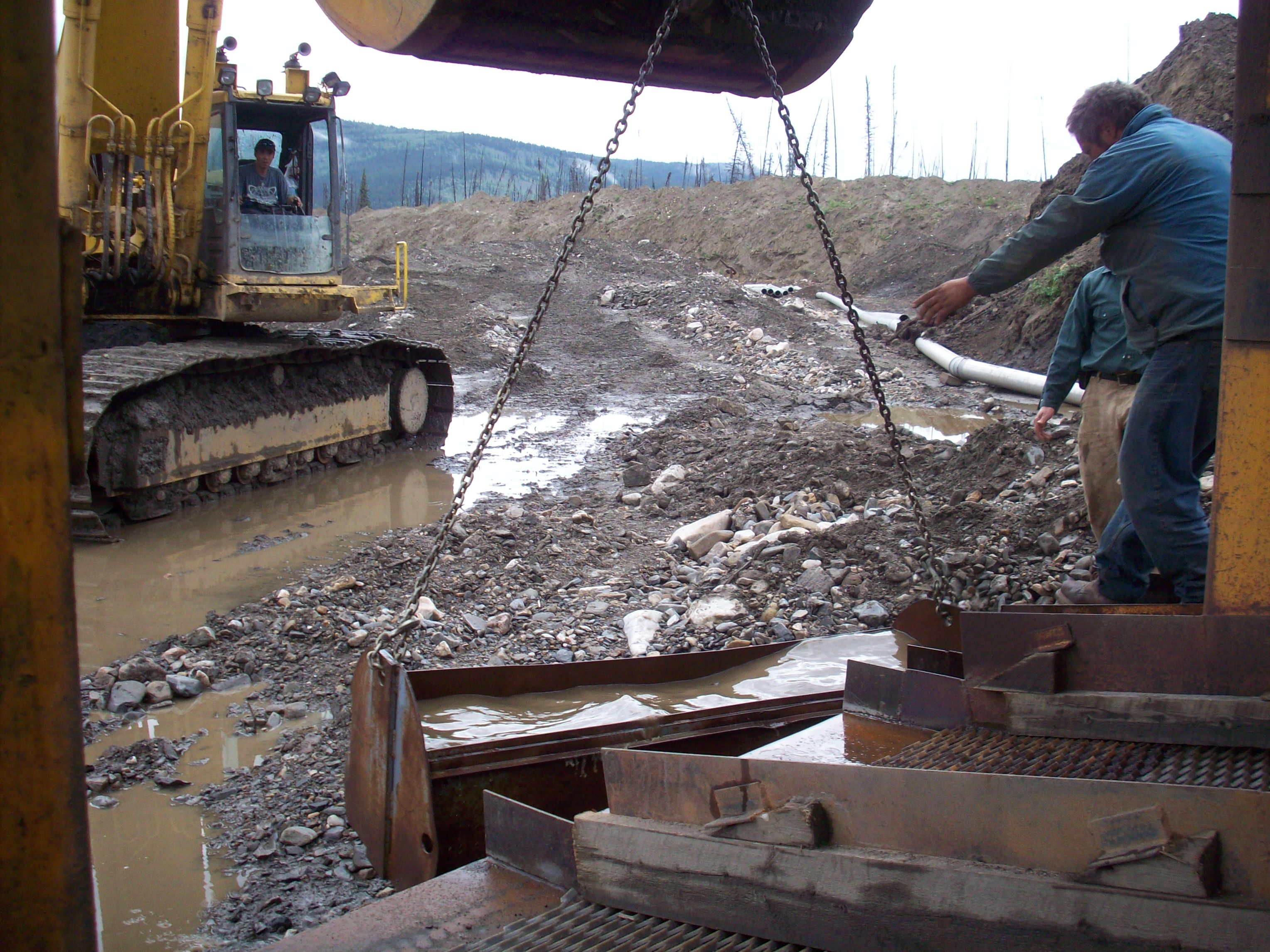
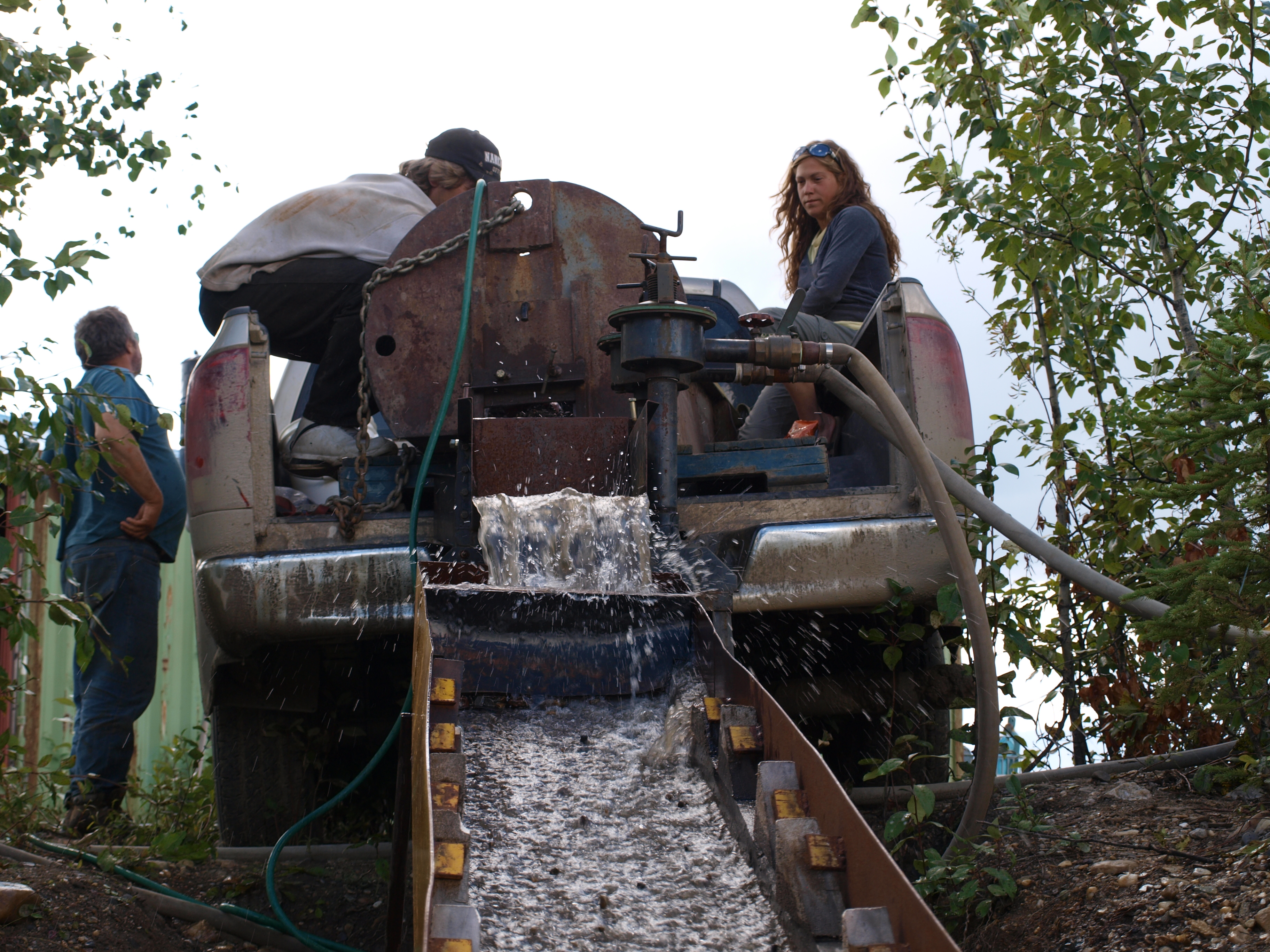
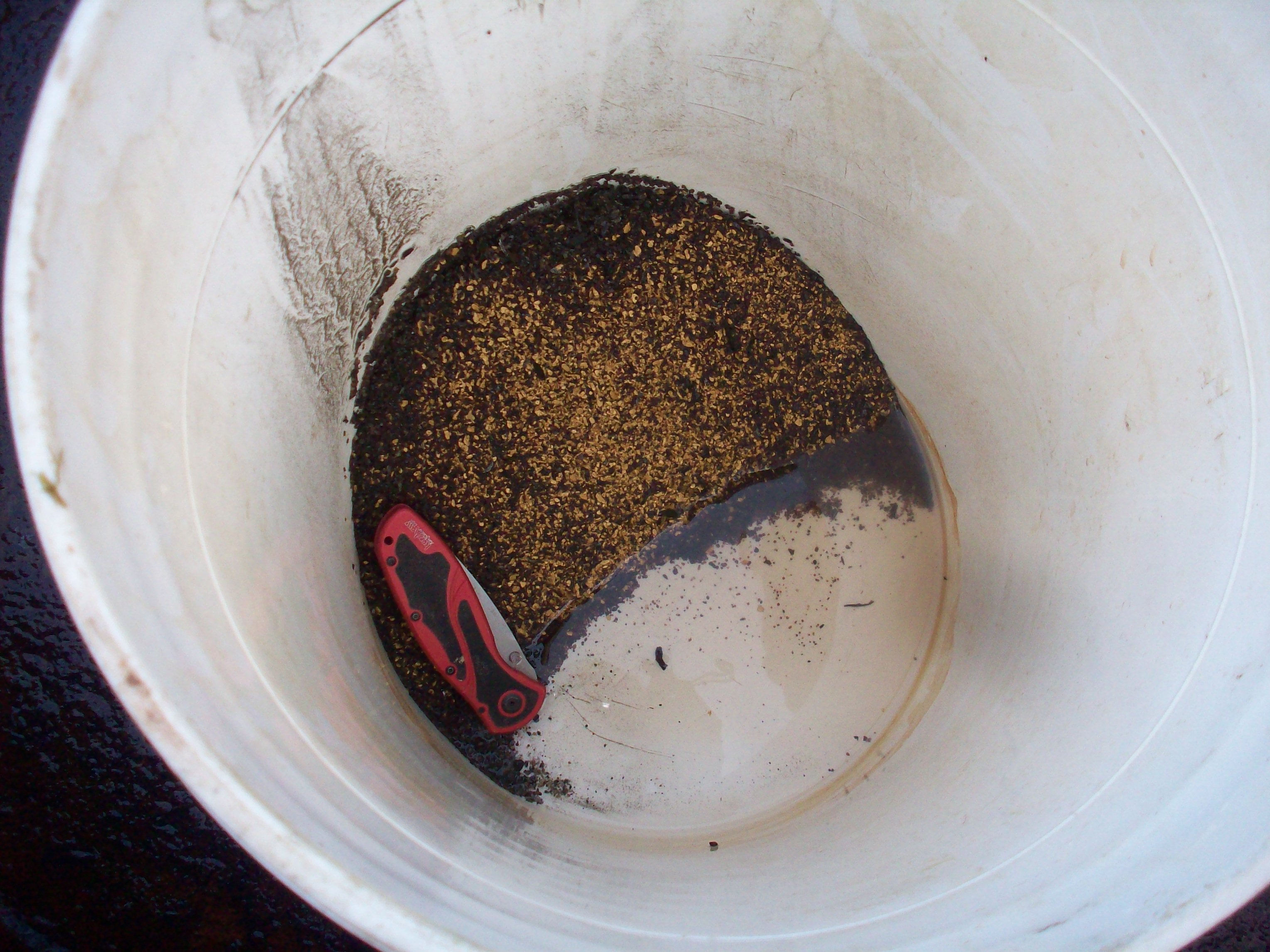
We came across several old mine shafts and evidence of placer mining was everywhere.  My crew participated in some of Big Al’s cleanups too.  It was exciting to see the amount of gold that he was pulling out.  We participated in all the steps of his cleanup process from cleaning the sluice to the concentrator jig and so on.  At each stage a fair amount of rum was consumed it seemed fitting when surrounded by hundreds of ounces of gold.

100_1565 CleanUP

Yup, that's exactly what it looks like.
Yup, that’s exactly what it looks like.

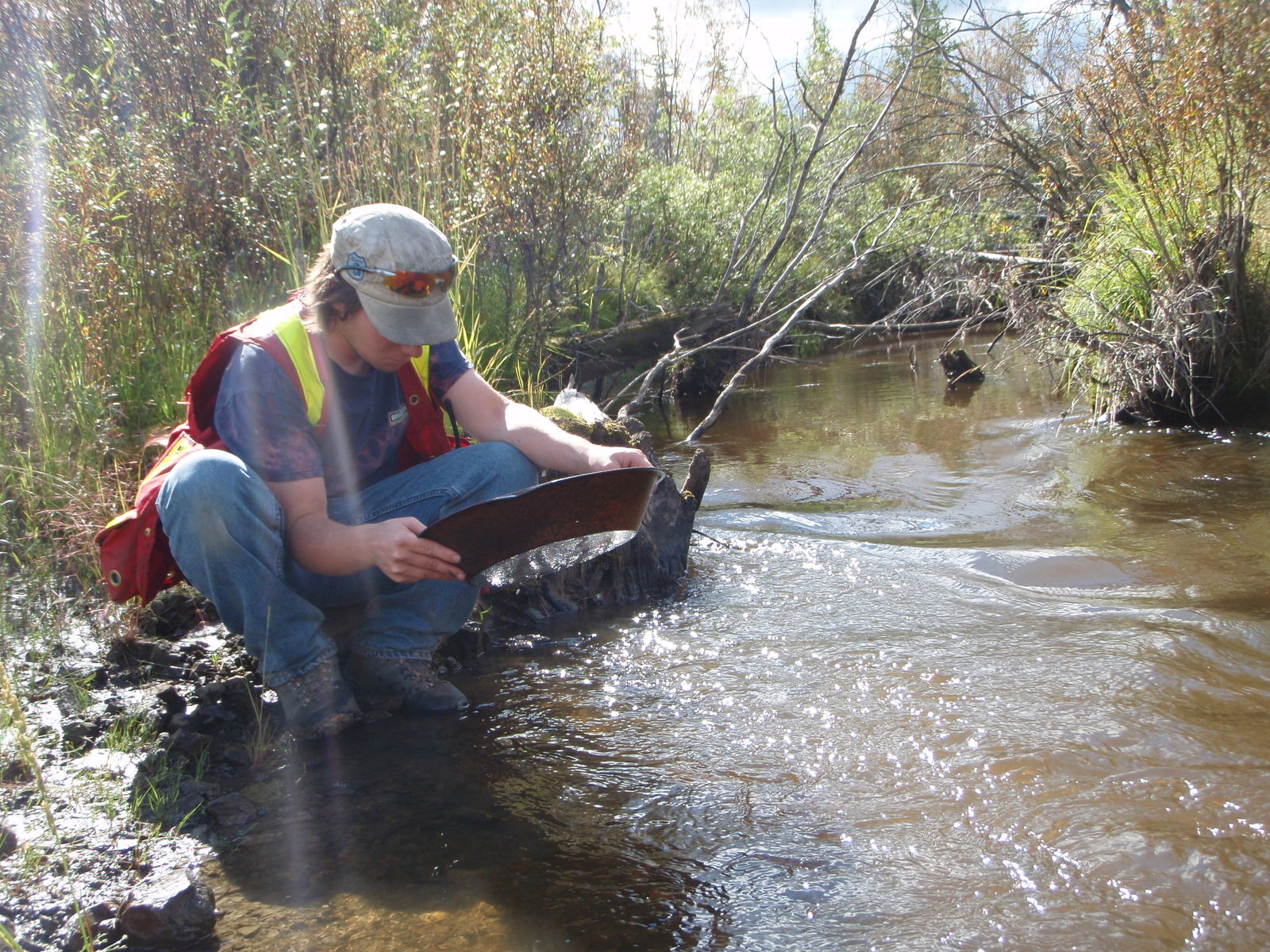
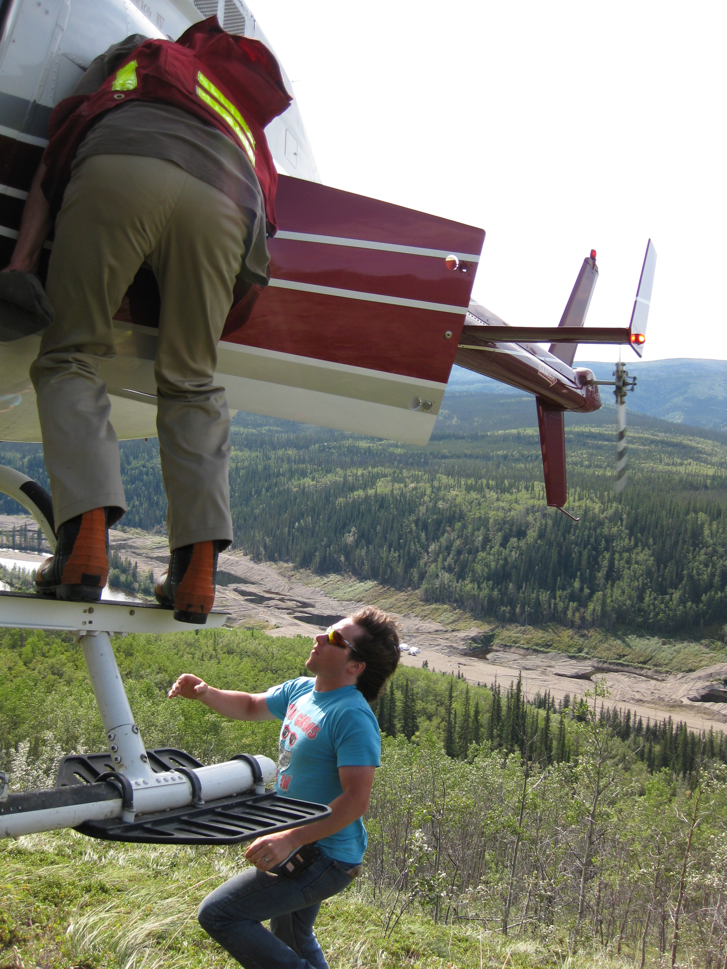
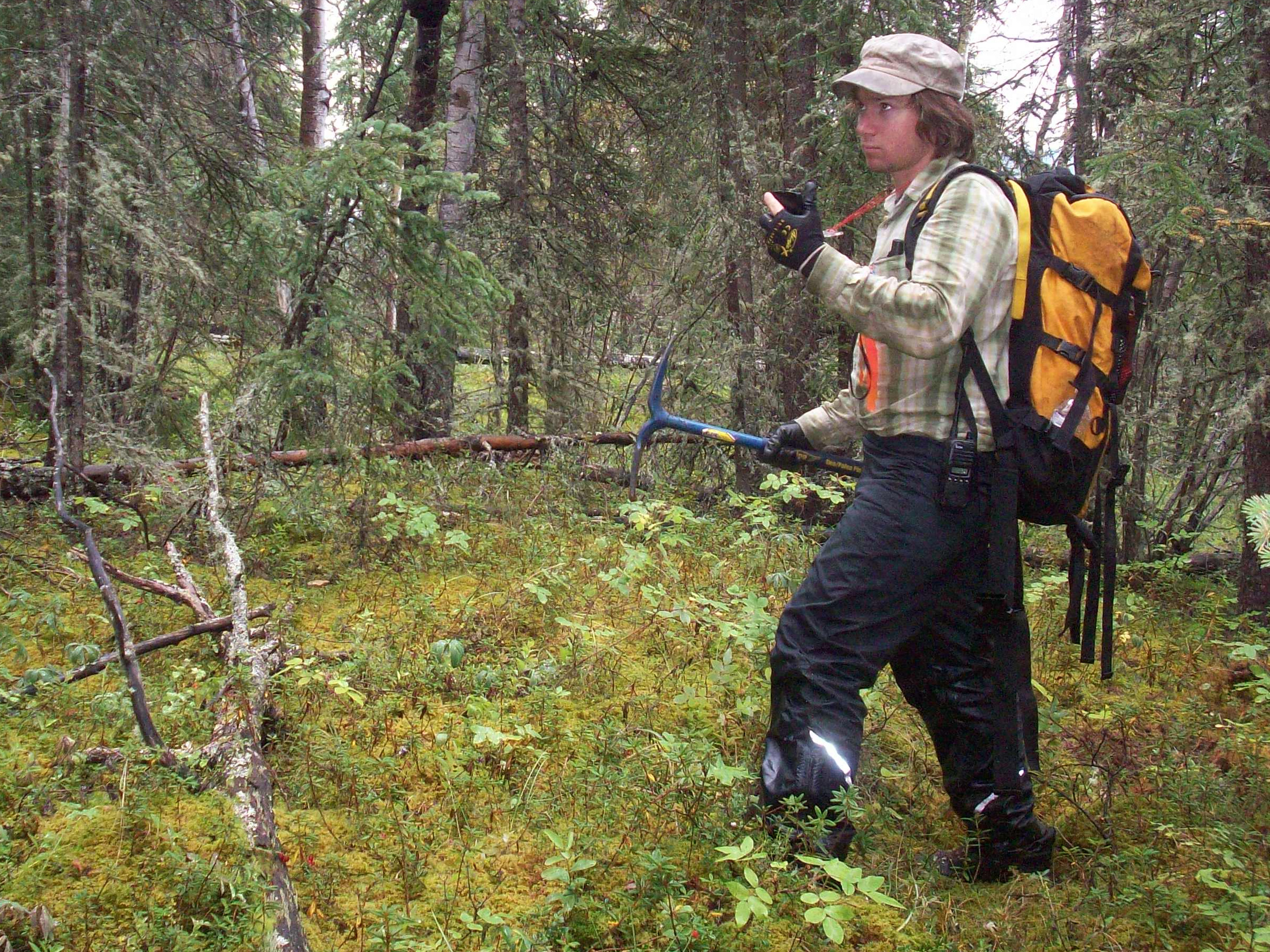
In our hard rock exploration we employed several techniques utilizing traditional prospecting as well as soil sampling and statistical pebble counts.  The soil sampling was conducted with helicopter support which made it a lot easier.  We were bagging close to a hundred samples per day each which was more than we could carry in the bush.  At the end of the day we’d chop out a helicopter landing area and radio the chopper.  Then we’d pick up the samples that we cached during the day.  Hard work but a lot of fun too.

IMG_1883

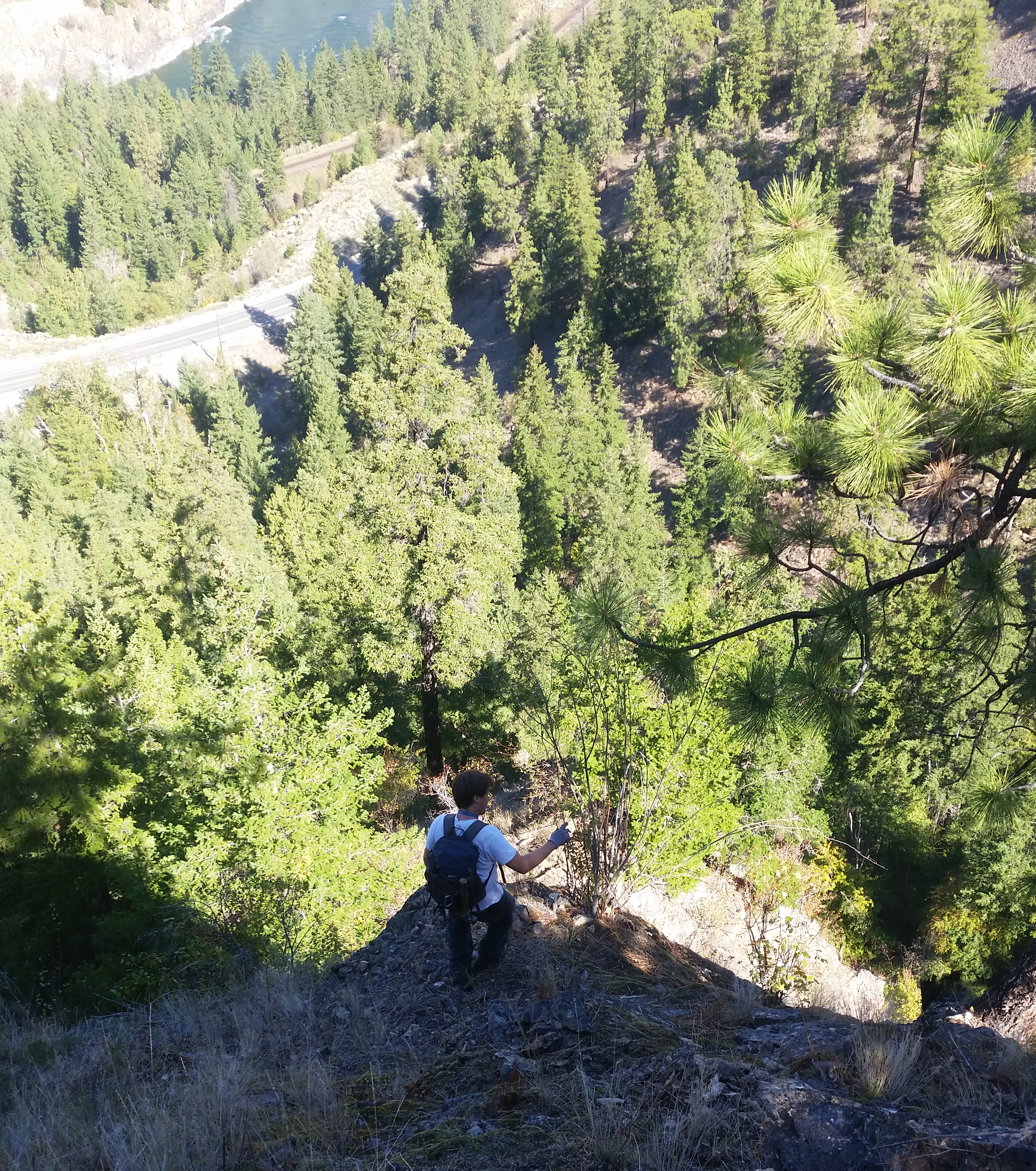
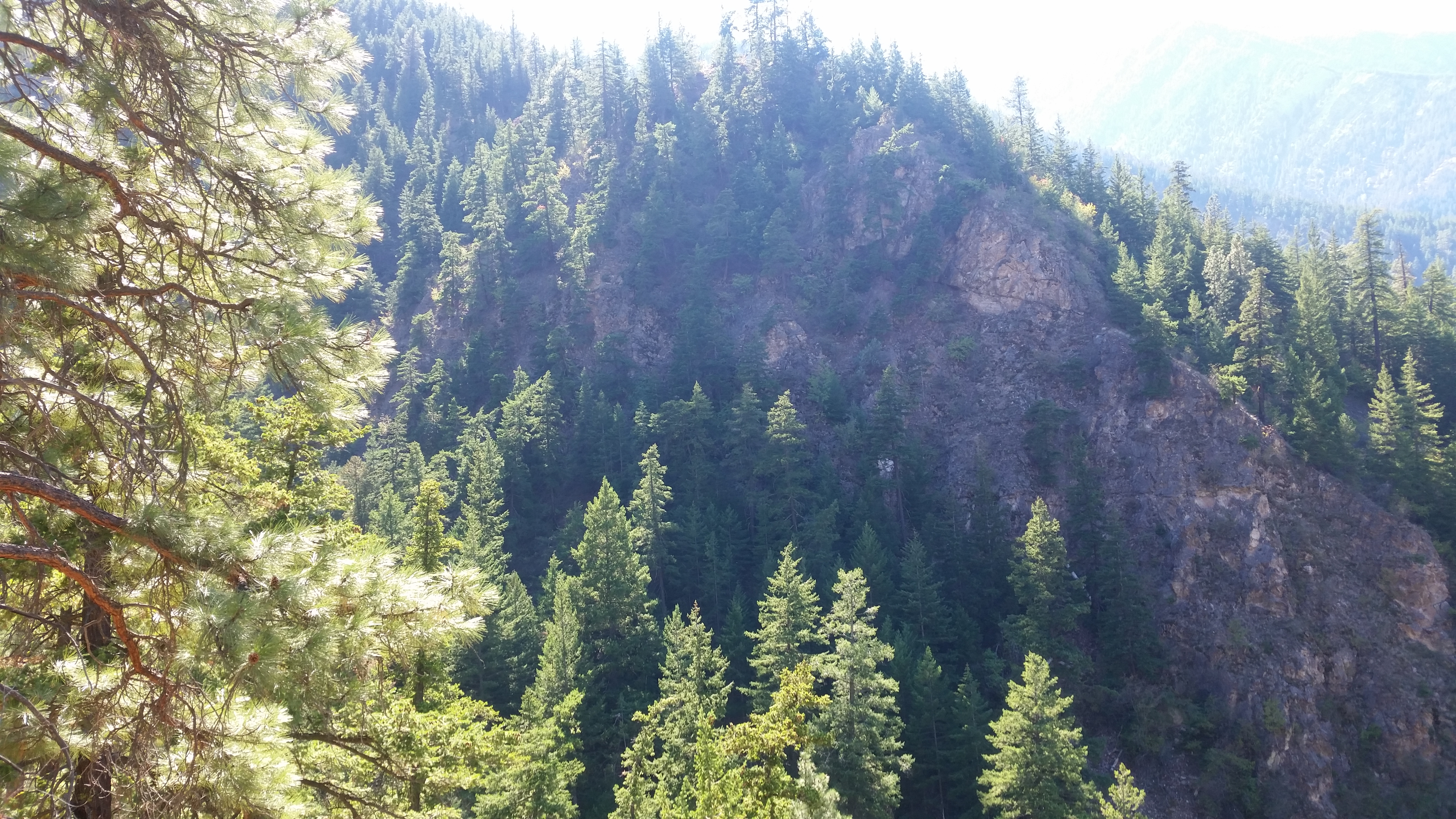
We spent a total of six weeks prospecting the area.  We took a lot of samples to be sent in for assay from all over the claims.  Prospecting in the Yukon is similar to BC, there is not a lot of exposed rock around.  Unlike the barren lands of the North West Territory and Nunavut there is plenty of forest and vegetation covering the rock.  We spent a lot of time in the helicopter scoping out rock outcrops.

IMG_1746

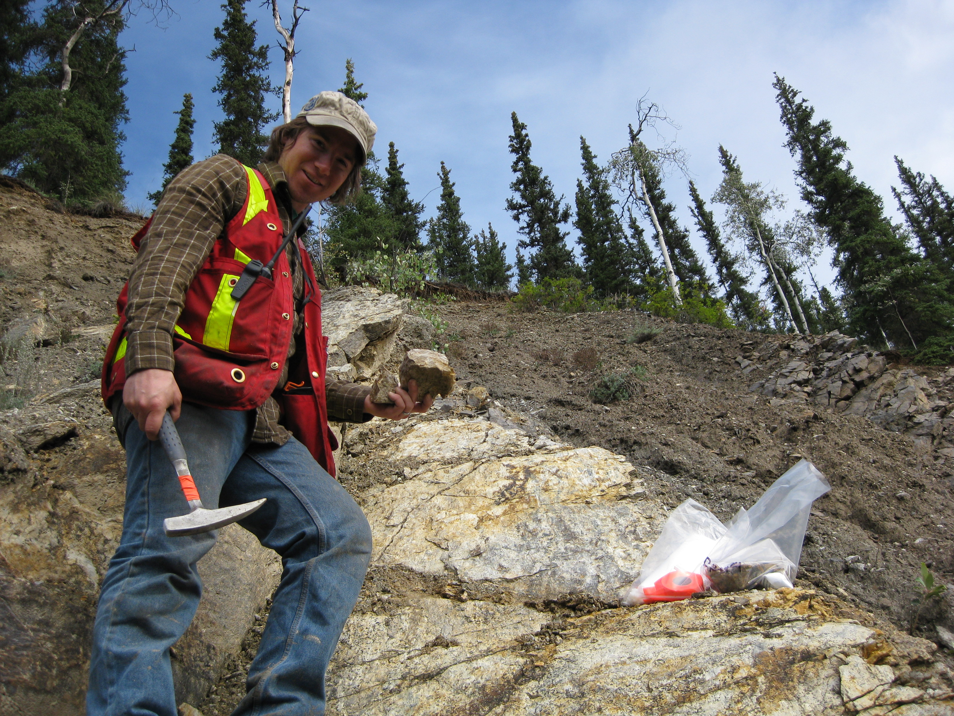
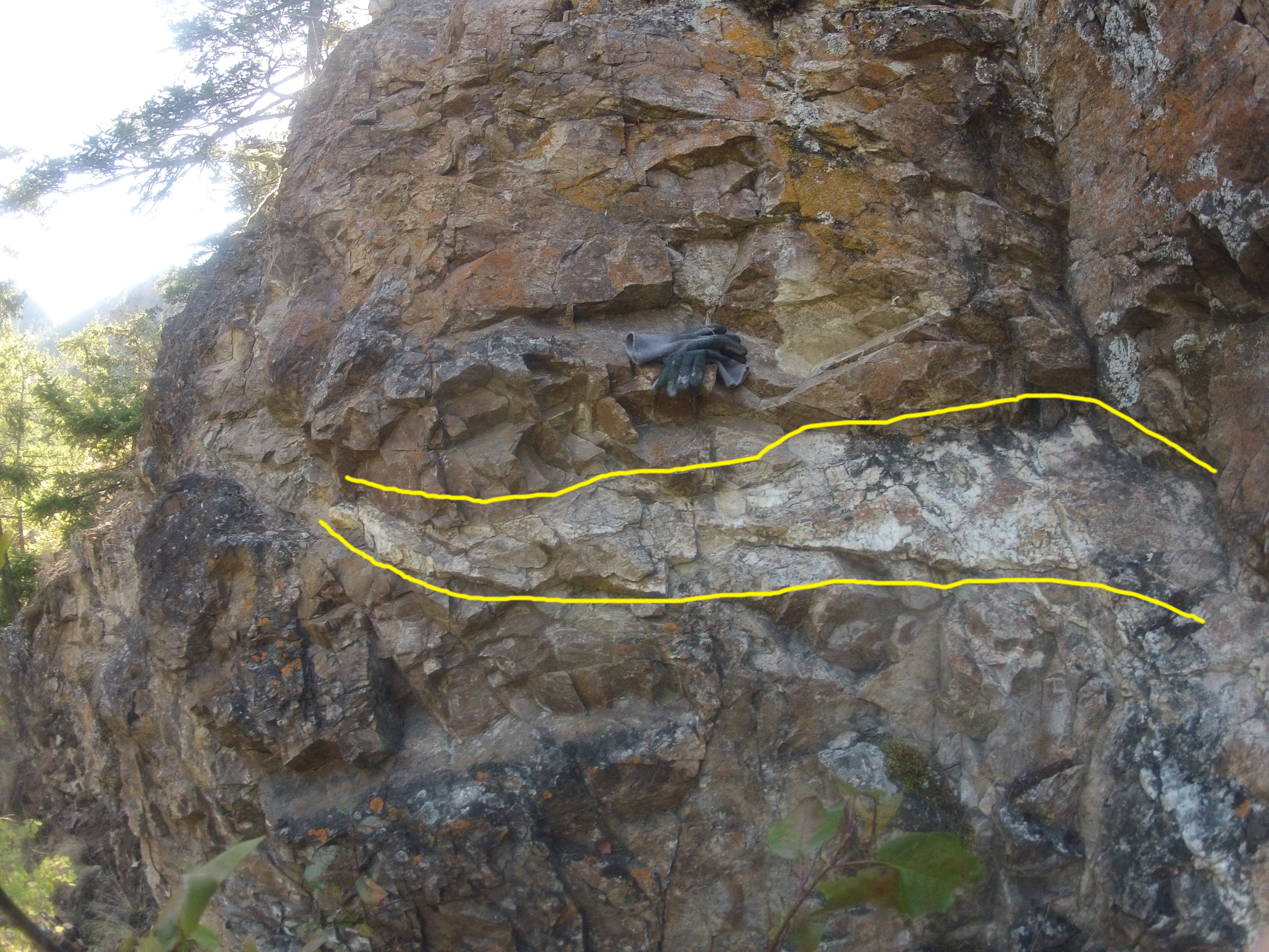
There seemed to be a correlation between the garnets that were showing up in the placer operation and high grade gold.  When the placer miners hit the paystreak they got a lot of garnets with it.  We started prospecting up a creek called “Ruby Creek” assuming it was named for the abundance of garnets.  The hunch turned out be be right.  We chased the garnets up to some large outcrops near the top of the mountain.  The samples contained a lot of garnet but not a lot of gold.

100_1595 SoilSampling

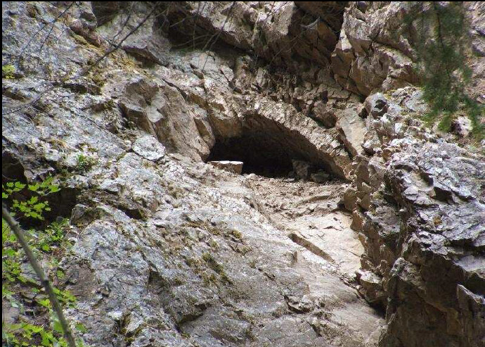
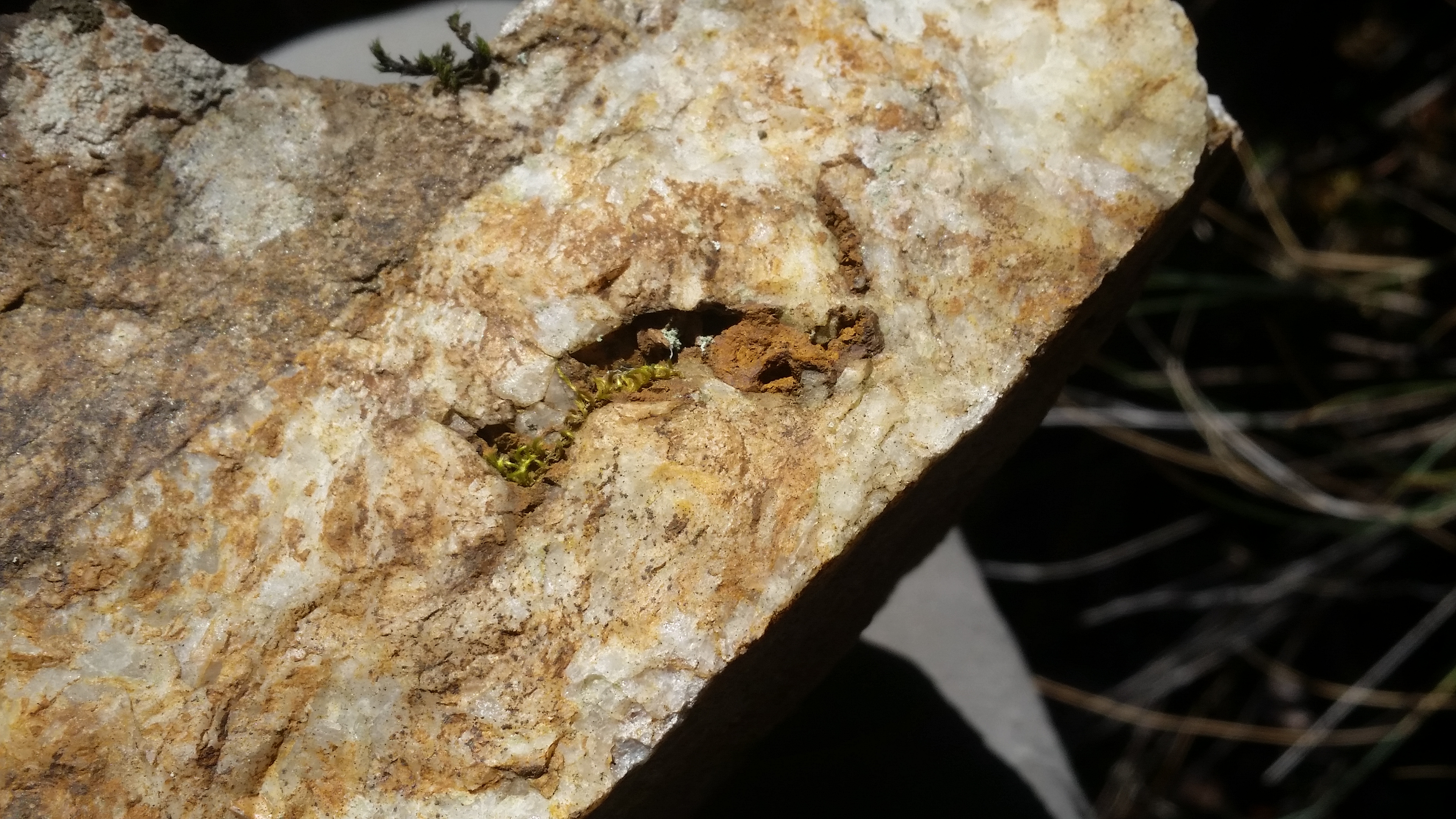
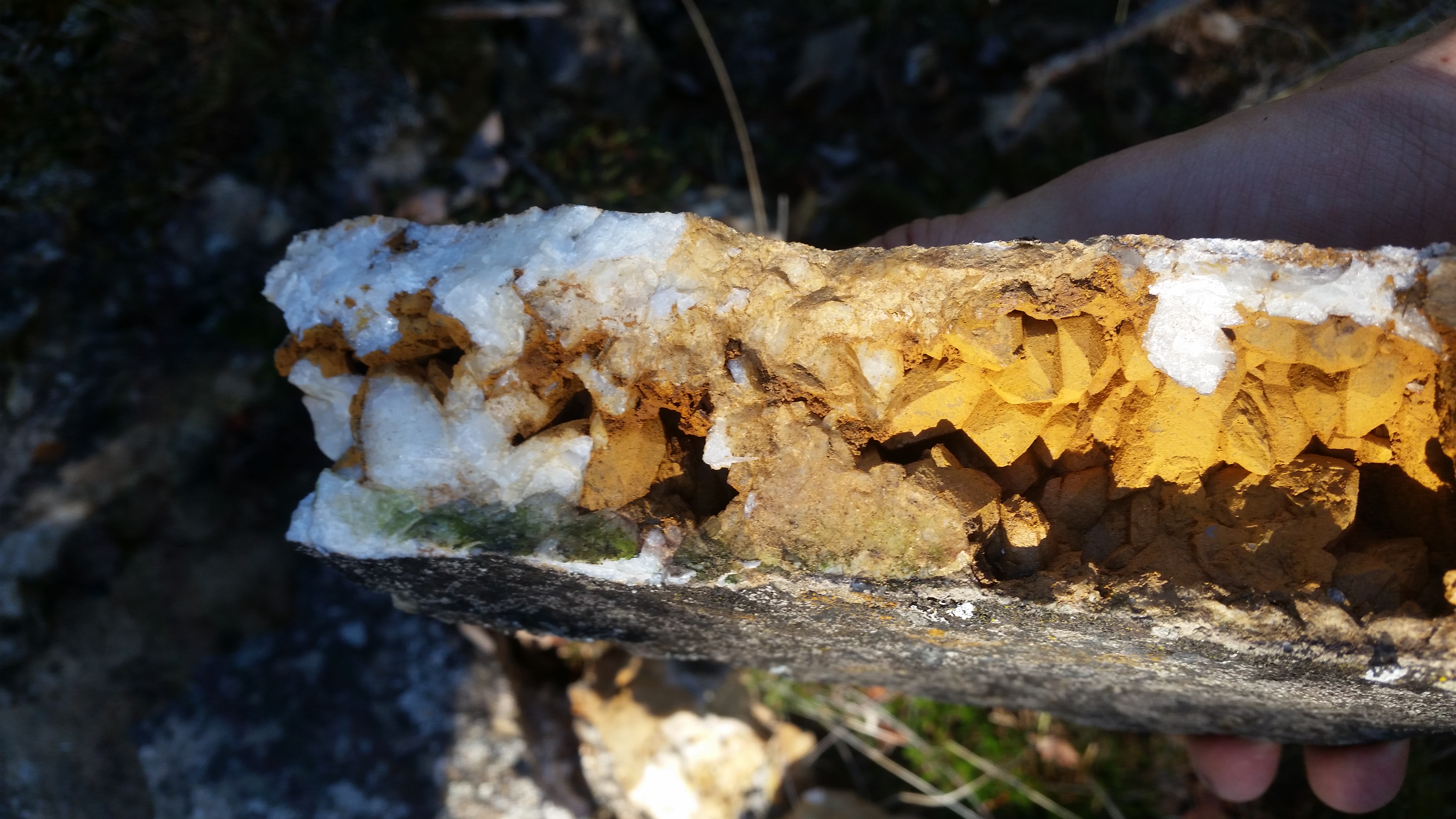
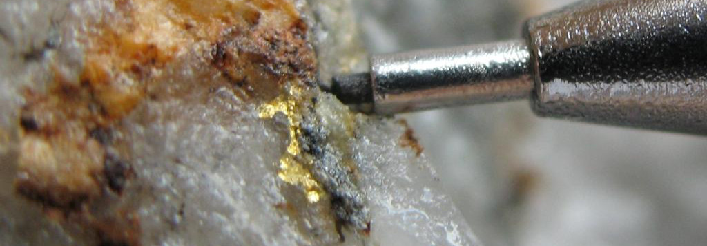
From an old mineshaft that we found near a cabin we discovered that the miners hit a layer of pure quartz conglomerate.  And it was loaded with gold.  We then knew what to look for.  The search for the source of the Klondike gold continued for several weeks.  We encountered giant moose, grizzly bears, Northern Lights and some great people.  On several occasions we thought we found the fabled mother lode but the samples returned disappointing assay results.  Some of the more random samples showed the highest grades.  They say gold is where you find it.  We did not find the source of the klondike but we did manage to have a great time and got paid for it.

OLYMPUS DIGITAL CAMERA

Top Ten Gold Rushes of BC – Part 2

Top Ten Gold Rushes of BC – Part 2

In part one of the top ten gold rushes of BC we covered the early gold rushes primarily in the Southern regions.  As time went on gold hungry adventurers pushed further in the wild North of the Canadian West coast.  Their adventurous spirit was rewarded greatly and eventually led them into the Yukon and Alaska.

1865 Big Bend Gold Rush

KootenalMap1897_crop
1897 Map of the Big Bend Area

The Big Bend refers to the shape of the Columbia River as it makes a huge detour at the continental divide.  This region encompasses several different mountain ranges including the Selkirks, the Cariboo Mountains, the Monashees and the Rocky Mountains.  In 1865 gold was discovered on French Creek which is straight North of Revelstoke.  As in other gold rushes a town was quickly erected named French Creek City.  Within the first year the town reached a population of over 4000 people.  Nothing is left today but during the rush French Creek had a general store, saloons with cabaret shows, barber shops and of course brothels.  Other important towns of the rush were La Porte and Downie Creek.  The inhabitants came mostly from the Wild Horse area and other areas in BC.

Steamboats were a major factor during the big bend gold rush.  Many of the prospectors reached the area on steamboats via the Arrow Lakes which make up part of the Columbia River.  The lake network allowed boat passengers to travel from areas as far South as the US border.

Boat
Columbia River Steamboat, the “Rossland”

Other notable creeks in the area are Carnes Creek, Downie Creek, McCullough Creek, and the Goldstream River.  A 14 ounce nugget was reported to be found on French Creek and numerous smaller nuggets were also found.  In 1865 miners were bringing out multiple ounces per day to the man on some claims.  On McCullough Creek pay streaks averaged 1/8 of an ounce per yard for many years.  Just like other places in the late 1800s hydraulic and drift mining driven by mining companies and syndicates quickly replaced hand mining techniques.  The big bend gold rush only lasted two years but mining in the area continues to this day.  Several large projects and proposed mines are located in the big bend.

1869 Omineca Gold Rush

The Omineca is a huge region in Nortn-Central BC.  The southern boundary is marked today by the Yellowhead highway the North boundary is the Liard Mountains.  Gold was first discovered in the Omineca in 1861 but the rush didn’t take place until eight years later.  The original discoveries were made on the Finlay River.  In the early days there were very few people in the area due to a complete lack of trails, roads or maps and unforgiving terrain and weather.  Much of the area is still wild today.

Northern BC circa 1898, red symbols are known gold discoveries

One of the first claims on the Finlay called Toy’s Bar produced 4 ounces to the man each day.  Several expeditions were launched though the area searching for gold.  One such party, the Peace River Prospecting Party, found a great discovery on Vital Creek in 1869.  The creek was named after one of the party members, Vital Laforce who was also instrumental in exploring the Cariboo region.  Vital Creek produced nearly 5000 ounces in the years following the rush.

Manson Creek and the Germansen River held the best gold deposits in the Omineca.  Gold discoveries were also made on Blackjack Creek, Kildare Creek, Mosquito Creek, Slate Creek and Nugget Gulch.  In the early days of the gold rush anything less than an ounce a day was considered unworthy.  Many creeks were paying 100 ounces per week.  If the gold rush happened today that would be well over $100,000 every week.  I’d be finding my way up there any any means possible.  Travelling to the Omineca in the 1800s was a feat in itself.

The discovery of gold in the Cassiar in 1873 spelled the end of the Omineca gold rush.  As with all gold rushes those who held good ground stayed and kept mining while everyone else headed on to the next boom town.  The Omineca is one of the least explored regions in BC today and there are still gold strikes waiting to be found.

1873 Cassiar Gold Rush

Gold was discovered on the Stikine River in 1861 and a minor rush developed.  A few hundred prospectors ascended the river in search of gold.  There was an existing fur trading fort at the mouth of the river called Fort Stikine which later became Wrangell, Alaska.  Not enough gold was found to entice more adventurers to the region but the excitement was enough to prompt Britain into claiming the region as a colony in 1862.

Cassiar region circa 1893

The Cassiar gold rush really took off once the high grade gold deposits in the extreme North of BC were discovered.  This part of the country is extremely rugged with huge mountains, glaciers and a very cold winter.  The discovery was made in the summer of 1872 by Henry Thibert and Angus McCulloch on a creek that drains into Dease Lake.  The creek was named after Thibert who froze to death the following winter.  Thibert Creek was very rich, in the first year miners were getting up to three ounces to the pan.

TurnagainNugget
The 52 oz “Turnagain Nugget” from Alice Shea Creek in the Cassiar

In 1874 an even bigger discovery was made further North on Mcdame Creek.  The largest gold nugget ever found in BC was taken from Mcdame Creek tipping the scale at 73 ounces!  Another giant nugget was found on Alice Shea Creek that weighed 52 ounces.

Several towns sprung up near the gold discoveries such as Laketon, Porter Landing and Centerville.  They are all ghost towns now but in the height of the rush thousands of people were passing through the shops and saloons of the Cassiar.  Like the Omineca much of this region is just as wild today as it was 150 years ago.

The Cassiar’s rich gold reserves have not been forgotten.  There are many large mining projects under way in the region.  Due to the high grade mineral deposits the area is known as BC’s “Golden Triange”.
BCs-Golden-Triangle

1885 Granite Creek Gold Rush

Granite Creek is a tributary to the Tulameen River.  In the gold rush era of the late 1800s the Tulameen was still a remote and wild area.  Like many of the best discoveries the Granite Creek gold was found by chance.  In this case it was actually found by a cowboy named Johnny Chance.  In the summer of 1885 Chance was delivering some horses to New Westminster and took a route through the Tulameen.  True to his lazy nature he took a nap at a spot on Granite Creek on a hot day.  When he woke up he happened to notice the reflection of some gold nuggets in the water.

Granite City in 1888

Within a year of the discovery the once vacant valley at the mouth of Granite Creek had over 2000 people living there.  At the time Granite City was the third largest town in BC.  There were over two hundred buildings, 13 of which were saloons.  The town never had a school or a mayor though.  The bars in Granite ran flat out and never closed down.  It was known as one of the wildest towns in the West.

In the early days gold nuggets weighing 5-10 ounces were commonly found.  Platinum was also prevalent on the creek.  Miners were producing equal weights of platinum and gold.  Interestingly for the first few years the Granite Creek miners had no idea what platinum was and most of them threw it back into the creek.  At today’s prices gold is going for $1077/oz and platinum is at $870/oz.

GrantieCabin4
Granite City in 2015

The Granite Creek rush brought attention to the surrounding area as well.  Other notable creeks in the Tulameen are Slate Creek, Lawless Creek, Lockie Creek and the Tulameen River.  Gold and platinum are still being produced today.  I heard from a Princeton local that the biggest nuggets to come out of the Tulameen this year were over an ounce.  I have some claims on Granite Creek and the Tulameen River myself.  Check this post from earlier this year Tulameen Prospecting Trip.

By the end of the 1890s the population of Granite City began to decline.  The easy gold was all claimed and in the process of being mined.  Those that didn’t already hold good ground headed North to try their luck in the Atlin and Klondike gold rushes that followed.

1898 Atlin Gold Rush

Atlin area map 1898
Atlin area map 1898

The Atlin gold rush was the last one to take place in BC.  It was a direct offshoot of the Klondike gold rush that took the world by storm.  The Klondike was the mother of all gold rushes, over 100,000 adventurers poured into Dawson City, YK from all over the world.  Some of the adventurous prospectors took a different route and ended up in Atlin.

The first big discovery was on Pine Creek.  A town was set up on Pine Creek aptly named Discovery.  At it’s peak there were over 10,000 people living in Discovery which was rivalled only by the infamous Dawson City.  Discovery had all the excitement of Dawson.  There were saloons, brothels, and gambling available at all hours of the day.  Discovery is a ghost town today, it was replaced by the town of Atlin.

Discovery Townsite in 1909

The gold that was found in the Atlin area was truly legendary.  It is estimated that over 1.5 million ounces of placer gold have been produced from the creeks.  Some giant nuggets were found too.  Several creeks are known to have produced nuggets in excess of 50 ounces!  The best placer gold creeks were Pine Creek, Spruce Creek, Ruby Creek, McKee Creek, Birch Creek, Boulder Creek, Otter (Surprise) Creek, and the McDonnel River.

Atlin is a beautiful town, I had the pleasure of working up there a few years ago.  In the early 1900s it was nicknamed the “Switzerland of the North” due to the picturesque mountain setting.  In many ways Atlin is like Dawson City’s little brother.  The music festival is smaller, the gold rush was smaller, less gold was produced but the Klondike is nowhere near as scenic.

Atlin Today
Atlin Today

Gold mining in Atlin has never stopped.  Every time the gold price spikes the area receives another mini gold rush.  There are a lot of large hard rock mining prospects in the area as well.  The region is not far from the golden triangle and benefits from similar underlying geology.  Due to its remote location the area is very under explored and has outstanding potential for exploration.

The BC gold rush period lasted just 50 years.  Many of the participants experienced more than one rush in their lifetime.  It would have been an amazing time to be a prospector.  Here’s a recap of the top ten BC gold rushes:

  • 1851 Haida Gwaii Gold Rush
  • 1858 Fraser River Gold Rush
  • 1858 Rock Creek Gold Rush
  • 1859 Cariboo Gold Rush
  • 1863 Wild Horse River Gold Rush
  • 1864 Leech River Gold Rush
  • 1865 Big Bend Gold Rush
  • 1873 Cassiar Gold Rush
  • 1885 Granite Creek Gold Rush
  • 1898 Atlin Gold Rush
The history of British Columbia is the history of gold and the men who hunt for it.  It was the Fraser River gold rush that led to BC becoming a colony and later a province.  Our towns, overland trails and roads, and much of the early infrastructure was built to support gold mining activity.  Without our lust for precious metal men would not have risked their lives to explore the rugged and unforgiving wilderness of this beautiful province.

Hard Rock Prospecting near the Thompson River

Hard Rock Prospecting near the Thompson River

In September I went out to check out a claim in the Thompson River area of Southern BC.  This claim has an adit on it that was hand excavated prior to World War 1.  A government report from the 1930s says that a sample from this adit assayed at 9.12 g/t Au.  The report also claims that the adit extended 80m into the rock face and intersected several large quartz veins.

PANO_20150911_134348

The claim was staked in 2006 by the previous owner who held it for several years.  They were able to locate the adit in 2007 but were not willing to enter the portal because of its precarious position on a vertical rock face.  It seems as though nobody has entered this lost mine since the 1930s era.  Naturally I wanted to check it out.

ClaimLocationJune

I was accompanied by a guy that I met on the internet named Rob.  He turned out to be a great partner, and took most of these photos.  We geared up with some rock climbing gear as well as prospecting equipment and a camera.

ClaimLocationAdit

The claim covers an area with a couple of narrow valleys with steep sides.  Its beautiful country but tough to get around in.  According to a prospecting report from the previous claim owner they were able to photograph the adit from the other side of the valley.  Take a look at their photo below.

Adit Location

So we had a photo and even a coordinate from the report.  We were ready to show up and heroically rappel into the adit.  We did not know exactly what we would find in there but I wanted to verify the old assay and hopefully find some gold.  Whoever put in the time and effort to dig an 80m tunnel into solid rock held a strong belief that there were riches in there.  It was all looking good and as usual I remained skeptically optimistic.

Heading Out

Right off the bat we headed up the creek towards the coordinate from the 2007 report.  It didn’t take long to reach the location.  There were no signs of an adit or anything that matched the picture.  It is difficult to tell though when looking straight up a rock face.  We proceeded to hike along the bottom of the vertical wall trying to spot the entrance.  Later we climbed to the top of the ridge to see if we could spot the adit from above and rappel down as planned.

Me on June Cliff

We did not have any luck.  We walked all over that ridge but were not able to spot the adit.  We went around for one last look and managed to find a decent quartz vein.  The vein was a decent size and seemed to continue in to the rock.  I took a sample which will be sent to a lab for assay to see how much gold is in it.  No gold was visible to the eye but it rarely is.  The quartz looks pretty good though, some iron staining and nice crystals in part of it.

Quartz Vein on June Bug

While taking the sample my camera fell out of my packpack and tumbled all the way down to the creek.  It must have bounced down at least 100m.  I scrambled after it expecting to find it in pieces to my surprise it was not shattered just soaking wet.  I was able to dry it out several days later and it seems to be OK.

Quartz

  QuartzCrystals

Having failed to find the old mine we climbed the opposing ridge across the valley.  It was somewhat easier climbing since there wasn’t much vertical rock to deal with.  It was mostly talus which poses its own challenges.  We tried to recreate the photos from the report.  Rob and I took lots of photos with the hope that we could later spot the adit using a computer.  Sadly none of the photos turned out well because the sun was facing us straight on.

Veiw From Across Valley

What started out as a plan to saunter up to a lost mine adit and rappel into it.  It turned into an all day scouting adventure and climbing two different steep mountain ridges.  It almost seems as if we were cursed, every attempt to locate the adit had failed.  Fortunately nobody got hurt and we did manage to get a nice quartz sample, even my camera survived.

I’ll be back soon to find that adit.  Our failure gives me even more enthusiasm to find this thing.  I just refuse to be beat by the mountains.


Where Does Placer Gold Come From? – Part 2 Deposits

Where Does Placer Gold Come From? – Part 2 Deposits

In part 1 of “Where Does Placer Gold Come From?” we discussed the origins of gold and how it appeared on earth.  Now we’ll discuss how it moves into mineable deposits.

LodeGoldwide

Gold is spread relatively evenly throughout the crust of the earth at approximate concentrations of 1 part per billion.  To put that into contrast, low grade mineable gold deposits need to be concentrated to at least 1 part per million which is about 1000 times more concentrated than the background.  High grade gold deposits are in the order of 20-100 ppm.  Gold concentrations are usually expressed in grams per ton, which is interchangeable to ppm.

So if gold is evenly spread through the crust how does it become concentrated?  There are several natural processes that allow this to happen and they are all driven by the same force, plate tectonics.  Plate tectonics is the force that moves continents, creates mountains and most volcanoes, and of course earthquakes.  The image below shows the current tectonic plates and their names.

Tectonic Plates

The plates are constantly moving, crashing into each other and subducting, they are pushed by convection currents in the mantle.  In the distant past there have been several supercontinents where all the continents had come together to from one.  Past supercontinents have names like Rodinia, Godwana and Pangea, it is predicted that a new supercontinent will occur in the next 250 million years.

Subduction

At the boundaries of these plates is where the excitement happens.  It is at these areas such as the West coast of North America where volcanic processes squeeze gold into veins.  There are two main ways that this happens.  Orogenesis (mountain building) takes place as the force of two plates hitting each other forms mountains as the edges of the plate buckle and slide.  In the mountain forming process rock is squeezed to the point of breaking and creates fissures and faults that extend deep into the crust.  These cracks allow heated and pressurized water to come up the cracks.

The other way is driven  by volcanoes forming from the subducted plate.  When the edge of the plate is far enough below the surface it re-melts and the newly molten rock builds up pressure.  This pressurized molten rock is what forms the volcanic chains inland from the subduction zone.  As volcanoes form they crack and fissure the surrounding rock and contribute to the same epithermal process.

HotSprings

Imagine the rock as a sponge and when it is squeezed the water is expelled through the cracks.  It is actually the same way that hotsprings work but with more squeezing.  This kind of gold mineralization often takes place near volcanic or geothermal activity such as hot springs or geysers.  When the mineralized water cools it leaves behind the minerals in solid form which we then call a vein.  Typically we are looking for quartz veins.  Vein deposits are often called lode deposits in artisanal miner vocabulary.  Placer miners will often refer to the “mother lode” that is the quartz vein or veins that broke down into rich placers.


There are other hard rock gold deposits other than epithermal lodes.  There are Greenstone, volcanic massive sulphides, porphyry and Calrin trend deposits.  All of these depend on volcanism as well and occur in similar ways as described above.  Areas high in volcanoes and seismic activity are good places to look for gold.  The Pacific ring of fire is an area surrounding the boundary of the Pacific tectonic plate.  This area contains 3/4 of the worlds volcanoes and is responsible for 90% of the world’s seismic activity.  In the gold rushes of the 1800’s prospectors envisioned a world wide gold belt.  It wasn’t until the 1950’s that plate tectonics became an accepted scientific theory and decades later we mapped out that gold belt.RingofFireROFdepositsOf course not all gold is found in the ring of fire.  The largest known gold deposit on earth is in Witwatersrand, South Africa.  It is estimated that 50% of the gold mined on earth has come from this mine.  Witwatersrand is actually a huge placer deposit from 3 billion years ago.    In my next post we’ll finally get to the formation of placer gold deposits.  Stay tuned.

Check out Part 3 on how gold placers form:

Where Does Placer Gold Come From? – Part 3 Placer