Top 10 Drone News Stories in 2015

Top 10 Drone News Stories in 2015

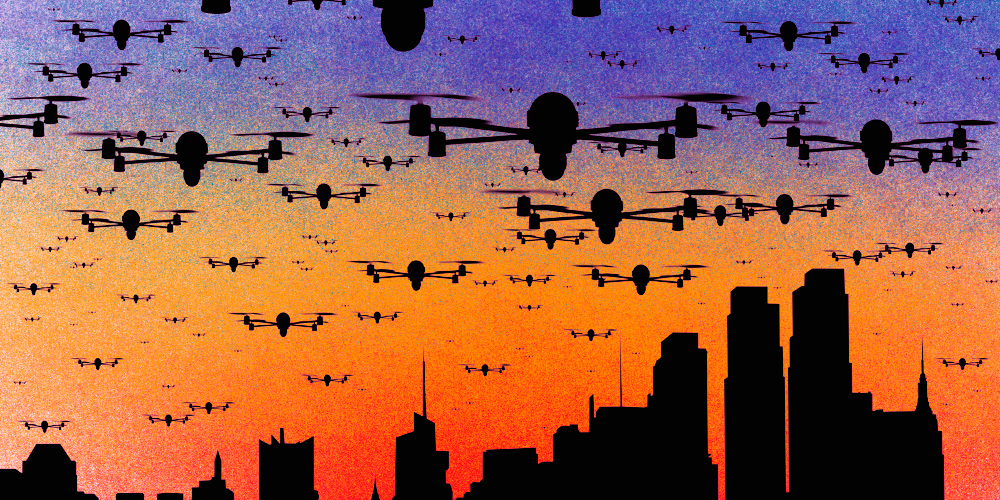
1. Hobby drones fly onto regulators’ radar

In 2015 the number of drone related incidents sky rocketed. Most of the big news stories of this year were about mishaps related to irresponsible drone users.

With the onslaught of amateur drone operators the US government scrambled to pass legislation that would stem the tide of drone crashes, privacy threats and dangerous flying. There was a great fear that massive numbers of drones would be given as Christmas presents this year dubbed by some at the great “drone invasion”.

DroneInvasion

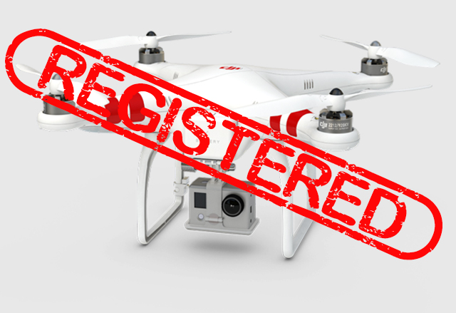
The FAA took responsibility for making drone users accountable by issuing a new law that all non-commercial drones need to be registered with the agency. The FAA reasoned that drone users are “aviators”

“Make no mistake: Unmanned aircraft enthusiasts are aviators, and with that title comes a great deal of responsibility,” U.S. Transportation Secretary Anthony Foxx said in a statement released by the FAA. “Registration gives us an opportunity to work with these users to operate their unmanned aircraft safely.”

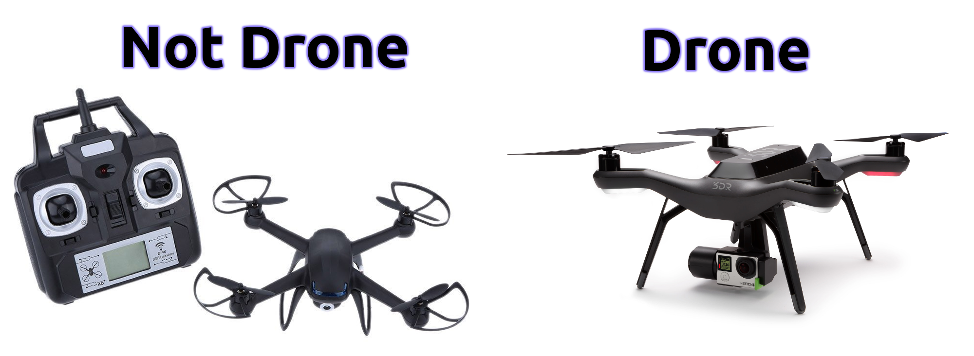
The FAA drone registration website went live on December 21st which can be seen here: FAA Drone Site. Their guidelines are bit foggy and fail to define what is and isn’t a drone. They do have a list of samples though, FAA Sample Guide. The guide seems to suggest that only drones with autopilot capability (aka actual drones and not R/C models) need to be registered.  At the moment the registration system is ambiguous and poorly though out.

droneregistrationproblems

The knee jerk reaction from the FAA makes an effort to control the huge number of hobby drones taking flight this year.  Much like the long gun registration in Canada the people who are going to break the rules will not register their drones anyway.

Transport Canada jumped on the drone invasion bandwagon as well but fortunately did not enact a poorly thought out registration scheme. They launched a media campaign instead to educate users to follow existing regulations (Transport Canada Announcement)


2. Drones interfere with forest fire operations

There were several big news stories this year about drones interfering with forest fire fighting operations in Canada and the United States.  This summer was unusually dry and led to an increase in forest fires all over North America.  In BC there was a province wide fire ban this summer due to the dry conditions.

YouFlyWeCant

One incident near the town of Oliver, BC made headline news across the country (CBC story).  Aerial fire suppression crews were hard at work battling a fire that engulfed 1500 hectares and led to the evacuation of over 100 homes.  When a small drone was spotted the whole crew of eight helicopters and 6 water bombers was grounded for five hours.

The story spurred negative emotions from many BC residents as the fire fighting effort was desperately needed and the interruption further threatened many homes.

There were several incidents in California this summer too.  California had a rough summer with widespread drought and many forest fires.  Public reactions were fierce. The county of San Bernadino is offering a $75,000 reward for the identity of drone pilots who interfered with three separate forest fire operations (Reward Story).

3. Hobbyists create weaponized drones

Within the last year two youtube videos from the same drone enthusiast sparked much controversy (CNN Article).  In the first video he mounted a handgun to a quadcopter drone and rigged up a remote firing system.  The result was pretty intimidating.  See the video below.

In December the same enthusiast mounted a custom designed flamethrower to a larger drone and posted anouther video.  Once again the controversy spread like wildfire (Popular Science article).  The inventor says that the experiments were conducted in a controlled environment with water and fire extinguishers nearby.

Internet users were mostly outraged with many in the drone community lambasting the teenager who created these drone weapons.  There were a lot of comments from people fearing their hobby would be banned because of this young man.  Others applauded the ingenuity that it took to put these together while some were just plain scared.

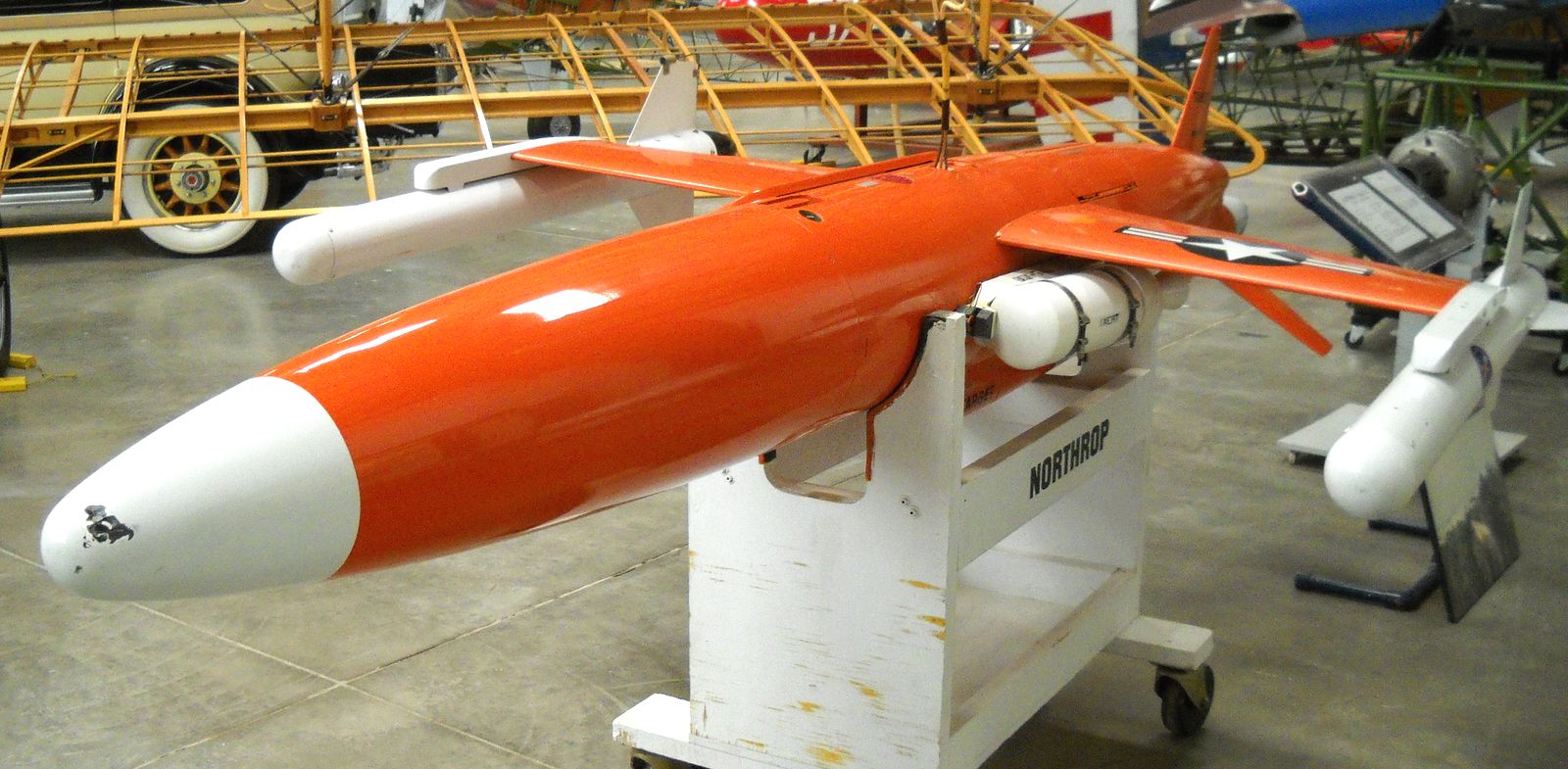
It will be interesting to see what hobbyist drone weapons make the news in 2016.  Drones were originally developed as weapons systems starting with the German V1 flying bomb in WWII which was essentially a cruise missile.  With the long history of weaponized drones we shouldn’t be so surprised when kids are creating them in their backyard.

4. Delivery Drones

Everbody has heard of the Amazon delivery drone by now.  News of their plans to develop a 30 minutes or less drone delivery system called Prime Air has been splattered all over the headlines for much of the year (30 minutes or less).  Just last month they released a video with former Top Gear presenter Jeremy Clarkson showing a concept of what Prime Air might look like.

Despite the many challenges involved in drone delivery Amazon seems to be taking their plan seriously.  They have proposed a special drone delivery only airspace (BBC article).  It will be several years at least before the technology and regulations are actually ready for something like this.  Take a look at my post on 6 Misconceptions About Drones in 2015 where I explained why this won’t work.

Google (aka Alphabet) and Walmart also filed applications to test drone delivery this year (Walmart Drone Delivery).  Futuristic drone delivery remains a tantalizing possibility and will likely remain in the headlines through 2016.

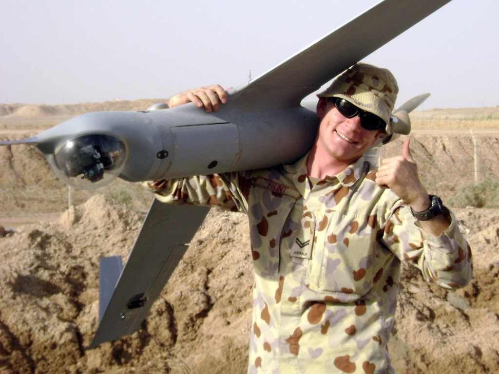
5. Military drone pilots speak out

Military drone strikes were a big story in the news this year.  In October a leak was released detailing the United States use of armed drones to murder suspected terrorists and other people they don’t like in the middle east (drone leaks).  It had been assumed for years that the US was using drones in countries that it was not supposed to.  The leak exposed a massive drone assassination program that was largely unknown

Around the same time stories began to surface of military drone pilots who quit their jobs due to the emotional toll of constantly killing people on the other side of the world (NBC story)

This story from 2012 explains how a US military drone pilot from Montana killed an innocent child.  He launched a missile at a building in Afghanistan when a child walked out at the last second before the missile hit.  There is a lot of collateral damage in the US drone war campaign.  According to this article on Vice News more civilians are killed than suspects (Vice story).  Anouther article in the New York Times tells the same story (NY Times).

A huge number of drone pilots are quitting their jobs.  More people are quitting than are being trained (Drone Pilots Are Quitting In Record Numbers).  The air force in apparently offering huge bonuses to retain qualified operators (NY Post article).

6. Guys shoots down drone and gets away with it

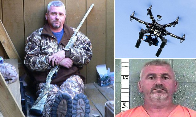
This summer a man from Louiville, Kentucky took down his neighbour’s drone with a shotgun.  He claimed that it was spying on his daughters who were sunbathing in his yard.  Initially he was charged by police for discharging a firearm in the city.  In October a judge ruled that the drone invaded his privacy and therefore he did not break the law in shooting it (Man Shoots Drone)

The drone’s flight data was analyzed after it was shot down.  The drone was clearly above 200 feet and had only been in the air for two minutes.  It seems obvious that the shooter was acting emotionally and testified that the drone was closer than it was.

There has a been a lot of hype about drones invading privacy.  While camera equipped drones do have the capability to spy on people it is up to the operator to act responsibly.  There are existing laws regarding voyeurism and trespassing which apply to drones as much as people.

Of course this was not the only drone shooting incident.  A New Jersey man also shot a drone with a shotgun he did not have such a sympathetic judge.  He was charged with Possession of a Weapon for an Unlawful Purpose and Criminal Mischief (NJ Drone Shooter).

Drone Shooter

Anouther interesting drone shooter story took place in Modesto, California (Cal Drone Shooter).  Again the shooter acted on concerns over privacy.  This case was handled by small claims court when the shooter refused to pay for the parts that he damaged.  The drone owner won the court case this time.

In some states its OK to shoot drones in others it is not.  It seems that shooting drones is a grey area as in the US the legal system (CNN Drone Shooting).

There have been several news stories of drone incidents on beaches.  In one case a man was arrested and charged for throwing his T-shirt into the propellers of a drone causing it to crash (T-shirt drone incident).

A particularly interesting incident happened in 2014 at beach in Connecticut (Woman Assults Drone Pilot).  A woman was offended that a drone pilot was flying a camera drone over the beach.  She attacked the man and was subsequently charged with assault.  The man filmed the assault on his cell phone and she now faces up to a year in prison.

DroneBeach

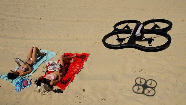
It is not against the law to fly or film in a public space.  If you are sunbathing on a public beach people can legally take pictures of you with a drone or otherwise.

7. White house drones

2015 saw two white house drone incidents.  The first incident happened in January (NBC, Mashable).  The drone operator lost control of his DJI phantom and it landed on the grounds of the white house in Washington, DC.  The incident was uneventful other than that fact that it landed on government property.  Nobody was hurt, no property damage, etc.  Although this story reports that the pilot was “drinking and droning” (DUI Droning).

Secret Service Handout Photo

In contrast the the January incident a man was detained for flying a small drone (Parrot Bebop) at the white house (CNN, DailyMail).  The area around the white house was put under lock down.  Secret Service agents quickly tackled the suspect and detained him.  All the surrounding roads have been cleared of people and cordoned off.  The pilot (Ryan MacDonald) was arrested and charged with violating a federal order.

The difference in handling of these two incidents is noteworthy.  In one case the perpetrator was a government employee who recklessly went to sleep with a drone in the air, and may have been drunk.  He actually crashed his drone.  In the second incident the man did not crash and was arrested and charged and the white house was put on lockdown.

8. Drones at airports

Drone incidents at airports have risen sharply in the last year.  It is inevitable that with the huge numbers of drone sales a small percentage of owners will operate in a completely reckless manor.

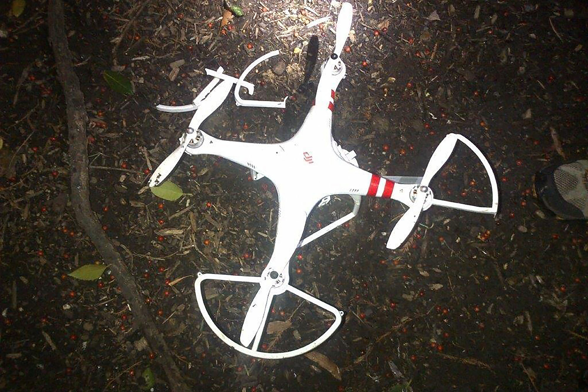
Once incident in May at New York’s LaGuardia Airport involved a near mid air collision between a drone and a jetliner at 2700 feet (Fox News).

IllegalDrone

According to this article from the Washington post there were in excess of 700 drone related incidents at airports in the United States in 2015 and the article was written in August.

On July 10, the pilot of an Air Force F-15 Strike Eagle said a small drone came within 50 feet of the fighter jet. Two weeks later, the pilot of a Navy T-45 Goshawk flying near Yuma, Ariz., reported that a drone buzzed 100 feet underneath.

There have been some actual mid-air collisons:

On May 9, the pilot of United Airlines Flight 863 — traveling from San Francisco to Sydney — reported that the Boeing 777 hit a drone at an altitude of 3,000 to 4,000 feet along the California coast.

Vancouver, BC has had several incidents as well (CBC News).  There was a high profile incident in October at the international airport and one in August involving a sea plane and a quadcopter (National Post).  According to the seaplane pilot the drone came within three meters of his windshield when he was landing.

These kind of incidents have been spreading rapidly and in each case you have to wonder what the person was thinking.  There are several awareness programs in place now but do you really need someone to tell you that its a stupid idea to fly a drone at an airport?

9. Drones over Paris

In February drones were spotted flying over several Paris landmarks including the Eiffel Tower, and the US embassy.  The drones were spotted two nights in a row presumably taking photos or video of the landmarks.  Flying a drone at night is illegal in France and drone flights in central Paris are also banned.

ParisDrone

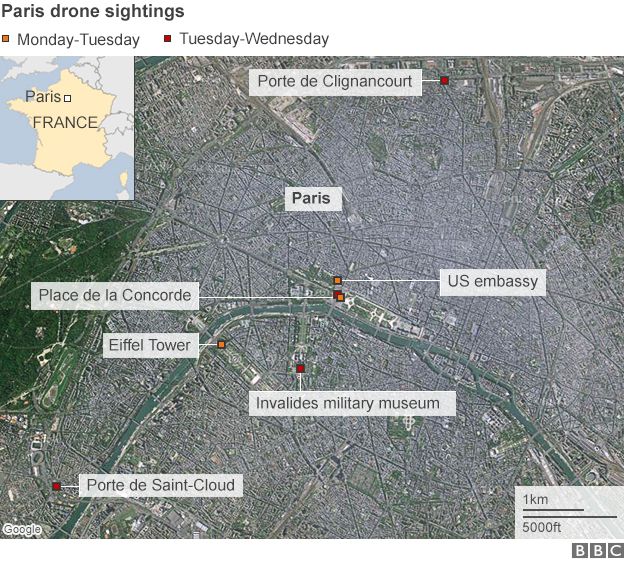
The story was huge news despite how little was known.  News agencies in Europe reported the facts and that the pilots or drones had not been located (BBC News).  Here is an excerpt from a BBC article.

The security threat from these drones is minimal. Bird’s-eye images of Paris landmarks are available online in far higher quality than anything these devices could produce. And small, shop-bought drones are not strong enough to deliver a significant payload of explosives.

News in the United States took the story to a whole different level.  The CNN video below has “TERROR IN THE SKIES” as the headline for their report.  With no information to go on CNN decided to scare the pants off American viewers.

A week later three Al Jazeera journalists were detained as suspects (Al Jazeera Story).  The reporters were in fact operating their own drone as part of their coverage of the mystery drone story.  They were detained for 19 hours and questioned.

The actual perpetrators were never found.  The Paris drone flights remain a mystery.  They were likely tourists using their toy drones to capture aerial video of landmarks.

10. FAA grants over 1000 permits

In August of 2015 the FAA announced that it had issued over 1000 exemptions for commercial drone operation (Fortune Article).  Through much of the year they were issuing permits at a rate of 50 per week.  The FAA was mandated by congress to come up with commercial drone rules by 2015.  They dragged their feet and still only have an interim measure called a section 333 exemption.

droneMining

Commercial drone activity is illegal in the United States and the permit grants an exemption to the law.  The process is similar to what Transport Canada has been doing for a decade.  Without a permit there is no commercial work.  What this story really means is that the United States is finally able to have a domestic commercial drone service industry.  Prior to 2015 only a small number of permits were issued giving the holders a virtual monopoly on drone services.  With the increase in permits there is beginning to be some competition in the market.

Section 333 exemptions are not easy to get.  There is a paperwork intensive application process and all the criteria need to be met.  The FAA is moving towards an actual licencing system instead of the patchwork of regulation that they are now using.


Runner Up News Story:

Enrique Iglesias Slices Fingers on Drone

During a concert in Tijuana, Mexico Enrique Iglesias grabbed a drone out of the air and sliced his fingers on the propeller.  This story made headlines in May of 2015 (DailyMail Story).

EnriqueDrone

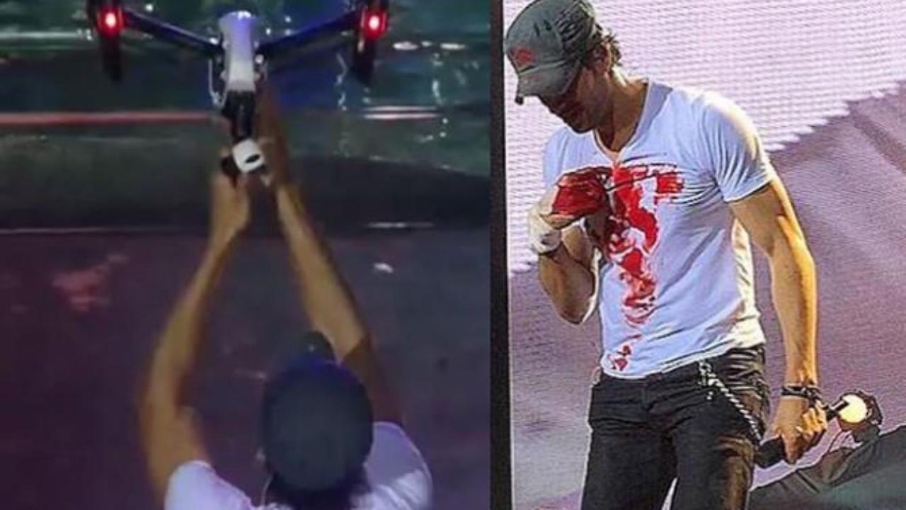
The drone was used to get crowd footage during the concert.  Enrique grabbed the drone to get a POV perspective.  He continued performing for 30 minutes and was airlifted to a hospital after the show.  He was bleeding the whole time.  You have to respect the guy for continuing the show despite some fairly serious bleeding.


The Search for Klondike Lode Gold

The Search for Klondike Lode Gold

In the summer of 2010 I was hired to work with a team to find hard rock gold in the Klondike.  We explored a group of claims on the Indian River.

IMG_1741My crew stayed at a camp operated by a character called Big Al.  That name might sound familiar because he has been featured on the popular TV show Yukon Gold on the History Channel.  Of course at that time we had no idea he was going to be a celebrity.  During the trip we heard a rumour that Hoffmans working a few claims over were filming for a TV show, it turned out to be the hit series Gold Rush on Discovery.  We were surrounded by gold mining TV stars but didn’t know it yet.

Klondike Tailings Piles

Indian River Yukon

The Klondike is a place that has a very storied history and was the site of the greatest gold rush of them all.  California, Oregon, and British Columbia had their gold rushes and stories but the Klondike was like no other.  Between 1896 and 1899 over 100,000 adventurers made the journey from all over the world to the largely uninhabited Yukon territory in search of gold.  What made this rush different is the long journeys and overall inexperience of the Argonauts.  At the time of discovery El Dorado and Bonanza creek were the richest creeks in the world.  Some claims on El Dorado were getting $27 to the pan once they hit the pay streak.  That is equivalent to about $750 per pan in today’s money.

My team met up in Whitehorse the capitol city of the Yukon Territory in early August 2010.  We then rounded up some remaining gear and drove in a rented truck up to Dawson City.  As you arive in Dawson City you can see the remains of over 100 years of placer gold mining. Before you reach the town you can see large tailings piles lining the sides of the highway.  When looked at from above they look like something that was produced by a giant insect.  The tailings piles were put there by humongous dredges that scoured the Klondike drainages until 1966.  It is estimated that each of the dredges were producing as much as 800 ounces of gold per day!

Aerial View of Kondike Tailings
Aerial View of Klondike Tailings

Dawson City is a cool town.  The residents have maintained the look and feel of Dawson’s heyday during the Klondike gold rush.  The streets are dirt with wood plank sidewalks.  Most of the buildings are original in the downtown area and many commercial buildings have the false front that was the norm during the gold rush era.  There is even a law that all signs have to be hand painted.

OLYMPUS DIGITAL CAMERA

OLYMPUS DIGITAL CAMERA

There are no corporate stores or businesses in Dawson.  Everything is locally owned and operated.  Some of the original establishments from the 1890s are still in operation today.  Diamond Tooth Gerties is one such establishment which offers games of chance and nightly can can dancers 7 days a week.  Anouther is Bombay Peggy’s which operated as a brothel during the gold rush.  It has turned into a classy bed and breakfast now.

OLYMPUS DIGITAL CAMERA
My Crew posing with the Can-Can girls

OLYMPUS DIGITAL CAMERADtHotel

Dawson has several historic bars as well.  One such bar is the Downtown Hotel.  We stopped in there one night after visiting several other bars and took part in a local tradition.  It is called the Sourtoe Cocktail.  Only one of my crew was willing to take the shot with me.  The Sourtoe Cocktail is a shot of Yukon Jack whiskey taken with an amputated human toe in the glass.  They keep the toe in a jar of salt above the bar.  Apparently the tradition started with a bootlegger losing his toe due to frostbite.  I was informed that this was their 6th toe which makes you wonder where they new ones came from.

Bombay Peggy'sThe Toe

The Bonanza Creek Road is the main access to Indian Creek.  Along this historic route there are plenty of relics of past mining adventures.  Most notably the historic Dredge No. 4 which mined Bonanza Creek until 1959.  There are other dredges as well and plenty of old heavy equipment that was abandoned by miners of the past.  There are abandoned bulldozers, excavators, trucks and other random big machines.  There is such a surplus of iron that many bridges use large dozer shovels as retaining walls.

Dredge No. 4
Dredge No. 4

We were tasked with finding the source of the placer gold in the Indian River.  We stayed at Big Al’s camp and were exploring mineral claims that overlapped his placer claims.  His knowledge of gold bearing benches as well as historical research was very important in our search.  Likewise our findings were beneficial to Al in exploring new placer areas.  Most of our time was spent exploring old miner’s trails on quads and by foot.  I’d be lying if I said it wasn’t a great time.

14 17

We came across several old mine shafts and evidence of placer mining was everywhere.  My crew participated in some of Big Al’s cleanups too.  It was exciting to see the amount of gold that he was pulling out.  We participated in all the steps of his cleanup process from cleaning the sluice to the concentrator jig and so on.  At each stage a fair amount of rum was consumed it seemed fitting when surrounded by hundreds of ounces of gold.

100_1565 CleanUP

Yup, that's exactly what it looks like.
Yup, that’s exactly what it looks like.

In our hard rock exploration we employed several techniques utilizing traditional prospecting as well as soil sampling and statistical pebble counts.  The soil sampling was conducted with helicopter support which made it a lot easier.  We were bagging close to a hundred samples per day each which was more than we could carry in the bush.  At the end of the day we’d chop out a helicopter landing area and radio the chopper.  Then we’d pick up the samples that we cached during the day.  Hard work but a lot of fun too.

IMG_1883

We spent a total of six weeks prospecting the area.  We took a lot of samples to be sent in for assay from all over the claims.  Prospecting in the Yukon is similar to BC, there is not a lot of exposed rock around.  Unlike the barren lands of the North West Territory and Nunavut there is plenty of forest and vegetation covering the rock.  We spent a lot of time in the helicopter scoping out rock outcrops.

IMG_1746

There seemed to be a correlation between the garnets that were showing up in the placer operation and high grade gold.  When the placer miners hit the paystreak they got a lot of garnets with it.  We started prospecting up a creek called “Ruby Creek” assuming it was named for the abundance of garnets.  The hunch turned out be be right.  We chased the garnets up to some large outcrops near the top of the mountain.  The samples contained a lot of garnet but not a lot of gold.

100_1595 SoilSampling

From an old mineshaft that we found near a cabin we discovered that the miners hit a layer of pure quartz conglomerate.  And it was loaded with gold.  We then knew what to look for.  The search for the source of the Klondike gold continued for several weeks.  We encountered giant moose, grizzly bears, Northern Lights and some great people.  On several occasions we thought we found the fabled mother lode but the samples returned disappointing assay results.  Some of the more random samples showed the highest grades.  They say gold is where you find it.  We did not find the source of the klondike but we did manage to have a great time and got paid for it.

OLYMPUS DIGITAL CAMERA

6 Misconceptions About Drones in 2015

6 Misconceptions About Drones in 2015

#1 Not all remote controlled aircraft are drones

The rise in popularity of consumer drones has led to a considerable amount of confusion.  The word drone has been misused by the media and manufacturers attempting to capitalize on the excitement that surrounds everything “drone”.  A drone is a robot that has the ability to operate autonomously without direct control from a human operator.
DroneNot“Drone” usually refers to unmanned aircraft which are also called UAVs (more on that later).  There are other types of drones too such as boats, submarines and ground based robots.  For an aircraft to be considered a drone it must have an autopilot and have the ability to fly without user input.  Many of the “drones” on the market right now do not meet that criteria.  For example this is not a drone, Flymemo DM007 but it is marketed as one.  This one is a drone 3DR Solo Drone Quadcopter.

There are similarities to real quadcopter drones though.  The DJI phantom is a real drone, the difference being that it has an autopilot and can operate a flight pattern autonomously.  Likewise “racing drones” are not drones at all.  They are totally cool though and look like a lot of fun.

Quadcopters have been around for a long time and offer a stable platform compared to conventional R/C helicopters.  The correct name for these non-drones is R/C quadcopter.  Adding a camera does not make an R/C aircraft a drone either.

#2 You can’t just fly wherever you want

Commercial and Hobby use of drones comes with regulations.  Like most laws it is the responsibility of the operator to learn and obey the regulations.  In Canada the regulations are in a state of flux so it is important to keep up to date with the changes.  Likewise in the United States new rules are currently being developed to register all recreational drones.

regs

Canadian recreational users can be fined up to $3000 for an infraction of the recreational rules.  Commercial operators are subject to fines up to $25,000 for flying without a permit or exemption.  Any damage caused by reckless drone usage can also be charged back to the owner.  Other laws also apply such as voyeurism and trespassing.  RCMP have been investigating unauthorized use and have issued fines to non-compliant operators (CTV article).

At the present time both Canada and the United States do not have a licencing system for commercial drone operations.  In both countries the existing laws consider commercial drone activity illegal and therefore an exemption or permit is required.  In Canada this is called an SFOC or a “Section 333 Exemption” in the US.  The Canadian laws are further ahead as there is somwhat of a streamlined system to apply with a clear set of criteria.  Exemptions have been made for small drones provided that they have insurance and operate at a safe distance from airports, and buildings. This link has flow chart for the current exemptions, TC Exemptions.

IllegalDrone

Reckless drone incidents have risen sharply in the last two years with the increase in drone sales.  There was an incident this summer where a recreational drone interfered with a forest fire fighting operation in Southern BC (news article).  A disturbing amount of drones have been spotted at airports interfering with commercial air traffic as well.

#3 Confusing Acronyms

Following up on misconception #1 there are a lot of confusing acronyms and terms for drones and drone-like aircraft.  The “proper” name for drones is actually UAVs or unmanned aerial vehicles.  Some people will say UAS or unmanned aerial systems.  These terms are a matter of debate in academic, military and regulatory circles.  Drone, UAV and UAS essentially mean the same thing.

The terminology gets a little foggy when you start talking about RPVs which stands for remotely piloted vehicle.  Many of the large military drones fall into the RPV class.  The difference is that they are actively piloted by a human although the human can be hundreds or in some cases thousands of miles away.  RPV’s are essentially big expensive R/C planes.  R/C is another acronym that is part of the mix.  As discussed in #1 R/C stands for radio control and refers to the hobby planes, helicopters and multirotors that are literally controlled by radio transmitters.

Modern drones developed from R/C aircraft and have many of the same components.  One more acronym that is related to drones is FPV which stands for first person view.  That is the technique used to fly R/C aircraft using a live video feed via radio link and video goggles.  FPV is pretty cool stuff, check out the video below (be advised that they are likely breaking the law).

#4 Drones will not be delivering packages anytime soon

There has been a lot media coverage recently about drone delivery systems.  Amazon has been leading the charge with a media frenzy around what they call “Amazon Prime Air”.  Just this week they put out a promotional video hosted by former Top Gear star Jeremy Clarkson.  See the video below,

It looks cool, even plausible, but there are several major road blocks that need to be dealt with before drones will be landing in your back yard.  First the drones require a system called Sense and Avoid.  This is arguably the holy grail of modern drone development.  Sense and avoid means that the drone can avoid collisions with unplanned obstacles, people and vehicles using onboard sensors and real time decision making.  Great strides have been made in the last two years in this field but it will be a while before it is ready for the real world.  Check out this ground breaking video from researchers at MIT,

In addition to sense and avoid systems delivery drones will also have to be reliable in all weather conditions.  There are very few drones today that are capable of flying in rain, strong wind or at night.  There are other reliability issues that need to be addressed such as battery life, and battery consistency.  Not to mention dealing with militant anti-drone activists or simply kids that might throw plastic bags or rocks at delivery drones.  Apparently it is legal to shoot down other people’s drones in the United States (see this article).

The last hurdle that needs to be cleared is regulation.  Amazon, Google and Walmart have all been lobbying for a designated altitude to be used for delivery drones above cities.  The proposal sounds like something out of a science fiction novel, and may one day part of the solution but it will take a long time.  Currently drones are not prohibited within 9km (Can) or 5 miles (US) from an airport which is where the majority of customers live.

Drone delivery is not a new concept.  In remote regions of Africa experiments are underway to deliver live organs and medicine between villages.  Check out this TED talk on the subject.  In rural Africa there is virtually nothing for the drone to hit, no conflicting traffic and so on.  In areas like that drone delivery can already take place.  Drone delivery services will be available in major cities one day but with today’s technology and regulatory climate it is nothing more than a publicity stunt.

#5 Most of the military drones are not killing machines

A widely held misconception about drones is that the US military drones are all weaponized killing machines.  Coverage in the press gravitates towards the very controversial remote killing machines that the military certainly does posses.  They have several models of weaponized drone, the main drone strike tool is the General Atomics MQ-9 Reaper. The Reaper is a bigger, more powerful version of the Predator with the addition of weapons payloads.  They also have F-16 fighter jets converted to drones and unmanned bombers.  The Tomahawk cruise missiles which were made famous in Desert Storm are also basically kamikaze drones.

1970s Target Drone
1970s Target Drone

The first drone weapon was developed by the Nazis in WWII.  It was called the V-1 Flying Bomb and was essentially an early cruise missile.  The US has a long history of drone useage beginning after WWII with unmanned target drones.  Miltiary forces all over the world routinely use target drones to for target practice every day.  It is mind boggling that they build simplified drones that cost between $10,000 and $40,000 just to shoot at and destroy.  These non-weaponized drones are used daily.

The drone age really took off with reliable photography drones in the 1990s.  The most successful drone to date is the Insitu ScanEagle.  The ScanEagle was originally developed in Oregon by Insitu to map tuna schools.  They have been deployed in US military operations since 2004 and all they do is take pictures.  The AeroVironment RQ-11 Raven is a small hand launced photography drone that can be rapidly deployed to take aerial photos.  The Shadow, Blackjack and RQ-170 Sentinel are all photography drones as well.  The Canadian military uses the Israeli made Heron UAV and the ScanEagle, we do not have any weaponized drones.

Insitu Scan Eagle
Insitu Scan Eagle

The Predator and Global Hawk are extremely successful long range, high altitude drones that collect aerial imagery and do not have weapons capability.  I am not advocating in any way the use of drones for murder but the media promotes stories on the controversial killing drones in the headlines.  This disproportionate reporting give the impression that all military drones are killing machines.  In reality there are only a handful of killer drones while the overwhelming majority take photos and collect remote sensing data.

#6 Drones will not crash if their radio is jammed or lost

There has been some press lately about using radio jammers to knock out drones.  There are even some start up companies marketing radio jammer guns.  They look like some kind of futuristic weapons.

72412d60-919f-413d-b7de-04c685ff153f-large
Drone radio jammer made to look like a weapon

Radio jammers work by overloading a signal with random noise.  The jammers that are being designed for drones use directional antennas and focus on the the frequencies often used by drones (2.4 – 5.8 GHz).  Some drones operate on different frequencies such as 900 MHz which would require different antennas.

If tuned to the correct frequency range a jammer can definitely disrupt a drone’s radio link.  That will not cause it to crash though.  Just about every drone in operation today has a set of failsafe programmed features.  One of the most important is a radio signal loss failsafe.  What that means is that the drone is programmed to follow a procedure when signal is lost.  Typically the drone will return to its take off point and hover or circle in the air until signal can be re-gained.

RadioJammer
Drone radio jammer

Drone’s can lose signal for a lot of reasons and it has happened to me on numerous occasions.  They also have failsafe procedures for loss of GPS signal, battey  power, etc.  The definition of drones comes into play again here.  Radio controlled aircraft such as R/C quadcopeters which are often mis-labelled as drones will crash when signal is lost.  That is true of any non-autonomous R/C aircraft.  Without receiving commands from the pilot they will all crash.  So radio jammers are effective on R/C devices.

In recent months momentum is building for drone radio jammers to be installed in airports and other sensitive areas where reckless drone activity could be a nuisance.  First of all they would not actually be effective against drones and second the jammers would overlap with commonly used aviation frequencies.  So that is never going to happen.  If commercial jet flights are concerned about having a cell phone powered up during flight how would they like high powered radio jammers operating in the vicinity?

Hunting for Diamonds in the Arctic

Hunting for Diamonds in the Arctic

Back in 2010 I had the opportunity to work on a diamond exportation program in the Canadian Arctic.  The camp was called Credit Lake and was located near Lac de Gras in the North West Territories.  The Lac de Gras region was the epicentre of the 1990s diamond rush after the discovery of the Point Lake kimberlite pipe by Chuck Fipke.  Today there are three operating diamond mines in the region Diavik, Ekati, and Snap Lake.

rawDiamond

Diamonds are found in volcanic structures that are called kimberlite pipes.  These are volcanic events that take place very rapidly.  Most volcanoes take thousands or millions of years to develop.  A volcanic pipe can develop and explode in less than a day.  These volcanic explosions are charged by high pressure carbon dioxide and water vapour.  And travel from the below the crust melting through rock at over 100km/h.

CreditLakeLocation

It is important that volcanic pipe events happen quickly if you want to mine diamonds.  The environment where diamonds form is under intense heat and pressure.  Once the pressure is removed diamonds will melt into graphite which is much less desirable.  In kimberlite pipes diamonds are carried to the surface as the superheated kimberlite melts its way through the layers of the crust. When the pipe reaches the surface it releases its energy in a huge explosion and then quickly cools.  The diamond crystals do not have time to melt, they cool with the rest of the pipe and stay in place.

Diavik Diamond Mine
Diavik Diamond Mine

The volcanic events that created the North West Territory kimberlite pipes took place millions of years ago.  The surface has been subjected to many ice ages over the years and different continental ice sheets have scoured the surface like a bulldozer.  To find a pipe today you look for the debris field left behind as the top of the pipe was scraped by ice sheets.  As the glacial ice sheets retreated they left behind a trail of ground up rock and indicators for diamonds if you’re lucky.

Credit Camp

My first stint at the camp was for six weeks in 2010.  We were searching for diamonds as well as nickel.  My role was to analyze pulverized rock samples from an R/C drill as well as preparing samples for assay and general exploration work.  I returned in 2013 to conduct geophysical surveys including ground (snowshoe) magnetometer and HLEM.  Both trips were in early spring when the temperature in the Arctic ranges from -50°C to -10°C.  Show storms were frequent and the ice on the lake was five feet thick.
TwinOtter

The camp is extremely remote, approximately 300km North of Yellowknife,NWT.  Everything is brought in by ski plane or helicopter.  In addition to exploration work we had to work together to keep the camp running.  When a plane would arrive we would all pitch in to get the groceries, diesel drums, and any other supplies off the plane and into the camp.  The same was true for getting water out of the frozen lake for showers, laundry and the kitchen.  Water is always a challenge in remote areas when it is extremely cold.


While I was at the camp we experimented with several different water gathering techniques they all had their merits.  What we ended up doing was using a chainsaw to cut out a section of the lake ice.  Then used an ice auger to drill the final few feet (see video above).  We used a snowmobile toboggan to transport pails up to the reservoir inside the kitchen.

To travel to and from the locations we were exploring we took a helicopter.  We had a Eurocopter Astar B3 to shuttle people and move the heli-portable drill around.  We also had a couple of snowmobiles and a GMC pickup truck that had tracks instead of wheels.

A Star GMC Track Truck

The RC drill is a super light weight drill that produces crushed rock instead of core.  The RC stands for Reverse Circulation.  The drill is air powered and behaves like a giant hammer drill, like the kind that you use for masonry work.  The air returns from the bit carrying the rock chips to a hopper where samples can be collected.  The advantage of an RC drill is that it doesn’t require water and breaks down for rapid transport.  RC drilling is quicker and less expensive than diamond drilling.

RC Drill in Action

100_1316

After field samples were collected I conducted several tests on them inside our field lab.  We had an X-ray fluorescence (XRF) analyzer which is a pretty cool instrument.  It bombards the sample with high energy X-ray radiation and the atoms re-emit photons which gives information about their structure.  XRF basically gives you a rapid geochemical assay.  I also conducted magnetic susceptibility tests and identified the lithology of chip samples using a microscope.

Field Lab

The accommodations were first class.  At least as far as small remote exploration camps go.  We stayed in Weatherhaven dome tents which are heated by diesel stoves.  As long as there is fuel in the stove you will be comfortable in any weather conditions.  The stoves are prone to issues though and use half a drum of diesel per day when its super cold.  Our beds are constructed out of 2×4 lumber that was flown in and everybody uses a sleeping bag for bedding.  This camp was not a “dry camp” which means that alcohol was allowed.  That is a huge plus when you’re stuck in the middle of nowhere for six weeks.

My houseCamp Tents

The high latitude makes for great northern lights viewing.  That is actually my favourite thing about the Arctic.  Interestingly the mechanism behind the glow of the Aurora Borealis is the same as the XRF machine.  The molecules in the upper atmosphere are excited by a stream of radiation from the sun called the solar wind.  When molecules are excited they reach an unstable electron configuration and rapidly release a photon as they return to a stable state.  The different colours are due to different molecules being excited such as high altitude ozone, oxygen and nitrogen.  The phenomenon is difficult to photograph but here are some of my best shots below.  The best photo in the world doesn’t compare to seeing it in real life though.

OLYMPUS DIGITAL CAMERA

ChopperAurora

The days out in the field can be pretty tough when the temperature drops.  We built a survival shack that would travel with the drill.  Other than that we were fully exposed until the helicopter arrived at the end of the day.  The survival shack also made a great place to have lunch out of the wind.

Credit lake April 031 Credit lake April 041

In addition to drill sampling I conducted geophysical surveys to identify kimberlite pipes.  We used two types of geophysical survey, magnetometer and HLEM.  Magnetometer or “Walk Mag” is a sensor that measures changes in Earth’s magnetic field in very high precision.  As you pass over different kinds of rock the sensor will record minute changes in the magnetic field.  Once the survey is complete you can produce a map that looks like a topo map except that the you are showing magnetic field instead of elevation.  Click here for a sample of a magnetometer map.  Kimberlite pipes stick out as an anomaly because they have a different magnetic signature to the surrounding rock.  You have to use the old school snow shoes because any metal will mess up the readings.

Walk Mag in Action
Walk Mag in Action

HLEM (Horizontal Loop Electomagnetic) works in a similar way except that there are two parts to the system.  One provides a source field and charges up ore bodies.  The receiver records the response signal from the rock.  HLEM actually works the same way as a metal detector just on a larger scale and records actual data.  The instrument is from the 1980s and is very uncomfortable, fortunately in the winter you are wearing lots of clothes.

Maxmin 1 Maxmin 2

I have always enjoyed working in the Arctic.  Its not for everyone though.  It is insanely cold in the winter and the summer has a lot of bugs.  The wildlife is breathtaking I have seen Muskox, Wolverines, Caribou, different coloured bears, Narwhals, and other wildlife that you cannot see below the Arctic Circle.  The Northern Lights shows are simply amazing.  The people are different too.  This kind of work attracts a different breed, those who are willing to travel to remote areas.  Arctic explorers all share a strong sense of adventure.


UAV Applications in Mining

UAV Applications in Mining

Unmanned Aerial Vehicles (UAVs) are in the process of changing many industries.  Before UAV technology matured into a safe, reliable and low cost system aerial data was acquired by full size human piloted aircraft and was very expensive.  With today’s drones aerial data is cheaper, quicker and more creative than ever before.

droneMining

The mining industry stands to benefit greatly from new advances in aerial data acquisition.  In many cases drones are already being used in mining and in the coming years will be almost ubiquitous.

Drones offer huge advantages in every part of the mining life cycle including Exploration, Planning/Permitting, Mining Operations and Reclamation.

Exploration

DroneBanner

Mineral properties are often in remote areas where existing maps are either non-existent or of poor resolution.  In early stage exploration it is beneficial to have a quick overview of the prospect area.  In the past this would have been acquired by a conventional aerial photography company.  This would come with a large price tag.  As a result aerial mapping surveys would not be conducted until later stages of exploration.

Today a drone can do a better job for less money.  Drones can map an area in high resolution in less than a day, usually a couple of hours.  The cameras on today’s drones have benefited from advancements in small high resolution sensors. Miniaturization of other components such as GPS and computer boards has also contributed to the modern drone.  Due to the unmanned nature of a drone it can fly close to the ground which allows unparalleled image resolution.  Conventional aerial survey aircraft require camera’s with extremely high resolution (80mp and up) because they fly at elevations of 2000-5000 ft above the survey area.  Drones can fly at 250 ft with a 16mp camera and get better data.

Satellite imagery has come a long way as well but does not come close to the quality of drone data and the cost is still prohibitive.  The best satellite data today is provided by the WorldView-3 satellite at 31cm/px.  Drones can produce 4.0cm/px or better.  You can forget about Google Earth, their resolution is no better than 65cm/px.

Early stage exploration projects can now get a rapid aerial image mosaic produced by a drone for a couple thousand dollars.  Where a conventional aircraft would produce an inferior product for about ten times the cost.  This cost advantage allows imagery to be collected very early in the exploration process when it can be of the most benefit.

In addition to aerial imagery the same drone data can be used to produce accurate topographical maps and GIS data in remote areas.  Topo mapping was previously produced by ground surveyors with an RTK/GPS rover.  You would have to pay a survey crew to walk the entire property and collect GPS points to be used in a map.  Mapping drones can do this today without the need for any ground control points at all!

Strati.jpg.pagespeed.ce.51mTrkbnOw

The combination of low cost aerial imagery and terrain data allow modern explorers to have a close up view of any property in 3D.  Having this capability in early stage exploration aids significantly in project planning.  Drones can provide support for mineral exploration in the following areas:

  • Terrain Assessment
  • Geomorphology
  • Outcrop Detection
  • Wildlife and Environmental Assessment
  • Drill, Showing and Equipment Location
  • Up to date imagery of the property

Remote sensing has huge applications in prospecting as well.  In the years to come sensors such as infrared, hyper/multispectral cameras and LiDAR will improve upon existing satellite based techniques to map underground river systems and directly identify mineral bearing outcrops.

Aerial geophysics is making its way into drones too.  I was involved in the development of a large scale drone from 2011-2013 designed to conduct long range aerial magnetometer surveys.  It was a great advancement but sadly the company suffered from poor management.  A few other companies have developed magnetometer drones in recent years too.  Drone geophysics has the same advantages over conventional aircraft such as low acquisition cost and rapid deployment.

Venturer Geophysics Drone
Prototype Long Range Geophysics Drone in 2012

Planning/Permitting

In the development stage drones offer unparalleled advantages to mining companies.  One of the biggest hurdles in developing a mine is environmental permitting.  Low cost drone imagery can map a mining property in incredible detail.  Aerial photos allow mine planners to easily locate and map:

  • Trees/vegetation
  • Streams, Rivers and Lakes
  • Wildlife Counts
  • Existing Roads, infrastructure
  • Before/After Ground Disturbance

Having aerial photos of an area before mining takes place will give an honest account of what the land was like when it comes to reclamation.  Wildlife counts and mapping of the ecosystem are crucial in development of environmental impact assessments.

Prototype LiDAR on drone
Wing-tip magnetometer on a drone


Three dimensional mapping has been used in mine development for decades.  This data is relied on by mine planners to develop the mine itself, roads, tailings ponds, electrical infrastructure, and pretty much everything.  The main tool used is LiDAR which is a laser scanner that produces a high resolution 3D model.  Drones can produce the same data for less money.  LiDAR sensors are just starting to be installed on drones.  Photogrammetry can produce the same quality of model as LiDAR as well but cannot separate trees from ground as effectively.

Photogrammetry and LiDAR data are used for:

  • Mine pit development
  • Tailings pond design
  • Cost effective power line routes
  • Development of access roads
  • Geological Assessment

Mining Operations

Ore Pile Volumetrics

In the operation/mining phase drones have a lot to offer.  One of the most widely used applications of drones in mining today in in stockpile volumetrics.  That is the 3D volume calculation of pile of waste rock or ore piles.  Having volumetric surveys completed at regular intervals will give an accurate measurement of how much material has been moved in that time.  This is important for many reasons.  Historically stock pile measurements have been conducted by ground surveyors with GPS rovers.  Many mines are still operating this way today.  Drone can do the same job without the need to pay for survey crews or to put people in a potentially dangerous situation.

Drones can provide detailed modelling and imagery of pit walls and slope stability.  Fixed-wing and multirotor inspection drones can get a close up, detailed image of potential points of failure in a pit wall.  Smaller multirotor drones are starting to be used to map underground mines too, offering the same advantages.

3D pit models can be done for a surprisingly low cost.  West Coast Placer conducted a pit mapping survey for a coal mine this summer and the results were amazing.  Check out the above video for a sample.  Mine engineers were able to use our data in their mine planning software (Minesight) to aid in development of the mine.  Like stockpile volumetrics pit mapping will provide a useful record of mine activity when repeated at a regular interval.  The low cost of drone data makes repeated surveys feasible on any budget.

Environmental monitoring is a part of active mines too.  As discussed drone aerial data offers huge advantages to environmental monitoring teams.  In the event of an accident or disaster drones can provide a detailed image of the event as it happens.  When the Mount Polley mine near Likely, BC had their tailing dam disaster in 2014 drones were used to map the extent of the damage.  The same drone company provided updates as the clean up progressed.

Reclamation

reclamation

During reclamation it is required to show before and after imagery to prove that a mining company is upholding their obligations.  Accurate three dimensional data acquired by UAVs helps mines return the terrain of a mine as close as possible to its original state.  Periodic surveys can show the progress as an ecosystem returns to it’s pre-mining conditions.

Currently in 2015 drones are just beginning to be used in mining.  There are a few intrepid drone service providers like West Coast Placer offering amazing products for prices that are 1/4 or less of what traditional aircraft would cost.  In the coming years we are going to see more and more drones operating on mine sites.  It will be standard equipment for explorers, miners and environmental teams in the not too distant future.

Check out our drones page to see the drone services provided by WestCoastPlacer.


Top Ten Gold Rushes of BC – Part 2

Top Ten Gold Rushes of BC – Part 2

In part one of the top ten gold rushes of BC we covered the early gold rushes primarily in the Southern regions.  As time went on gold hungry adventurers pushed further in the wild North of the Canadian West coast.  Their adventurous spirit was rewarded greatly and eventually led them into the Yukon and Alaska.

1865 Big Bend Gold Rush

KootenalMap1897_crop
1897 Map of the Big Bend Area

The Big Bend refers to the shape of the Columbia River as it makes a huge detour at the continental divide.  This region encompasses several different mountain ranges including the Selkirks, the Cariboo Mountains, the Monashees and the Rocky Mountains.  In 1865 gold was discovered on French Creek which is straight North of Revelstoke.  As in other gold rushes a town was quickly erected named French Creek City.  Within the first year the town reached a population of over 4000 people.  Nothing is left today but during the rush French Creek had a general store, saloons with cabaret shows, barber shops and of course brothels.  Other important towns of the rush were La Porte and Downie Creek.  The inhabitants came mostly from the Wild Horse area and other areas in BC.

Steamboats were a major factor during the big bend gold rush.  Many of the prospectors reached the area on steamboats via the Arrow Lakes which make up part of the Columbia River.  The lake network allowed boat passengers to travel from areas as far South as the US border.

Boat
Columbia River Steamboat, the “Rossland”

Other notable creeks in the area are Carnes Creek, Downie Creek, McCullough Creek, and the Goldstream River.  A 14 ounce nugget was reported to be found on French Creek and numerous smaller nuggets were also found.  In 1865 miners were bringing out multiple ounces per day to the man on some claims.  On McCullough Creek pay streaks averaged 1/8 of an ounce per yard for many years.  Just like other places in the late 1800s hydraulic and drift mining driven by mining companies and syndicates quickly replaced hand mining techniques.  The big bend gold rush only lasted two years but mining in the area continues to this day.  Several large projects and proposed mines are located in the big bend.

1869 Omineca Gold Rush

The Omineca is a huge region in Nortn-Central BC.  The southern boundary is marked today by the Yellowhead highway the North boundary is the Liard Mountains.  Gold was first discovered in the Omineca in 1861 but the rush didn’t take place until eight years later.  The original discoveries were made on the Finlay River.  In the early days there were very few people in the area due to a complete lack of trails, roads or maps and unforgiving terrain and weather.  Much of the area is still wild today.

Northern BC circa 1898, red symbols are known gold discoveries

One of the first claims on the Finlay called Toy’s Bar produced 4 ounces to the man each day.  Several expeditions were launched though the area searching for gold.  One such party, the Peace River Prospecting Party, found a great discovery on Vital Creek in 1869.  The creek was named after one of the party members, Vital Laforce who was also instrumental in exploring the Cariboo region.  Vital Creek produced nearly 5000 ounces in the years following the rush.

Manson Creek and the Germansen River held the best gold deposits in the Omineca.  Gold discoveries were also made on Blackjack Creek, Kildare Creek, Mosquito Creek, Slate Creek and Nugget Gulch.  In the early days of the gold rush anything less than an ounce a day was considered unworthy.  Many creeks were paying 100 ounces per week.  If the gold rush happened today that would be well over $100,000 every week.  I’d be finding my way up there any any means possible.  Travelling to the Omineca in the 1800s was a feat in itself.

The discovery of gold in the Cassiar in 1873 spelled the end of the Omineca gold rush.  As with all gold rushes those who held good ground stayed and kept mining while everyone else headed on to the next boom town.  The Omineca is one of the least explored regions in BC today and there are still gold strikes waiting to be found.

1873 Cassiar Gold Rush

Gold was discovered on the Stikine River in 1861 and a minor rush developed.  A few hundred prospectors ascended the river in search of gold.  There was an existing fur trading fort at the mouth of the river called Fort Stikine which later became Wrangell, Alaska.  Not enough gold was found to entice more adventurers to the region but the excitement was enough to prompt Britain into claiming the region as a colony in 1862.

Cassiar region circa 1893

The Cassiar gold rush really took off once the high grade gold deposits in the extreme North of BC were discovered.  This part of the country is extremely rugged with huge mountains, glaciers and a very cold winter.  The discovery was made in the summer of 1872 by Henry Thibert and Angus McCulloch on a creek that drains into Dease Lake.  The creek was named after Thibert who froze to death the following winter.  Thibert Creek was very rich, in the first year miners were getting up to three ounces to the pan.

TurnagainNugget
The 52 oz “Turnagain Nugget” from Alice Shea Creek in the Cassiar

In 1874 an even bigger discovery was made further North on Mcdame Creek.  The largest gold nugget ever found in BC was taken from Mcdame Creek tipping the scale at 73 ounces!  Another giant nugget was found on Alice Shea Creek that weighed 52 ounces.

Several towns sprung up near the gold discoveries such as Laketon, Porter Landing and Centerville.  They are all ghost towns now but in the height of the rush thousands of people were passing through the shops and saloons of the Cassiar.  Like the Omineca much of this region is just as wild today as it was 150 years ago.

The Cassiar’s rich gold reserves have not been forgotten.  There are many large mining projects under way in the region.  Due to the high grade mineral deposits the area is known as BC’s “Golden Triange”.
BCs-Golden-Triangle

1885 Granite Creek Gold Rush

Granite Creek is a tributary to the Tulameen River.  In the gold rush era of the late 1800s the Tulameen was still a remote and wild area.  Like many of the best discoveries the Granite Creek gold was found by chance.  In this case it was actually found by a cowboy named Johnny Chance.  In the summer of 1885 Chance was delivering some horses to New Westminster and took a route through the Tulameen.  True to his lazy nature he took a nap at a spot on Granite Creek on a hot day.  When he woke up he happened to notice the reflection of some gold nuggets in the water.

Granite City in 1888

Within a year of the discovery the once vacant valley at the mouth of Granite Creek had over 2000 people living there.  At the time Granite City was the third largest town in BC.  There were over two hundred buildings, 13 of which were saloons.  The town never had a school or a mayor though.  The bars in Granite ran flat out and never closed down.  It was known as one of the wildest towns in the West.

In the early days gold nuggets weighing 5-10 ounces were commonly found.  Platinum was also prevalent on the creek.  Miners were producing equal weights of platinum and gold.  Interestingly for the first few years the Granite Creek miners had no idea what platinum was and most of them threw it back into the creek.  At today’s prices gold is going for $1077/oz and platinum is at $870/oz.

GrantieCabin4
Granite City in 2015

The Granite Creek rush brought attention to the surrounding area as well.  Other notable creeks in the Tulameen are Slate Creek, Lawless Creek, Lockie Creek and the Tulameen River.  Gold and platinum are still being produced today.  I heard from a Princeton local that the biggest nuggets to come out of the Tulameen this year were over an ounce.  I have some claims on Granite Creek and the Tulameen River myself.  Check this post from earlier this year Tulameen Prospecting Trip.

By the end of the 1890s the population of Granite City began to decline.  The easy gold was all claimed and in the process of being mined.  Those that didn’t already hold good ground headed North to try their luck in the Atlin and Klondike gold rushes that followed.

1898 Atlin Gold Rush

Atlin area map 1898
Atlin area map 1898

The Atlin gold rush was the last one to take place in BC.  It was a direct offshoot of the Klondike gold rush that took the world by storm.  The Klondike was the mother of all gold rushes, over 100,000 adventurers poured into Dawson City, YK from all over the world.  Some of the adventurous prospectors took a different route and ended up in Atlin.

The first big discovery was on Pine Creek.  A town was set up on Pine Creek aptly named Discovery.  At it’s peak there were over 10,000 people living in Discovery which was rivalled only by the infamous Dawson City.  Discovery had all the excitement of Dawson.  There were saloons, brothels, and gambling available at all hours of the day.  Discovery is a ghost town today, it was replaced by the town of Atlin.

Discovery Townsite in 1909

The gold that was found in the Atlin area was truly legendary.  It is estimated that over 1.5 million ounces of placer gold have been produced from the creeks.  Some giant nuggets were found too.  Several creeks are known to have produced nuggets in excess of 50 ounces!  The best placer gold creeks were Pine Creek, Spruce Creek, Ruby Creek, McKee Creek, Birch Creek, Boulder Creek, Otter (Surprise) Creek, and the McDonnel River.

Atlin is a beautiful town, I had the pleasure of working up there a few years ago.  In the early 1900s it was nicknamed the “Switzerland of the North” due to the picturesque mountain setting.  In many ways Atlin is like Dawson City’s little brother.  The music festival is smaller, the gold rush was smaller, less gold was produced but the Klondike is nowhere near as scenic.

Atlin Today
Atlin Today

Gold mining in Atlin has never stopped.  Every time the gold price spikes the area receives another mini gold rush.  There are a lot of large hard rock mining prospects in the area as well.  The region is not far from the golden triangle and benefits from similar underlying geology.  Due to its remote location the area is very under explored and has outstanding potential for exploration.

The BC gold rush period lasted just 50 years.  Many of the participants experienced more than one rush in their lifetime.  It would have been an amazing time to be a prospector.  Here’s a recap of the top ten BC gold rushes:

  • 1851 Haida Gwaii Gold Rush
  • 1858 Fraser River Gold Rush
  • 1858 Rock Creek Gold Rush
  • 1859 Cariboo Gold Rush
  • 1863 Wild Horse River Gold Rush
  • 1864 Leech River Gold Rush
  • 1865 Big Bend Gold Rush
  • 1873 Cassiar Gold Rush
  • 1885 Granite Creek Gold Rush
  • 1898 Atlin Gold Rush
The history of British Columbia is the history of gold and the men who hunt for it.  It was the Fraser River gold rush that led to BC becoming a colony and later a province.  Our towns, overland trails and roads, and much of the early infrastructure was built to support gold mining activity.  Without our lust for precious metal men would not have risked their lives to explore the rugged and unforgiving wilderness of this beautiful province.

Top Ten Gold Rushes of BC – Part 1

Top Ten Gold Rushes of BC – Part 1

Prior to the gold rushes in BC this part of the country remained almost entirely unexplored.  The Clovis people and their descendants the North American Indians were the first settlers of North America.  The Clovis crossed the Beringia Land Bridge from Siberia to present day Alaska approximately 13,500 years ago.  When Europeans began exploring the area, first by sea in the late 1700s and later by canoe, they encountered aboriginal groups covering much of the province.  Many Indians had seen gold in creeks but had little use for it.  They did not have the knowledge or motivation to mine gold until they came into contact with Europeans.  After learning the value of gold to the British they began to mine it and trade for goods.

Map of British Columbia Goldfields circa 1858
Map of British Columbia Goldfields circa 1858, click for larger image

The Spanish explorers on the other hand were completely obsessed with the yellow metal.  Spanish explorers were motivated primarily by legends of “El Dorado” in their search of the Americas.  Each Spanish explorer had the ultimate goal of returning to Spain with a ship full of gold.  Most of their attention was focussed in South America where their superior weaponry, armour and small pox allowed them to quickly decimate tribal empires and steal their gold.  There is evidence of Spanish gold exploration in BC as well.  Most of the Spanish exploration took place on Vancouver Island and other coastal areas such as Haida Gwaii.  One Spanish expedition travelled inland as far as the Okanagan and Similkameen regions.

Fur trading is what led to the first European settlement of British Colombia but the impact remained relatively small.  The first settlements were established by early explorers such as Simon Fraser, Alexander Mackenzie, and David Thompson.  Early forts were established along the river routes that these explorers used as well as along the coast.  The area became a recognized fur trading district called New Caledonia and it held that name until it became a British Colony in 1858.

Fort St. James was founded in 1806 and was the first major inland fur trading post in BC and still bears that name.  Other notable early forts are Ft. George (now Prince George), Ft. Kamloops, Ft. Langley and Ft. Victoria (1844).  During the fur trade the European population slowly grew to a few hundred people but little effort was put into exploring new ground outside of the established trade routes.

EarlyBC

1851 Haida Gwaii Gold Rush

The Haida Gwaii gold rush was the first recorded gold rush in BC but was very short lived due to hostilities with the local natives.  The rush began in 1851 when a Haida man traded a 27 ounce nugget for 1500 blankets in Fort Victoria.  A Hudson’s Bay Company ship was sent up there soon after and discovered a very high grade lode deposit.

The HBC crew began mining the lode deposit but the Haida Indians soon turned against them and prevented further mining.  In 1852 a ship with 35 adventurers from San Francisco set out for the islands.  They arrived at “Gold Harbour” in the Tasu Sound but did not have much luck finding gold.  They did however manage to trade with the Haida Indians for gold.

1857 Gold Found At the Nicoamen River

Placer gold was discovered in Nicoamen River which is a tributary to the Thompson River.  The Nicoamen enters the Thompson about 12 kilometers up stream from the confluence with the Fraser River at Lytton.  A local Indian discovered gold there by chance and soon the majority of the tribe was mining the area.  This discovery is credited with igniting the Fraser River gold rush.

1858 Fraser River Gold Rush

The Fraser River gold rush involved one of the largest populations of migrant prospectors in history.  It is estimated that around 30,000 people rushed to the lower Fraser River in 1858.  The rush began after an 800 ounce gold sample was sent from Fort Victoria to San Francisco for assay.

Yale in 1868
Yale in 1868

Soon after a shipload of 800 American prospectors from California arrived in Victoria to hunt for gold on the Fraser River.  The influx of American prospectors overwhelmed the small government that managed the territory.  HBC Governor James Douglas requested immediate help from Britain to control this massive foreign population .  The British Government responded by formally claiming BC as sovereign British Colony in 1858.  The new government quickly enacted mining laws to prevent the mayhem that took place in the California goldfields.  Along with the declaration came British military support and the Royal Engineers who went on to build several major road systems including the Cariboo Wagon road and Dewdney Trail.

The early work centred around the community of Hope where steamboats allowed for easy access.  The majority of the gold rushers were participants in the California gold rush that fizzled out a few years earlier.  As a result the population of Yale was largely american and the town was modelled after San Francisco.

Lower Fraser River Circa 1862

A story in the San Francisco Bulletin is credited with igniting the rush.  According to the newspaper:

“In one month the Hudson’s Bay Company fort in Victoria had received 110 pounds of gold dust from the Indians … (prospected) without aid of anything more than … pans and willow baskets.”

Numerous bars were prospected and mined between Hope and Lytton.  Some communities along the Fraser are still named after the bars that were mined such as “Boston Bar”.  Like most gold rushes the men who arrived first snapped up the good claims and the the majority of the adventurers ended up working for them.

Cariboo Wagon Road in Fraser Canyon 1867

The British Royal engineers developed a route from Port Douglas at the head of Harrison Lake to Lillooet to accommodate the influx of miners.  Many new communities popped up and some are still settled today.

The Fraser rush brought people from all over the world but the bulk of the miners came from California.  At the peak of the rush there were over 10,000 miners operating on the section of river form Hope to Lillooet.  The bars depleted rapidly and by 1860 most of the miners continued on the other gold rushes in BC.

1858 Rock Creek Gold Rush

Gold was discovered in Rock Creek in 1858 soon after miners rushed in from the United States and the rest of the world.  The Rock Creek rush was also instrumental in the development of British Columbia.  The discovery was made by two American soldiers who were chased North of the boarder by a band of Indians.  Just 5km from the border where an unnammed creek entered the Kettle River they found gold.

XGEA8_008
This photo is actually from Rock Creek in Alaska, not BC. Still a good photo though.

At the time of the discovery the colony of British Columbia was only a year old.  American miners tried to claim the area as part of the United States due to the high grades and the fact that it was discovered by Americans.  The Rock Creek claim issues prompted the construction of the Dewdney Trail as a means to separate the new colony from the United States.  The Dewdney Trail snaked its way from New Westminster all the way to Wild Horse in the Kootenay region staying just North of the Canada-US border.

Soon after the discovery an estimated 5,000 prospectors migrated to the newly established town of Rock Creek.  In the beginning there were two saloons, a butcher’s shop, a hotel and five stores.  Within the first year a revolt broke out due to tensions between Chinese and American miners and refusal to pay for mining licences.  The incident became known as the Rock Creek War.  The governor of British Columbia Sir James Douglas travelled there from Victoria to straighten out the miners.  He threatened to send in 500 British soldiers if they couldn’t behave themselves.  Sir Douglas was successful and soon the miners paid their claim fees and mined the creeks in peace.

There were some amazing claims on Rock Creek.  Adam Beame’s claim on Soldier’s Bar  in 1859 allegedly netted $1,000 in six weeks.  That gold would be worth $70,500 today!  Other bars such as Denver Bar and White’s Bar produced similar results.

1859 Cariboo Gold Rush

Gold was discovered on the Horsefly River in 1859 by prospectors who participated in the Fraser River rush.  They were guided by a local Indian and shown a spot on the Horsefly River with abundant gold and nuggets the size of wheat kernels.  The rush was on as more miners from the Fraser River rush migrated North to the Cariboo.  Soon a town was erected near the strike that exists today.

Cariboo Map Circa 1862

In 1860 gold was discovered on Keithly and Antler creeks to the North of Horsefly.  Other notable creeks of the region are Lightning, Lowhee, and Williams Creeks, the Quesnel River and Parsnip River.  Towns popped up all over the place with the most exciting being Barkerville.  That town was named after a British prospector named Billy Barker and had a popluaton of 10,000 at its peak.  His claim on Willams Creek was one of the greatest gold producers in history yielding an estimated 37,500 ounces of gold.  Barkerville was restored in 1997 as a tourist historic town that is a popular attraction in the area.

Barkerville1868
Barkerville circa 1868

The Cariboo gold rush saw 100,000 people flood into the area during 1862-70 from all over the world.  By 1864 the Cariboo Wagon Road was completed from New Westminster all the way to Barkerville.  This allowed for easy travel of people and supplies, wich substantially brought down the costs.  It also allowed for stage coaches to securely move gold from the mines.  The stagecoaches operated on this road from 1863 to 1917 carrying people, mail, express packages and of course gold.  The stagecoaches saw surprisingly few hold ups, even though they carried literally tons of gold.  There are only five hold ups on record, two of which were successful.

stagecoach11

By 1870 the gold rush had largely fizzled out.  The good claims were now owned by mining companies who could gather the money needed to undertake underground drift mining.  Those who didn’t stick around to work in underground mines spread around other parts of BC’s North and some sparked gold rushes in new areas.  Others settled in and started up cattle ranches or logging companies.  Gold mining in the Cariboo is still active today, as a matter of fact I have a couple claims near Keithly Creek.

Cariboo Drift Mine
Cariboo Drift Mine

1863 Wild Horse River Gold Rush

Gold was discovered on the Wild Horse River in the Kootenay region in 1863 once again by American prospectors.  The Wild Horse held great gold reserves and still does today.  Early in the rush huge nuggets were found with the biggest tipping the scale at 36 ounces.  The first town that was built was called Fisherville.  Apparently after one resident found a nugget under his house the size of his fist the whole town burned their houses down to dig underneath.

A town was erected named Galbraith’s Ferry, named after John Galbraith who operated a ferry across Kootenay lake.  Later the town was re-named Fort Steele after the legendary Sam Steele.  A second gold rush broke out in the same area in 1885.  Later hard rock silver rushes spread around the region.

The Wild Horse River is estimated to have produced over $7,000,000 in the initial gold rush which would be worth about $490,000,000 today.  There is a very well preserved historic town at Fort Steel that is a popular tourist spot with many actors playing the roles of old time blacksmiths, prospectors, sheriffs and so on.  It is located North of Cranbrook at the intersection between Highway 93 and 95.

The initial gold rush ended after about 6 years but soon the great silver rush would flood the region.  Places like Nelson, Kaslo, Slocan grew out of the silver rushes that blanketed the Kootenay region.


1864 Leech River Gold Rush

The Leech River gold rush started with a letter from Robert Brown who was Commander of the Vancouver Island Exploring Expedition.  Yes that was the correct name of the VIEE expedition.  The expedition was launched by the British government in Victoria.

1880Leechtown
1880 map depicting the locaton of Leechtown

A letter from Brown published in the British Colonist newspaper on July 29, 1864 ignited the rush.  Here are some exerpts from the letter:

..the intelligence I have to communicate is of too important a nature to bear delay in forwarding to you, even for one hour…

The discovery which I have to communicate is the finding of gold on the banks of one of the Forks of the Sooke River, about 12 miles from the sea in a straight line, and in a locality never hitherto reached by white men, in all probability never even by natives. I forward anquarter eighth of an ounce (or thereabouts) of the coarse scale gold, washed out of twelve pans of dirt, in many places 20 feet above the river, and with no tools but a shovel and a gold pan. The lowest prospect obtained was 3 cents to the pan, the highest $1 to the pan, and work like that with a rocker would yield what pay you can better calculate than I can, and the development of which, with what results to the Colony you may imagine.

Leechtown - Berks Hotel
Leechtown – Berks Hotel

A town called Leechtown was built near the discovery.  By November that year there were an estimated 6 general stores, 3 hotels and over 1,200 miners at work in the area.  By 1866 an estimated 200,000 ounces of gold had been produced in the area and the gold rush had passed its peak.  It was over in a flash as the Leech and Sooke river placer deposits, although high grade, were limited in size.

In the span of one decade gold rushes turned the vast unexplored fur trading district of New Caledonia into a sovereign British Colony.  By the end of the 1860’s the new region had gone from a population of under one thousand people to a colony with several major wagon roads and towns covering much of the Southern half of BC.  The gold rushes continued and led to more development in British Columbia.  Stay tuned for part 2.

Check out part two here:

Part 2: Top 10 Gold Rushes

Late Season Prospecting on the Fraser

Late Season Prospecting on the Fraser

This claim is located in the Cariboo-Chilcotin region of BC.  The location is fairly remote and there are no paved roads for quite a distance in any direction.  When you are out there you are definitely alone.  It has sort of an eerie feeling all day and night, it feels deserted.  There is a ghost town near the claim and some signs of a more active human presence from a distant time.  Check out this post for pics on of the ghost town, Southern Cariboo Prospecting Trip.

DSC00723

The hike down to the river is pretty tough.  There is about a 1000 foot elevation change from the access road to the river.  We went down there the first day to sample the beach.  We came across a couple of bedrock outcrops which prevented us from travelling any further.  The bedrock had some gold stored in the cracks and we were able to get some of it out.  Near the river we saw some decent colour in our test pans.  We marked the locations on my GPS and made our way back up to the camp.

DSC01373

We had some great burgers cooked on the campfire and a couple of beers.  It is getting pretty cold up there this time of year.  Once the sun goes down the temperature quickly falls below freezing.  We had a nice big fire and enjoyed the stars for the evening.  It was pretty tough to get out of our tents in the morning.  The moment when you unzip your sleeping bag and start putting on cold clothing is the worst.  I’d like to stay in my nice warm bag for a couple more hours but we came up here for a reason.
CreekRavine

We found an old claim post with tags from 1989/90 right in the center of the claim.  The post was actually carved out of a tree trunk and is the most creative claim post I have ever seen.  As far as industrial markers go this is a work of art.  I hope to find out more about this G. Johnson and what he had discovered on the claim.

20151106_101854  20151106_101753

As we were making our way down to the river for day two of prospecting we came across a creek that seemed to appear out of nowhere.  My partner noticed some gravel near the surface and we thought we might as well pan it.  In that pan we saw a small coarse chunk of gold.  This was pretty exciting since it was located several hundred feet above the river.  We took several more pans in that spot and found a little bit of gold in each one.  Now we have to find out where that mysterious little creek is getting the gold from.

Bazooka

My partner had a Bazooka Gold Trap and we tried it out on this little creek.  The gold trap seemed to work pretty well.  It’s an interesting design that has a chamber at the back and a water scoop underneath that forces water into the trap.


That was our last trip of the season to this area.  The weather forecast says snow is coming this week and it will probably stick until the spring.