Autumn Prospecting on the Similkameen River

Autumn Prospecting on the Similkameen River

Earlier this week I traveled to the Similkameen to prospect a gold claim.  I was joined by Bernie, who I met on the internet.  The goal of the trip was to due some reconnaissance prospecting of this claim to determine where to focus our efforts in the future.  We were prospecting using hand tools and gold pans.  In addition to gold panning we took several large samples using a pyramid pan to concentrate the material on site.

DSC01341

This claim is located a short drive to the East of the town of Princeton.  The weather in October is a bit of a gamble but we had great conditions for this two day trip.  It was sunny both days and slightly below room temperature.  The scenery is spectacular this time of year with the bright colors of the fall leaves contrasting the evergreen trees and the surrounding mountains.

The Similkameen river has a long history of placer mining and exploration.  Prospectors began digging in the area soon after the Fraser River gold rush that began in 1858.   By 1860 prospectors had found gold on the Similkameen and men were soon staking claims.  The area experienced a gold rush and a town called Blackwood was created just South of present day Princeton.  Prospectors descended on the Similkameen again during the Tulameen gold rush of 1885.  People have been pulling gold and platinum out of the river ever since.

WideAngleRiver

The first day we made the two and a half hour journey from Abbotsford early in the morning.  There is a small farm between the highway and the claim.  We stopped to talk to the land owner and the refused to allow us to access the claim through their property.  This meant that we had to hike an extra 2km to access the claim without trespassing.

DSC01355

DSC01356

We began digging test holes right away focusing on the gravel bars and floodplain above the beach.  It was easier digging than expected which allowed us to dig deeper holes to get closer to the bedrock.  This area has numerous channels that show evidence of water flowing during the spring melt.  The area close to the river is a bit of maze of channels and will take several trips to sample them all.

Usually I camp right near the work site on a claim but this time we went for the glamping approach due to the unexpected hike into the claim.  We stayed in a historical cabin in Princeton that was built in 1937.  The owners have upgraded the interior over the years with power, hot water and so on but the structure is original.  These log cabins only cost $65/night, definitely worth it if you are staying in Princeton.

PrincetonCabin

We were at it again the next day covering more ground.  We managed to dig some big holes and take some volumetric samples and lots of gold panning.  During the two days we did see some color but no platinum.  This area has produced a significant amount of platinum in the past.

Southern BC Prospecting Road Trip

Southern BC Prospecting Road Trip

Earlier this month I made a prospecting road trip to check out some of my claims in Southern BC. I was joined by my brother, Mike from Alberta and a couple friends met up with us in Salmo. We prospected three gold cliams in near Coalmont, Hedley and Salmo.

AugustProspectingTrip

The Coalmont claim is close to the other Tulumeen claims that I checked out earlier this year on Granite Creek.  This one is a few kilometers down river from the confluence of Granite Creek and the Tulumeen River.  The old Kettle Valley railroad line actually passes right through the claim and the railbed gives excellent access.  Its apparently a popular hiking and cycling route, I ran into a guy who walked all the way there from Princeton which is about 30 km.

Coalmont Claim Location

There was evidence of previous work on the claim which is to be expected in an area with a rich placer mining history.  There were some old dredge hoses, plastic pails, and machine dug pits.  There were also signs indicating active mining.  We sampled the banks of the Tulumeen river taking advantage of the extremely dry summer that BC has had this year.  The river is so low that you could easily walk across it.

We test panned along the beach and took some volumetric samples with my pyramid pan.  We saw some decent gold in the test pans, especially in one spot where we hit shallow bedrock.  The drought also resulted in a province wide fire ban which makes for an unusual vibe when you are camping.  Without a fire you are just sitting there in the dark, thank goodness for beer!

UseCoalmont
My brother panning the Tulumeen

The next stop was at a claim near Hedley, BC. Hedley has a long history of gold mining. The historic Nickel Plate and Mascot mines produced from the 1880’s till about 1950. Several smaller mines are in operation today.  My claim is on the Similkameen river but is also covered by private land.  In BC a claim gives you the rights to the minerals but you don’t own the land.  Fortunately the land owner was there when we showed up and was pretty cool.

HedleyClaimLocation
Hedley Claim Location

The Similkameen like the Tulumeen is super low this year.  This provided good access to the beach and areas that would usually be under water.  We panned and sampled some promising locations.  We saw some small gold in the pans and took some concentrated samples home to process later.

Hedley PanningHeldey Sample Location
We went to Salmo next.  This claim is very close to the site of the Shambhala music festival.  There was no shortage of hitchhikers wearing animal print clothing and other bizarre outfits.  Near the claim there were several hippies with signs up asking for tickets.  I actually picked up a hitchhiker on the way there since I had an empty seat.

SalmoClaimLocation

Some friends met me up there to help search for gold and work on their prospecting technique.  This claim is known to have gemstones of the beryl variety.  Emeralds are the green form of Beryl, caused by a chromium impurity.  Aquamarine is the light blue/green form.  Sadly we didn’t see any emeralds in our pans and we only saw trace amounts of gold.  We took some larger samples which I haven’t processed yet so hopefully there are some gemstones there, and gold.  I’ll head back there as soon as I get a chance the allure of beryl is just too strong.
Salmo RiverDSC01303
After prospecting the Salmo claim my brother and I joined a group at Koocanusa Lake for a houseboat bachelor party adventure.  That is another story though.

Tulameen Prospecting Trip

Tulameen Prospecting Trip

Last weekend I went out to check out some claims on Granite Creek.  This creek experienced a significant gold rush in 1885.  The ghost town of Granite city is at the mouth of the creek, what’s left of it anyway.  Our GPS track is below.

TracksMap

We took Highway 3 from Hope to Princeton then took the backroads through the Tulameen.  The first stop was the Granite City ghost town, then up Granite Creek to my claims.  Later we drove up through the town of Tulameen up the Forestry roads to see Tulameen falls.  We camped nearby and exited the dirt roads at Britton Creek on the Coquihalla highway.  We checked out the Othello tunnels on the way home.  The whole trip was approximately 470km.  My 8 year old son accompanied me on this trip because he had a geography report for school and decided to do it on the history of this area.

We passed through the hamlet of Coalmont on the way to Granite Creek.  There’s not much there except for a couple of streets with some old buildings and these funny signs.

ColmontSign2ColmontSign1

I had been waiting a long time to check out the Granite City ghost town.  It was quite a large city at the height of the gold rush.  There were over two hundred buildings, 13 of which were saloons.  The bars in Granite ran flat out 24/7.  This was a real frontier town with all the ingredients for a great western movie, gunslingers, gamblers and prospectors.  With a population of over two thousand in 1885 Granite City was the third largest city in BC, even larger than Vancouver at the time.

GraniteCity1 GraniteCity2

There are many stories about Granite City, such as the lost platinum cache.  It is interesting that the tributaries of the Tulameen, including Granite Creek, are one of two places in the world where both platinum and gold are found in the creeks.  The other is the Amur river in Russia.  At the beginning of the gold rush in this area the miners were collecting platinum in their gold pans and rockers but they didn’t know what it was.  Platinum is very dense and will sit in the bottom a gold pan the same way gold does.  I have found platinum in my pan before and it took me a couple seconds to realize what it was.  Most miners kept their platinum but many threw it away with their black sands.

The lost cache legend states that a prospector named Johannson collected platinum from the miners and build up several tin cans full.  He apparently buried his cache within sight of the front door of his cabin with the intention of returning to collect it.  He was never heard from again.  At any rate there is not much left of this gold rush town today.  There are a handful of cabins in various states of decay, a monument and a graveyard.

GrantieCabin4GrantiteCabin3

My claims are about 17 kilometers up the road from the old townsite.  We took the Arastra creek forest road up to the confluence of Arastra and Granite creeks.  I met a local prospector while we were up there and he told me Arastra creek got its name because the chinese miners built a large water wheel crusher called and Arastra.  The claims that I have are not directly on the water so we had to bring our samples to the creek to pan.  It was very labor intensive.

GranitePPan GranitePails

One claim was right off the road so we were able to use my truck to drive the buckets of gravel to the creek.  The second claim required that we hike along Granite creek on a very old trail.  While hiking along the 2km section to my claim one can’t help but imagine what it would have been like out here in the 1880s.  There was evidence of old camps and such all along the way.  We even found an old miner’s cabin that had long since been deserted.

CabinWoods2 CabinWoods

We managed to get a few samples of 20L each.  I concentrated the samples on site with my pyramid pan so I only had to hike out with 1L bags.  We did a few test pans around the area and saw some color.  No platinum though.  After finishing the work on my claims we packed up our camp and headed up the Tulameen to check out an awesome waterfall called Tulameen falls.

OliverPan OLYMPUS DIGITAL CAMERA

The waterfall is located approximately 30km up the river from the townsite of Tulameen.  The Similkameen tourist pamphlet that we picked up in Princeton said the waterfall is accessed by a 1km moderate hiking trail with two river crossings.  That doesn’t sound too bad.  When we got to the trail head it looked like nothing was there it seems that a forestry operation has moved the road an piled banks of large rocks over the old recreation site.  We found the trail marked by spray paint on a tree.  The first part was not too bad, then we crossed the river in our bare feet to keep our boots dry.  There were signs to only cross in low water but it seemed low enough.  The water was up to my mid thigh but a lot higher on my son.  After that the trail was pretty bad with some sections of no trail at all.  It looked like it was a well maintained trail once but must have been hit with a flood or something.   The waterfall is amazing, it has over 1400 feet of drop and a lot of water pouring over it.

TulameenFalls

We found a really nice free camp site a few kilometers up the road from the trailhead.  It is called Sutter Creek Recreation Site.  After staying the night we headed back to civilization with one more stop on the way.  We checked out the Othello tunnels just North of Hope.  These tunnels were part of the old Kettle Valley railroad.  The KVR was a steam railroad the serviced the region from Hope to present day Kelowna.  There are five tunnels close together and several bridges to make it possible to access this section of the Coquihalla canyon.  Apparently the lead engineer was a Shakepeare nut and named several of the stations after characters from Shakepeare plays.  There were Othello, Romeo, Juliet, Lear, Jessica, Shylock and Portia.

OthelloTunnels

Overall it was a great trip.  We did some initial sampling on two claims and saw some cool parts of Southern BC.  I have other claims in the area and will be back soon.  There’s something about the Tulameen that gives an eerie feeling when you are out there.  It could be the remoteness or the history of the area.  Maybe its the platinum, whatever it is I like it and can’t wait to explore the region in the future.

Where Does Placer Gold Come From? – Part 3 Placer

Where Does Placer Gold Come From? – Part 3 Placer

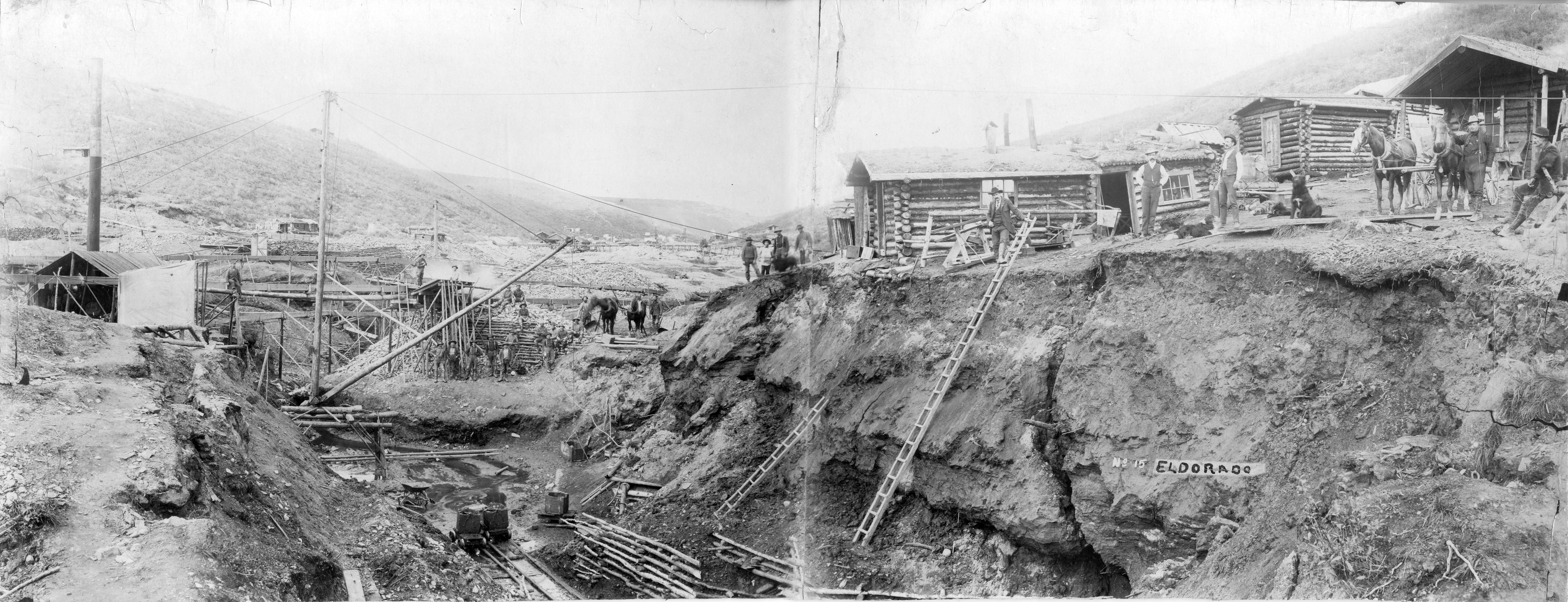
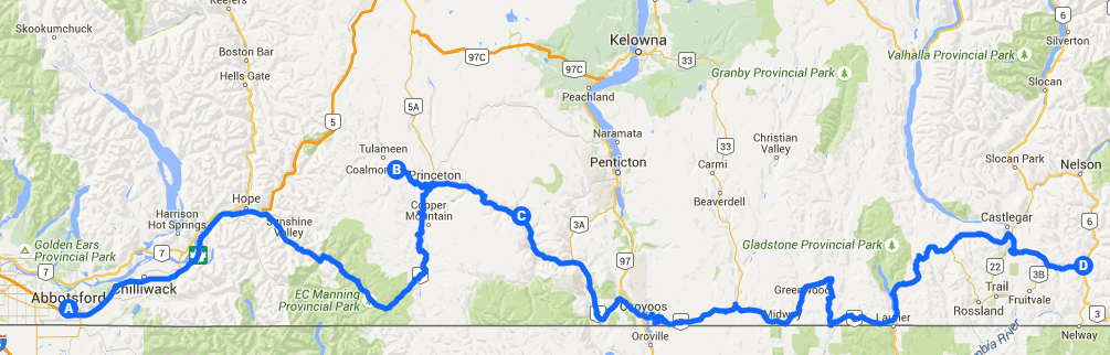
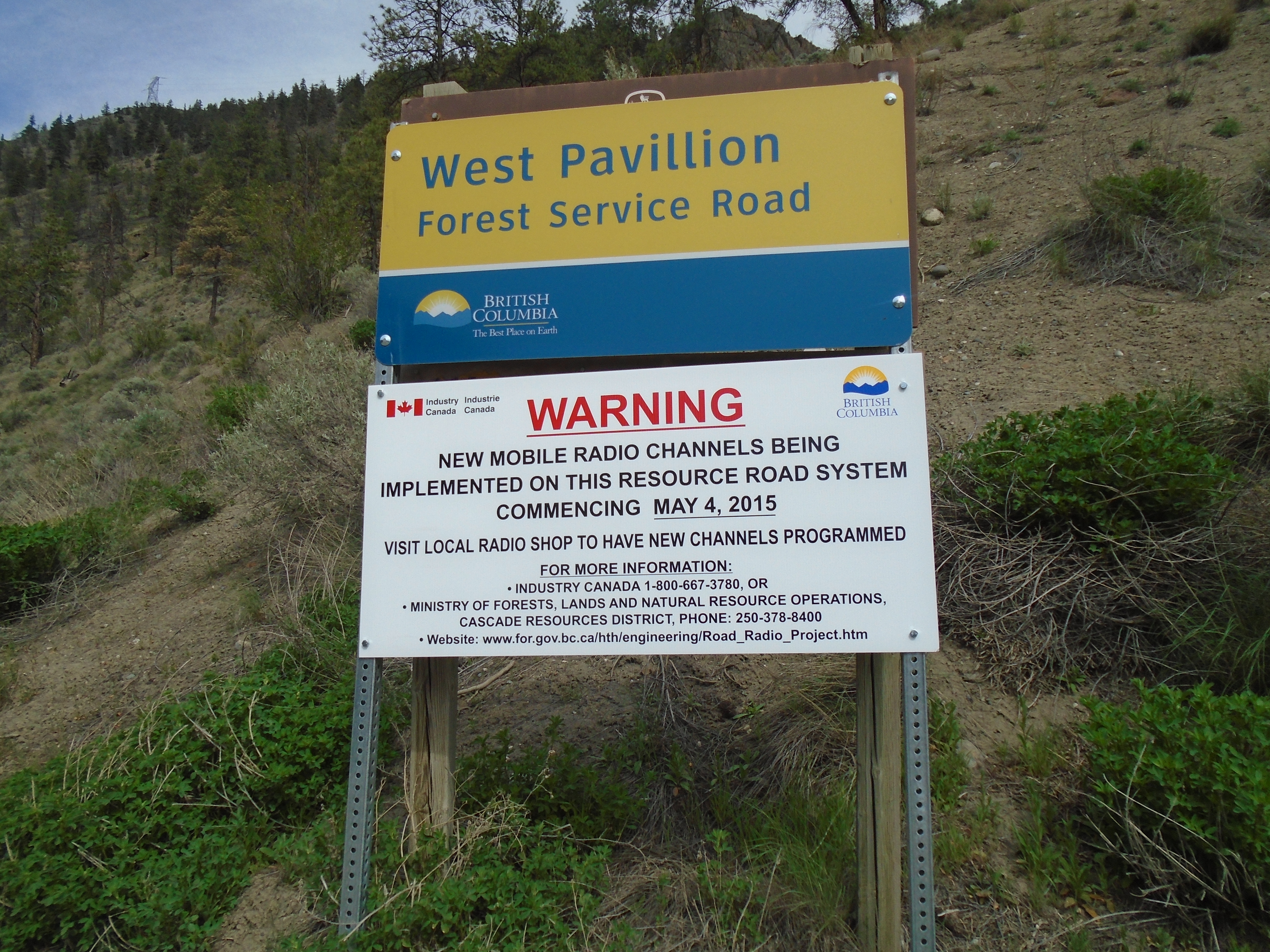
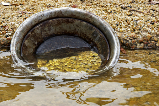
Placer gold mining has been practiced for thousands of years with evidence dating back as far as 2600 BC in ancient Sumeria and Egypt.  The technology required is minimal with only a gold pan you can refine gold in a placer deposit.  The word “placer” comes from the spanish word meaning “pleasure”.  Perhaps an allusion to the delight of finding precious metal in a river bank.  The word was spread as gold bearing gravels were discovered in parts of North America colonized by Spain.  In fact the discovery of gold the primary motivation for Spanish explorers to dig deeper and deeper into the newly discovered continent.

Big Al Jig

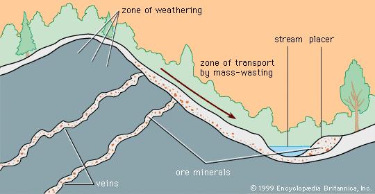
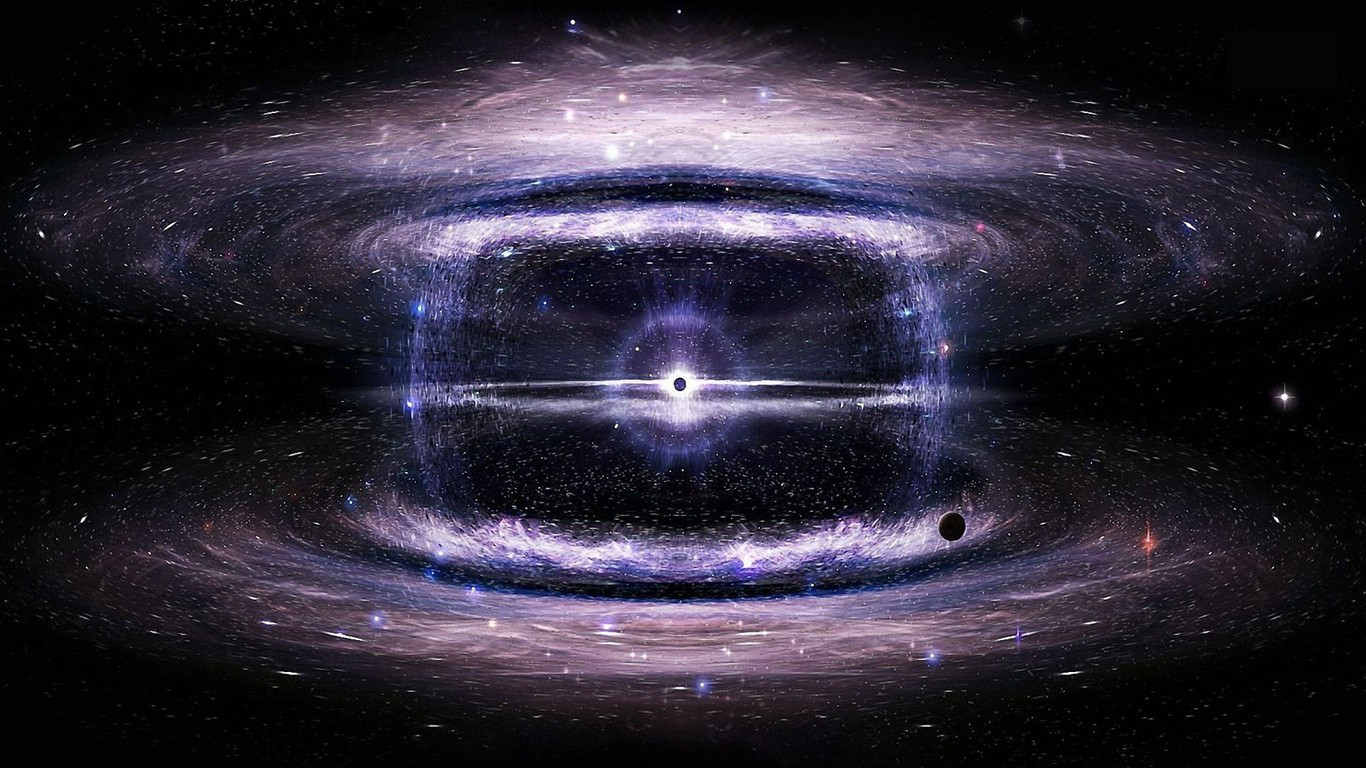
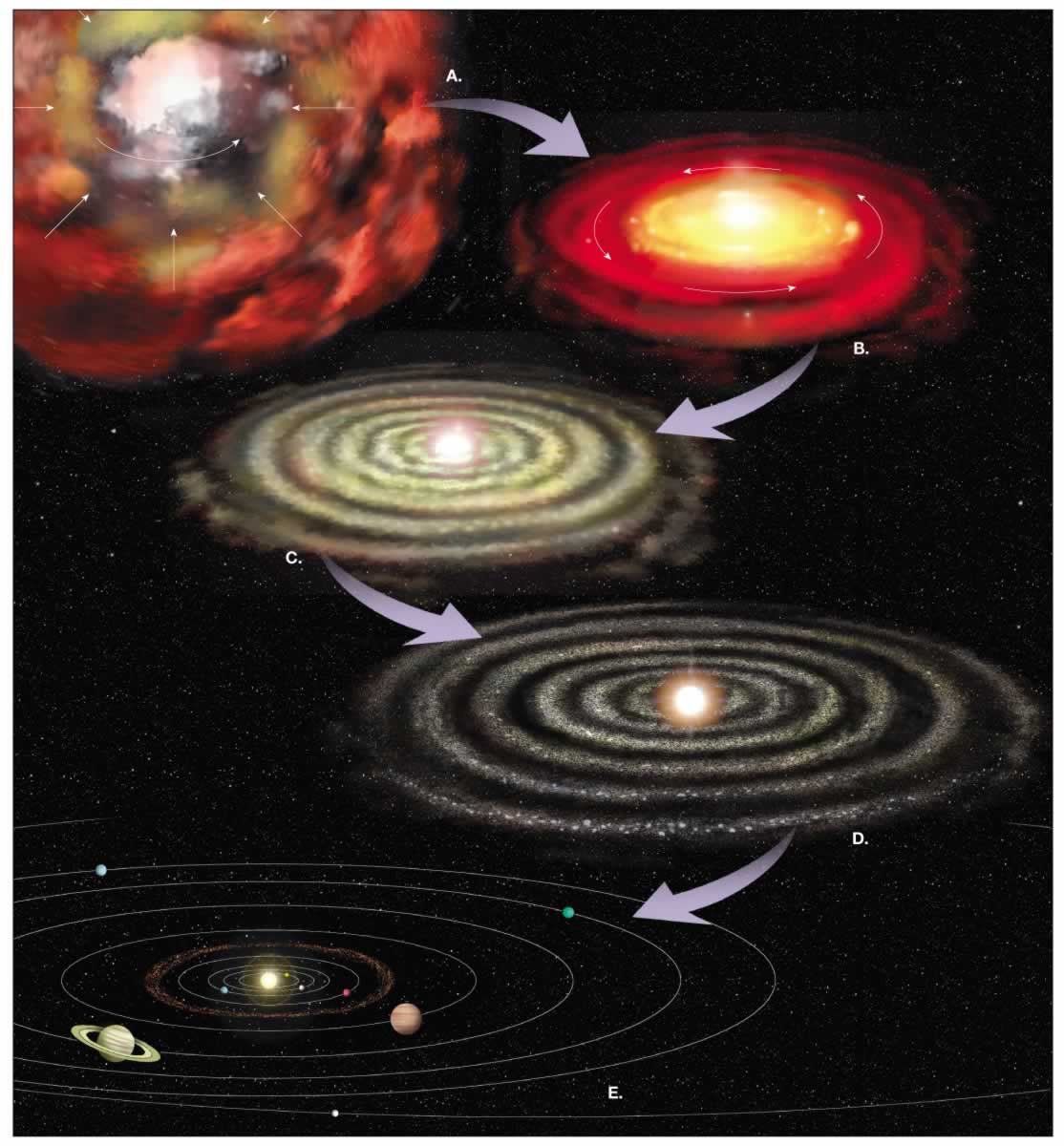
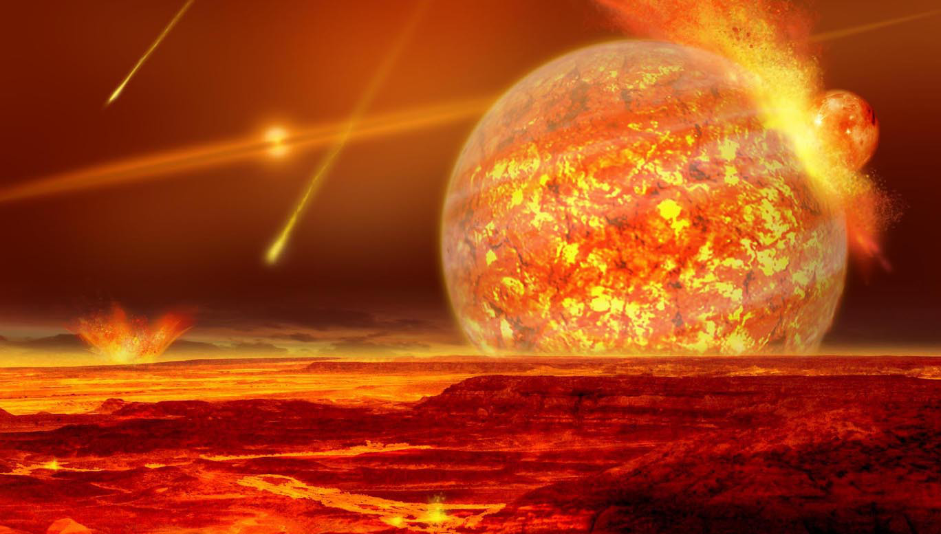
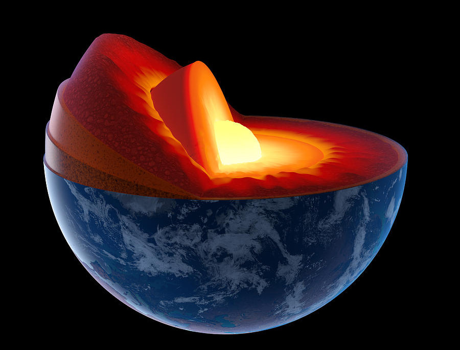
As we discussed in the part 1 and part2 gold is created in fantastic cosmic explosions.  It has traveled across the universe and made up a small part of the material that the earth formed from.  Tectonic and volcanic forces collected gold in concentrated lode deposits where it can be mined.  The concept of how gold transfers from lode deposits to placer deposits is pretty straightforward.  Rock holding the gold bearing veins or ore is slowly chiseled and broken by weathering and erosion.  The erosive forces of water, wind, and ice transport rock fragments into drainage systems such as streams and rivers.  Gold and other heavy minerals will settle out in areas in the stream where the water loses momentum or creates a trap.  These traps form into placer deposits over time.

Erosion

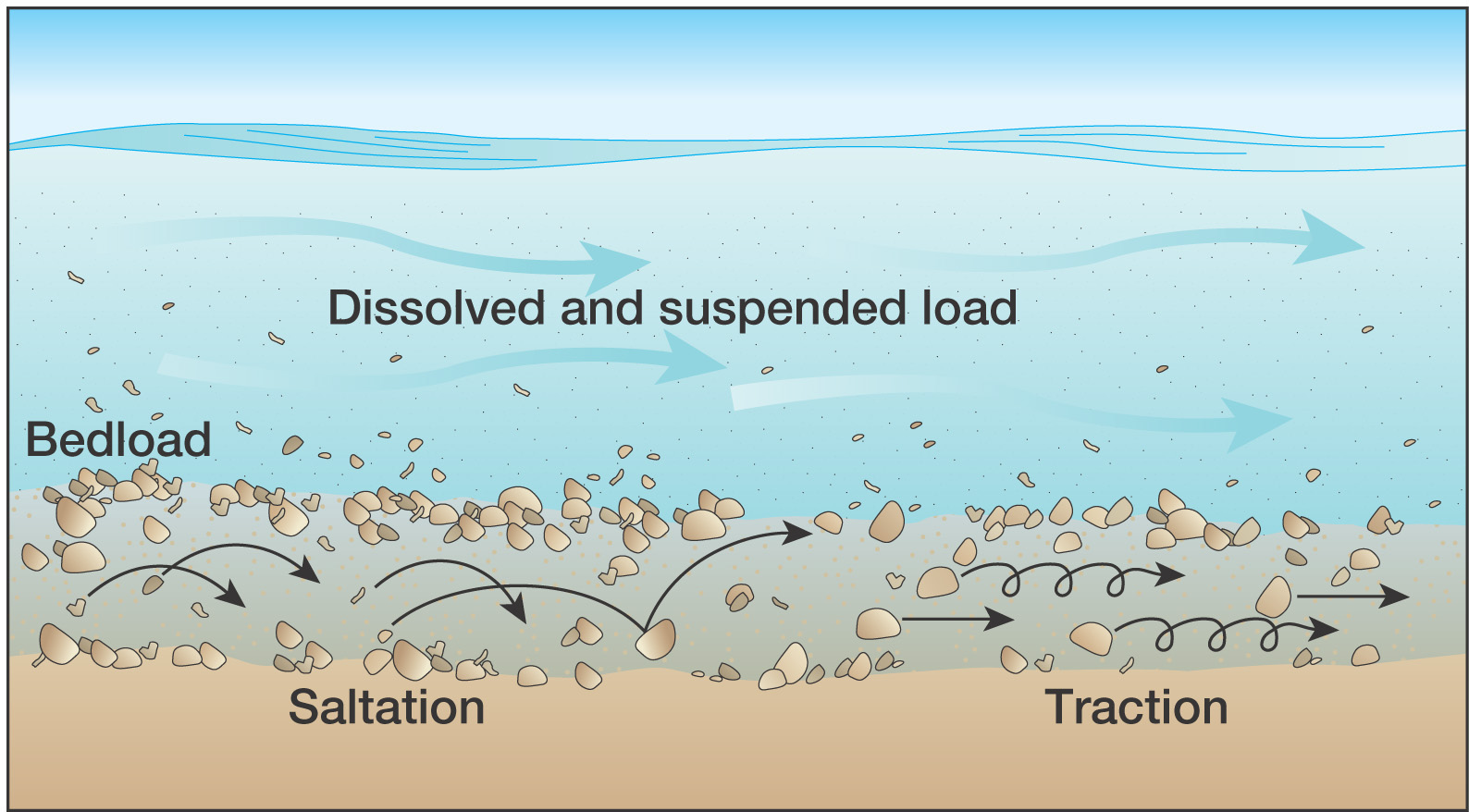
Placer deposition is driven by gravity.  Gold is very dense, meaning that compared to another substance of the same volume it experiences a stronger pull of gravity.  There are other principles of physics that apply to placer deposition.  The property of inertia is the resistance of any physical object to any change in its state of motion.  Less dense objects require less force to move them and in the case of a stream will travel farther and faster than heavy objects.  Gold has a density that is twenty times that of water and about 8 times the density of sand.  Another factor in the formation of placer deposits is Archimedes’ principle which states that the force of buoyancy on an object is  equal to the weight of the displaced fluid.  This principle was historically used to measure density of gold by Archimedes himself.  As gold is many times more dense than water the force of buoyancy on submerged gold particles is much less than the force of gravity.  So gold in a stream is held in place by gravity and resists movement due to its weak buoyancy and strong inertia.
Nuggets

There are several types of placer deposits.  There are alluvial placers, eluvial placers, beach placers, eloian placers and paleo-placers.  For each type of deposit there are miners who specialize in that type of deposit.  All placer deposits have concentrated gold from its source in some kind of trap.  The vast majority of the placer gold that is mined in the world is of the alluvial variety.

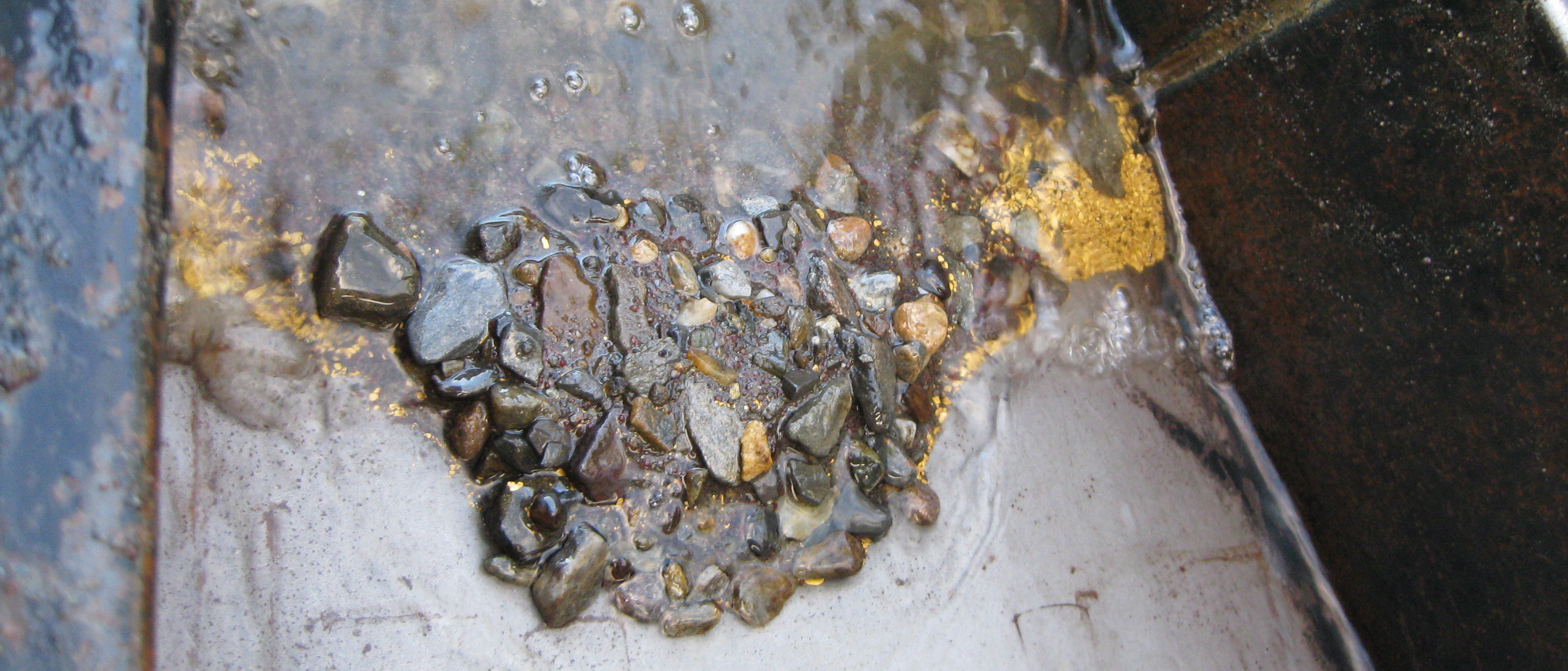
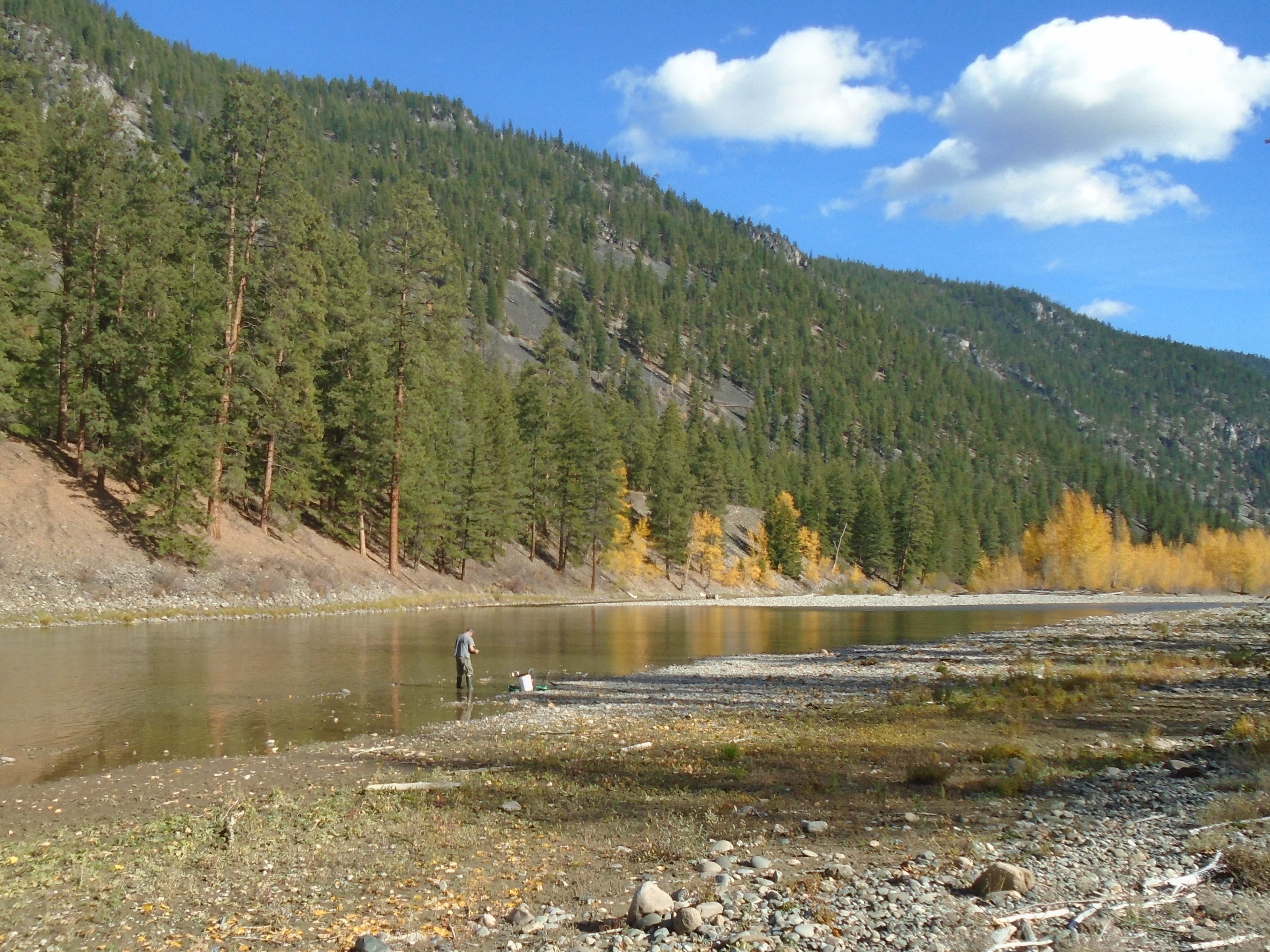
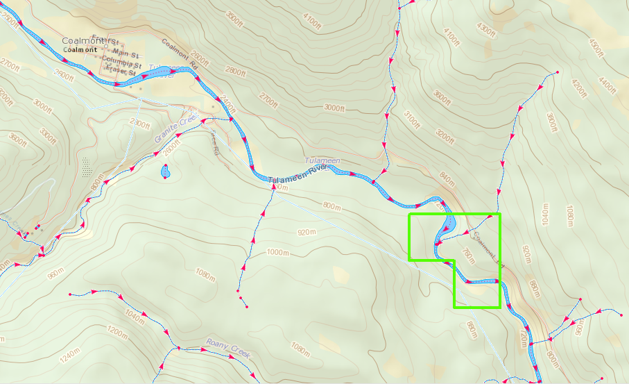
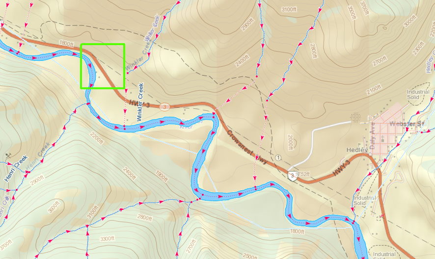
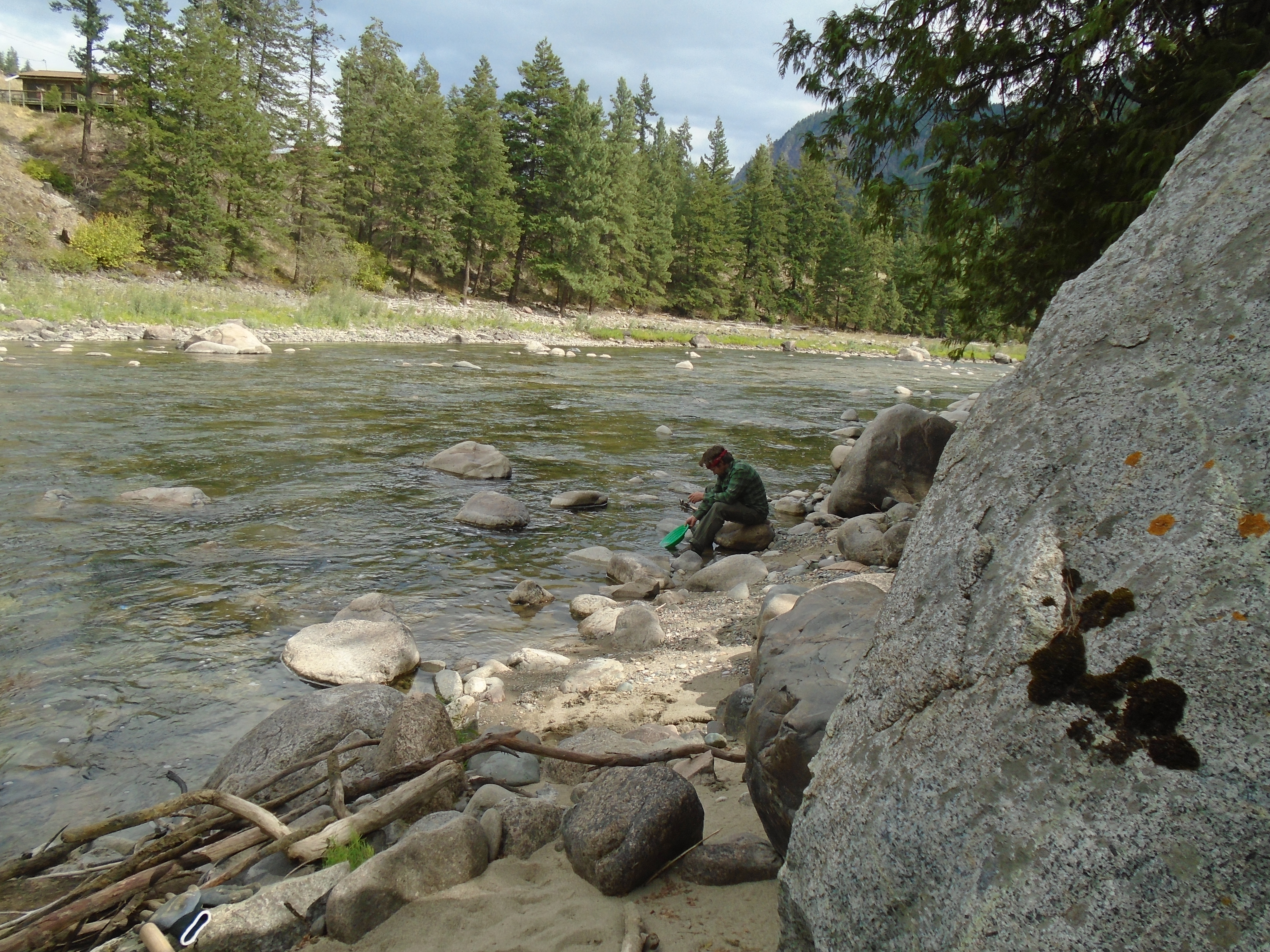
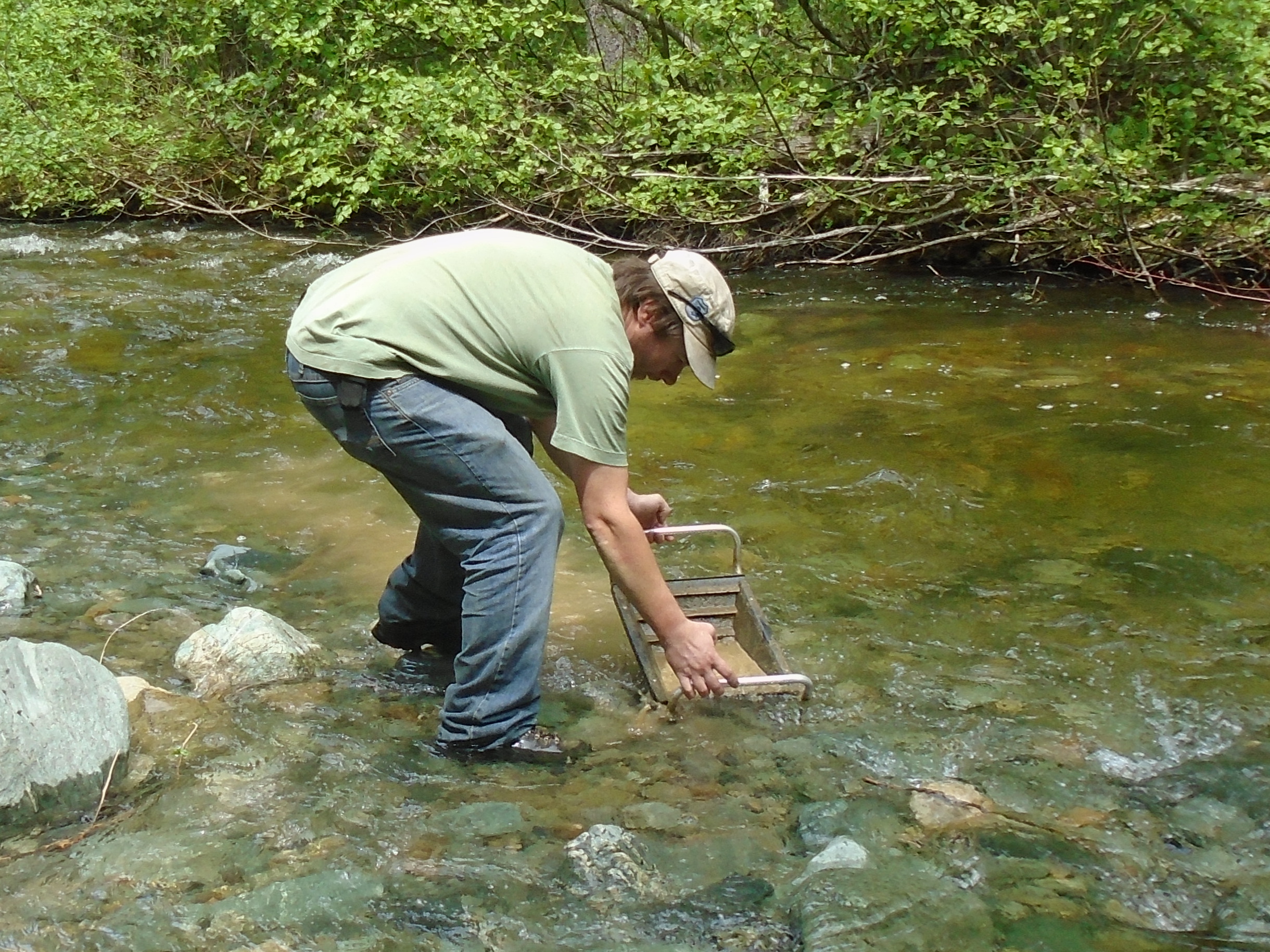
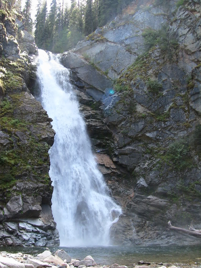
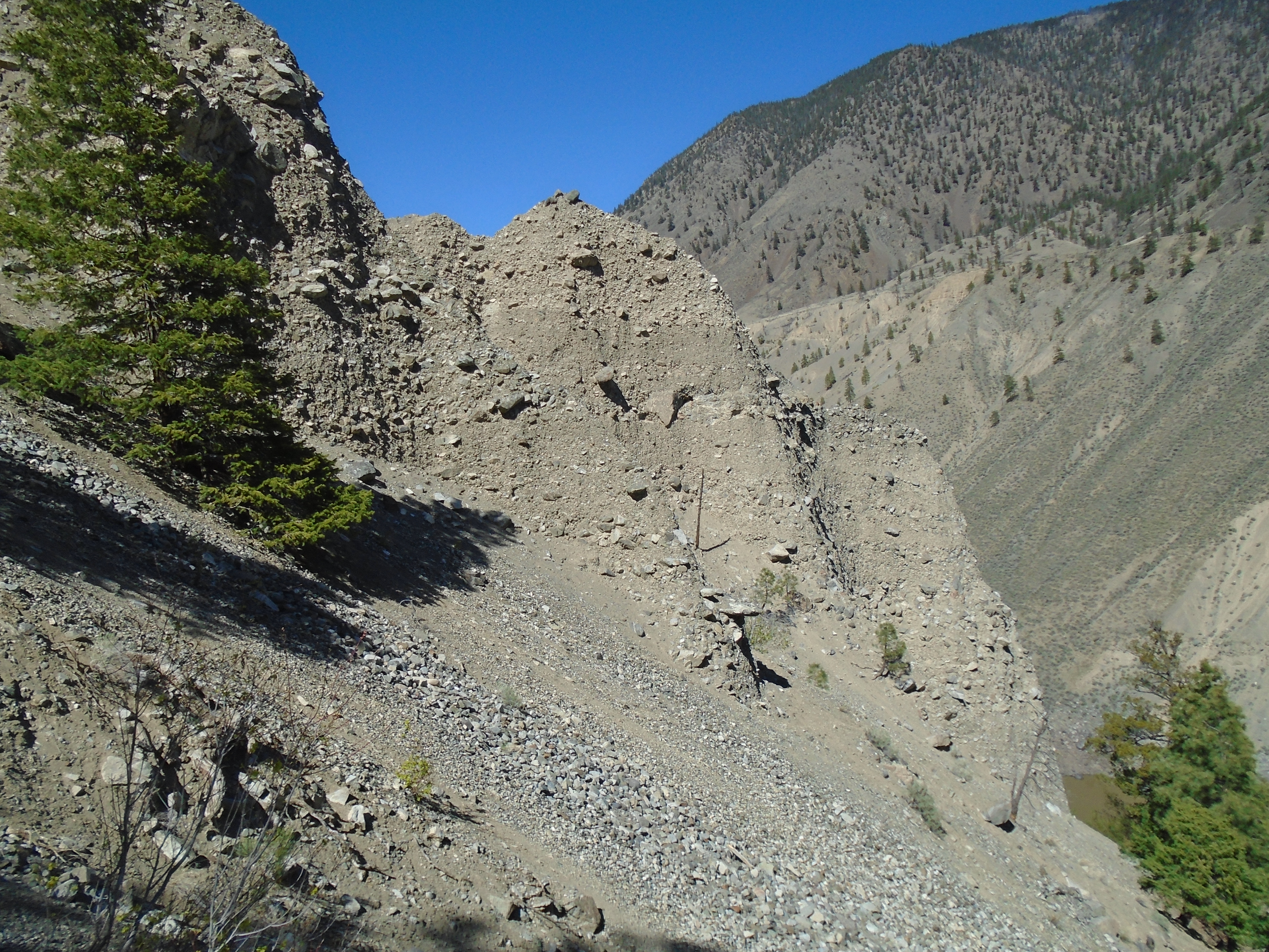
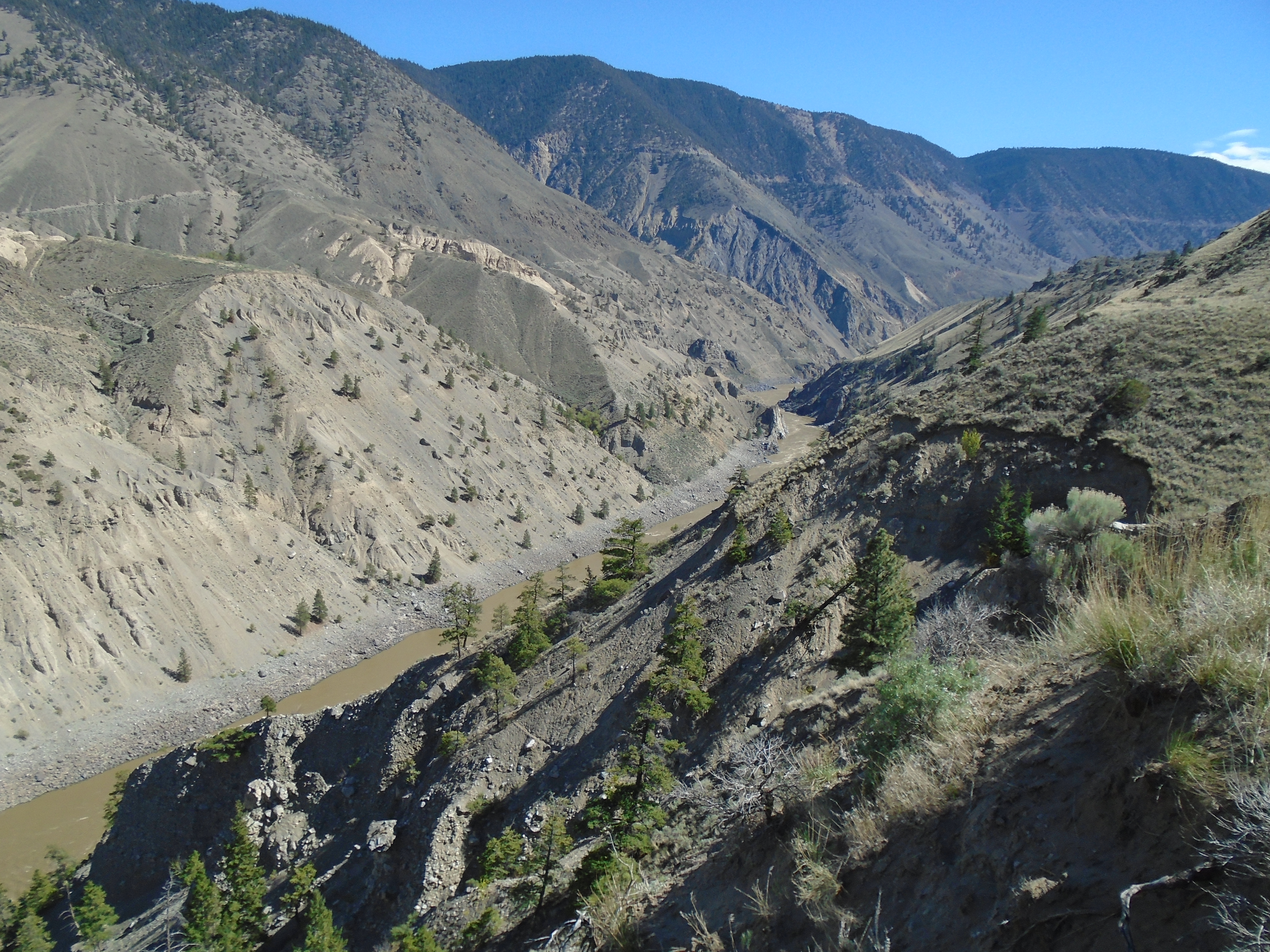
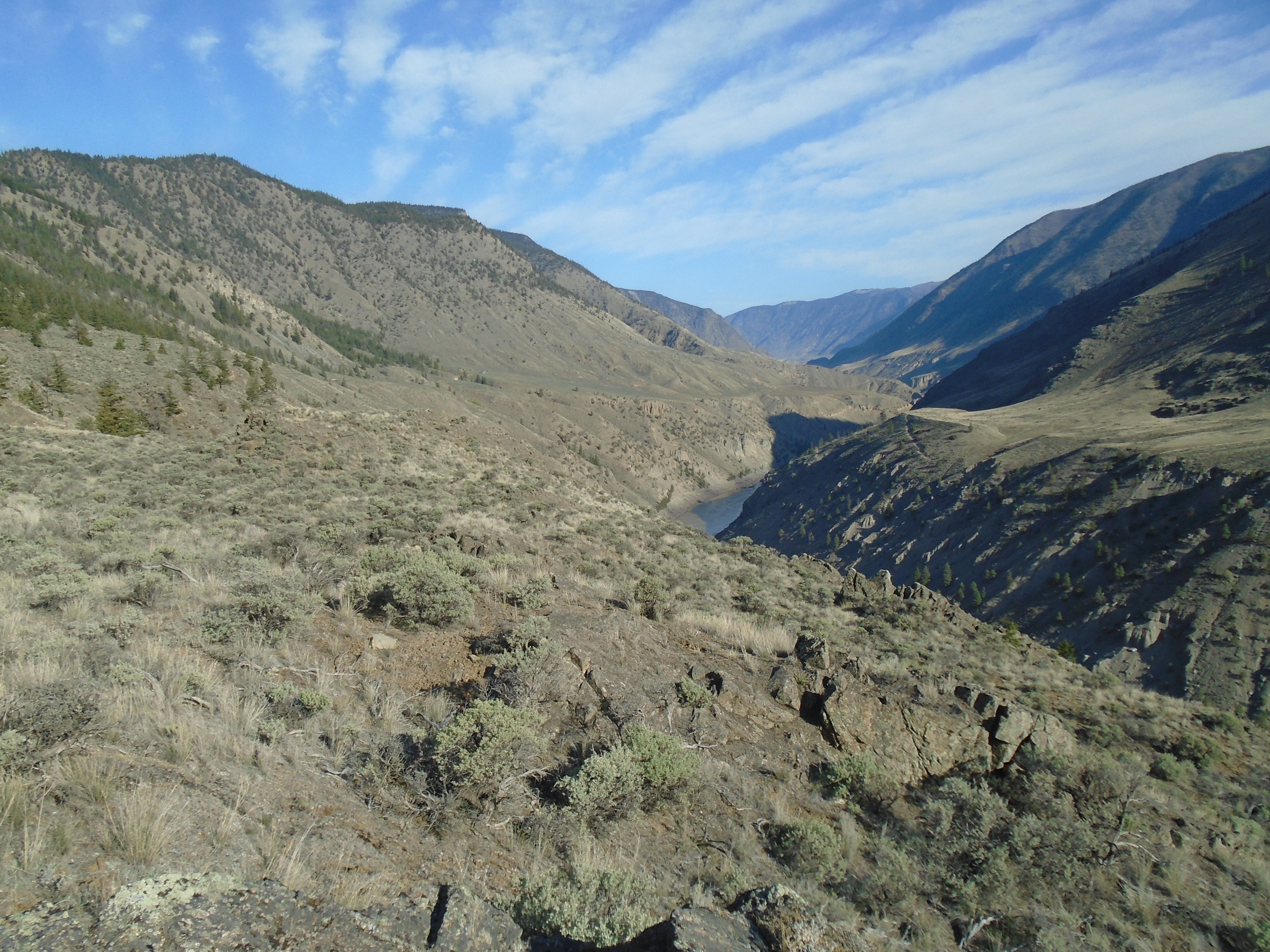
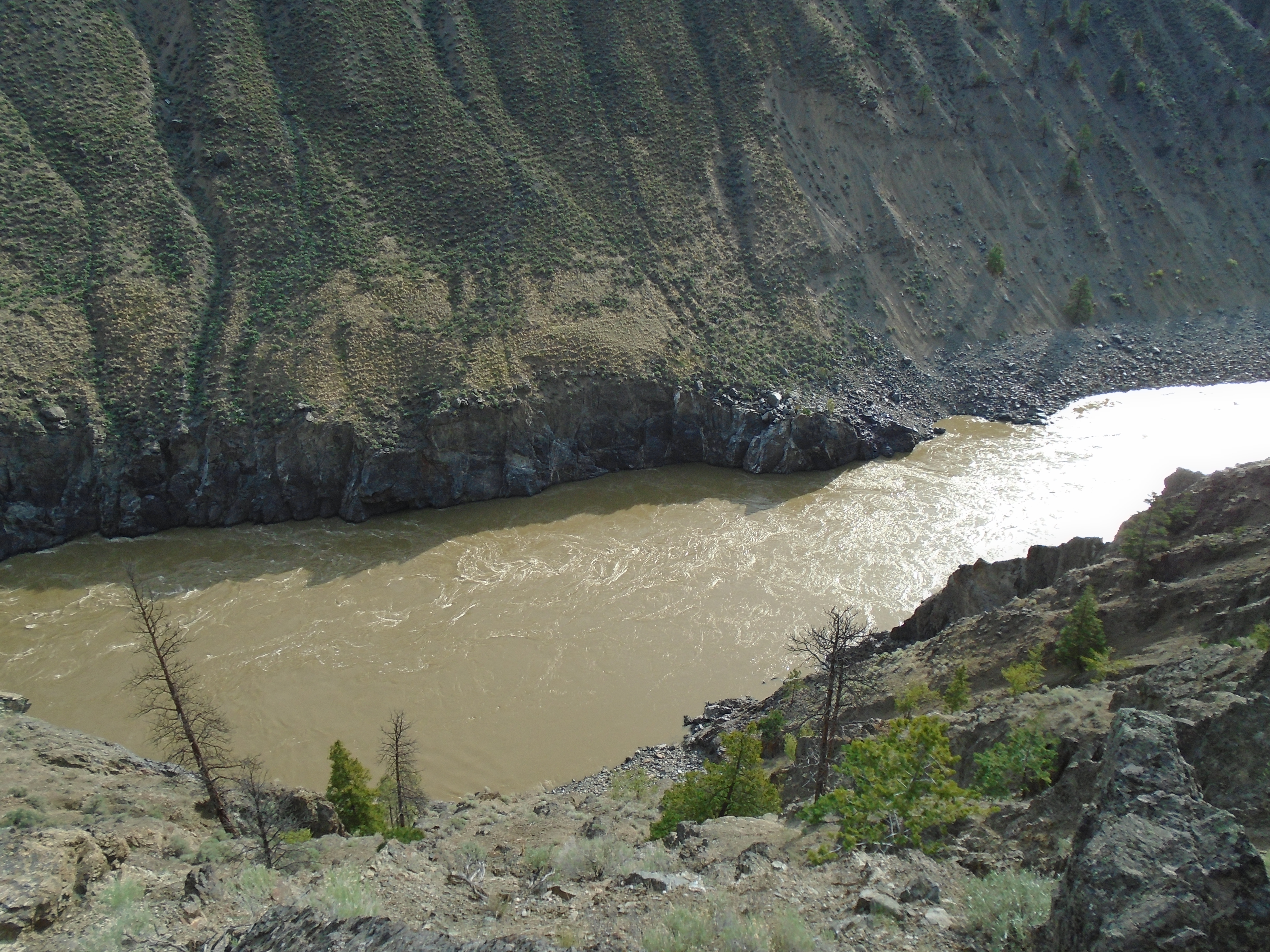
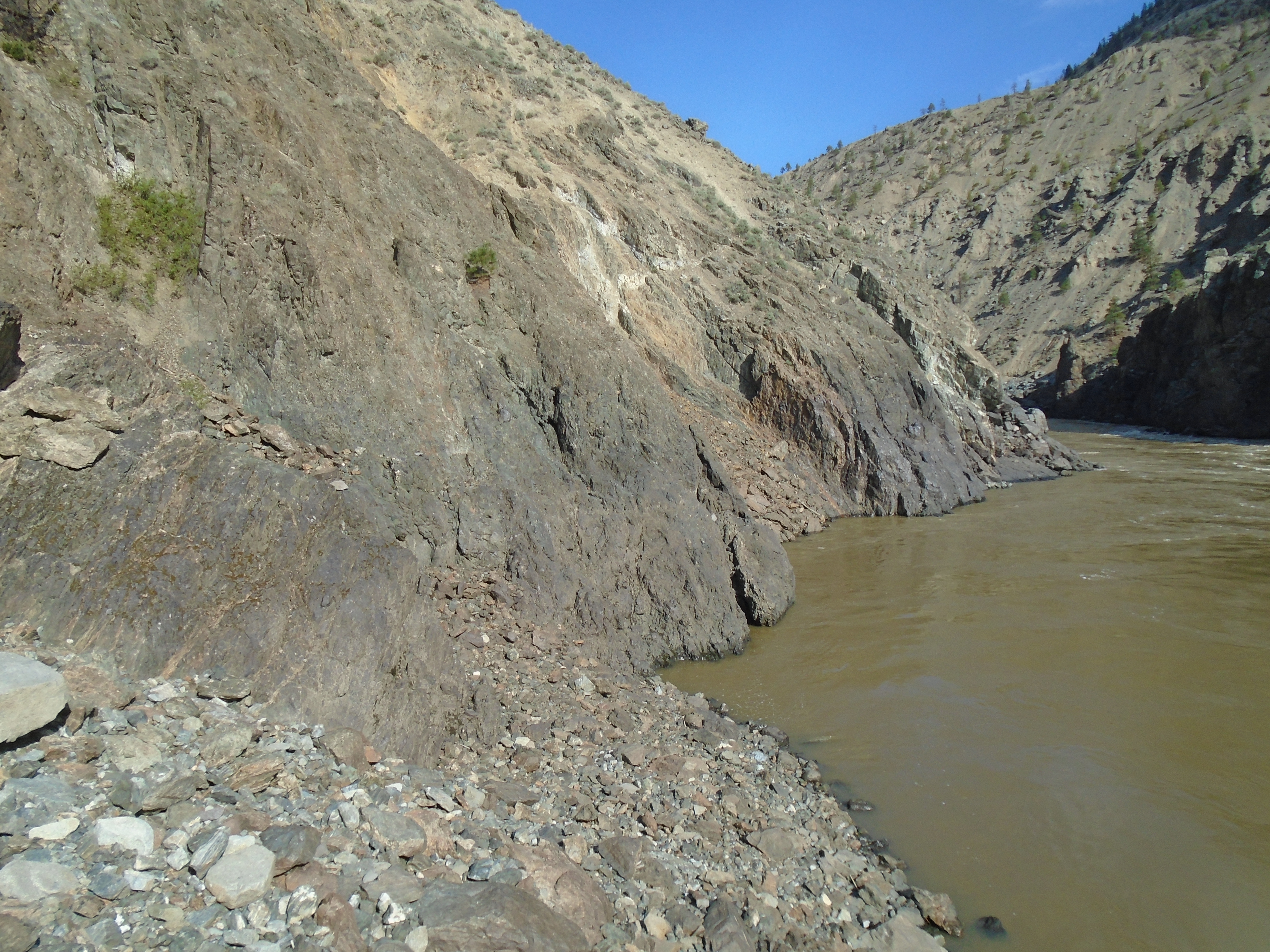
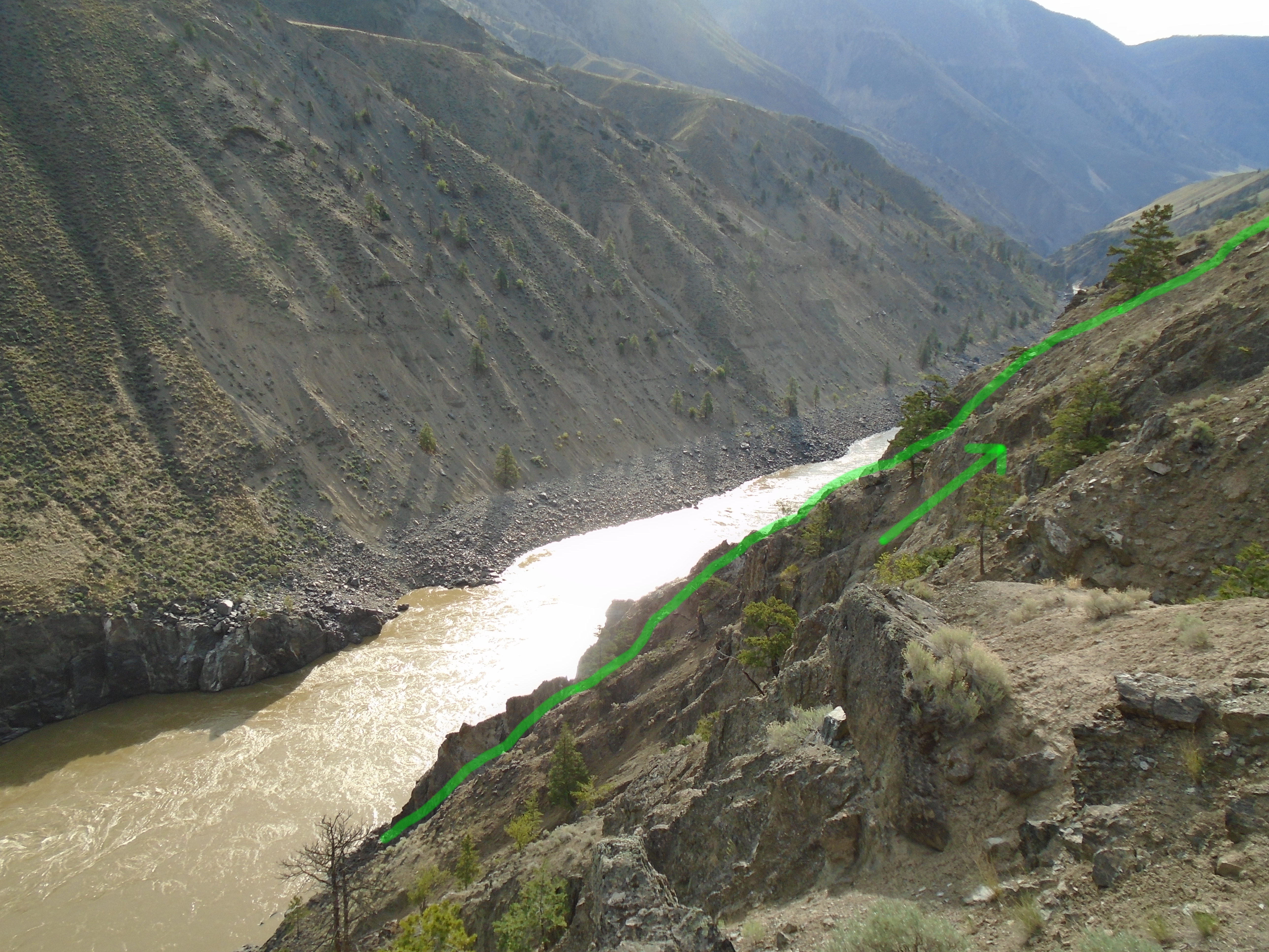
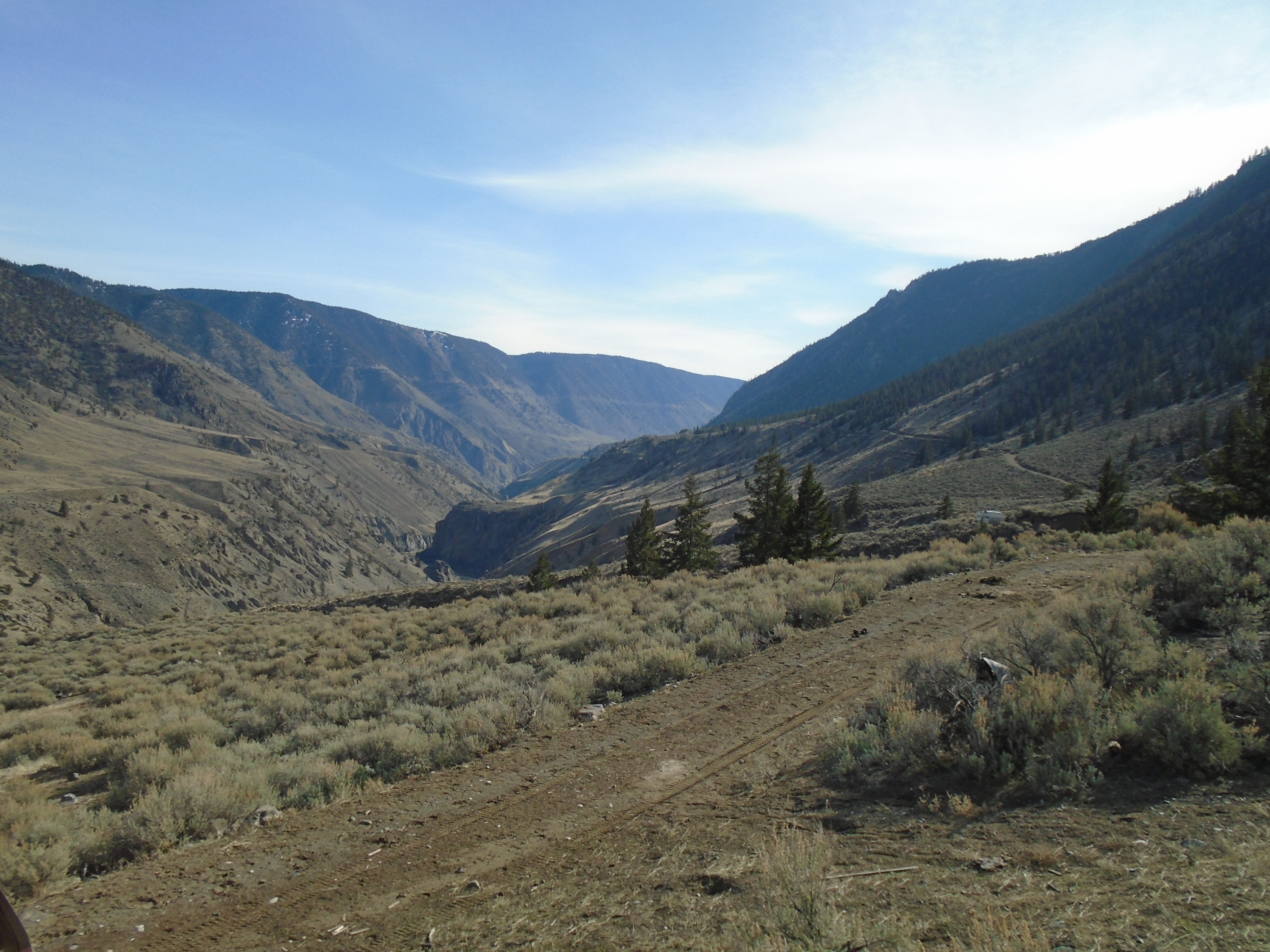
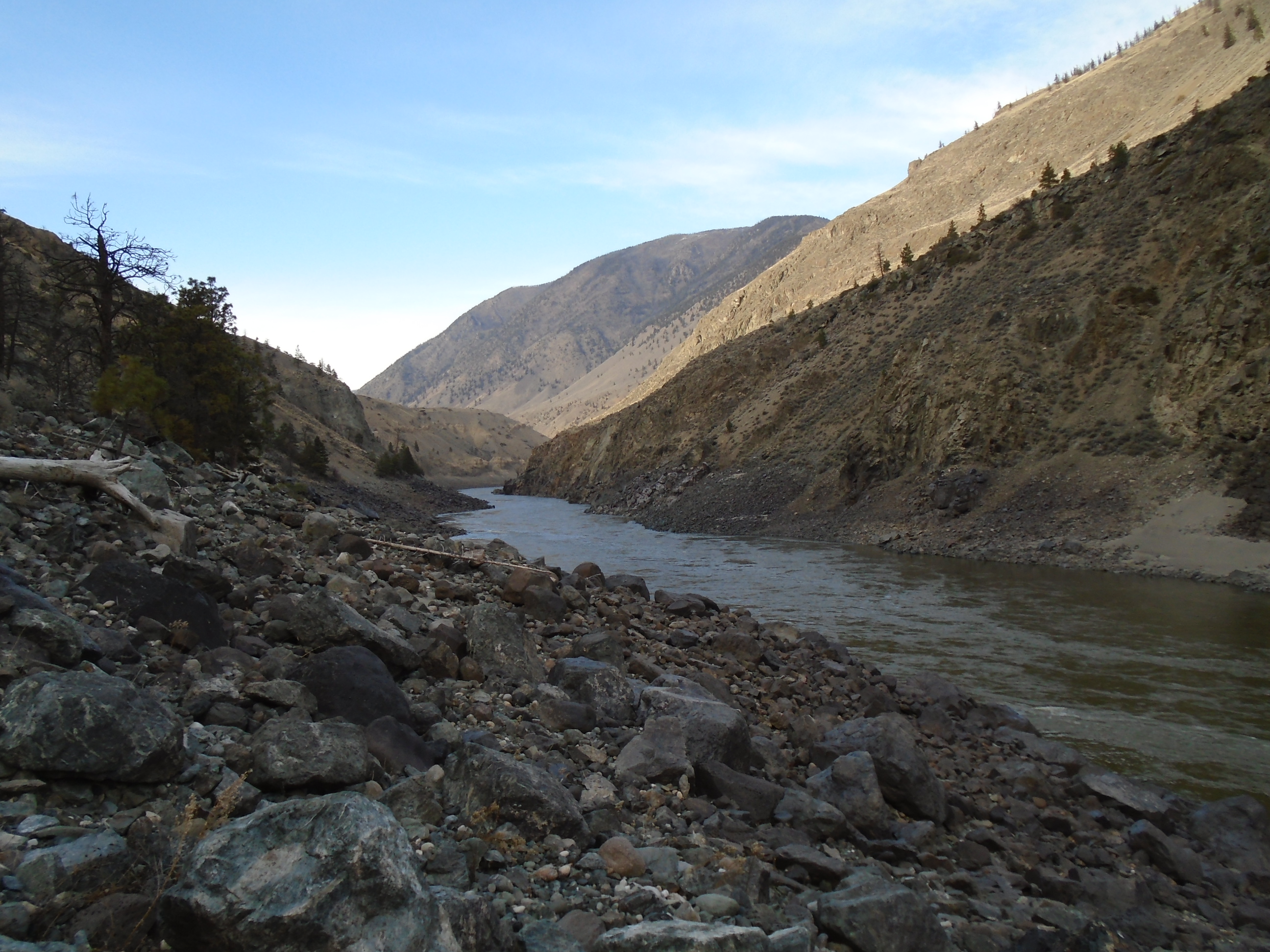
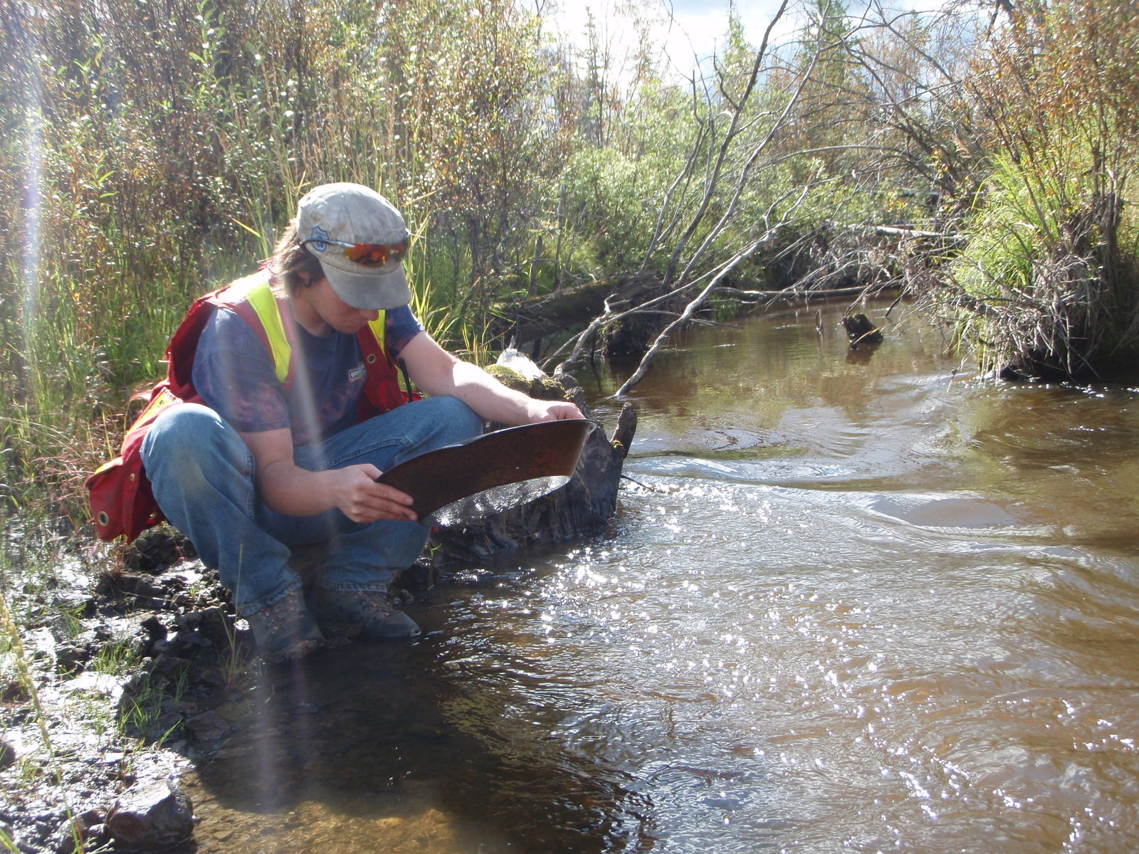
Alluvial placer deposits are formed in watercourses such as creeks, rivers, streams and deltas.  The gold is eroded from lode deposits and carried into the watercourse through rains and melt.  Once into a stream it can be moved great distances.  Gold does not move easily in a stream due to the inertia and buoyancy forces described above.  It takes many years for gold to make its way into a stream and to travel within it.  The gold will move along the bottom of the stream until it reaches a point where the water loses velocity or it is physically trapped.  Typically gold will accumulate on the inside bends of a river where the water velocity is lower.  Large rocks or outcrops can create a natural riffle or eddy where the water slows down and dense material will accumulate.  Waterfalls are another great trap for gold.

Alluvial placers can be broken into several groups.  Flood gold is placer gold that moves during annual floods or other flood events.  Gravel bars and upper sections of stream sediment are where flood gold is usually found.  This type of deposit generally consists of small flake and flour gold since they move more rapidly than nuggets.  Flood gold is actively being deposited and will replenish year after year

StreamSediment

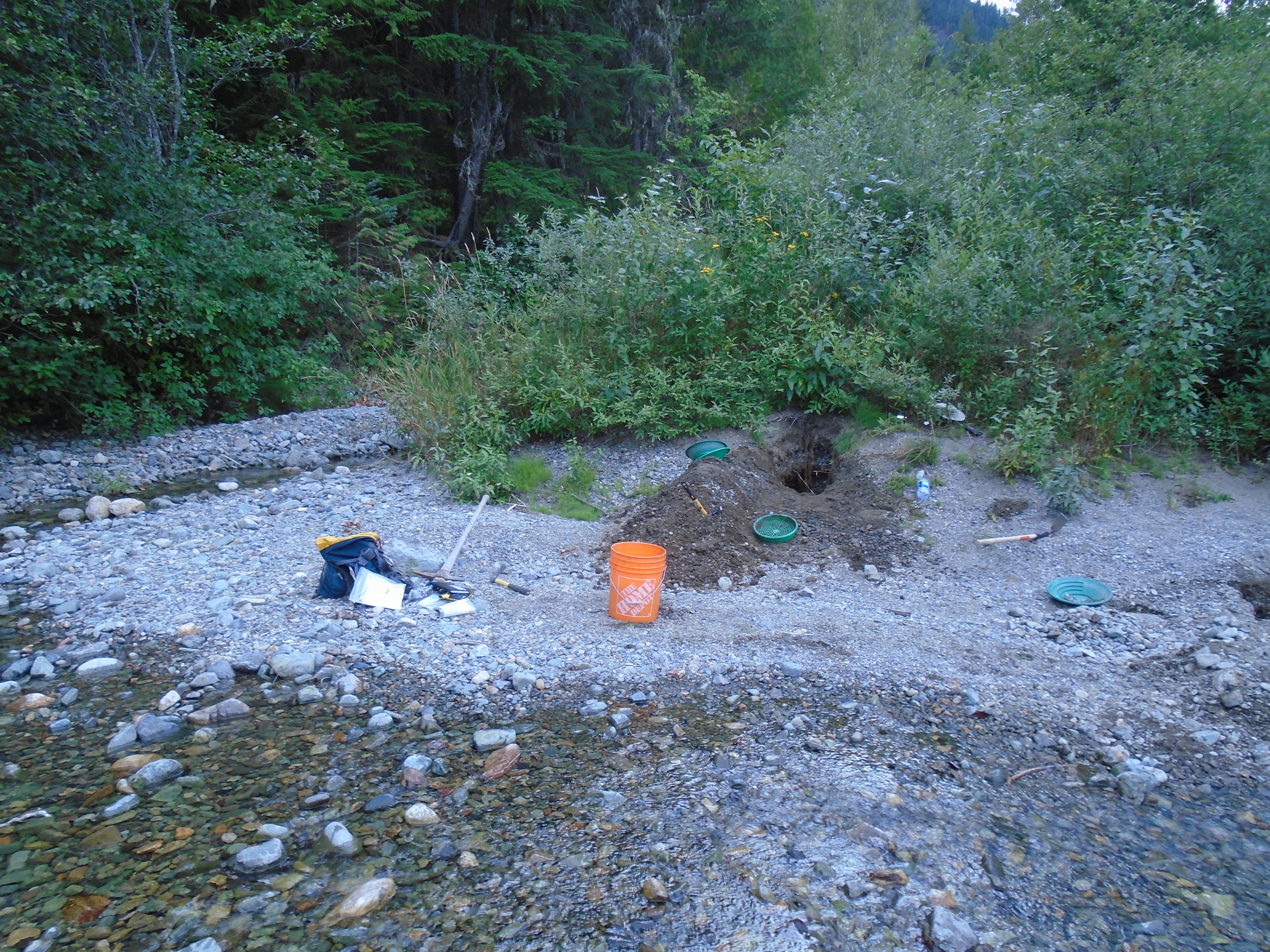
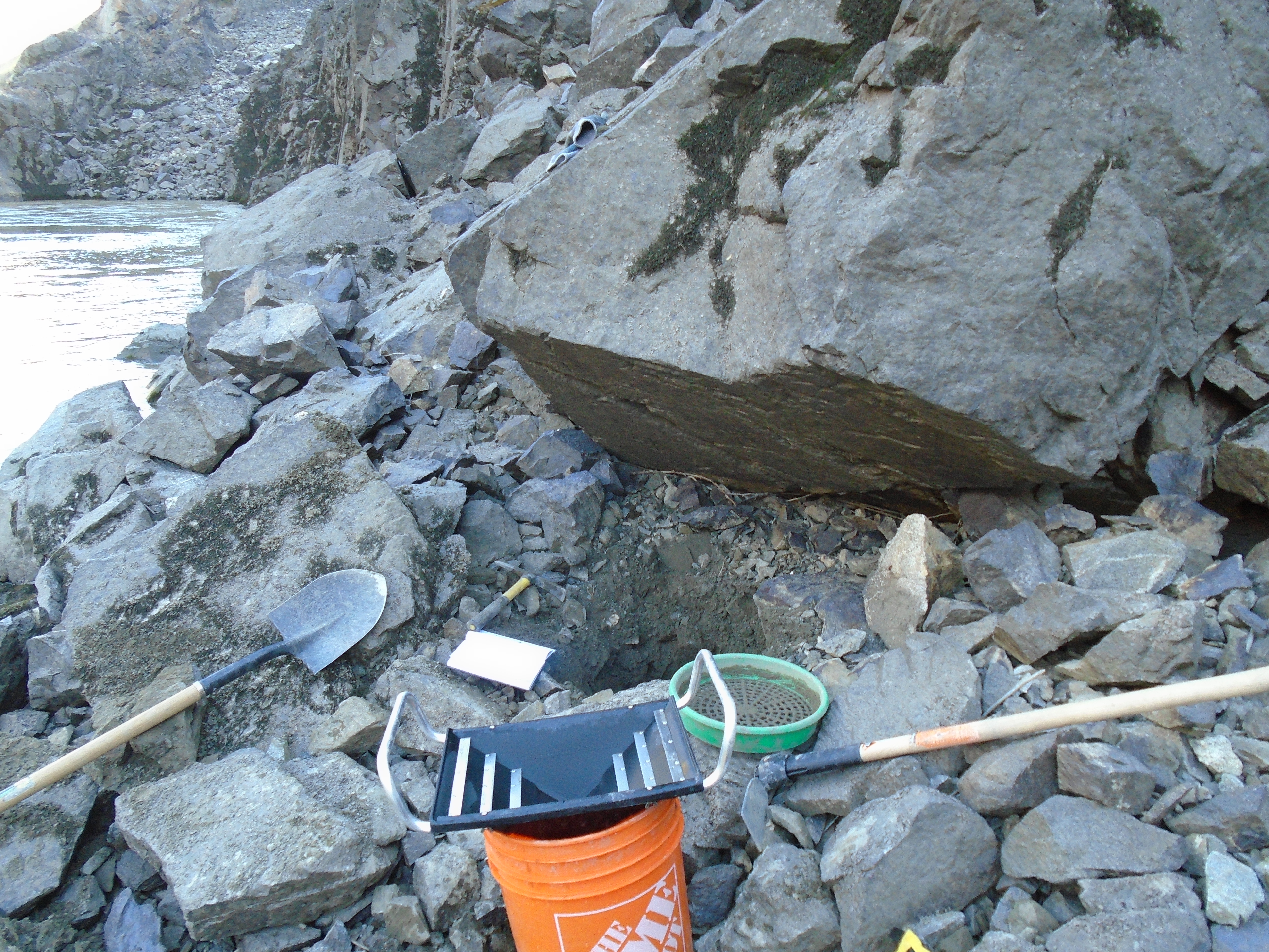
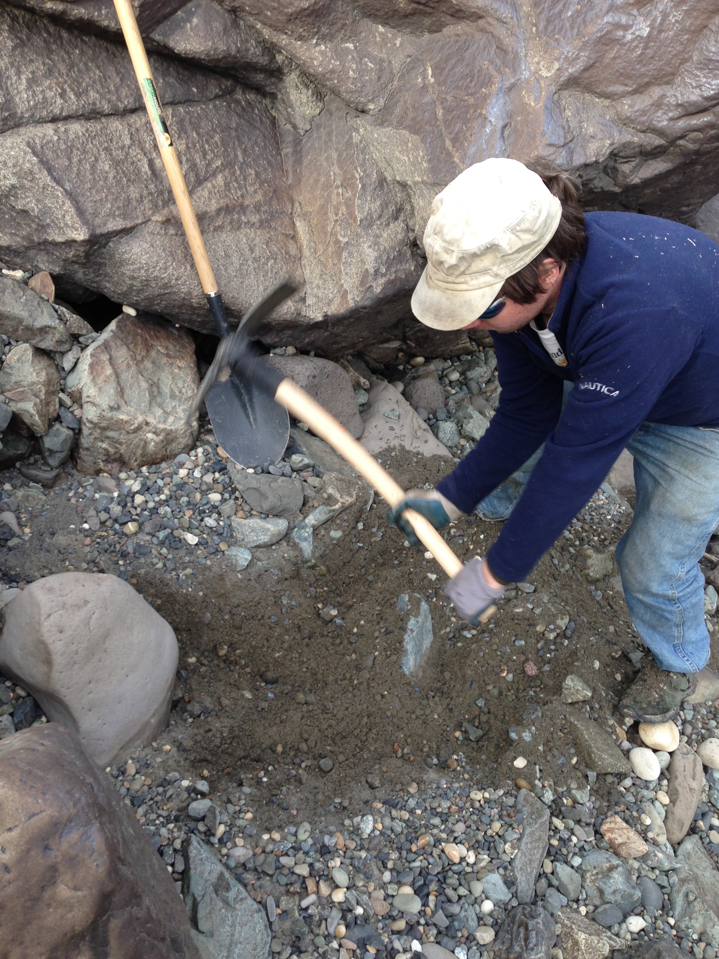
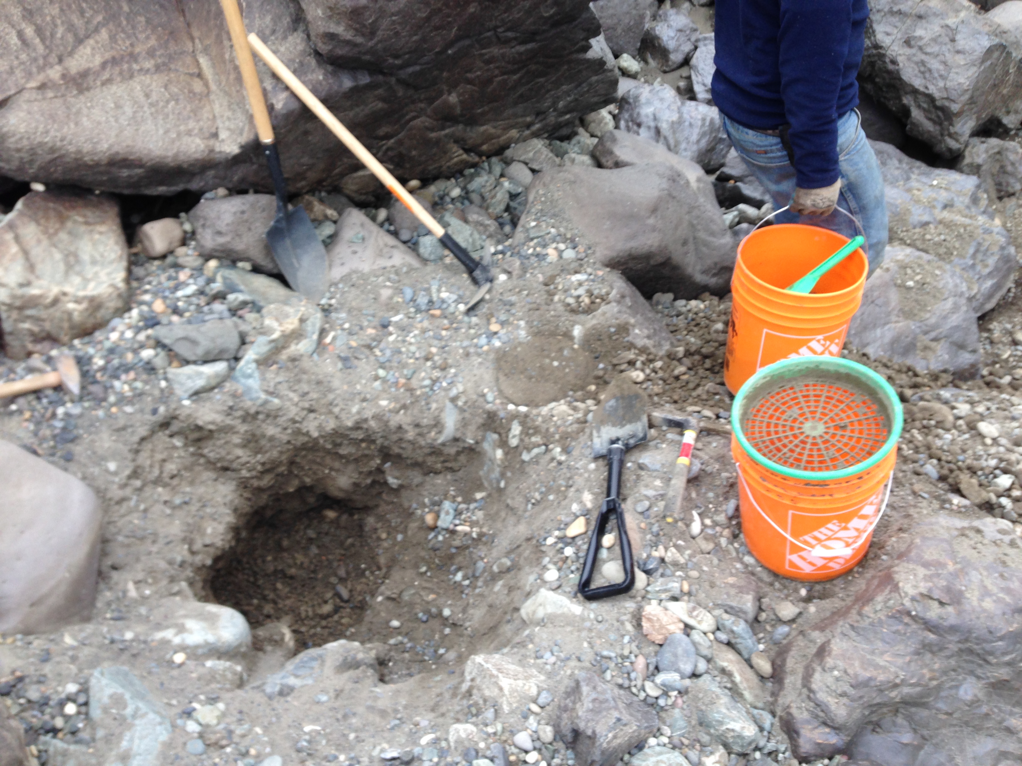
Streambed placer deposits are essentially the same as flood deposits except that they no longer move.  Streambed placers are found in a current watercourse.  These deposits typically consist of gravel that is settled in the stream bed.  To produce a streambed placer you have to mine under the water.  Techniques that can be used are sniping, suction dredge, or diverting the water using a dam such as a wing dam.

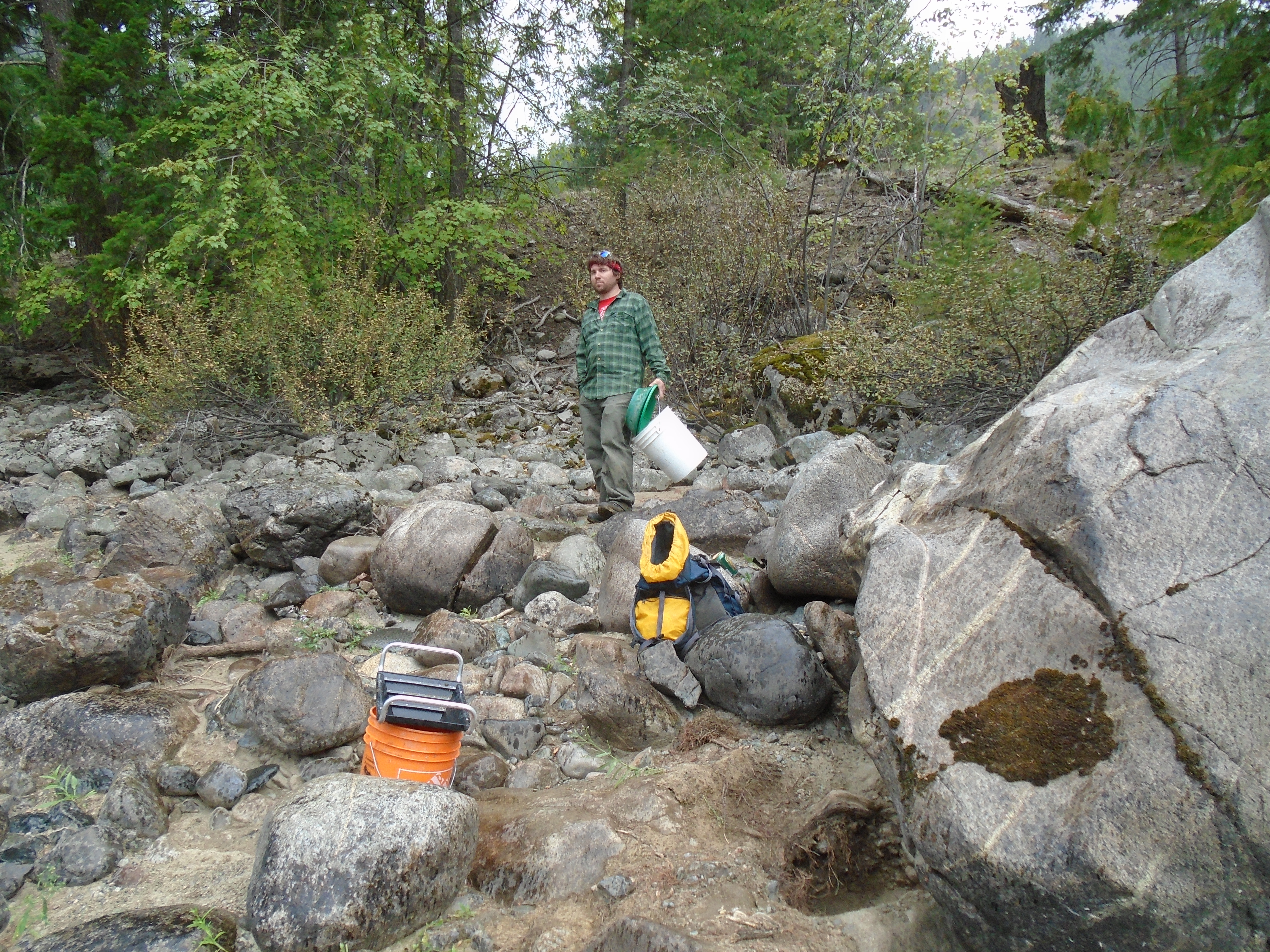
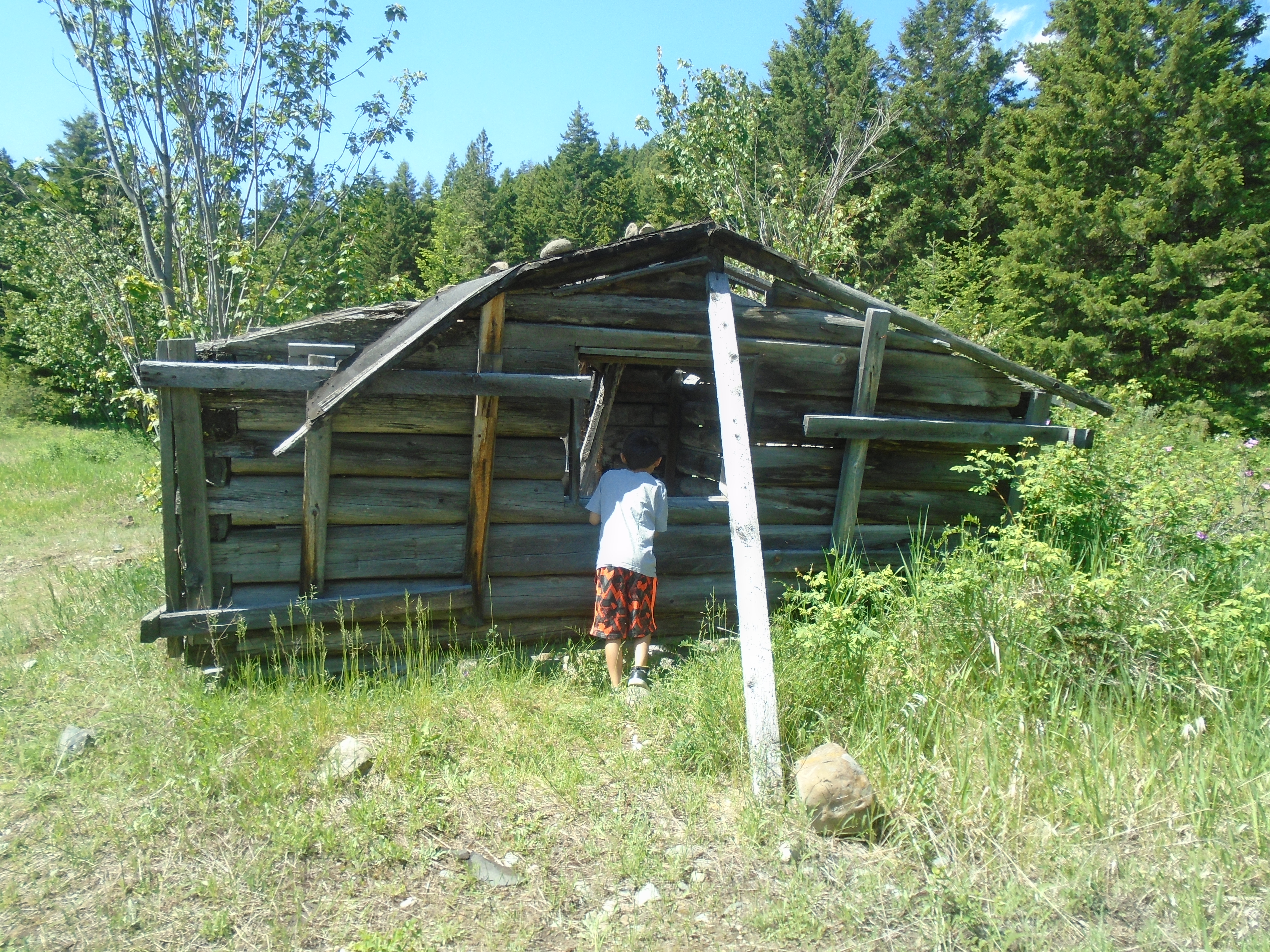
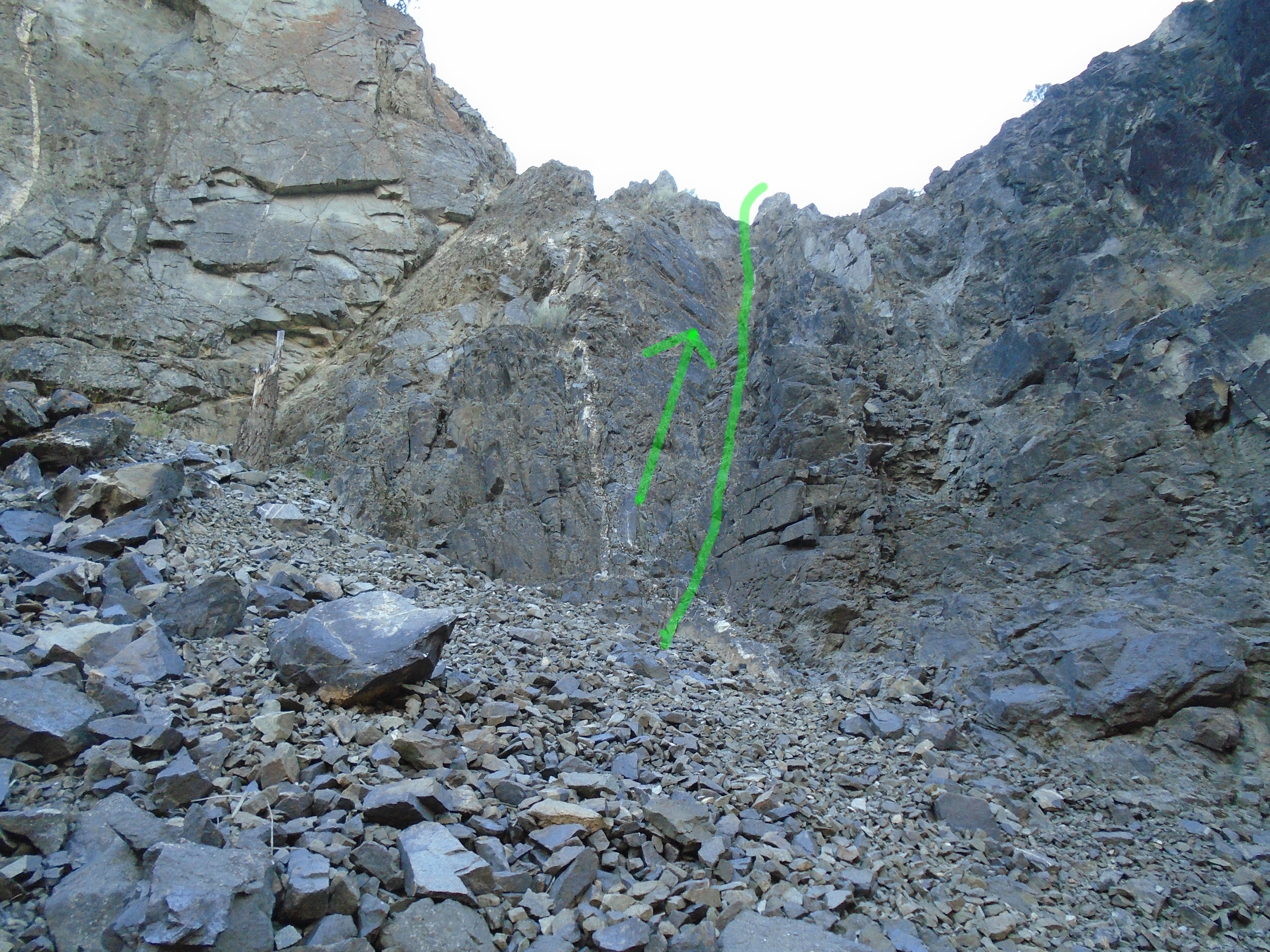
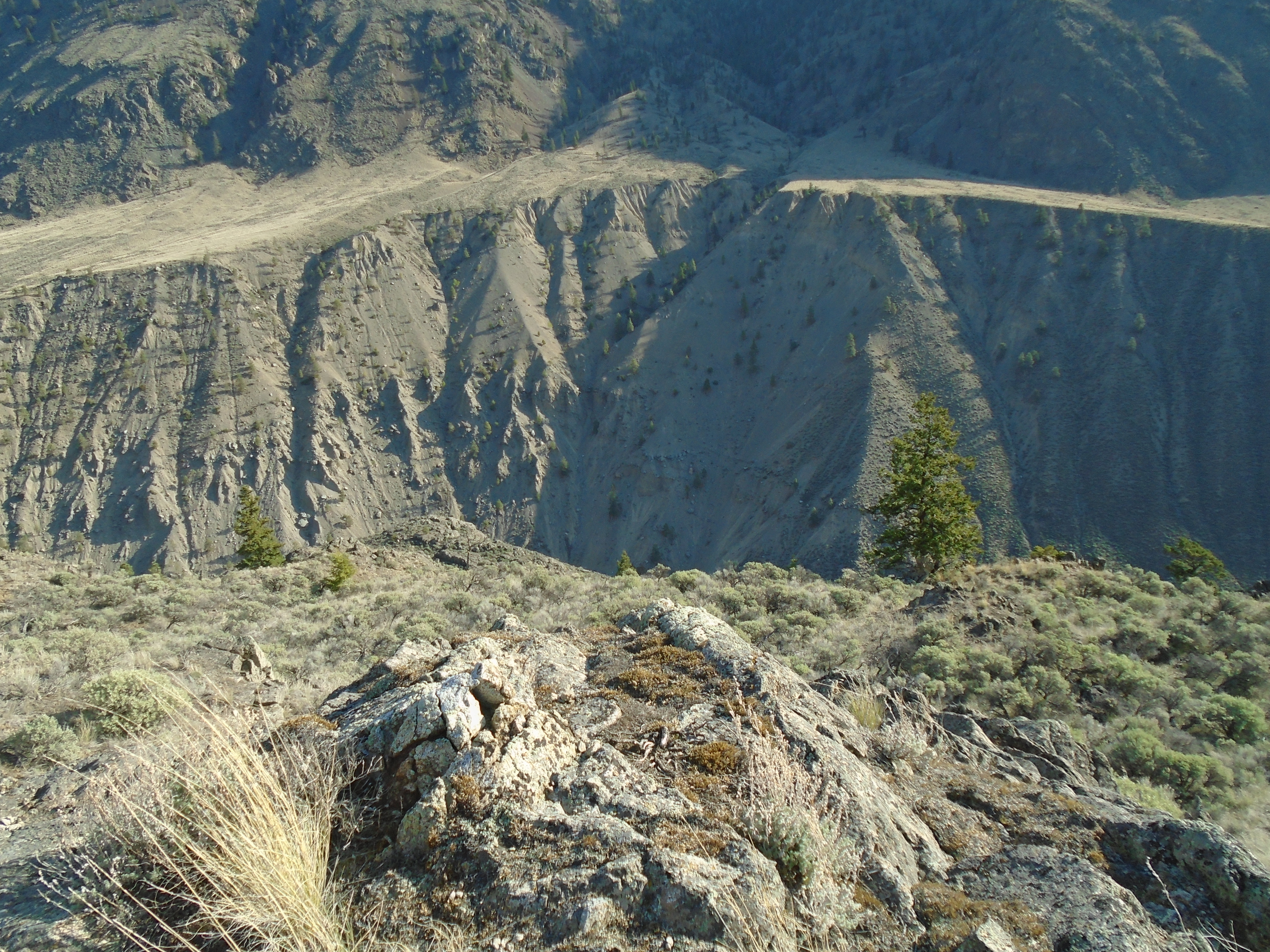
The third type of alluvial placer deposit is a bench placer.  Bench deposits are part of the old stream bed before it cut into a deeper channel.  Benches can contain huge amounts of gold if the river carried gold at that time.  A bench is typically flat on top and may appear like steps coming down the valley side.  Benches can be mined using conventional mining equipment since they are usually high and dry above the current river.

OldSchool

Eluvial placer also known as residual placer deposits are formed before any water transportation has taken place.  These deposits form close the source of hard rock gold.  Eluvial placers will contain much large particles of gold than other types because it takes a lot of energy to move large nuggets.  Often quartz will be found with gold still attached in Eluvial placers.  These types of placers are formed by weathering and decay of the host rock that holds gold.  Areas where there is a lot of iron can break down rapidly as the iron oxidizes.  The lighter overburden is generally washed away and unsorted gravel and heavy material is left in place.  These deposits are generally small and very attractive to small miners they also are close to gold bearing veins which can be very exciting.

Beach placers are deposits that occur on the edges of large lakes or the ocean.  The wave action on the beach is the mechanism that concentrates gold and other dense minerals.  Gold can either be carried to the beach by an alluvial system or eroded directly by waves.  A famous beach placer is the deposit in Nome, Alaska which is featured in the TV reality show “Bering Sea Gold”.

CreepSaltSusp

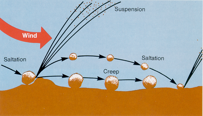
Eolian placers form in areas where wind is the main mechanism of erosion and not water.  Eolian placers are similar to Eluvial placers in some ways, they occur close to the hard rock source, and are poorly sorted.  Wind does a terrible job of moving gold.  In Eolian placers the overburden is swept away by strong winds and leave the heavy ore behind.  They occur primarily in desert regions such as the arid regions of Australia.

The last type is paleo-placer deposits.  These are any of the above placer types that happened a long time ago.  By a long time we are talking about millions of years.  Paleo-placers were once placer deposits but over time they have been hidden and covered in sediment.  There is often no sign at the surface of ancient river systems below.  Paleo-placers can be ancient river channels, benches or sedimentary rock formed from old placers such as quartz pebble conglomerate.  This kind of deposit can amount to huge quantities of gold and make you very rich.  The largest known gold deposit in the world in Witwatersrand, South Africa is one of these.  Over 1.5 billion ounces of gold has been mined in Witwatersrand.  Deposition occurred approximately 3 billion years ago in Witwatersrand, and it is estimated that 50% of all the gold mined on earth came from that deposit.

Witwatersrand

That’s the story of where placer gold came from.  It was created in incredibly powerful explosions from dying stars.  It made up the earth as it formed and was squeezed into concentrated deposits by volcanic processes.  The veins eroded into river systems and hopefully made its way into your gold pan.  Gold’s unique properties of density and its resistance to corrosion and most other chemical reactions allow it to build into the kind of deposits that we can find and mine.


Fraser River Unexpected Rock Climbing

Fraser River Unexpected Rock Climbing

In April I went to check out two claims in the area North of Lillooet, BC. These two claims are close to the one that I wrote about in my Southern Cariboo Prospecting Trip.  On the way up the Fraser Canyon I stopped at the old Alexandra bridge to get a peep at a claim that I have on the other side of the river.  The old bridge is part of the original Cariboo wagon road that serviced the gold rushes of the Fraser and Cariboo.  The Alexandra bridge that stands today was built in the exact same spot of the original bridge from in 1861.  The current bridge was completed in 1926.  There’s a lot of history here.

Alexandra Bridge 2 Bridges

In the second photo you can see the latest bridge in the distance that replaced the old suspension bridge in the 1960s.  The old bridge has an open grate for a bridge deck.  I’m not afraid of heights but it is a little hard to trust a bridge that has been decommissioned.  There has to be a reason right?

Long way down

Once again I travelled up the West Pavillion forest service road to do some gold panning.  This time though the road frequency had been changed, and the new one wasn’t posted yet.

Pavillion Road Sign

There were some phone numbers and a website posted but this area is outside of cell range so that is not really helpful.  I had a my trusty Baofeng but it wasn’t any good without the proper channel.  Here’s a link to the new posted channels for the area, FYI.  According to that site the new channel is 150.11 MHz.  Fortunately it was a quiet day on the road and I didn’t see anybody.

Claim #1, other viewClaim #1

I got to the first claim later that day.  I found a nice camp site near the dirt road and eagerly began hiking down to the river to take my first samples.  It looked pretty steep on the topo maps and with my prior experience in the area I was expecting it to be.  The maps were accurate and it was at least as ugly as I had imagined.  Loose gravel and significant slope on the way in.  I was hoping to find a more civilized route up once I got down to the river.

SamplesApril

I managed to get a couple samples before the light started to fade.  The samples that I take consist of two full pails each, and partially processed on site.  I use the pyramid pan to concentrate that down to about 1L and store the samples in a waterproof zip lock bag for the hike out.  It takes at least an hour to excavate each test hole in this area due to the abundance of large rocks making up the beach.

RockClimb1

My hope of finding a “civilized” route was not fulfilled, I marked the climbing route in the above photo.  I was faced with either hiking up the super steep talus slope or rock climbing up some exposed rock.  I chose the rock climbing.  I must mention that I am experienced with rock climbing and don’t recommend this course of action if you aren’t comfortable.  Its not exactly safe, especially with a backpack loaded with a pick axe, shovel, 5 gallon pail, samples, gold pans and all the other prospecting gear.  Not to mention no rope.

April Fraser Looking South April Fraser Looking North

I made it up OK, with a little bit of a gut check at the top, then hiked the rest of the steep slope up to the camp for some well deserved beer and food.  Little did I know that was just the beginning of the unexpected climbing on this trip.  On the previous trip to this area we thought that climbing ropes and gear might be needed for these claims but it was impossible to tell until you come over the edge towards the river.

AprilClaim2 Canyon AprilClaim2

The second claim was just down river from a small canyon.  This is a good thing for trapping gold but it does not make for easy access.  It all looked good on the way down but it dropped off steeply as I descended towards the river.  Pretty soon I found my self perched on top of what was a near vertical drop.  I spotted a line down but I couldn’t see the whole path.  At this point I was committed.    The further I descended the worse it got and next thing I knew I was reverse rock climbing down to the beach.

Claim2Beach

Once again I hoped that I would find a better route up.  This time around I knew it wasn’t going to be easy.  I had a whole day of sampling to do so I’d worry about climbing out when the time comes.  I managed to get three good samples from the beach and inevitably the time came to climb out.  I knew the way in was very dangerous and didn’t know if I even could climb back up.  The photos below show the route to the beach.

Claim2ClimbDownClaim2ClimbDown2

I spotted a route to rock climb out but it was nasty too.  It looked like solid rock with good holds so I went for it.  It turned out not to be solid and almost every hold I grabbed broke loose and slid down the slope.  I got to a point about 3/4 the way up the rock climb section where I was certain that I was screwed.  No way up and no way down.  Not a good feeling.  After several minutes of gathering my courage I decided I had no choice and went for it.  Once I was on top and able to walk on my feet I was relieved and more than happy to hike up the rest of the steep slope to my camp. I didn’t get a great picture of the route up from the beach.  The photo below shows the approximate route.Claim2ClimbUp

I’ve gotten myself into these sort of situations more times than I’d like to admit.  Honestly though the unexpected situations are one of the most exciting parts of prospecting.  At the time you are terrified and wonder how you ended up in this situation but afterwards those are some of your best memories.  Without a sense of adventure who would go out to these places looking for gold?  As luck would have it, these claims actually had some decent gold.  The trouble is how am I going to get in there next time?

Where does placer gold come from?

Where does placer gold come from?

If you are trying to find gold it helps to know where it came from.

gold-panning

To start with there is only one kind of gold.  Placer gold and lode gold both come from the same place and are made of the same stuff.  Gold is not actually formed on earth it was formed millions of years ago in distant stars.  In large stars, much larger than our sun elements are combined together in their cores through the process of nuclear fusion.  Our sun like all stars runs on fusion too but it does not have enough mass to produce atoms larger than carbon or oxygen.  Larger stars can generate the gravitational force and heat in their cores necessary to produce elements as heavy as iron.  To create things like gold even more energy is required and that takes place in a supernova.


Supernova

When a large star runs out of light matter the fusion reaction is no longer sustainable and the star begins to collapse on itself very rapidly.  The supernova collapse takes place in a matter of seconds.  While the star is collapsing it produces heat very rapidly and explodes in what is essentially a humongous nuclear bomb.  Supernova events are so bright and powerful that they are brighter than then entire galaxy that hosts the star.  This nuclear explosion allows for higher energy fusion reactions that can produce heavy elements like gold.  The explosion also scatters the newly created material over great distances.
SolarNebula

So how did the star dust make it into the mountains and rivers on earth?  When our solar system began approximately 4.6 billion years ago it was a cloud of dust and gas called a nebula.  This nebula was composed of the remains from older stars that had spread their guts around the universe in supernova explosions.  The molecules of the nebula naturally pulled on each other by the force of gravity growing more and more dense.  As the nebula was collapsing in on itself it also started to spin faster and faster.  The condensing and spinning action formed the nebula into a disk, much like you spin dough into a pizza.  In the center where the force of gravity is the strongest a new star was created, our sun.  The swirling mass around the sun clumped together into the planets, moons, asteroid and comets that we see today.
Early Earth

The early solar system was different that it is today.  The big planets did not form all at once, it was a gradual process.  Small plantoids formed first and crashed and coalesced into each other to form larger planets.  In theory the distribution of gold was basically even in all the rocky material that made up the early solar system.  In the early earth, while it was still completely molten the heavy material (such as iron and precious metals like gold) all sunk to the center of the planet to form the core.  The process is similar to the way that dense material sinks to the bottom of your gold pan.  If you could mine the core you would be very rich but it would be very difficult with current gold mining equipment.  Current scientific theories estimate that there is enough gold in the core to cover the surface of the earth with a 4 meter thick layer of pure gold.


earth-core

We can only reach gold that is trapped in the crust of the earth.  The precious metals in the crust were put there by meteor bombardments that took place after the crust had formed.  As these meteorites crashed into the surface of the earth they disintegrated and mixed their material into the upper mantle.  The meteorite guts had the effect of enriching the amount of precious metals in the crust.


So we know where gold came from and how it was formed.  Stay tuned for a future post to learn how the gold formed into deposits in the mountains and streams that we mine.


Check out Part 2 & 3 here:

Where Does Placer Gold Come From? – Part 2 Deposits

Where Does Placer Gold Come From? – Part 3 Placer

Southern Cariboo Prospecting Trip

Southern Cariboo Prospecting Trip

Here is another trip report from March.  This trip was to a claim in the Cariboo region.

The claim is located approximately 30km to the North of the town of Lillooet on the Fraser River.  Access to the claim was gained via Highway 1 from the lower mainland to Lillooet, then 4×4 roads to the claim. We took the West Pavillion FSR and turned onto an un-named dirt road towards the claim.  The driving distance from Abbotsford is approximately 316km and took about 5.5 hours to drive.  The map below shows the route taken.

Map to Cariboo Claims

Upon arrival to the claim we spotted some old buildings and decided to check them out.  It turned out to be a really cool ghost town.  There were several shacks that are still standing and a very well preserved church.  I haven’t been able to find out any information on the ghost town.  It is really one of the best preserved ghost towns that I have seen.

DSC00705 IMG_2385 DSC00714 IMG_2390.DSC00718IMG_2382_mod

The trip was off to a great start.  After checking out the ghost town we tried to find a suitable route down to the river.  The sides of the river in this part of the valley are very steep.  We tried out a route and it ended up being a little too steep, we were able to make it but it wasn’t easy.

DSC00723 DSC00732

The next morning after looking over the topo maps and weighing our experience from the previous day we decided to take an old creek bed down to the river.  The creek bed was not a direct route but it is much easier walking and a fairly consistent grade.  We arrived at the beach and began scouting sample locations and started digging.

IMG_2420 IMG_2411


We managed to get four samples this time.  As usual we used a measured volume of material, screened on site and hand panned down to a manageable amount.  The gold values were not super exciting from this round but there was gold in each sample.  I saw some small flakes in the gold pan in a couple spots.

IMG_2421 Trommel

Across the river on a different claim we spotted some old mining equipment.  It looks like an old trommel with a hopper and possibly some jigs.  That property was a past producer but it looks like it hasn’t been worked in some time.  After three days the trip was over and we headed back to civilization.  To top off the trip we spotted some mountain sheep on the side of the highway.

IMG_2452_mod

Propsecting Tools: The Gold Pan

Propsecting Tools: The Gold Pan

There is a whole world of tools to assist in gold prospecting out there.  Every day you hear of a new innovative product that will do all the work for you and leave you with clean gold while you sit in your lawn chair and drink beer.  Some of these claims are true, most are partially true or only work under ideal conditions.

There are concentrator jigs, highbanker sluices, magnetic machines, trommels of all shapes and sizes, rockers, dredges, blue bowls, miller tables and anything else you can imagine.

The quintessential tool for any prospector is and always has been the gold pan.  It is the go to tool in the prospector’s tool kit.  The concept is quite simple, you shovel gold bearing gravel into the pan, agitate it and allow the more dense material to reach the bottom.  You then remove the lighter material from the upper layer and re-agitate.  After repeating the motion several times you are left with only the dense material including gold.  Everyone has their own little tricks for panning, including myself, but it all boils down to the same thing.

Gold pans have not changed dramatically over time, historically they used a metal, shallow smooth pan.  Much like the one in the photo below.  That’s me in the photo, I was on an exploration trip in the Yukon and found that pan in an old cabin.  It was old and rusty but still worked.

Indian River Yukon

Today there are many styles of pans available with different kinds of riffles and shapes.  There are square pans, pyramid pans (which I’ll cover in a future post), and round pans.  Also they come in different sizes from 6″ to 30″.  Essentially the larger the pan, the more material you can run.

Realistically a pan is not a production gold separator by today’s standards.  You will really use a pan to test areas to see if and how much gold is present.  So a gigantic one doesn’t make a lot of sense.  I use 14″ pans in the field for testing, they allow a reasonable amount of material to get an idea of the potential grade.  I also have some smaller pans around 8″ diameter.  They are great for the concentrating process after you have collected your samples.
Assorted Pans

I prefer the green plastic pans made by Garrett.  The plastic gets roughed up over time and works to keep gold in the pan.  Also they have very effective riffles and a smooth side for finer panning.  The green color shows the gold really well.  Black works OK but in my opinion green is the best for spotting small gold.

I don’t like metal pans for a couple reasons, they are heavier which matters to me because I go to a lot of rugged areas that require hiking in.  They have less aggressive riffles.  Metal pans are also susceptible to rust and they require that the oils left over from manufacturing be burned off prior to use.

As a beginner or experienced gold panner I recommend plastic pans.  Check out the links below to get some for yourself.


Garrett 14″ Gold Pan ($10.60)

garrett14inchpan
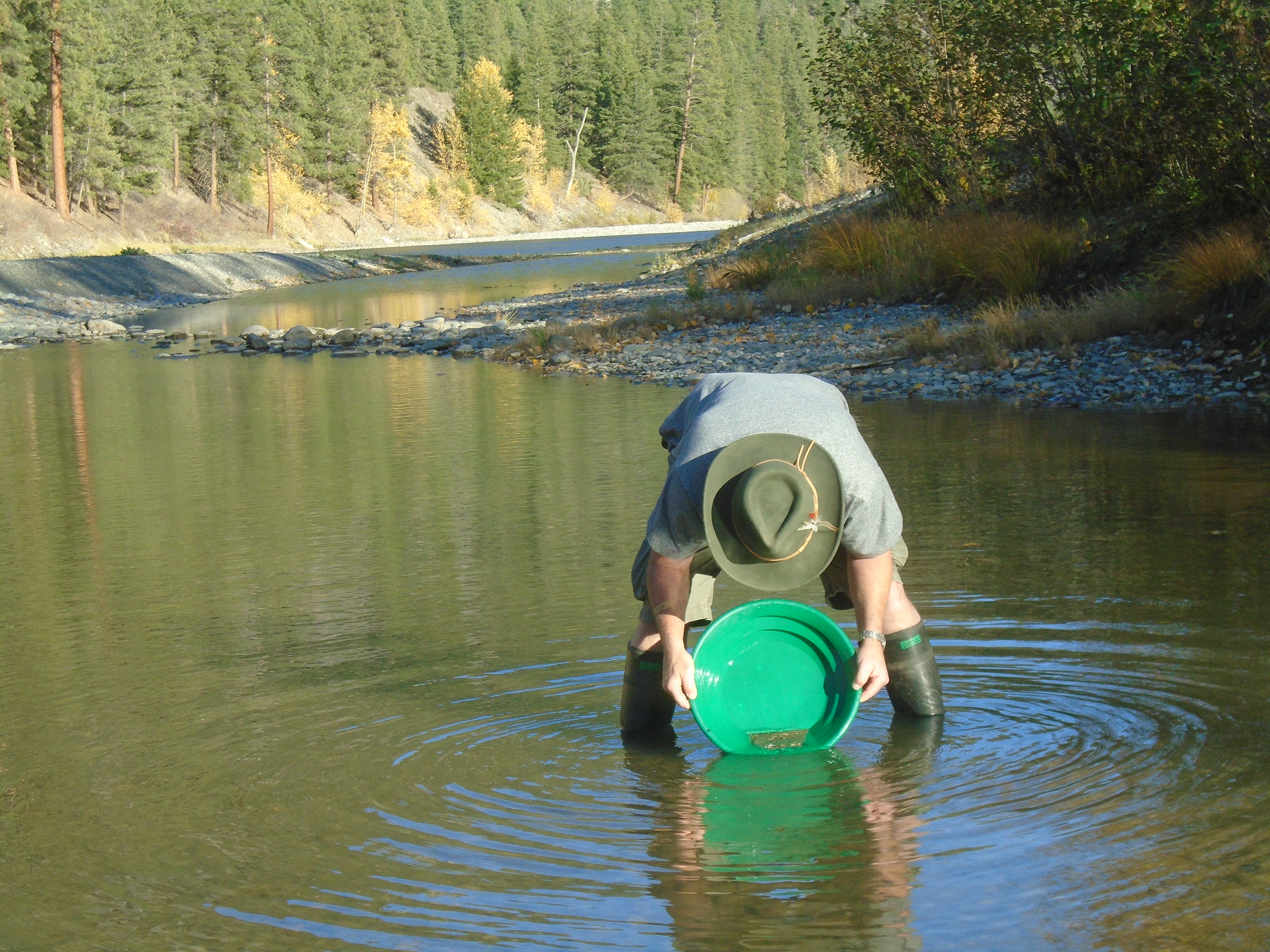
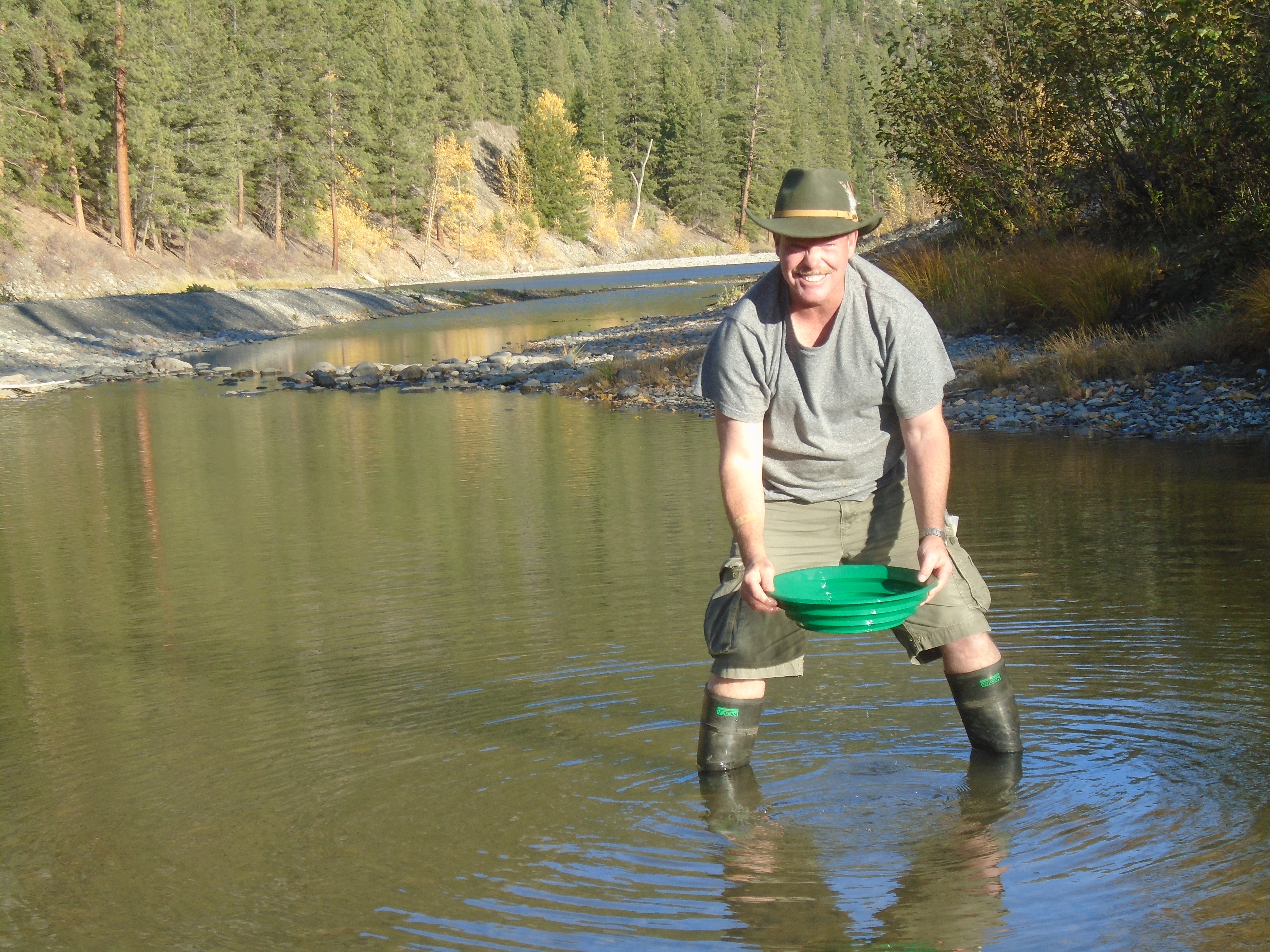
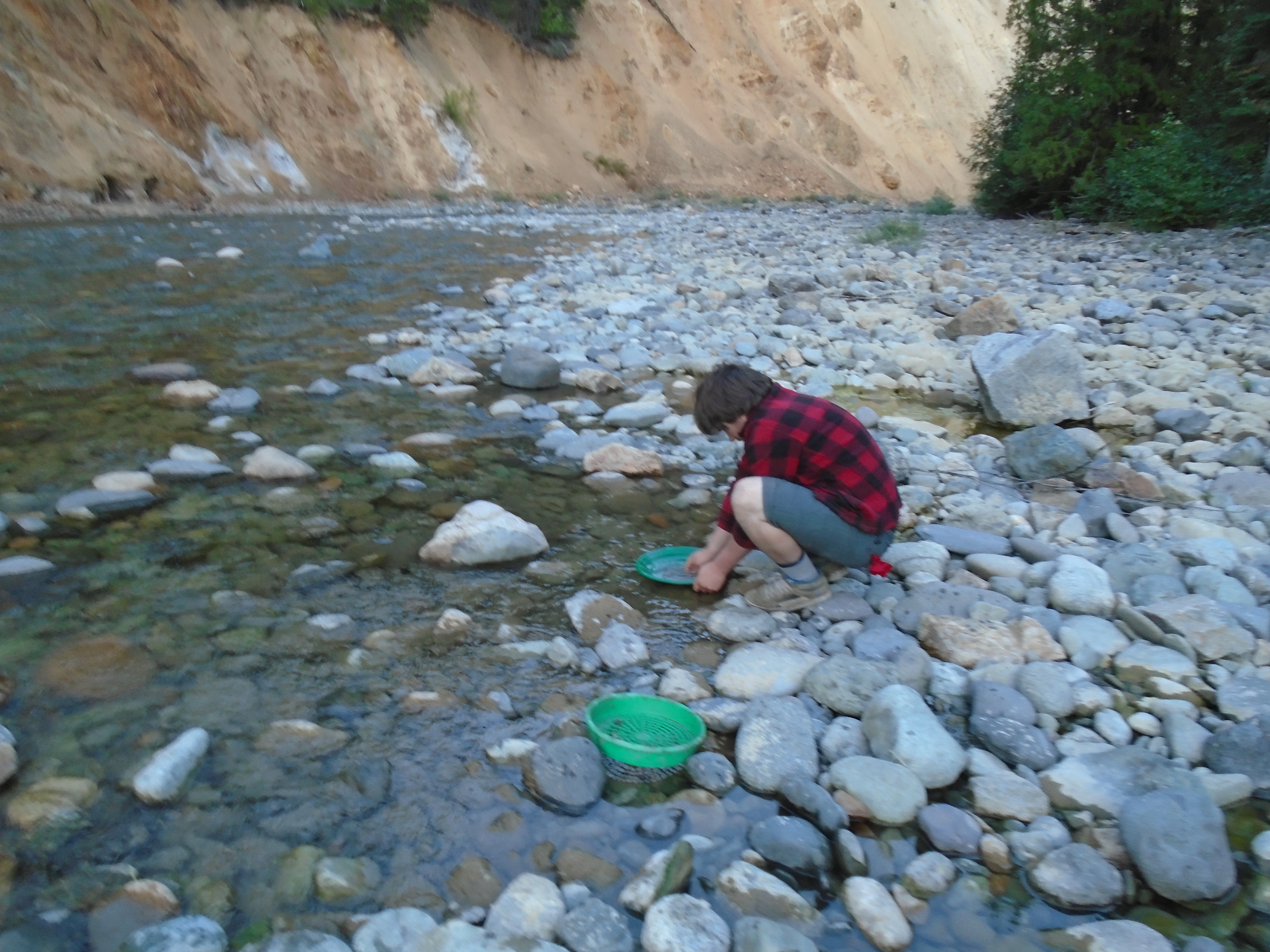
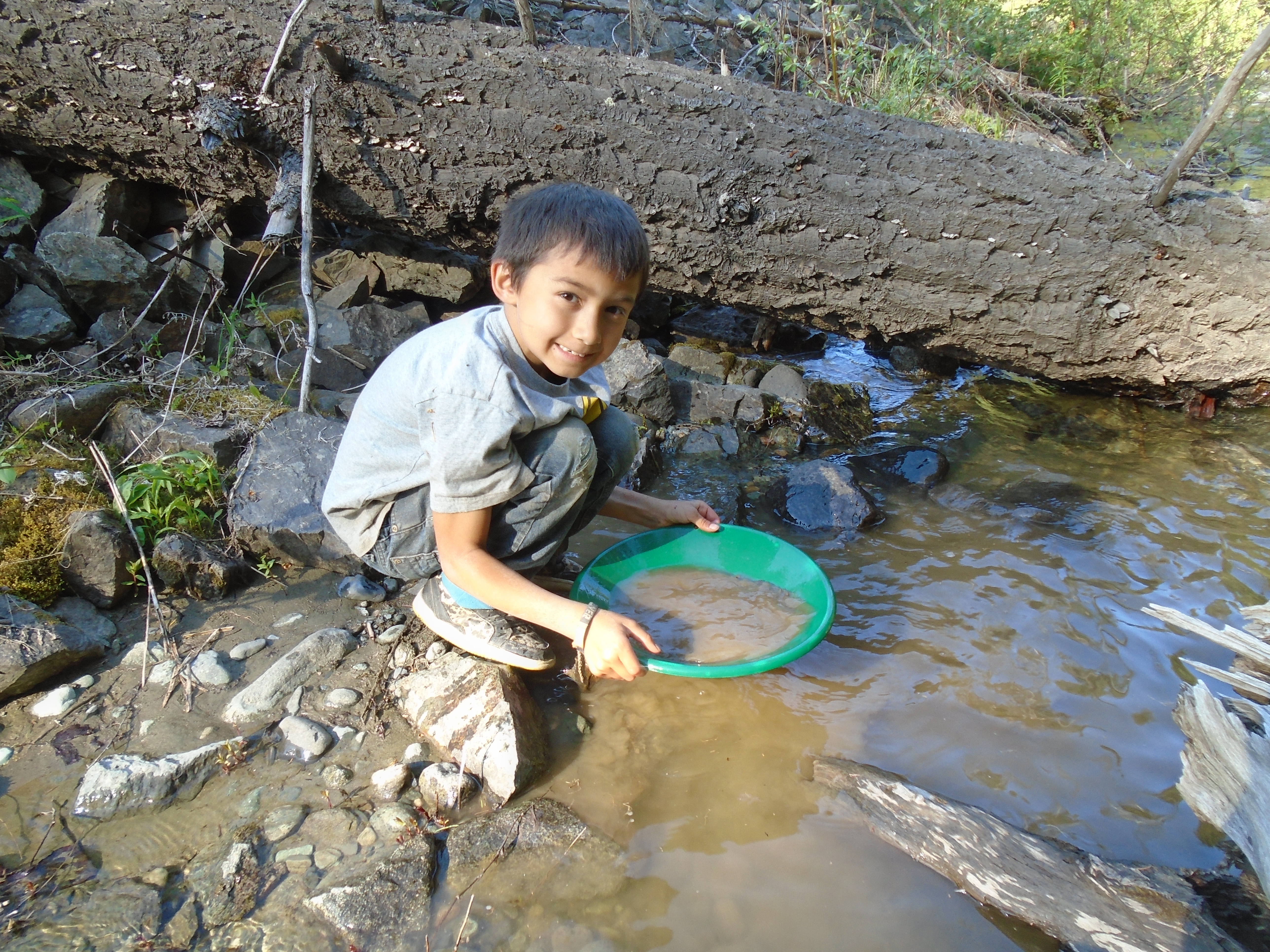
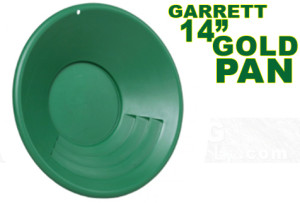
I have three of these pans and they work great.  The big riffles make it easy to move lots of material.  The gravity trap in the bottom holds fine gold very well.  They are tough!  I have fallen on them and dropped them down rock faces and they do not crack.  Also the green color makes gold extra visible.


VAS 8″ Gold Pan ($5.79)

IVAS8inchpan 
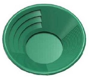
have a couple of these smaller pans that I use for cleaning up samples and panning small amounts of material.  This is a versatile pan, the large riffles work well when you have the pan full.  I use the smaller riffles most of the time for fine panning.  This pan also has a trap in the bottom like the Garrett and a similar green color.