
Aerial imagery can be acquired rapidly and at a low cost due to advances in unmanned technology. This allows us to provide exciting high resolution aerial data products in many new applications. Conventional manned aircraft require expensive sensors, upkeep, and permitting which places traditional aerial photography and mapping out of the reach of many small projects.
We’re now offering agricultural imagery services in BC, Alberta and Saskatchewan. More details here, Crop Imaging.
We’re based out of Abbotsford, BC. Fully legal and we have liability insurance up to $1,000,000.
Our system brings high resolution aerial data to projects with small budgets.
Deliverable Products
 Orthophoto Mosaic (GeoTIFF, JPG, PDF)
- Digital Terrain Model (DEM, DSM, TIN, ASC)
- 3D Point Cloud (LAS, XYZ)
- 3D Model (OBJ, 3DS, DXF)
- Hundreds of raw photos (JPG)
- Large scale printed maps available for extra charge
- Contoured Topo maps and other products also available
UAV Map Products:
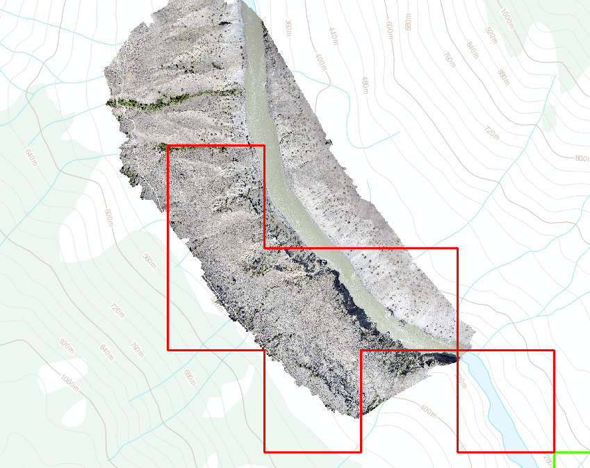
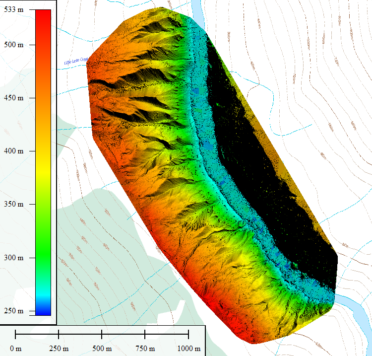
Check out this case study on a placer claim in BC, Drone Mapping of Placer Claim on Fraser River.
Also check out this survey that we did at a coal mine in Alberta, Drone Mapping of a Coal Mine.
High Resolution Digital Orthophotos
We can produce orthophotos up to 4 cm/px resolution. Orthophotos are a mosaic of all the photos taken over a pre-defined area. Each photo has geotagged coordinates from the onboard GPS. Through post-processing a combined image with real world coordinates is produced.
3D Terrain Maps and Models
3D data is created in post-processing using photogrammetry techniques. This technique tracks objects and features from overlapped photos taken from different angles. When completed a high definition 3D model or terrain map is produced.
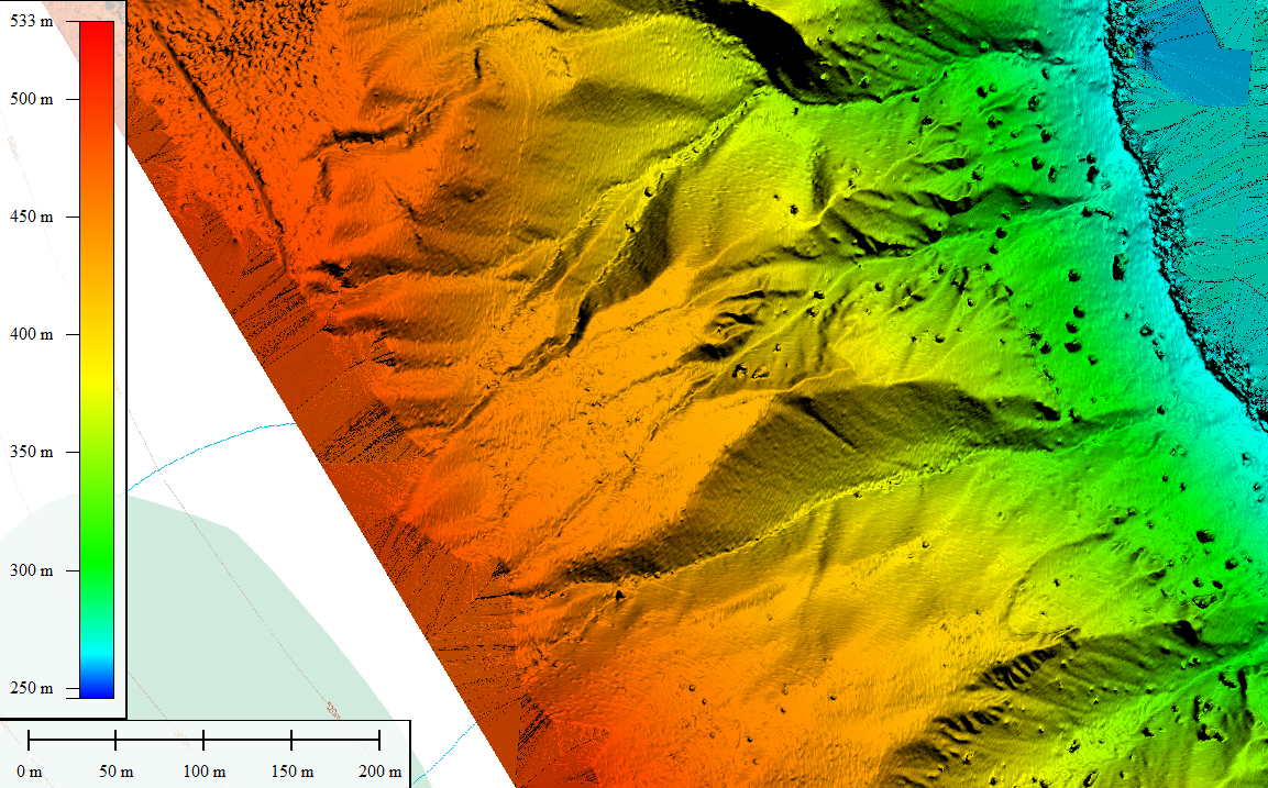
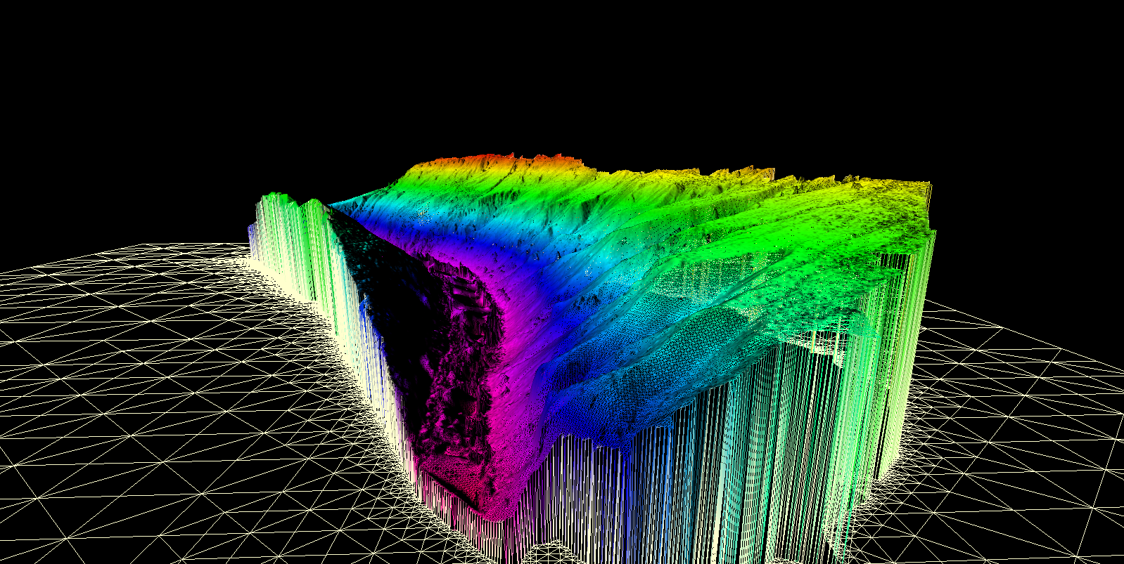
3D Point Clouds
The 3D data from the drone can be used to create a high resolution point cloud. This is a 3D model that consists of millions of individual points with accurate X,Y and Z locations. The points are represented as voxels which are essentially 3D pixels. This product is the same format as LiDAR data. The difference with LiDAR is that it can remove vegetation as a layer, photogrammetric point clouds have the trees in the model.
Drone vs Satellite
We record imagery at 4 cm/px which is amazing quality. Google Earth’s highest resolution data is at 65cm/px and the best satellite data you can buy today is 30 cm/px and is quite expensive. Check out the image below to see what how our resolution compares to Google.

The standard rate that we charge is $4 per acre for large areas. Satellite imagery which is lower resolution will cost around $10 per acre and increases substantially for more advanced products such as 3D terrain. We do not charge extra for 3D. We are providing high quality data for a reasonable price. Custom drone imagery is current to the date that it is acquired, satellite data is often months or years old.
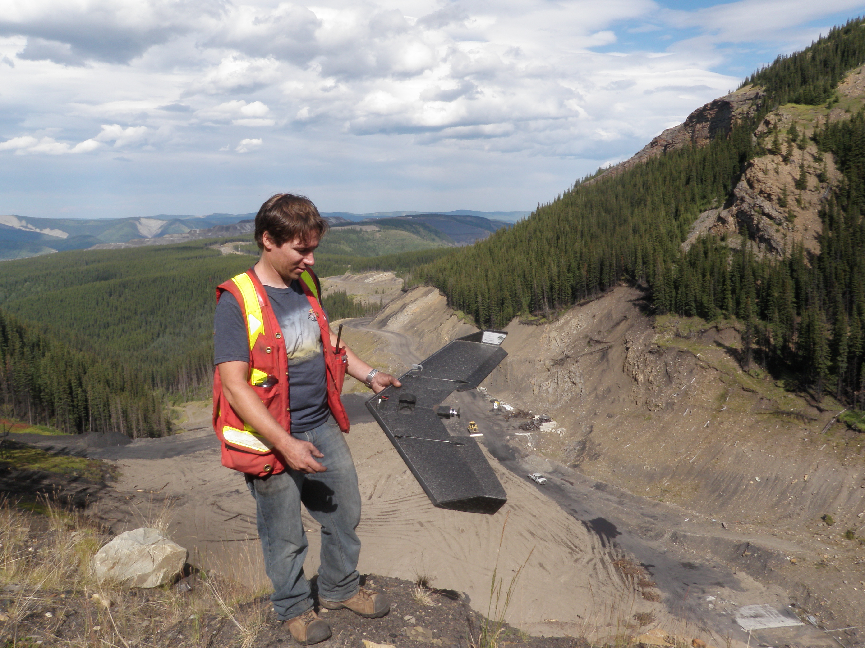
This drone can cover approximately 250 Acres in one flight. We have multiple batteries and can currently do up to 5 flights per day. Flight planning will be completed prior to arriving at a site to ensure safety and compliance with Transport Canada regulations. We also hold a $1,000,000 liability insurance policy for all UAV operations. To discuss your project please send an email from the contact page.
Pilot Qualifications:
Our pilot has worked in the UAV industry since 2011. He began working with drones as part of a three person team developing large scale mapping drones. These drones had a 14ft wingspan, 100cc gas engine and 1000km range. His primary role was ground station operation and set up as well as logistics, flight planning and ensuring regulatory compliance. He has over 100 flight hours of UAV operation to his credit. Our pilot has also has taken the private pilot ground school course at Pacific Aviation and holds a restricted aeronautical radio license.
Hi , I have just moved to Abbotsford B.C. from Vernon B.C. and I would like to join a Placer Miners Club. I previously belong to The Vernon Placer Miner Club and still do and was wondering if you could find me a club around the Abbotsford area. Thank you for your time. Ken Cuffe