Bedrock Profiling

Our bedrock profiling system uses the latest technology to map and investigate bedrock.
Our system is designed to map placer paleochannels. In placer gold exploration and mining, it is imperative to understand your bedrock depths and where gold is likely to be found. In almost every placer deposit the best gold is found in ancient river channels. Since the gold rush era, numerous techniques have been used to find and understand the makeup of tertiary channels.
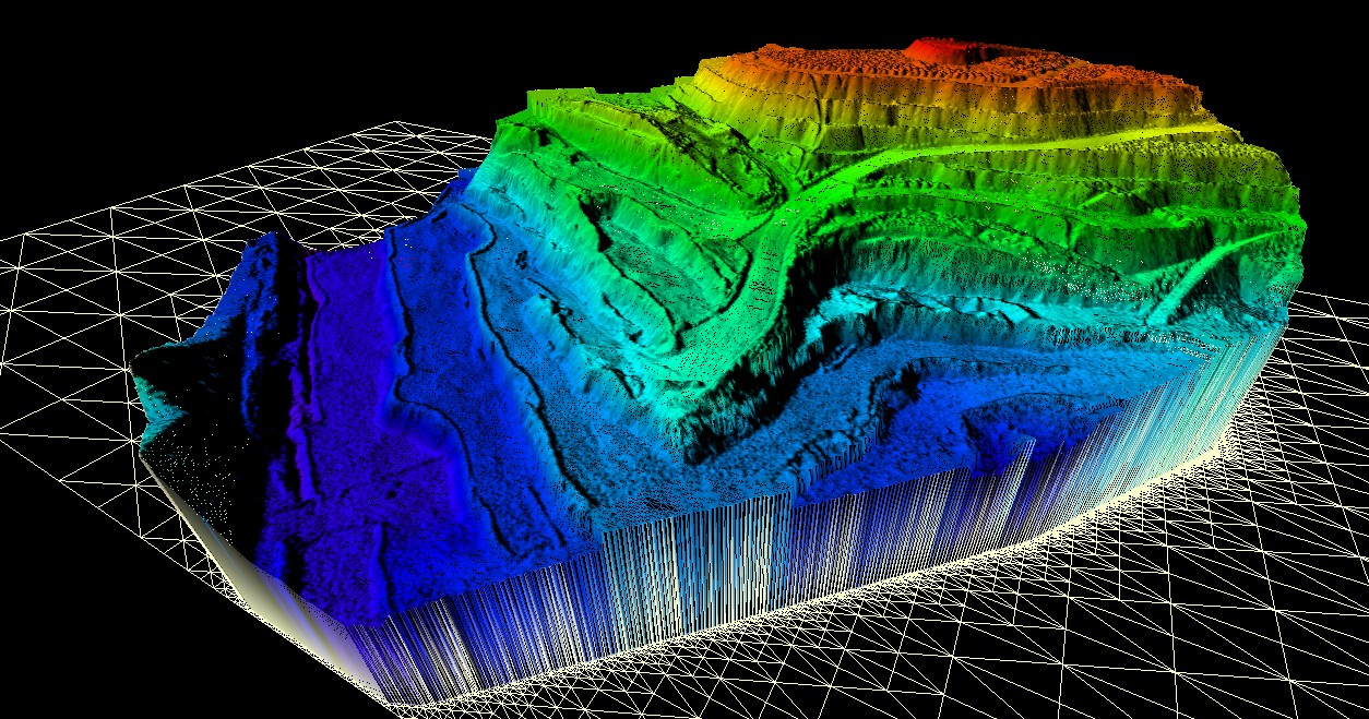
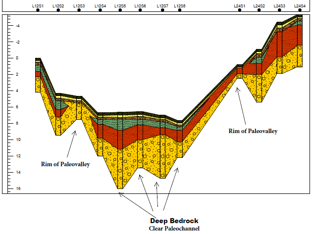
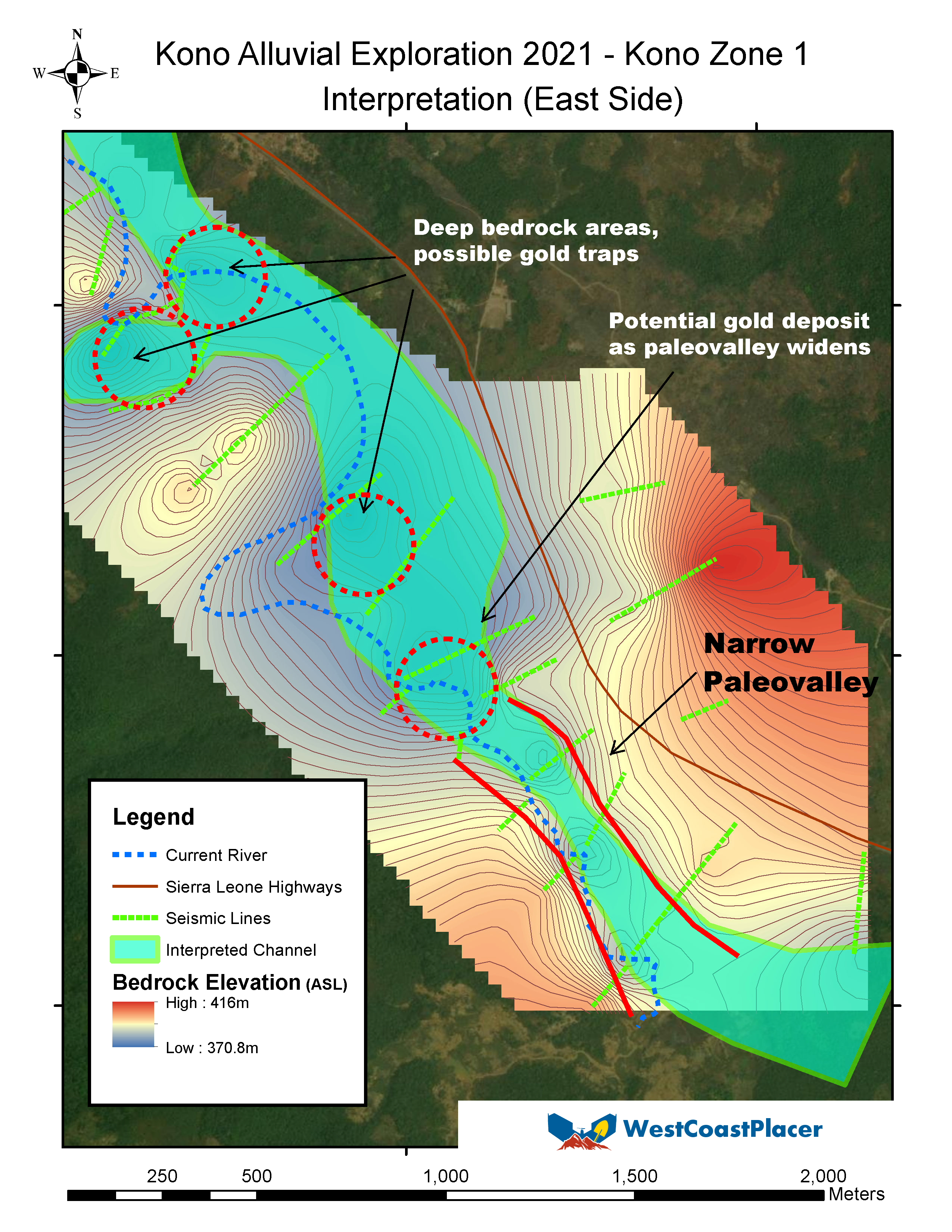
We create a topo map of the bedrock surface showing the shape of the bedrock as well as the overburden thickness. You’ll know how deep the bedrock is and which parts are economical to mine.
Our system is designed to locate ancient river channels that are invisible to the naked eye. We design the survey lines specifically to locate rich tertiary channels on your claim.
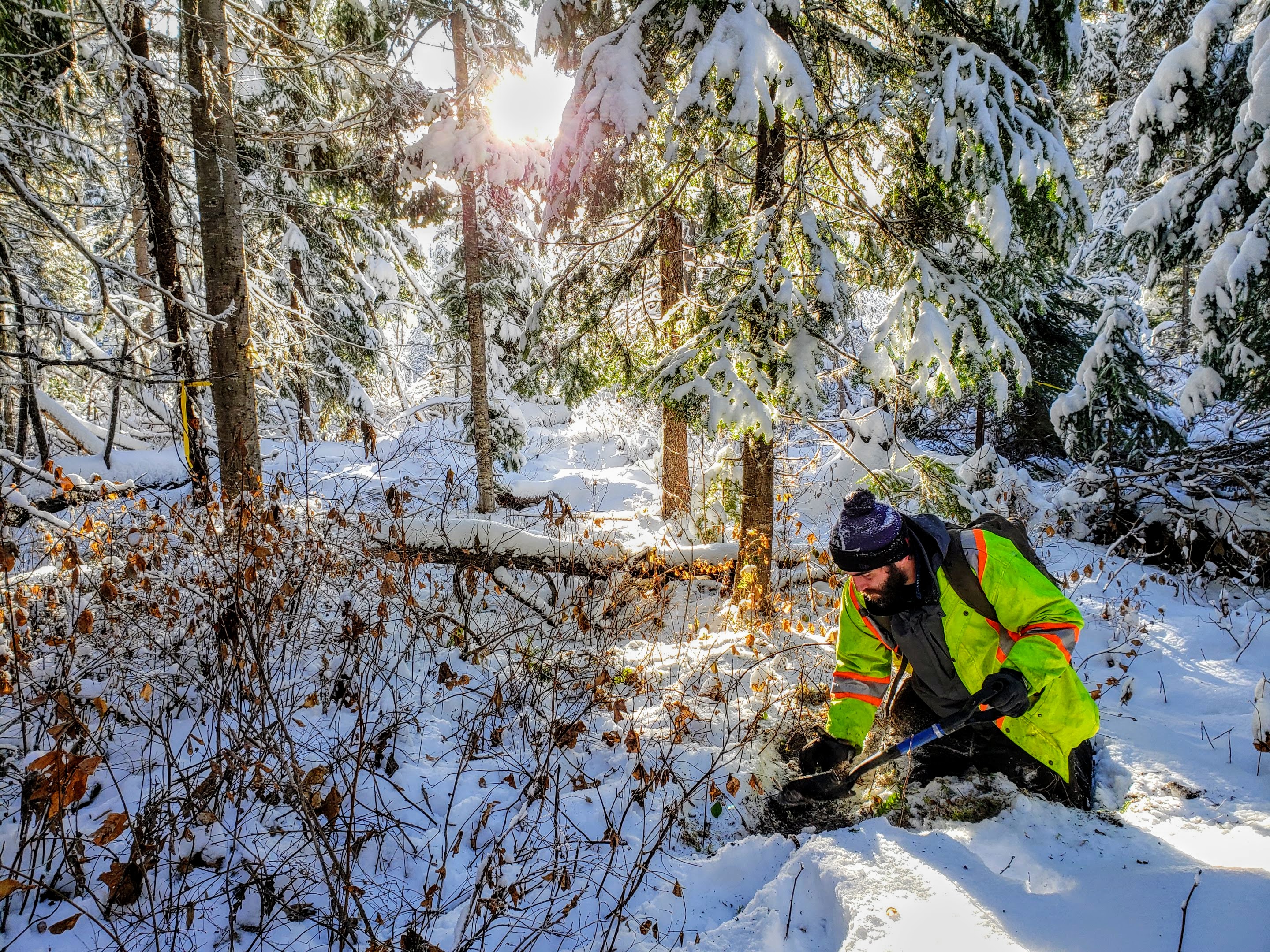
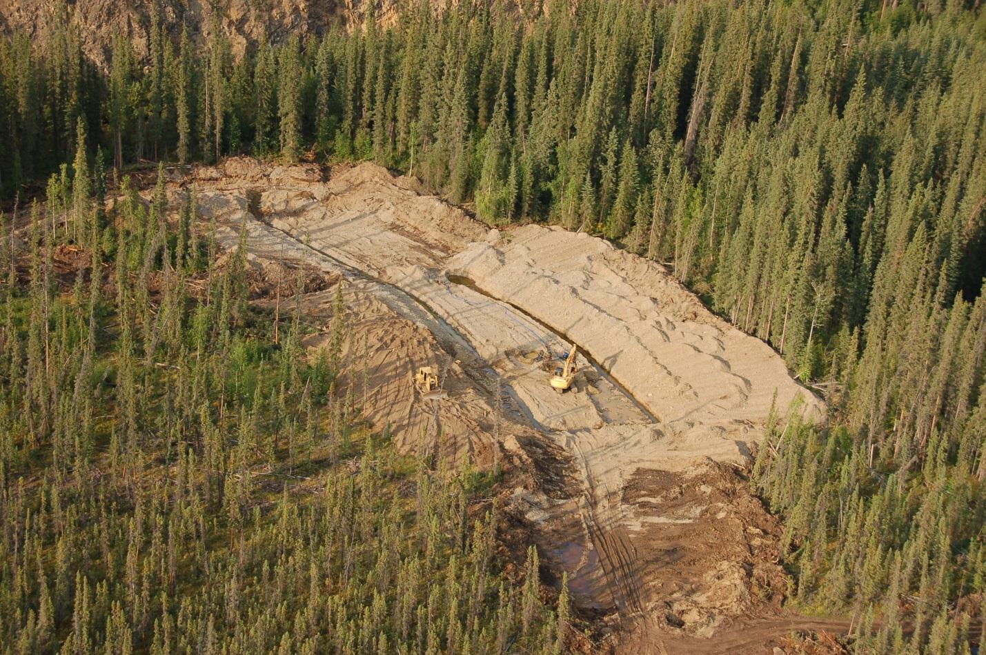
Our technique has zero environmental impact. No line cutting, no permits required and we leave no trace after the survey is completed.
In the old days, miners would simply dig and hope for the best. Some miners still do. Those are the guys that usually go bust in their first season. Smarter miners will bring in R/C or sonic drills and test the bedrock that way. Geophysics and remote sensing techniques are commonly used in large-scale mining exploration but the costs were out of reach of the budget of your average placer mine.
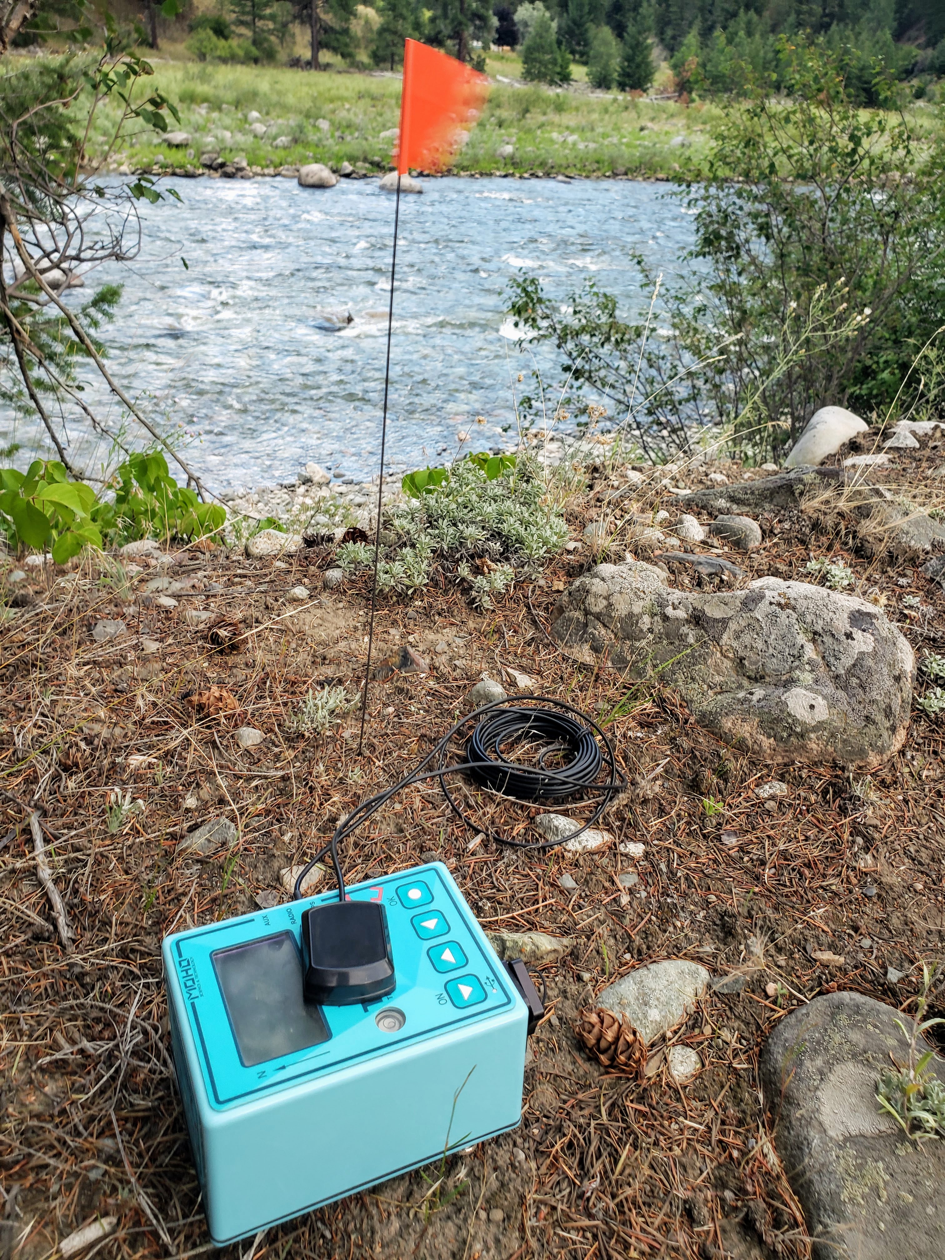
Our new passive seismic system is the best tool for mapping bedrock and finding hidden paleochannels. The technique uses a special seismic sensor that does not require an energy source such as dynamite. With minimal impact, we can quietly map bedrock on your claims and show you exactly where your channels are.
On top of finding hidden channels, our seismic system will give you a profile of overburden thickness so you know where it is economical to mine and where it isn’t.
Any time that you move dirt it costs you money. Knowing where to dig just makes sense.
Other techniques such as Ground Penetrating Radar (GPR) work in a similar to traditional seismic by sending radio waves into the ground and measuring the response. GPR will not see past clay layers, permafrost or water-bearing gravels. Our seismic system will map bedrock regardless of water, ice or clay in between.
Drilling results are undeniable if done correctly but drilling is expensive. Our system will let you know where to drill and prevent wasting money on areas that won’t hold good gold values. Save your budget for the areas that are going to make you money. For decades large scale mineral exploration has followed this approach. Using geophysics to find drill targets then prove the targets. West Coast Placer is applying this approach to placer mining on a budget that you can handle.
The West Coast Placer system is designed specifically for placer exploration. Our final results are easy to understand and won’t leave you guessing.
Our geophysical sensor is set up at evenly spaced stations along survey lines that we set up. No line-cutting is necessary. Our instrument “listens” to the earth and records seismic data.
After data is collected we process it using special software and processing techniques. Then we produce a map of the bedrock and detailed cross sections.
We can deliver a variety of GIS and map products to suit your needs. When combined with our drone mapping system we can deliver high definition 3D models comparing the surface and bedrock in their true position.
We provide a detailed report with maps and interpretation of the data explaining the results in an easy to understand format. This survey qualifies for placer assessment work in BC and the Yukon.
Here are some publicly available reports from our work that you can check out:
We have had a lot of success with this system in finding hidden paleochannels all over BC and the Yukon as well as some international locations. We have some reports that are publicly available as well, just ask when you contact us and we’ll be happy to answer any questions that you might have.
To discuss your project please send an email from the contact page.
Contact us to take your placer project to the next level.